Cockley Beck

Settlement in Lancashire Copeland

England

Cockley Beck

The Final Slog The last few hundred feet of the climb up the western side of Hardknott Pass.
The Final Slog Credit: Andy Beecroft

Cockley Beck is a small hamlet situated in the Lake District National Park, within the county of Cumbria, England. Although it is often associated with Lancashire due to its proximity to the county border, it is actually located within the boundaries of Cumbria.

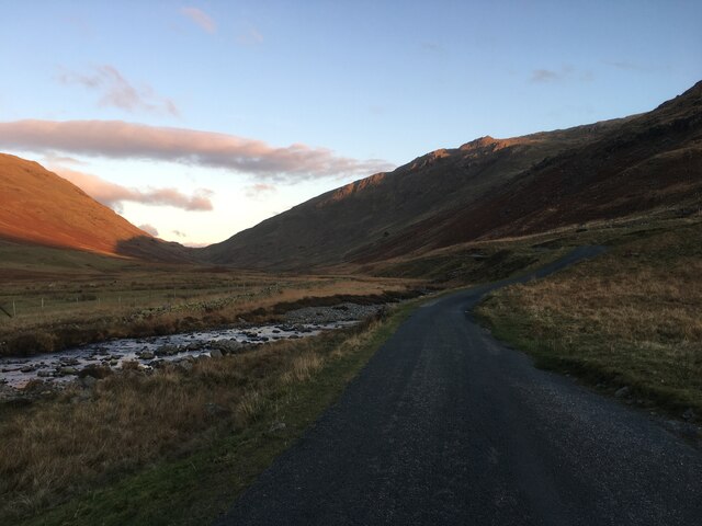
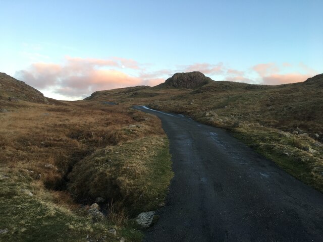
Nestled in a picturesque valley, Cockley Beck is renowned for its stunning natural beauty and serves as a gateway to some of the most breathtaking landscapes in the Lake District. Surrounded by rugged mountains and rolling hills, the hamlet offers a tranquil retreat for nature lovers and outdoor enthusiasts.

The village itself consists of a handful of traditional stone buildings, including a few residential properties and a former farmhouse which now operates as a tearoom and small shop. It is worth noting that services and amenities are limited in Cockley Beck, with the closest town being Broughton-in-Furness, approximately 8 miles away.

One of the main attractions in the area is the Cockley Beck Ford, where the River Duddon flows through a shallow crossing. This ford is a popular spot for walkers and hikers, as it is part of the famous Wainwright Coast to Coast trail, which stretches across northern England.

Overall, Cockley Beck offers visitors a peaceful retreat in the heart of the Lake District, with its idyllic surroundings and access to some of the region's most stunning landscapes.

If you have any feedback on the listing, please let us know in the comments section below.
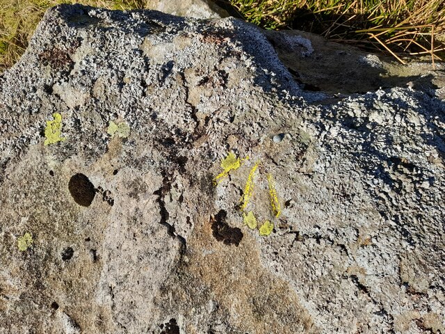
Cockley Beck Images

Images are sourced within 2km of 54.404776/-3.1618383 or Grid Reference NY2401. Thanks to Geograph Open Source API. All images are credited.

The Final Slog The last few hundred feet of the climb up the western side of Hardknott Pass.
The Final Slog
The last few hundred feet of the climb up the western side of Hardknott Pass.
Cockley Beck from above Wrynose Bottoms The view is looking westwards towards Hardknott Pass.
Cockley Beck from above Wrynose Bottoms
The view is looking westwards towards Hardknott Pass.
Ordnance Survey Cut Mark This OS cut mark can be found on the west face of Dale Head House. It marks a point 198.373m above mean sea level.
Ordnance Survey Cut Mark
This OS cut mark can be found on the west face of Dale Head House. It marks a point 198.373m above mean sea level.
Ordnance Survey Rivet This OS rivet can be found on the wall NW side of the road. It marks a point 207.615m above mean sea level.
Ordnance Survey Rivet
This OS rivet can be found on the wall NW side of the road. It marks a point 207.615m above mean sea level.
Ordnance Survey Cut Mark This OS cut mark can be found on barn at Cockley Beck Farm. It marks a point 216.688m above mean sea level.
Ordnance Survey Cut Mark
This OS cut mark can be found on barn at Cockley Beck Farm. It marks a point 216.688m above mean sea level.
Ordnance Survey Rivet This OS rivet can be found on a rock north side of the road. It marks a point 241.813m above mean sea level.
Ordnance Survey Rivet
This OS rivet can be found on a rock north side of the road. It marks a point 241.813m above mean sea level.
Ordnance Survey Rivet This OS rivet can be found on a rock SE side of the road. It marks a point 250.643m above mean sea level.
Ordnance Survey Rivet
This OS rivet can be found on a rock SE side of the road. It marks a point 250.643m above mean sea level.
Ordnance Survey Rivet This OS rivet can be found on a rock NW side of the road. It marks a point 263.082m above mean sea level.
Ordnance Survey Rivet
This OS rivet can be found on a rock NW side of the road. It marks a point 263.082m above mean sea level.
Road ascending Wrynose Pass
Road towards the Wrynose Pass
Eastern end of the Hardknott Pass
Road over the Hardknott Pass
Wrynose Bottom View to Hardknott Pass viewed from Wyrnose Bottom.  The road traversing Hardknott Pass, one of the steepest in the country can be seen.
Wrynose Bottom
View to Hardknott Pass viewed from Wyrnose Bottom. The road traversing Hardknott Pass, one of the steepest in the country can be seen.
Cattle in Wrynose Bottom
Harter Fell viewed from Wrynose Bottom Harter Fell viewed from the Duddon Valley  between Wrynose Pass and Hardknott Pass.  There are two Harter Fells in the Lake District, this one is above Eskdale, the other is above Mardale in the east of the district.
Harter Fell viewed from Wrynose Bottom
Harter Fell viewed from the Duddon Valley between Wrynose Pass and Hardknott Pass. There are two Harter Fells in the Lake District, this one is above Eskdale, the other is above Mardale in the east of the district.
On the move! Farmers moving their Herdwick sheep in the Duddon valley.  The picture was taken out of the car window as I sat waiting for the sheep to cross the road.
On the move!
Farmers moving their Herdwick sheep in the Duddon valley. The picture was taken out of the car window as I sat waiting for the sheep to cross the road.
The Hardknott Pass Approaching the Hardnott Pass, one of the steepest road pass in the country.
The Hardknott Pass
Approaching the Hardnott Pass, one of the steepest road pass in the country.
Show me another place!

Cockley Beck is located at Grid Ref: NY2401 (Lat: 54.404776, Lng: -3.1618383)

Administrative County: Cumbria

District: Copeland

Police Authority: Cumbria

What 3 Words

///awestruck.empty.pelt. Near Ambleside, Cumbria

Nearby Locations

Cockley Beck

Related Wikis

Cockley Beck

Cockley Beck is a small hamlet, situated in the Duddon Valley in Cumbria, England. Historically, the hamlet was part of Lancashire. Located today within...

Hard Knott

Hard Knott is a fell in the English Lake District, at the head of Eskdale. == Geology == Rhyolitic lava-like tuff of the Bad Step Tuff forms the summit...

Grey Friar

Grey Friar is a fell in the English Lake District, it is one of the Coniston Fells and is situated 13 kilometres (8 miles) west-south-west of Ambleside...

Hardknott Pass

Hardknott Pass is a hill pass between Eskdale and the Duddon Valley in the Lake District National Park, Cumbria, England. The tarmac-surfaced road, which...

Nearby Amenities

Located within 500m of 54.404776,-3.1618383
Cockley Beck
Place: hamlet
Source: npe
Wikidata: Q5139641
Lat/Long: 54.4041861/-3.1619661
Bus Stop
Cockley Beck Farm
Naptan AtcoCode: 090079202248
Naptan Bearing: N
Naptan BusStopType: CUS
Naptan CommonName: Cockley Beck Farm
Naptan Indicator: o/s
Naptan Landmark: Cockley Beck Farm
Naptan NaptanCode: cumdgwjw
Naptan Street: Hardknott Pass
Naptan Verified: no
Source: naptan_import
Lat/Long: 54.4045902/-3.1620538
Cockley Beck Copper Mine
Historic: mine
Mineral: copper
Lat/Long: 54.4016309/-3.1584751
Barrier: cattle_grid
Lat/Long: 54.4047428/-3.1618215
Booth: oakham
Colour: blue
Covered: booth
Disused Amenity: telephone
Note: Aug 2019. Phone no longer working, marked as 'decomissioned'
Lat/Long: 54.4047007/-3.1619786
Ford: yes
Lat/Long: 54.4052511/-3.1623752
Ford: yes
Lat/Long: 54.4075705/-3.1577456
Ford: yes
Lat/Long: 54.4073901/-3.1590319
Ford: yes
Lat/Long: 54.4068804/-3.160451
Ford: yes
Lat/Long: 54.4059788/-3.1662072
The data included in this document is from www.openstreetmap.org. The data is made available under ODbL.

Have you been to Cockley Beck?

Leave your review of Cockley Beck below (or comments, questions and feedback).