Cowley

Settlement in Gloucestershire Cotswold

England

Cowley

Manx Loaghtan sheep Manx Loaghtan sheep in a field at Coberley.
Manx Loaghtan sheep Credit: Philip Halling

Cowley is a small village located in the county of Gloucestershire, England. Situated near the River Coln, Cowley is nestled within the picturesque Cotswold countryside. The village is part of the Cotswold District Council and falls within the Churn Valley ward.

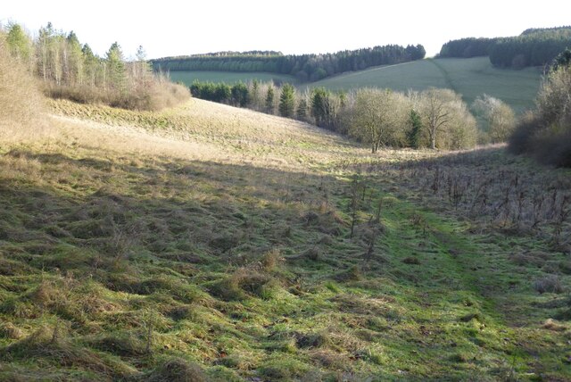
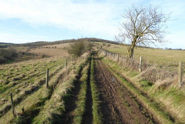
With a population of around 300 residents, Cowley exudes a charming and tranquil atmosphere. The village is known for its quintessential Cotswold stone houses, which create a visually appealing and traditional landscape. The surrounding countryside offers stunning views and numerous walking trails, attracting visitors who seek to explore the natural beauty of the area.

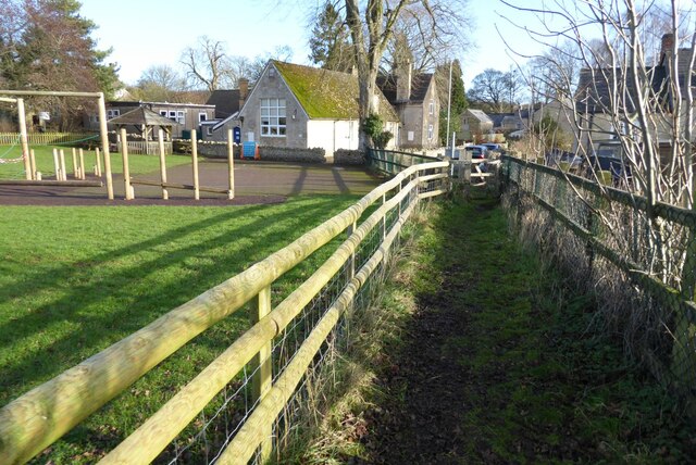
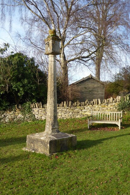
Despite its small size, Cowley has a strong community spirit, with various social events and gatherings taking place throughout the year. The village boasts a historic church, St. Mary's, which dates back to the 12th century and serves as a focal point for both religious and community activities.

The village is conveniently located near the town of Cheltenham, which is approximately 10 miles away. This proximity provides residents with easy access to a range of amenities, including shopping centers, schools, healthcare facilities, and entertainment options.

Cowley offers a tranquil and idyllic lifestyle, appealing to those who appreciate the charm of a rural village setting while still having access to nearby urban areas. With its rich history, stunning natural surroundings, and strong sense of community, Cowley is a hidden gem within the Gloucestershire countryside.

If you have any feedback on the listing, please let us know in the comments section below.
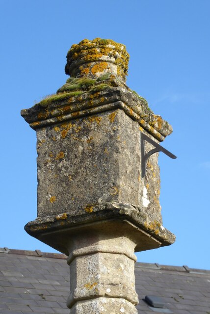
Cowley Images

Images are sourced within 2km of 51.830514/-2.0557637 or Grid Reference SO9614. Thanks to Geograph Open Source API. All images are credited.

Manx Loaghtan sheep Manx Loaghtan sheep in a field at Coberley.
Manx Loaghtan sheep
Manx Loaghtan sheep in a field at Coberley.
Manx Loaghtan sheep Manx Loaghtan sheep in a field at Coberley.
Manx Loaghtan sheep
Manx Loaghtan sheep in a field at Coberley.
Manx Loaghtan sheep Manx Loaghtan sheep in a field at Coberley.
Manx Loaghtan sheep
Manx Loaghtan sheep in a field at Coberley.
The Gloucestershire Way The Gloucestershire Way crossing a field between forestry and entering the valley above Coberley known as Coldwell Bottom.
The Gloucestershire Way
The Gloucestershire Way crossing a field between forestry and entering the valley above Coberley known as Coldwell Bottom.
Coldwell Bottom The Gloucestershire Way long distance footpath follows this path above the valley on the right which is called Coldwell Bottom.
Coldwell Bottom
The Gloucestershire Way long distance footpath follows this path above the valley on the right which is called Coldwell Bottom.
Path and gate above Coldwell Bottom The Gloucestershire Way follows this right of way above Coldwell Bottom.
Path and gate above Coldwell Bottom
The Gloucestershire Way follows this right of way above Coldwell Bottom.
Coldwell Bottom View across Coldwell Bottom to the Churn valley beyond, from the Gloucestershire Way.
Coldwell Bottom
View across Coldwell Bottom to the Churn valley beyond, from the Gloucestershire Way.
Gloucestershire Way Gloucestershire Way with Coldwell Bottom below on the left.
Gloucestershire Way
Gloucestershire Way with Coldwell Bottom below on the left.
A junction of paths The right of way on the left passing through the gate is the route of the Gloucestershire Way, alternatively there is a right of way on the right which eventually rejoins the Gloucestershire Way.
A junction of paths
The right of way on the left passing through the gate is the route of the Gloucestershire Way, alternatively there is a right of way on the right which eventually rejoins the Gloucestershire Way.
A junction of rights of way Continuing along this right of way passes Cuckoopen Barn Farm.  The path on the left, out of view is the route of the Gloucestershire Way.  This is almost exactly the same view as when I was last here almost fourteen years ago to the day <a href="https://www.geograph.org.uk/photo/653006">SO9515 : Footpath junction near Coberley</a>.
A junction of rights of way
Continuing along this right of way passes Cuckoopen Barn Farm. The path on the left, out of view is the route of the Gloucestershire Way. This is almost exactly the same view as when I was last here almost fourteen years ago to the day SO9515 : Footpath junction near Coberley.
The Gloucestershire Way The Gloucestershire Way to the west of Coberley and above Coldwell Bottom which is out of view on the left.
The Gloucestershire Way
The Gloucestershire Way to the west of Coberley and above Coldwell Bottom which is out of view on the left.
Dowman's Farm Dowman's Farm in the village of Coberley.
Dowman's Farm
Dowman's Farm in the village of Coberley.
Footpath approaching Dowman's Farm Footpath crossing field approaching Dowman's Farm at Coberley.
Footpath approaching Dowman's Farm
Footpath crossing field approaching Dowman's Farm at Coberley.
Footpath passing Coberley School Footpath passing Coberley Primary School.
Footpath passing Coberley School
Footpath passing Coberley Primary School.
Coberley war memorial
Sundial on Coberley war memorial
Plaque on Coberley war memorial
Houses in Coberley The village war memorial is on the right.
Houses in Coberley
The village war memorial is on the right.
Show me another place!

Cowley is located at Grid Ref: SO9614 (Lat: 51.830514, Lng: -2.0557637)

Administrative County: Gloucestershire

District: Cotswold

Police Authority: Gloucestershire

What 3 Words

///motion.makeovers.stir. Near Shurdington, Gloucestershire

Nearby Locations

Cockleford Cowley

Related Wikis

Cowley, Gloucestershire

Cowley is a village and civil parish in the Cotswold District of Gloucestershire, England. It lies between the A417 and A435 roads between Cheltenham...

Coberley

Coberley is a village and civil parish in the Cotswold District of Gloucestershire in England, 4 miles (6.4 km) south of Cheltenham. It lies at the confluence...

Cockleford Marsh

Cockleford Marsh (grid reference SO977133) is a 3.2-hectare (7.9-acre) biological Site of Special Scientific Interest in Gloucestershire, notified in 1991...

Bushley Muzzard, Brimpsfield

Bushley Muzzard, Brimpsfield (grid reference SO944133) is a 1.13-hectare (2.8-acre) biological Site of Special Scientific Interest in Gloucestershire,...

Church of St John the Evangelist, Elkstone

The Anglican Church of St John the Evangelist at Elkstone in the Cotswold District of Gloucestershire, England was built in the 12th century. It is a grade...

Seven Springs, Gloucestershire

Seven Springs is a hamlet in the heavily wooded parish of Coberley in the Cotswold District of Gloucestershire in England, 4 miles (6.4 km) south of Cheltenham...

Elkstone

Elkstone is a village and civil parish in the English county of Gloucestershire. In the 2001 United Kingdom census, the parish had a population of 203...

Church of St Michael, Brimpsfield

The Anglican Church of St Michael at Brimpsfield in the Cotswold District of Gloucestershire, England was built in 12th century. It is a grade I listed...

Nearby Amenities

Located within 500m of 51.830514,-2.0557637
Cowley
Is In: Gloucestershire, England, UK
Place: village
Lat/Long: 51.8310464/-2.0545887
Bus Stop
Cowley Manor
Bench: no
Bin: no
Bus: yes
Naptan AtcoCode: 1600GL1493
Naptan Bearing: E
Naptan CommonName: Cowley Manor
Naptan Indicator: Opp
Naptan NaptanCode: glodwadp
Naptan Street: Main Street
Naptan Verified: no
Public Transport: platform
Shelter: no
Source: naptan_import
Tactile Paving: no
Lat/Long: 51.8308403/-2.0538681
Bus Stop
Cowley Manor
Bench: no
Bin: no
Bus: yes
Naptan AtcoCode: 1600GL1494
Naptan Bearing: W
Naptan CommonName: Cowley Manor
Naptan NaptanCode: glodtwtj
Naptan Street: Main Street
Naptan Verified: no
Public Transport: platform
Shelter: no
Source: naptan_import
Lat/Long: 51.830876/-2.0543905
Barrier: kissing_gate
Lat/Long: 51.8276315/-2.0594871
Fixme: incomplete
Lat/Long: 51.8289234/-2.060422
Cowley Manor
Operator: Curious Hotels
Tourism: hotel
Website: https://www.cowleymanor.com/
Wikidata: Q111368542
Lat/Long: 51.8305518/-2.0528241
Post Box
Brand: Royal Mail
Brand Wikidata: Q638098
Brand Wikipedia: en:Royal Mail
Collection Times: Mo-Fr 09:00; Sa 07:00
Operator: Royal Mail
Operator Wikidata: Q638098
Post Box Type: wall
Ref: GL53 179
Royal Cypher: EVIIR
Royal Cypher Wikidata: Q33102324
Lat/Long: 51.8308698/-2.053816
Defibrillator
Access: yes
Booth: KX100
Covered: booth
Defibrillator Location: inside old phone box in Cowley
Disused Amenity: telephone
Emergency: defibrillator
Man Made: telephone_box
Lat/Long: 51.830779/-2.0530783
HE Ref: 1091741
Description: CASCADE AND ASSOCIATED POOL AND STEPS CIRCA 70 METRES SOUTH EAST OF COWLEY MANOR
Listed Status: Grade II
Lat/Long: 51.8297087/-2.0519218
Description: ROBERT BRIGGS MONUMENT IN THE CHURCHYARD OF THE CHURCH OF ST MARY
Historic: tomb
Listed Status: Grade II*
Lat/Long: 51.8304115/-2.0519035
Description: WILLIAM RANDLE MONUMENT IN THE CHURCHYARD OF THE CHURCH OF ST MARY, CIRCA 5 METRES SOUTH OF THE CHANCEL
Historic: tomb
Listed Status: Grade II
Lat/Long: 51.8303845/-2.0519035
HE Ref: 1091740
Description: GATE PIERS, GATES AND RAILINGS AT THE WEST ENTRANCE TO COWLEY MANOR
Listed Status: Grade II
Lat/Long: 51.8307797/-2.0529488
HE Ref: 1340118
Description: CROSS SHAFT AND CROSS BASE AT FORK IN ROAD
Historic: wayside_cross
Listed Status: Grade II
Lat/Long: 51.8304369/-2.0559021
Parking
Access: customers
Lat/Long: 51.8308051/-2.0522976
Give Way
Direction: forward
Lat/Long: 51.8310257/-2.054743
Location Transition: yes
Power: pole
Lat/Long: 51.8277261/-2.0508385
Location Transition: yes
Power: pole
Lat/Long: 51.8283452/-2.0523975
Location Transition: yes
Power: pole
Lat/Long: 51.8280808/-2.0515593
Location Transition: yes
Power: pole
Lat/Long: 51.8286452/-2.0533758
Location Transition: yes
Power: pole
Lat/Long: 51.8290265/-2.054489
Location Transition: yes
Power: pole
Lat/Long: 51.829341/-2.0554552
Power: pole
Lat/Long: 51.8295184/-2.0587678
Location Transition: yes
Power: pole
Lat/Long: 51.8296282/-2.0563088
Location Transition: yes
Power: pole
Lat/Long: 51.8298681/-2.0570679
Cowley
Location Transition: yes
Power: pole
Transformer: distribution
Voltage Primary: 11000
Lat/Long: 51.8298454/-2.057493
Cowley Manor
Power: pole
Transformer: distribution
Voltage Primary: 11000
Lat/Long: 51.8308258/-2.0544206
Churnside Camp
Power: pole
Transformer: distribution
Voltage Primary: 11000
Lat/Long: 51.8318435/-2.0525913
Power: pole
Lat/Long: 51.8296657/-2.0628608
Jesmond Cottage
Power: pole
Transformer: distribution
Voltage Primary: 11000
Lat/Long: 51.8300327/-2.0612092
Power: pole
Lat/Long: 51.8294662/-2.0614446
Hill Covert House
Power: pole
Transformer: distribution
Voltage Primary: 11000
Lat/Long: 51.829179/-2.0601484
The data included in this document is from www.openstreetmap.org. The data is made available under ODbL.

Have you been to Cowley?

Leave your review of Cowley below (or comments, questions and feedback).