Great Green Hows Plantation

Wood, Forest in Lancashire South Lakeland

England

Great Green Hows Plantation

Lane at entrance to YMCA National Centre
Lane at entrance to YMCA National Centre Credit: Colin Pyle

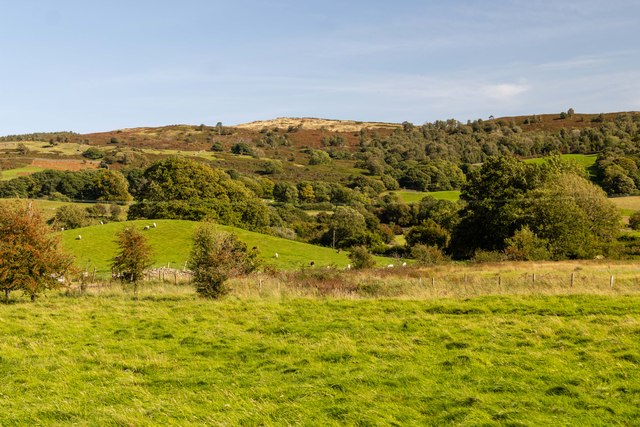
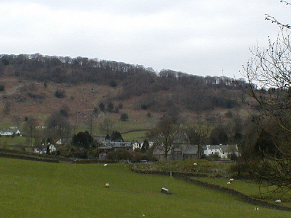
Great Green Hows Plantation is a sprawling woodland located in Lancashire, England. Situated in the heart of the picturesque countryside, this plantation covers a vast area of approximately 500 acres. It is known for its dense and diverse collection of trees, making it an ideal habitat for various wildlife species.

The plantation primarily consists of deciduous trees, such as oak, beech, and birch, which provide a stunning display of vibrant colors during the autumn season. These trees form a dense canopy, creating a serene and tranquil atmosphere within the woodland. Additionally, there are also patches of coniferous trees, including pine and spruce, adding to the overall biodiversity of the area.

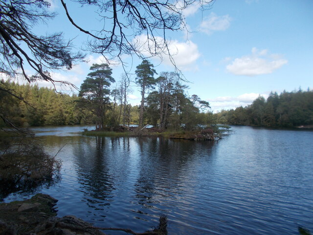
Great Green Hows Plantation is home to a wide range of flora and fauna. The dense vegetation provides excellent cover and nesting sites for numerous bird species, including woodpeckers, owls, and songbirds. The woodland also attracts a variety of mammals, such as deer, foxes, rabbits, and squirrels, which thrive in this natural habitat.

The plantation offers several well-maintained walking trails, allowing visitors to explore the woodland's beauty at their leisure. These trails wind through the enchanting forest, offering breathtaking views of the surrounding landscape. The plantation's management actively encourages responsible and sustainable use of the woodland, aiming to balance recreational activities with the preservation of its natural environment.

Great Green Hows Plantation in Lancashire is not only a haven for wildlife enthusiasts and nature lovers but also a place of tranquility and natural beauty, providing a much-needed escape from the hustle and bustle of everyday life.

If you have any feedback on the listing, please let us know in the comments section below.

Great Green Hows Plantation Images

Images are sourced within 2km of 54.302826/-2.9842791 or Grid Reference SD3690. Thanks to Geograph Open Source API. All images are credited.

Lane at entrance to YMCA National Centre
Lane at High Stott Park
Tree by Windermere What a wonderful form this solitary tree takes.
Tree by Windermere
What a wonderful form this solitary tree takes.
Thwaite Moss View across fields at Thwaite Moss.
Thwaite Moss
View across fields at Thwaite Moss.
Low Dam Tarn An artificial reservoir lower down from nearby High Dam Tarn.  This one is not as pretty or large as High Dam Tarn.
Low Dam Tarn
An artificial reservoir lower down from nearby High Dam Tarn. This one is not as pretty or large as High Dam Tarn.
High Dam Tarn - view from the dam A tarn in the "natural, enlarged by damming" category. The former smaller tarn, then known as Finsthwaite Tarn, was enlarged in 1835 to create what is now known as High Dam Tarn.
High Dam Tarn - view from the dam
A tarn in the "natural, enlarged by damming" category. The former smaller tarn, then known as Finsthwaite Tarn, was enlarged in 1835 to create what is now known as High Dam Tarn.
High Dam Tarn - the dam and walkway
Wooden walkway on a circuit of High Dam Tarn A circular walk around the tarn is enabled in places by a wooden walkway such as this one.  The tarn may be viewed from a few select points near to the shore but is frequently not seen in summer due to tree cover.
Wooden walkway on a circuit of High Dam Tarn
A circular walk around the tarn is enabled in places by a wooden walkway such as this one. The tarn may be viewed from a few select points near to the shore but is frequently not seen in summer due to tree cover.
High Dam Tarn A view from the shoreline showing one of the two islands.
High Dam Tarn
A view from the shoreline showing one of the two islands.
Dogs and ducks at High Dam Tarn
High Dam Tarn, looking towards the dam
High Dam Sunset on the day the clocks went back.
High Dam
Sunset on the day the clocks went back.
Wooded Knoll on the rear entrance to The National YMCA Centre
Across the fields to Thwaite Moss
Farmland, High Stott Park By the Lake Windermere which can just be seen through the trees.
Farmland, High Stott Park
By the Lake Windermere which can just be seen through the trees.
House, High Stott Park On the road between Finsthwaite and Cunsey
House, High Stott Park
On the road between Finsthwaite and Cunsey
Low Parks Wood Near High Stott Park on the western shore of Windermere
Low Parks Wood
Near High Stott Park on the western shore of Windermere
High Dam Tarn A picturesque side effect of the Lancashire cotton industry. The tarn was created to power the Bobbin Mill at Finsthwaite.
High Dam Tarn
A picturesque side effect of the Lancashire cotton industry. The tarn was created to power the Bobbin Mill at Finsthwaite.
Show me another place!

Great Green Hows Plantation is located at Grid Ref: SD3690 (Lat: 54.302826, Lng: -2.9842791)

Administrative County: Cumbria

District: South Lakeland

Police Authority: Cumbria

What 3 Words

///cleanest.clock.marbles. Near Windermere, Cumbria

Related Wikis

Graythwaite Hall

Graythwaite Hall, in Ulverston, Cumbria in the Lake District of England is the home of the Sandys family. One of the more famous members of the family...

Finsthwaite Heights

Finsthwaite Heights is an upland area in the English Lake District, above Finsthwaite, Cumbria. It is the subject of a chapter of Wainwright's book The...

Crosslands

Crosslands is a hamlet in the South Lakeland district of Cumbria, England. It is located just to the northeast of Rusland in the civil parish of Colton...

Rusland, Cumbria

Rusland is a village in the South Lakeland district of Cumbria, England. It is located just to the southwest of Crosslands in the civil parish of Colton...

Nearby Amenities

Located within 500m of 54.302826,-2.9842791
Ele: 210
Is In Country Code: GB
Is In County: Cumbria
Is In National Park: Lake District National Park
Natural: peak
Source: npe
Lat/Long: 54.3017535/-2.977984
Ford: yes
Lat/Long: 54.3021676/-2.9833965
The data included in this document is from www.openstreetmap.org. The data is made available under ODbL.

Have you been to Great Green Hows Plantation?

Leave your review of Great Green Hows Plantation below (or comments, questions and feedback).