Ewens's Copse

Wood, Forest in Somerset South Somerset

England

Ewens's Copse

Oxenford House Attractive buildings in Ham stone near Dowlish Wake, the main C17-C18 house and cottage described at <span class="nowrap"><a title="http://webapp1.somerset.gov.uk/her/details.asp?prn=57238" rel="nofollow ugc noopener" href="http://webapp1.somerset.gov.uk/her/details.asp?prn=57238">Link</a><img style="margin-left:2px;" alt="External link" title="External link - shift click to open in new window" src="https://s1.geograph.org.uk/img/external.png" width="10" height="10"/></span>
Oxenford House Credit: Derek Harper

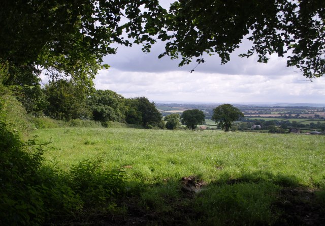
Ewens's Copse is a picturesque woodland located in Somerset, England. Spread across an area of approximately 10 acres, this charming copse is known for its rich biodiversity and tranquil atmosphere. It is situated near the small village of Ewens, adding to its rural and secluded appeal.

The copse is predominantly composed of deciduous trees such as oak, beech, and ash, which create a dense canopy above, allowing only dappled sunlight to filter through. This creates a magical and enchanting ambiance, especially during the spring and autumn seasons when the copse is ablaze with vibrant colors.

Ewens's Copse is a haven for wildlife, attracting a diverse range of species. It provides a suitable habitat for birds including woodpeckers, owls, and various songbirds. Small mammals such as squirrels, rabbits, and hedgehogs can be spotted scurrying amongst the undergrowth, while larger mammals like deer occasionally visit the area.

The copse offers a network of well-maintained footpaths that wind through the woods, providing visitors with the opportunity to explore its beauty. These pathways are also used by local nature enthusiasts for birdwatching and photography.

Ewens's Copse is a popular destination for locals and tourists alike, seeking solace in nature and a peaceful retreat from the hustle and bustle of everyday life. Its natural beauty, combined with the soothing sounds of rustling leaves and chirping birds, make it an ideal spot for relaxation, meditation, and enjoying the great outdoors.

If you have any feedback on the listing, please let us know in the comments section below.

Ewens's Copse Images

Images are sourced within 2km of 50.894426/-2.9145632 or Grid Reference ST3510. Thanks to Geograph Open Source API. All images are credited.

Oxenford House Attractive buildings in Ham stone near Dowlish Wake, the main C17-C18 house and cottage described at <span class="nowrap"><a title="http://webapp1.somerset.gov.uk/her/details.asp?prn=57238" rel="nofollow ugc noopener" href="http://webapp1.somerset.gov.uk/her/details.asp?prn=57238">Link</a><img style="margin-left:2px;" alt="External link" title="External link - shift click to open in new window" src="https://s1.geograph.org.uk/img/external.png" width="10" height="10"/></span>
Oxenford House
Attractive buildings in Ham stone near Dowlish Wake, the main C17-C18 house and cottage described at LinkExternal link
Remains of Chard Canal near Dowlish Ford The wooded line of the canal has here been made into a nature reserve.
Remains of Chard Canal near Dowlish Ford
The wooded line of the canal has here been made into a nature reserve.
Squash Withy Bed Now effective as a shelter belt, this woodland near Dowlish Wake presumably once consisted of willows.
Squash Withy Bed
Now effective as a shelter belt, this woodland near Dowlish Wake presumably once consisted of willows.
Cottage at Oxenford With some modern conversions on the left. Seen from the lane from Dowlish Wake.
Cottage at Oxenford
With some modern conversions on the left. Seen from the lane from Dowlish Wake.
Church of St Michael and All Angels, Chaffcombe Plenty of C15 work still in evidence in this church in a charming village.  <span class="nowrap"><a title="http://webapp1.somerset.gov.uk/her/details.asp?prn=57202" rel="nofollow ugc noopener" href="http://webapp1.somerset.gov.uk/her/details.asp?prn=57202">Link</a><img style="margin-left:2px;" alt="External link" title="External link - shift click to open in new window" src="https://s1.geograph.org.uk/img/external.png" width="10" height="10"/></span> 
Taken from a corner of the churchyard.
Church of St Michael and All Angels, Chaffcombe
Plenty of C15 work still in evidence in this church in a charming village. LinkExternal link Taken from a corner of the churchyard.
Chard Reservoir The northeast corner of the reservoir. See <a href="https://www.geograph.org.uk/photo/244982">ST3309 : Chard Reservoir</a>. I think that's a Great Crested Grebe near the far shore.
Chard Reservoir
The northeast corner of the reservoir. See ST3309 : Chard Reservoir. I think that's a Great Crested Grebe near the far shore.
C18 screen wall, Cricket Malherbie <span class="nowrap"><a title="http://webapp1.somerset.gov.uk/her/details.asp?prn=57263" rel="nofollow ugc noopener" href="http://webapp1.somerset.gov.uk/her/details.asp?prn=57263">Link</a><img style="margin-left:2px;" alt="External link" title="External link - shift click to open in new window" src="https://s1.geograph.org.uk/img/external.png" width="10" height="10"/></span> . Impressive finials and brickwork for a farm wall. The Manor Farm is opposite St Mary Magdalene church.
C18 screen wall, Cricket Malherbie
LinkExternal link . Impressive finials and brickwork for a farm wall. The Manor Farm is opposite St Mary Magdalene church.
Widgery Farm Farm buildings by the lane between Dowlish Wake and Knowle St. Giles.
Widgery Farm
Farm buildings by the lane between Dowlish Wake and Knowle St. Giles.
Malherbie Court Smart modern dwellings from farm buildings on Pinkham Hill, near Knowle St. Giles
Malherbie Court
Smart modern dwellings from farm buildings on Pinkham Hill, near Knowle St. Giles
Cudworth: parish church of St. Michael
View above Cudworth Taken from a gateway on the lane down from the Windwhistle Ridge to Cudworth; the lane continues behind the hedge on the left. The two darker trees formed part of a vanished field boundary.
View above Cudworth
Taken from a gateway on the lane down from the Windwhistle Ridge to Cudworth; the lane continues behind the hedge on the left. The two darker trees formed part of a vanished field boundary.
Field near Higher Farm Taken from the double bend on the lane between Cudworth and Dowlish Wake; the trees to the right are following a stream that flows between the two villages.
Field near Higher Farm
Taken from the double bend on the lane between Cudworth and Dowlish Wake; the trees to the right are following a stream that flows between the two villages.
Autumn leaves A pretty autumn view looking down lane towards Dowlish Wake. West farm and turning for Cudworth on the right.
Autumn leaves
A pretty autumn view looking down lane towards Dowlish Wake. West farm and turning for Cudworth on the right.
Frosty morning Looking up Sprays Hill towards Windwhistle on the first day of 2009
Frosty morning
Looking up Sprays Hill towards Windwhistle on the first day of 2009
Winter scene St Mary Magdalene church in the village of Cricket Malherbie
Winter scene
St Mary Magdalene church in the village of Cricket Malherbie
Wet October morning View looking Southwest towards Cudworth from outside Higher farm after a heavy rainfall
Wet October morning
View looking Southwest towards Cudworth from outside Higher farm after a heavy rainfall
Moat near Cudworth This moat just to the south of the church at Cudworth  is probably the remains of a fortified manor house although there is very little in the way of remains inside the moat. The moat is approximately circular and is approximately 75m to 80m in diameter. The interior is slightly higher than the surrounding field. This is the west side of the moat looking north west from just outside the moat on the southern side. There are the remains of fishponds in the adjacent field. Further details can be found here <span class="nowrap"><a title="http://www.gatehouse-gazetteer.info/English%20sites/3867.html" rel="nofollow ugc noopener" href="http://www.gatehouse-gazetteer.info/English%20sites/3867.html">Link</a><img style="margin-left:2px;" alt="External link" title="External link - shift click to open in new window" src="https://s1.geograph.org.uk/img/external.png" width="10" height="10"/></span>
Moat near Cudworth
This moat just to the south of the church at Cudworth is probably the remains of a fortified manor house although there is very little in the way of remains inside the moat. The moat is approximately circular and is approximately 75m to 80m in diameter. The interior is slightly higher than the surrounding field. This is the west side of the moat looking north west from just outside the moat on the southern side. There are the remains of fishponds in the adjacent field. Further details can be found here LinkExternal link
Cudworth Moat A view of the western side of the moat looking south, showing in the foreground the earthwork in the moat where the entrance point may have been.
Cudworth Moat
A view of the western side of the moat looking south, showing in the foreground the earthwork in the moat where the entrance point may have been.
Show me another place!

Ewens's Copse is located at Grid Ref: ST3510 (Lat: 50.894426, Lng: -2.9145632)

Administrative County: Somerset

District: South Somerset

Police Authority: Avon and Somerset

What 3 Words

///less.salmon.supporter. Near Ilminster, Somerset

Related Wikis

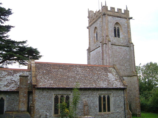
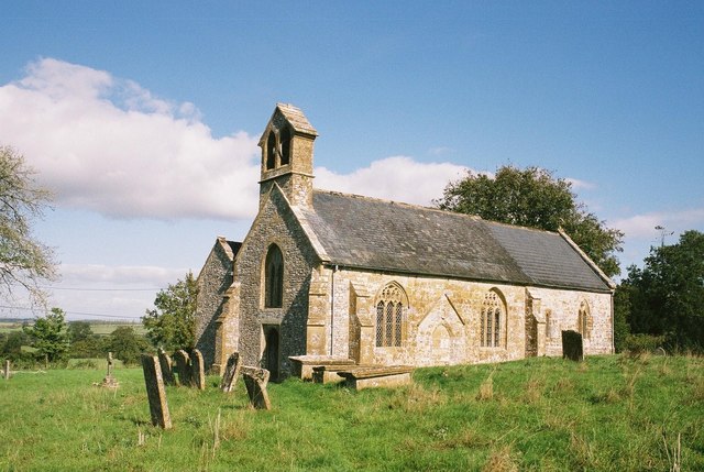
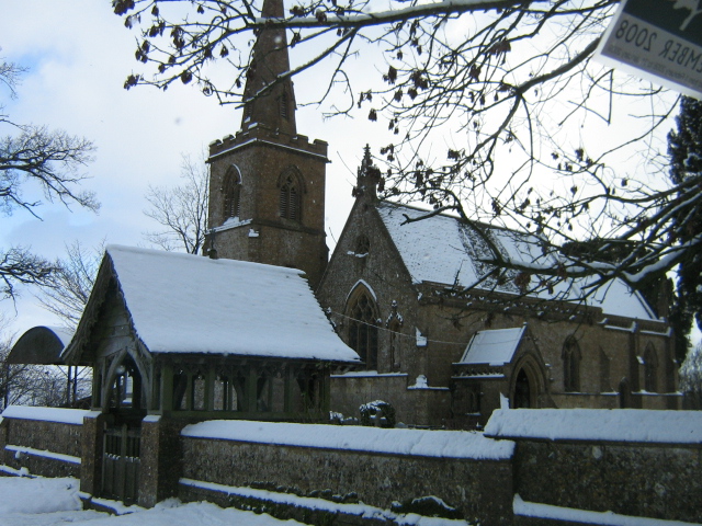
Church of St Mary Magdalene, Cricket Malherbie

The Anglican Church of St Mary Magdalene in Cricket Malherbie, Somerset, England was built in the 12th century and rebuilt in 1855. It is a Grade II* listed...

Church of St Michael and All Angels, Chaffcombe

The Anglican Church of St Michael and All Angels in Chaffcombe, Somerset, England was built in the 15th century. It is a Grade II* listed building. �...

Chaffcombe

Chaffcombe is a village and civil parish in Somerset, England, situated 2 miles (3.2 km) north east of Chard in the South Somerset district. The village...

Knowle St Giles

Knowle St Giles is a village and civil parish in the South Somerset district of Somerset, England, situated on the River Isle 2 miles (3 km) south of Ilminster...

Church of St Michael, Cudworth

The Anglican Church of St Michael in Cudworth, Somerset, England was built in the 12th century. It is a Grade II* listed building. == History == The church...

Cudworth, Somerset

Cudworth (English: ) is a village and parish in Somerset, England, situated 5 miles (8.0 km) north east of Chard in the South Somerset district. The village...
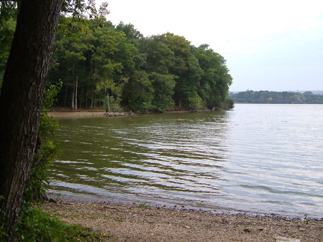
Chard Reservoir

Chard Reservoir is a 36.97-hectare (91.4-acre) reservoir north east of Chard Somerset, England. It is owned and managed by South Somerset District Council...

Dowlish Wake

Dowlish Wake is a small village and civil parish in Somerset, England, 2 miles (3 km) south of Ilminster and 5 miles (8 km) northeast of Chard in the South...

Have you been to Ewens's Copse?

Leave your review of Ewens's Copse below (or comments, questions and feedback).