Furze Close Plantation

Wood, Forest in Devon East Devon

England

Furze Close Plantation

Musbury: from Musbury Castle to the mouth of the Axe Musbury Castle is a hill fort, 170m high, above and to the south east of Musbury village. Seaton can be seen in the distance
Musbury: from Musbury Castle to the mouth of the Axe Credit: Martin Bodman

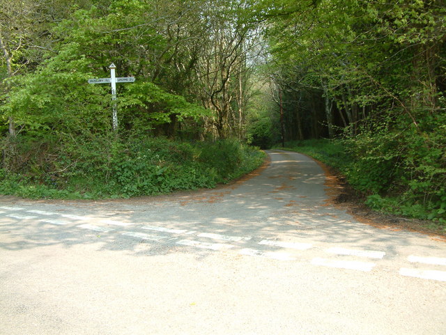
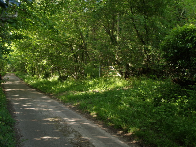
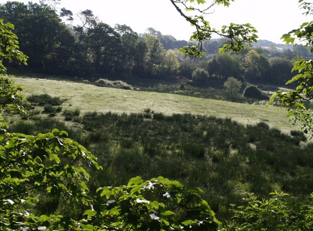
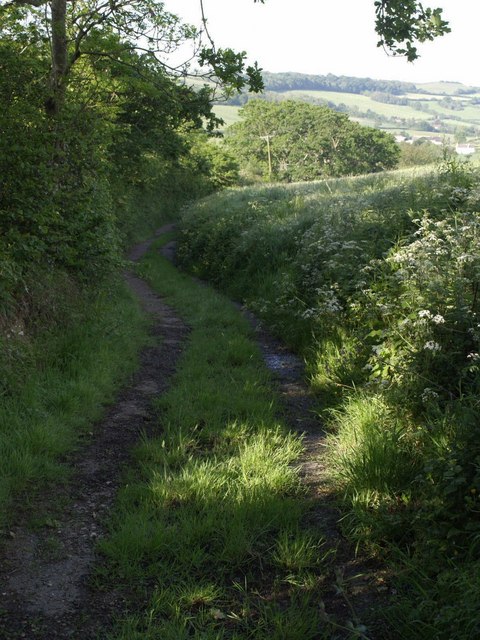
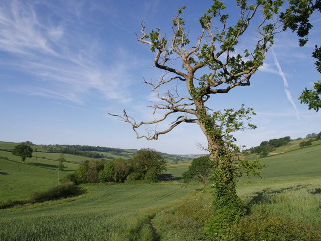
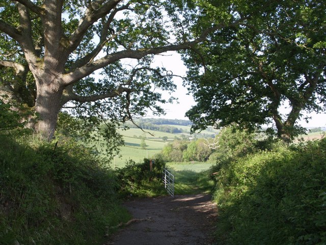
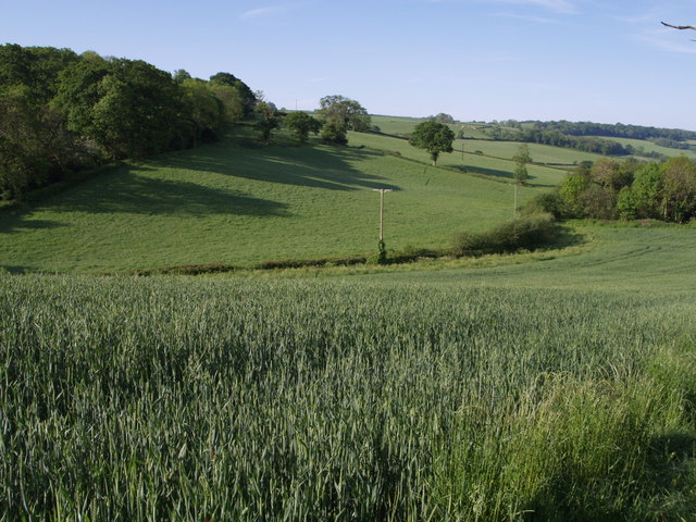
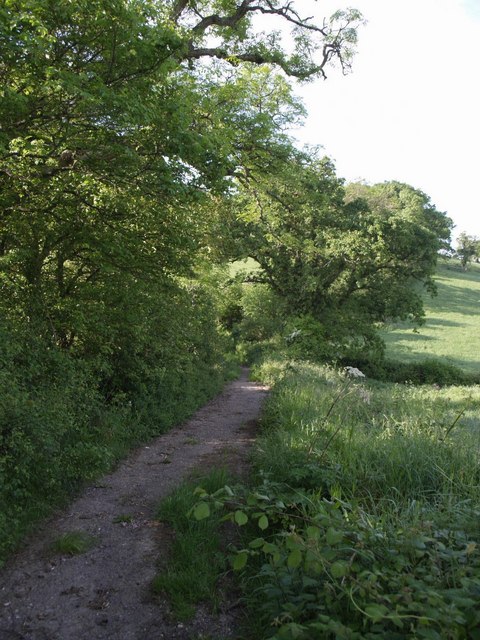
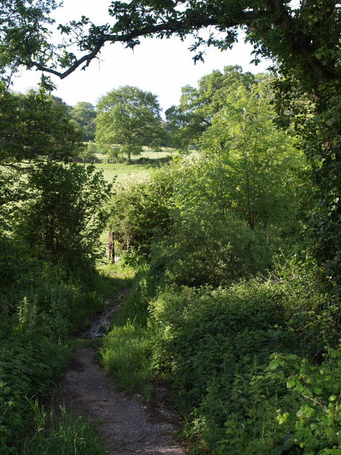
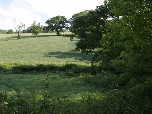
Furze Close Plantation is a picturesque woodland area located in Devon, England. Situated near the village of Devon, this plantation covers a vast area of approximately 100 acres. The woodland is predominantly composed of native tree species such as oak, beech, and birch, providing a diverse and thriving ecosystem.

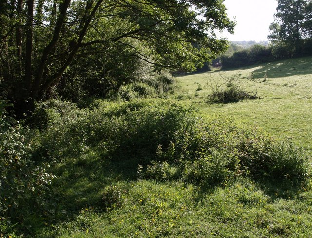
The plantation is well-maintained and managed by the local forestry authority, ensuring the preservation of its natural beauty and ecological balance. Walking trails and footpaths wind through the wood, allowing visitors to explore the area and observe its flora and fauna up close. The woodland floor is adorned with a carpet of wildflowers, creating a vibrant and colorful atmosphere during the spring and summer months.

Furze Close Plantation is also home to a variety of wildlife, offering an ideal habitat for numerous species. It is common to spot woodland creatures such as deer, squirrels, and a wide range of bird species. Birdwatchers will be delighted to find that the plantation attracts many different avian species, making it a popular destination for birdwatching enthusiasts.

The plantation is open to the public throughout the year and is a popular spot for nature lovers, hikers, and families looking for a tranquil and serene escape. Its proximity to the village of Devon makes it easily accessible, and ample parking facilities are available nearby. Whether it's a leisurely stroll, a birdwatching expedition, or simply enjoying the peaceful ambiance of a woodland setting, Furze Close Plantation offers a delightful experience for all.

If you have any feedback on the listing, please let us know in the comments section below.

Furze Close Plantation Images

Images are sourced within 2km of 50.744706/-2.9925165 or Grid Reference SY3094. Thanks to Geograph Open Source API. All images are credited.

Musbury: from Musbury Castle to the mouth of the Axe Musbury Castle is a hill fort, 170m high, above and to the south east of Musbury village. Seaton can be seen in the distance
Musbury: from Musbury Castle to the mouth of the Axe
Musbury Castle is a hill fort, 170m high, above and to the south east of Musbury village. Seaton can be seen in the distance
Musbury Castle Seen from the public footpath from Musbury Church. Musbury Castle is a hill fort overlooking the Axe valley
Musbury Castle
Seen from the public footpath from Musbury Church. Musbury Castle is a hill fort overlooking the Axe valley
Bulmoor Cross, Devon Bulmoor Cross is 2 miles east of Musbury.
Bulmoor Cross, Devon
Bulmoor Cross is 2 miles east of Musbury.
Little Trill Holiday Cottages, Trill A most wonderful part of the Axe Valley.
Little Trill Holiday Cottages, Trill
A most wonderful part of the Axe Valley.
Combpyne Rousdon: Lower Farm On the lane to Higher Bruckland. Looking north
Combpyne Rousdon: Lower Farm
On the lane to Higher Bruckland. Looking north
Combpyne Rousdon: above Combpyne Looking north west towards Musbury Castle from a field close to Lidyates Barn
Combpyne Rousdon: above Combpyne
Looking north west towards Musbury Castle from a field close to Lidyates Barn
View from Pudleylake Road The road briefly crosses the southwest corner of this square, but this view from a gateway on the edge of Ashford Hill Plantation looks right across the square. The valley in the centre carries the tributary of the Axe that flows past Great Trill. The first line of trees on the north side of the valley marks the line of the dismantled Axminster & Lyme Regis Railway. Above the fields is Trinity Hill, in <a href="https://www.geograph.org.uk/gridref/SY3095">SY3095</a>.
View from Pudleylake Road
The road briefly crosses the southwest corner of this square, but this view from a gateway on the edge of Ashford Hill Plantation looks right across the square. The valley in the centre carries the tributary of the Axe that flows past Great Trill. The first line of trees on the north side of the valley marks the line of the dismantled Axminster & Lyme Regis Railway. Above the fields is Trinity Hill, in SY3095.
East Devon Way below Bulmoor The green lane from Bulmoor to Combpyne makes a right-angled bend to the left here, dropping to cross a tributary of the Axe, but the East Devon Way, which has followed it below Woodland Farm, continues as a field path, leaving the square after a few metres.
East Devon Way below Bulmoor
The green lane from Bulmoor to Combpyne makes a right-angled bend to the left here, dropping to cross a tributary of the Axe, but the East Devon Way, which has followed it below Woodland Farm, continues as a field path, leaving the square after a few metres.
Ashford Hill Plantation The gate leads into the northern corner of the plantation. The lane (Pudleylake Road) leads to Bulmoor Cross. <a href="https://www.geograph.org.uk/photo/441660">SY2995 : View from Pudleylake Road</a> was taken from a few yards along the lane on the left.
Ashford Hill Plantation
The gate leads into the northern corner of the plantation. The lane (Pudleylake Road) leads to Bulmoor Cross. SY2995 : View from Pudleylake Road was taken from a few yards along the lane on the left.
Field at Bulmoor A view from the East Devon Way below Bulmoor Cross, where it follows the no through lane to Woodlands Farm.
Field at Bulmoor
A view from the East Devon Way below Bulmoor Cross, where it follows the no through lane to Woodlands Farm.
East Devon Way below Woodland Farm The path follows this green lane to Combpyne as far as <a href="https://www.geograph.org.uk/photo/441693">SY2993 : East Devon Way below Bulmoor</a>. In the distance are farms along Bruckland Lane.
East Devon Way below Woodland Farm
The path follows this green lane to Combpyne as far as SY2993 : East Devon Way below Bulmoor. In the distance are farms along Bruckland Lane.
East Devon Way below Bulmoor The footpath running along the edge of a field and passing a rather gaunt oak after it has left the green lane shown in <a href="https://www.geograph.org.uk/photo/441693">SY2993 : East Devon Way below Bulmoor</a>. Ahead is a valley descending to join the Axe near Boshill Cross; the East Devon Way, however, climbs the valley side to the right, passing Crocker's Pit Coppice which can be seen on the hillside.
East Devon Way below Bulmoor
The footpath running along the edge of a field and passing a rather gaunt oak after it has left the green lane shown in SY2993 : East Devon Way below Bulmoor. Ahead is a valley descending to join the Axe near Boshill Cross; the East Devon Way, however, climbs the valley side to the right, passing Crocker's Pit Coppice which can be seen on the hillside.
Green lane below Bulmoor Another view of the turn in the green lane seen in <a href="https://www.geograph.org.uk/photo/441693">SY2993 : East Devon Way below Bulmoor</a>.
Green lane below Bulmoor
Another view of the turn in the green lane seen in SY2993 : East Devon Way below Bulmoor.
Fields from East Devon Way Taken from the same point as <a href="https://www.geograph.org.uk/photo/448581">SY2893 : East Devon Way below Bulmoor</a>, and looking more to the south, across the valley mentioned in that description. A green lane to Combpyne climbs past the small wood on the left.
Fields from East Devon Way
Taken from the same point as SY2893 : East Devon Way below Bulmoor, and looking more to the south, across the valley mentioned in that description. A green lane to Combpyne climbs past the small wood on the left.
Green lane to Combpyne The green lane featured in <a href="https://www.geograph.org.uk/photo/447862">SY2993 : East Devon Way below Woodland Farm</a> drops to cross the valley shown in <a href="https://www.geograph.org.uk/photo/448978">SY2893 : Fields from East Devon Way</a>.
Green lane to Combpyne
The green lane featured in SY2993 : East Devon Way below Woodland Farm drops to cross the valley shown in SY2893 : Fields from East Devon Way.
Green lane to Combpyne The path crosses the stream at the foot of the valley - see <a href="https://www.geograph.org.uk/photo/450000">SY2993 : Green lane to Combpyne</a> - evidence by the damp patch. Beyond rises Edge Hill.
Green lane to Combpyne
The path crosses the stream at the foot of the valley - see SY2993 : Green lane to Combpyne - evidence by the damp patch. Beyond rises Edge Hill.
Field below Edge Hill Looking up the south side of the stream mentioned in <a href="https://www.geograph.org.uk/photo/450013">SY2993 : Green lane to Combpyne</a>, from the gateway seen in that photo.
Field below Edge Hill
Looking up the south side of the stream mentioned in SY2993 : Green lane to Combpyne, from the gateway seen in that photo.
Fields below Bulmoor Looking north across the shallow valley shown in <a href="https://www.geograph.org.uk/photo/450000">SY2993 : Green lane to Combpyne</a>; the gaunt oak tree across the gridline in <a href="https://www.geograph.org.uk/photo/448581">SY2893 : East Devon Way below Bulmoor</a> is on the left. Taken from the green lane from Combpyne to Bulmoor.
Fields below Bulmoor
Looking north across the shallow valley shown in SY2993 : Green lane to Combpyne; the gaunt oak tree across the gridline in SY2893 : East Devon Way below Bulmoor is on the left. Taken from the green lane from Combpyne to Bulmoor.
Show me another place!

Furze Close Plantation is located at Grid Ref: SY3094 (Lat: 50.744706, Lng: -2.9925165)

Administrative County: Devon

District: East Devon

Police Authority: Devon and Cornwall

What 3 Words

///blackbird.lawfully.stags. Near Axminster, Devon

Related Wikis

Musbury Castle

Musbury Castle is an Iron Age Hill fort situated above the Village of Musbury in Devon. The fort occupies a commanding hill top approx 175 Metres above...

Abbey Gate, Devon

Abbey Gate is a hamlet just south of Axminster in Devon, England. Abbey Gate is at the junction between the A35 and A358 main roads, just west of Wyke...

Holcombe, East Devon

Holcombe is a hamlet in the district of East Devon in the English county of Devon. Holcombe is located northwest of the town of Lyme Regis about a mile...

Combpyne railway station

Combpyne railway station was the intermediate station on the Lyme Regis branch line in East Devon, England. Serving the village of Combpyne, it was sited...

Nearby Amenities

Located within 500m of 50.744706,-2.9925165
Hartgrove
Junction: yes
Lat/Long: 50.7435556/-2.986828
Generator Method: photovoltaic
Generator Output Electricity: yes
Generator Source: solar
Generator Type: solar_photovoltaic_panel
Location: roof
Power: generator
Lat/Long: 50.7453511/-2.9864104
Power: pole
Source: bing
Lat/Long: 50.7433645/-2.9865593
Power: pole
Source: bing
Lat/Long: 50.7430352/-2.9859571
Power: pole
Source: bing
Transformer: distribution
Lat/Long: 50.7457109/-2.9904807
Power: pole
Source: bing
Lat/Long: 50.7449726/-2.9902688
Power: pole
Source: bing
Lat/Long: 50.7442055/-2.9900864
Power: pole
Source: bing
Lat/Long: 50.7425217/-2.9898772
Power: pole
Source: bing
Lat/Long: 50.7414932/-2.9897565
Furze Cose Plantation
Natural: wood
Lat/Long: 50.7453288/-2.9926783
Addr Housename: Knowles
Lat/Long: 50.7452579/-2.9863723
The data included in this document is from www.openstreetmap.org. The data is made available under ODbL.

Have you been to Furze Close Plantation?

Leave your review of Furze Close Plantation below (or comments, questions and feedback).