Clow Bridge

Settlement in Lancashire Burnley

England

Clow Bridge

Approaching Compston's Cross On the Rossendale Way and the White Hill Circular Walk. The cross was erected in 1902 and may partly replace the two lost wayside crosses in this area
Approaching Compston's Cross Credit: Kevin Waterhouse

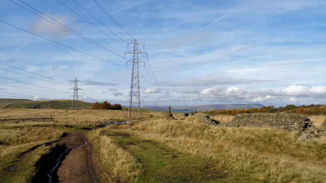
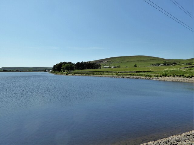
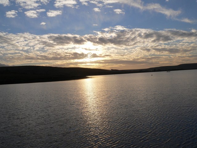
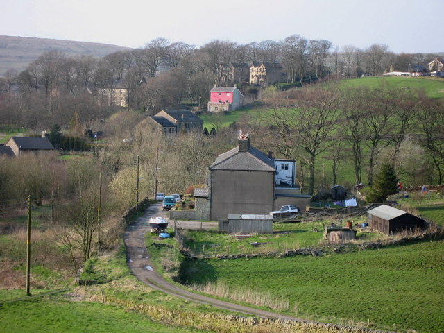
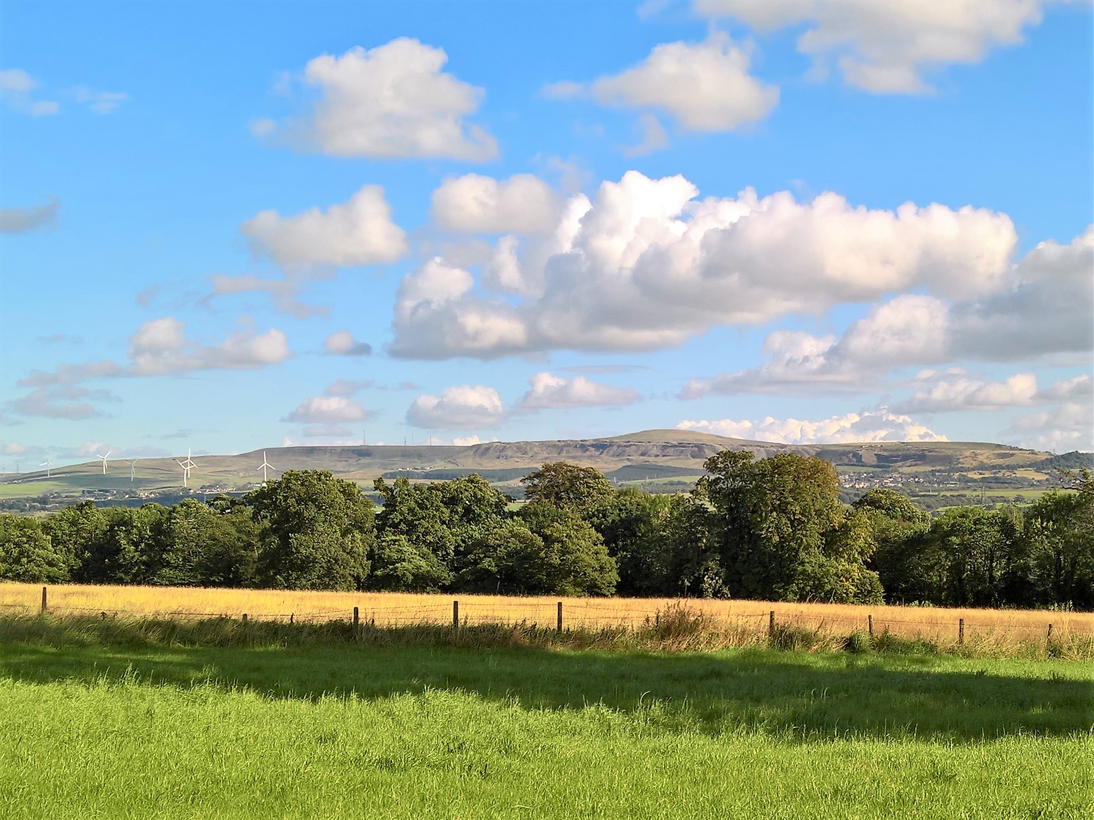
Clow Bridge is a small village located in Lancashire, England. Situated in the picturesque Rossendale Valley, it is known for its scenic beauty and historical significance. The village is situated near the larger town of Rawtenstall and is surrounded by the rolling hills of the Pennines.

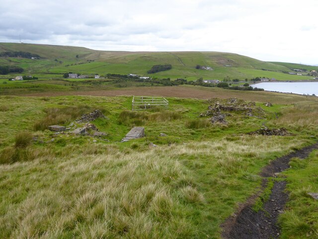
Clow Bridge is historically significant due to its association with the industrial revolution. It was a thriving cotton mill town during the 19th century, with several textile mills operating in the area. These mills played a crucial role in Lancashire's cotton industry, which was once at the forefront of the global textile trade.

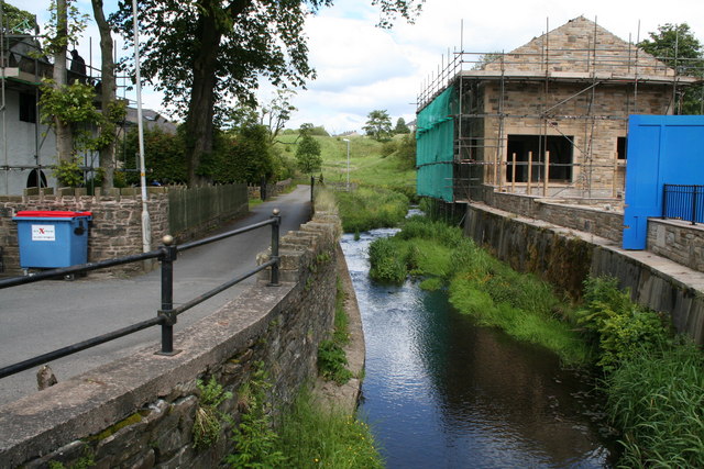
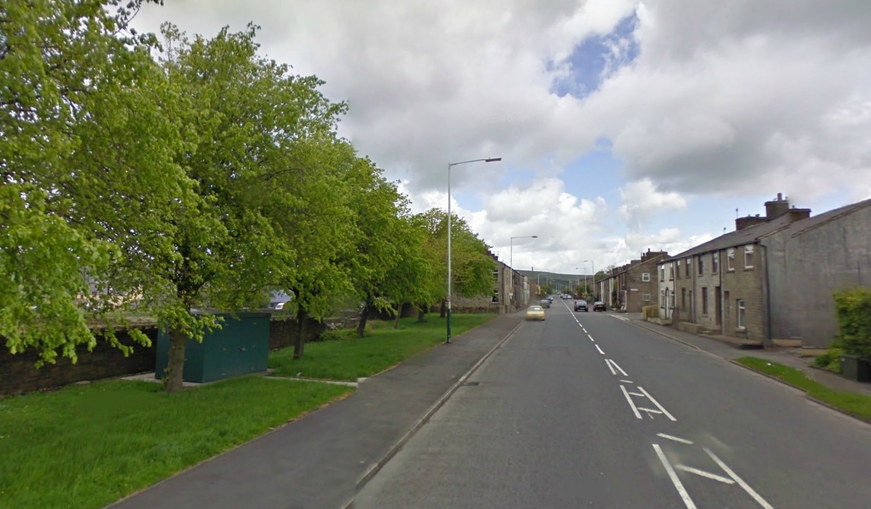
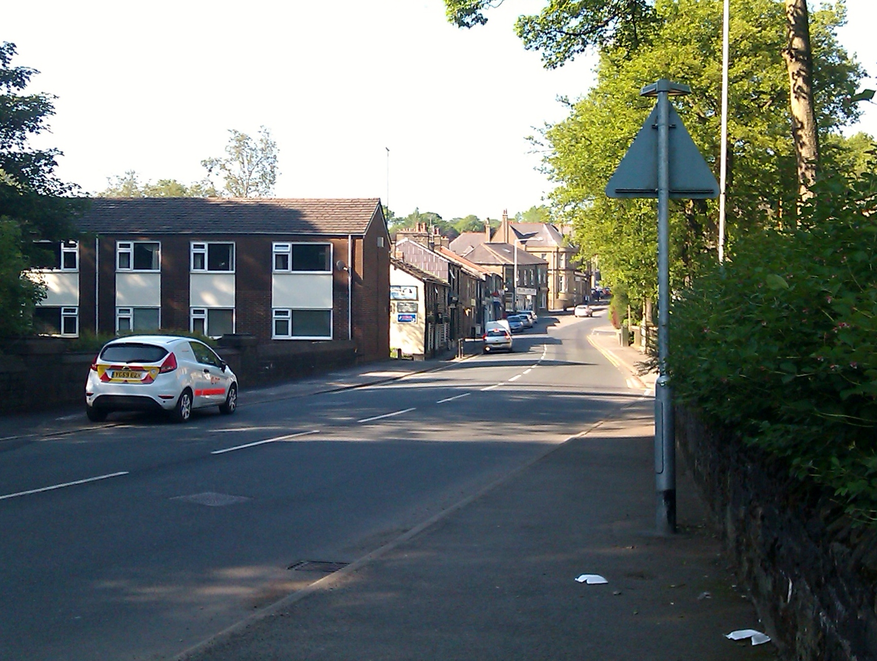
Today, Clow Bridge retains much of its historical charm. Visitors can explore the remnants of the old mills, some of which have been converted into residential properties or transformed into museums and cultural centers. The village also boasts a number of traditional stone houses and buildings, giving it a distinct architectural character.

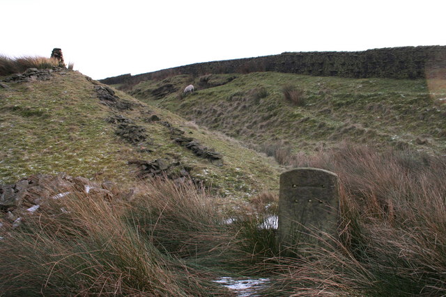
Nature enthusiasts will find plenty to enjoy in Clow Bridge. The surrounding countryside offers opportunities for hiking, birdwatching, and other outdoor activities. The nearby Rossendale Forest Park provides a serene backdrop for leisurely walks or picnics.

For those seeking cultural experiences, Clow Bridge is in close proximity to several attractions. The Whitaker Museum and Art Gallery, located in nearby Rawtenstall, showcases local history and contemporary art. The East Lancashire Railway, a heritage steam railway, offers nostalgic train rides through the beautiful Lancashire countryside.

Overall, Clow Bridge offers a unique blend of history, natural beauty, and cultural attractions, making it a charming destination for visitors and residents alike.

If you have any feedback on the listing, please let us know in the comments section below.

Clow Bridge Images

Images are sourced within 2km of 53.750312/-2.269902 or Grid Reference SD8228. Thanks to Geograph Open Source API. All images are credited.

Approaching Compston's Cross On the Rossendale Way and the White Hill Circular Walk. The cross was erected in 1902 and may partly replace the two lost wayside crosses in this area
Approaching Compston's Cross
On the Rossendale Way and the White Hill Circular Walk. The cross was erected in 1902 and may partly replace the two lost wayside crosses in this area
Masts on Hameldon Hill View from near Compston's Cross on Rossendale Way
Masts on Hameldon Hill
View from near Compston's Cross on Rossendale Way
Woodland north of Greenhill Clough With Clowbridge Reservoir beyond on the left of the view
Woodland north of Greenhill Clough
With Clowbridge Reservoir beyond on the left of the view
Gateway at Wholaw remains The property marked as Wholaw on old OS maps appeared to cover a large site with two gateway access points, this view of one to the north and another behind the camera
Gateway at Wholaw remains
The property marked as Wholaw on old OS maps appeared to cover a large site with two gateway access points, this view of one to the north and another behind the camera
Valley of Limy Water Crossed by a path in Dunnockshaw Community Woodland from Wholaw
Valley of Limy Water
Crossed by a path in Dunnockshaw Community Woodland from Wholaw
Clowbridge Reservoir View from the reservoir embankment causeway
Clowbridge Reservoir
View from the reservoir embankment causeway
Gambleside Mine Pumping Station Beneath the hillside with several former coal mines and close to Clowbridge Reservoir
Gambleside Mine Pumping Station
Beneath the hillside with several former coal mines and close to Clowbridge Reservoir
Clowbridge Reservoir underground chamber There appears to be a vented chamber by the side of the reservoir dam, but OS maps appear to have no information on this feature.
Clowbridge Reservoir underground chamber
There appears to be a vented chamber by the side of the reservoir dam, but OS maps appear to have no information on this feature.
Old holloway An old route to climb Stony Hill which winds around an enclosed field (behind the camera) from the valley of Limy Water (covered by Clowbridge Reservoir) before striking out in this view. This is probably one of the many routes known as Limersgate.
Old holloway
An old route to climb Stony Hill which winds around an enclosed field (behind the camera) from the valley of Limy Water (covered by Clowbridge Reservoir) before striking out in this view. This is probably one of the many routes known as Limersgate.
Gambleside Colliery remains With Clowbridge Reservoir on the right of this view
Gambleside Colliery remains
With Clowbridge Reservoir on the right of this view
Tramway remains Ahead are the remains of a tramway tunnel at the head of a shallow cutting. The tramway went through a tunnel to Gambleside Colliery. A path follows this tramway route between Gambleside Colliery and another behind the camera, which appeared to be unnamed on early OS maps but at the head of Green Fold Reservoir.
Tramway remains
Ahead are the remains of a tramway tunnel at the head of a shallow cutting. The tramway went through a tunnel to Gambleside Colliery. A path follows this tramway route between Gambleside Colliery and another behind the camera, which appeared to be unnamed on early OS maps but at the head of Green Fold Reservoir.
Path to Meadow Head Ahead is a difficult to navigate marshy reed bed, behind the camera is Oaks Mill at Dunnockshaw
Path to Meadow Head
Ahead is a difficult to navigate marshy reed bed, behind the camera is Oaks Mill at Dunnockshaw
Love Clough:  'The Glory' This old pub is still going strong.  It was formerly called the 'Holt's Arms'. Easy to call in, it is right on the A682 and also on the Rossendale Way footpath. There is much of interest in the immediate area, not least, excellent walking country.
Love Clough: 'The Glory'
This old pub is still going strong. It was formerly called the 'Holt's Arms'. Easy to call in, it is right on the A682 and also on the Rossendale Way footpath. There is much of interest in the immediate area, not least, excellent walking country.
Love Clough Social Club
Love Clough:  Commercial Street The north side of the street, with houses 1 to 19 (odds). Unusually for the North of England, the numbering has the odd numbers on the right-hand side.  These houses were built in the early 1860s for the workers at the large Print Works nearby, now demolished.
Love Clough: Commercial Street
The north side of the street, with houses 1 to 19 (odds). Unusually for the North of England, the numbering has the odd numbers on the right-hand side. These houses were built in the early 1860s for the workers at the large Print Works nearby, now demolished.
Love Clough:  Printing works Although this building appears to have been a church, it is in fact a printing works.  Whether there is any connection with the large textile printing works which formerly stood slightly further west, is not known.
Love Clough: Printing works
Although this building appears to have been a church, it is in fact a printing works. Whether there is any connection with the large textile printing works which formerly stood slightly further west, is not known.
Love Clough:  Limy Water At the bottom of Commercial Street a small bridge crosses over Limy Water, seen here looking upstream.  Limy Water is a tributary of the River Irwell, into which it flows at Rawtenstall.
Love Clough: Limy Water
At the bottom of Commercial Street a small bridge crosses over Limy Water, seen here looking upstream. Limy Water is a tributary of the River Irwell, into which it flows at Rawtenstall.
Love Clough:  Limy Water Looking downstream
Love Clough: Limy Water
Looking downstream
Show me another place!

Clow Bridge is located at Grid Ref: SD8228 (Lat: 53.750312, Lng: -2.269902)

Administrative County: Lancashire

District: Burnley

Police Authority: Lancashire

What 3 Words

///slice.glue.amuse. Near Hameldon Hill, Lancashire

Related Wikis

Dunnockshaw

Dunnockshaw or Dunnockshaw and Clowbridge is a civil parish in the borough of Burnley, in Lancashire, England. The parish is situated between Burnley and...

Gambleside

Gambleside is an abandoned village located in northern Rossendale close to the boundary with Burnley's Dunnockshaw parish. In the late Middle Ages Gambleside...

Loveclough

Loveclough is a small hamlet at the edge of the Rossendale Valley, in Lancashire, England, near Crawshawbooth and Rawtenstall, 20 miles north of Manchester...

Habergham Eaves

Habergham Eaves is a civil parish in the borough of Burnley, in Lancashire, England. The parish consists of a rural area south of Burnley, and suburban...

Goodshaw

Goodshaw is a hamlet situated on the edge of the Pennine hills in England, located just north of the market town of Rawtenstall in Lancashire. To the south...

Singing Ringing Tree (sculpture)

The Singing Ringing Tree is a wind powered sound sculpture resembling a tree set in the landscape of the Pennine hill range overlooking Burnley, in Lancashire...

Hameldon Hill

Hameldon Hill is a Carboniferous sandstone hill with a summit elevation of 409 metres (1,342 ft), situated between the towns of Burnley and Accrington...

Crawshawbooth

Crawshawbooth is a small village located on the edge of the Pennines in England, just north of the market town of Rawtenstall, Lancashire, and south of...

Nearby Amenities

Located within 500m of 53.750312,-2.269902
Created By: YahooApplet 1.0
Lat/Long: 53.7519992/-2.2639492
Created By: YahooApplet 1.0
Lat/Long: 53.7510848/-2.265183
Created By: YahooApplet 1.0
Lat/Long: 53.7505265/-2.2659769
Created By: YahooApplet 1.0
Lat/Long: 53.7501712/-2.2667494
Created By: YahooApplet 1.0
Lat/Long: 53.7498477/-2.2674709
Created By: YahooApplet 1.0
Lat/Long: 53.7487755/-2.2703194
Clow Bridge
Place: hamlet
Source: npe
Lat/Long: 53.7501358/-2.2684401
Barrier: kissing_gate
Lat/Long: 53.7471511/-2.2682528
Barrier: kissing_gate
Lat/Long: 53.7466775/-2.2681961
Entrance: yes
Lat/Long: 53.7471177/-2.2674455
Bicycle Parking
Bicycle Parking: stands
Capacity: 8
Lat/Long: 53.7476961/-2.2692313
Bus Stop
Alma Terrace
Naptan AtcoCode: 2500IMG2525
Naptan NaptanCode: langdgwj
Public Transport: platform
Lat/Long: 53.7474935/-2.2750611
Bus Stop
Alma Terrace
Naptan AtcoCode: 2500IMG2524
Naptan NaptanCode: langdgwg
Public Transport: platform
Lat/Long: 53.747781/-2.2741793
Bus Stop
Beijing Restaurant
Public Transport: platform
Lat/Long: 53.7489265/-2.2697919
Bus Stop
Beijing Restaurant
Naptan AtcoCode: 2500DCL518
Naptan NaptanCode: landmdja
Public Transport: platform
Lat/Long: 53.7488869/-2.2701191
Bus Stop
Reservoir
Naptan AtcoCode: 2500IMG2887
Naptan NaptanCode: langjdtm
Public Transport: platform
Lat/Long: 53.7499721/-2.2671526
Bus Stop
Reservoir
Naptan AtcoCode: 2500LAA15841
Naptan NaptanCode: lanjtjga
Public Transport: platform
Lat/Long: 53.750001/-2.2673075
Bus Stop
Cotton Row
Bus: yes
Naptan AtcoCode: 2500LAA15840
Naptan NaptanCode: lanjtjdw
Public Transport: platform
Shelter: yes
Lat/Long: 53.7524013/-2.2631844
Barrier: stile
Stile: stepover
Lat/Long: 53.7523785/-2.2631926
The data included in this document is from www.openstreetmap.org. The data is made available under ODbL.

Have you been to Clow Bridge?

Leave your review of Clow Bridge below (or comments, questions and feedback).