Strangways Copse
Wood, Forest in Somerset Somerset West and Taunton
England
Strangways Copse

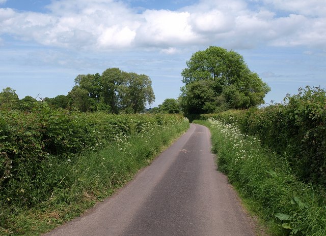
Strangways Copse is a picturesque woodland located in Somerset, England. Situated in the southwest region of the country, this copse is a serene haven for nature enthusiasts and those seeking a peaceful escape from the bustling city life. Covering an area of approximately 20 acres, Strangways Copse is a hidden gem nestled within the stunning Somerset countryside.
This woodland is characterized by its diverse range of trees, including oak, beech, and ash. The canopy formed by these towering trees creates a cool and shaded atmosphere, providing a welcome respite during warmer months. The forest floor is adorned with an array of wildflowers, adding a burst of color to the landscape.
Strangways Copse is home to a variety of wildlife, making it a popular spot for nature lovers and birdwatchers. Visitors may catch a glimpse of red deer, foxes, and rabbits roaming freely in their natural habitat. The copse also attracts a diverse range of bird species, with frequent sightings of woodpeckers, chaffinches, and tawny owls.
For those looking to explore the copse, there are several footpaths and trails that wind their way through the woodland. These trails offer a chance to immerse oneself in the tranquility of nature and discover the copse's hidden treasures. Additionally, there are picnic areas and benches scattered throughout the copse, providing a perfect spot to relax and enjoy a packed lunch amidst the scenic beauty.
Overall, Strangways Copse is a captivating woodland in Somerset, offering a breath of fresh air and a chance to reconnect with nature. Its diverse flora and fauna, combined with its peaceful ambiance, make it a must-visit destination for anyone seeking a serene escape from the hustle and bustle of everyday life.
If you have any feedback on the listing, please let us know in the comments section below.
Strangways Copse Images
Images are sourced within 2km of 50.990863/-3.0187328 or Grid Reference ST2821. Thanks to Geograph Open Source API. All images are credited.


Strangways Copse is located at Grid Ref: ST2821 (Lat: 50.990863, Lng: -3.0187328)
Administrative County: Somerset
District: Somerset West and Taunton
Police Authority: Avon and Somerset
What 3 Words
///wordplay.belief.grudge. Near Creech St Michael, Somerset
Nearby Locations
Related Wikis

West Hatch
West Hatch is a hamlet and civil parish in Somerset, England, situated 5 miles (8.0 km) south east of Taunton. It has a population of 306. == History... ==

Taunton Stop Line
The Taunton Stop Line was a World War II defensive line in southwest England. It was designed "to stop an enemy's advance from the west and in particular...

Thornfalcon
Thornfalcon is a village and civil parish in Somerset, England, situated 4 miles (6.4 km) east of Taunton. The village has a population of 119. The parish...
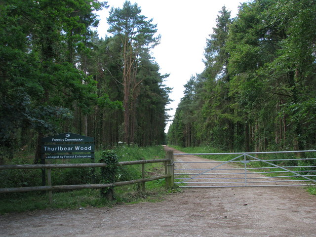
Thurlbear Wood and Quarrylands
Thurlbear Wood and Quarrylands (grid reference ST270210) is a 26.7 hectare (65.8 acre) biological Site of Special Scientific Interest south of Stoke St...
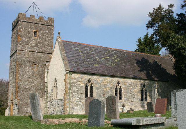
Church of St Mary, Stoke St Mary
The Anglican Church of St Mary in Stoke St Mary, Somerset, England was built in the 13th century. It is a Grade II* listed building. == History == The...

Hatch Beauchamp
Hatch Beauchamp is a village and civil parish in Somerset, England, situated 5 miles (8.0 km) south east of Taunton. The village has a population of 620...
Stoke St Mary
Stoke St Mary is a village and civil parish in Somerset, England, situated 2 miles (3.2 km) south east of Taunton. == History == The earliest recorded...

Bickenhall
Bickenhall is a hamlet and parish in Somerset, England, situated 5 miles (8.0 km) south east of Taunton. The parish, which includes the hamlet of Batten...
Nearby Amenities
Located within 500m of 50.990863,-3.0187328Have you been to Strangways Copse?
Leave your review of Strangways Copse below (or comments, questions and feedback).