Water Shoot Copse

Wood, Forest in Somerset South Somerset

England

Water Shoot Copse

Combe St Nicholas : Charmoor Drove Looking along Charmoor Drove.
Combe St Nicholas : Charmoor Drove Credit: Lewis Clarke

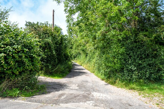
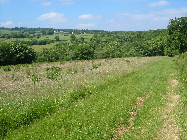
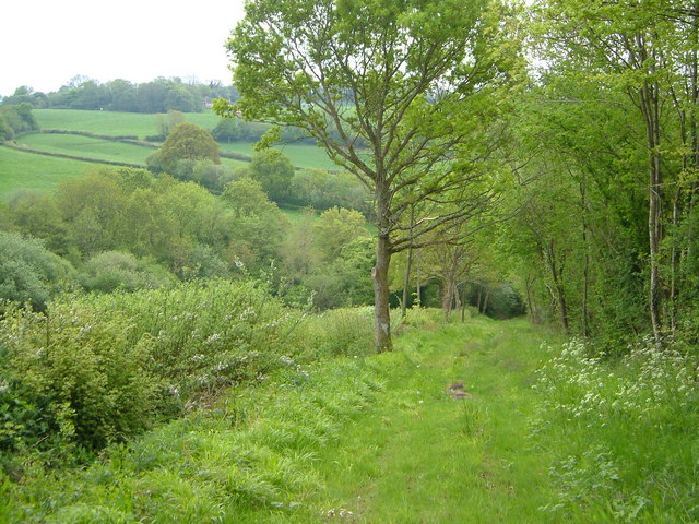
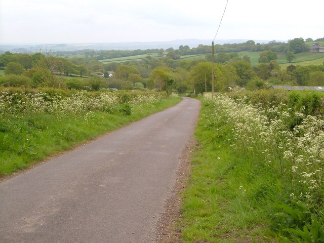
Water Shoot Copse is a captivating woodland located in Somerset, England. Situated in the heart of the county, this copse covers an area of approximately 20 acres and offers visitors a serene and enchanting experience. The copse is predominantly made up of deciduous trees, including oak, beech, and ash, creating a diverse and rich habitat for a variety of flora and fauna.

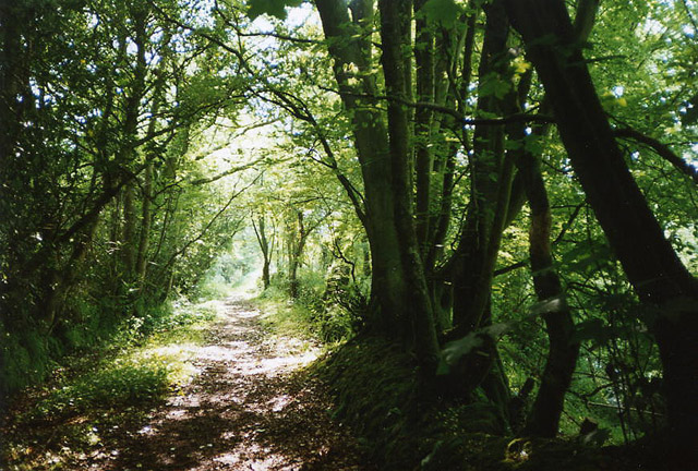
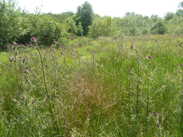
The copse is known for its picturesque beauty, with a dense canopy of trees that filters the sunlight, casting a dappled glow on the forest floor. The ground is covered in a thick carpet of moss, ferns, and wildflowers, providing a tranquil and peaceful setting for visitors to explore and immerse themselves in nature.

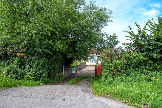
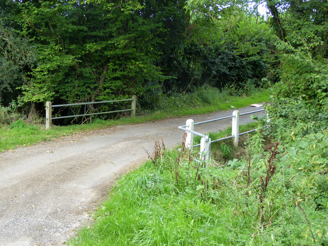
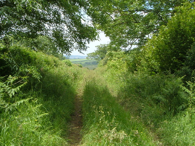
A network of well-maintained footpaths meanders through the copse, allowing visitors to wander through the woodland and discover its hidden treasures. These paths lead to a small stream that runs through the copse, providing a calming soundtrack as the water gently flows over rocks and pebbles.

Water Shoot Copse is not only a haven for nature lovers but also a sanctuary for a variety of wildlife. The copse is home to a diverse range of bird species, including woodpeckers, owls, and various songbirds. Squirrels can be spotted scurrying up and down trees, while deer and foxes occasionally make appearances.

This woodland gem offers a peaceful retreat for those seeking solace in nature. Whether it's a leisurely stroll, birdwatching, or simply enjoying the tranquility, Water Shoot Copse is a must-visit destination in Somerset for anyone looking to connect with the natural world.

If you have any feedback on the listing, please let us know in the comments section below.

Water Shoot Copse Images

Images are sourced within 2km of 50.918598/-3.0218483 or Grid Reference ST2813. Thanks to Geograph Open Source API. All images are credited.

Combe St Nicholas : Charmoor Drove Looking along Charmoor Drove.
Combe St Nicholas : Charmoor Drove
Looking along Charmoor Drove.
Combe St Nicholas : Oakfields Entry to a house off the A303.
Combe St Nicholas : Oakfields
Entry to a house off the A303.
Combe St Nicholas : House A house alongside the A303.
Combe St Nicholas : House
A house alongside the A303.
Ham Hill, A303 The A303 is a main trunk road running 92 miles between Basingstoke and Honiton. Along with the A30 and M3 it forms a major route between London and the South West. Much of the road is dual carriageway, but some stretches remain single and prone to congestion.

Wikipedia: <span class="nowrap"><a title="http://en.wikipedia.org/wiki/A303_road" rel="nofollow ugc noopener" href="http://en.wikipedia.org/wiki/A303_road">Link</a><img style="margin-left:2px;" alt="External link" title="External link - shift click to open in new window" src="https://s1.geograph.org.uk/img/external.png" width="10" height="10"/></span>
Ham Hill, A303
The A303 is a main trunk road running 92 miles between Basingstoke and Honiton. Along with the A30 and M3 it forms a major route between London and the South West. Much of the road is dual carriageway, but some stretches remain single and prone to congestion. Wikipedia: LinkExternal link
Bridge on Priddles Lane The water crossed appears to be a tributary of the River Isle, which flows into the River Parrett to reach the sea in Bridgwater Bay.
Bridge on Priddles Lane
The water crossed appears to be a tributary of the River Isle, which flows into the River Parrett to reach the sea in Bridgwater Bay.
Buckland St Mary: woodland path An old track linking Buckland St Mary and Bishopswood
Buckland St Mary: woodland path
An old track linking Buckland St Mary and Bishopswood
Belcombe Drove Looking west by north along a drove road across the Blackdown Hills
Belcombe Drove
Looking west by north along a drove road across the Blackdown Hills
View near Belcombe, Blackdown Hills Looking west-north-west across the valley of a tributary of the Yarty. The wooded area beyond the road is Freshmoor, an SSSI, consisting of bog habitat with scrub.
View near Belcombe, Blackdown Hills
Looking west-north-west across the valley of a tributary of the Yarty. The wooded area beyond the road is Freshmoor, an SSSI, consisting of bog habitat with scrub.
Freshmoor SSSI Looking south-west across part of Freshmoor Site of Special Scientific Interest on a slope in the Blackdown Hills, a bog habitat in decline. Prominent here is Cirsium palustre, the Marsh Thistle.
Freshmoor SSSI
Looking south-west across part of Freshmoor Site of Special Scientific Interest on a slope in the Blackdown Hills, a bog habitat in decline. Prominent here is Cirsium palustre, the Marsh Thistle.
Buckland St Mary, the old Rectory As indicated on older maps (the current rectory of this scattered village in the Blackdown Hills is some distance away). View from the north-west.
Buckland St Mary, the old Rectory
As indicated on older maps (the current rectory of this scattered village in the Blackdown Hills is some distance away). View from the north-west.
Blackdown Hills at Wheatlands Coppice Looking north-north-west from the bridleway from Buckland St Mary to Blindmoor, with Wheatlands Coppice ahead right, the hamlet of Blackwater and the summit ridge of the Blackdown Hills in the distance.
Blackdown Hills at Wheatlands Coppice
Looking north-north-west from the bridleway from Buckland St Mary to Blindmoor, with Wheatlands Coppice ahead right, the hamlet of Blackwater and the summit ridge of the Blackdown Hills in the distance.
The Eagle Tavern on the A303 west of Ilminster
Higher Hare Farm Beside a long drove that climbs the eastern slopes of the Blackdown Hills.
Higher Hare Farm
Beside a long drove that climbs the eastern slopes of the Blackdown Hills.
Charmoor Lane This green lane descends towards a ford across the River Ding.
Charmoor Lane
This green lane descends towards a ford across the River Ding.
Silver Street Looking down a typical Blackdown drove road to the scattered hamlet of Silver Street.
Silver Street
Looking down a typical Blackdown drove road to the scattered hamlet of Silver Street.
Dommett Farm A remarkable old farmhouse on the slopes of the Blackdown Hills, with mullioned windows on the ground floor.
Dommett Farm
A remarkable old farmhouse on the slopes of the Blackdown Hills, with mullioned windows on the ground floor.
View from Hare Lane A view in the Blackdown Hills over a tributary valley of the River Ding; the patch of bluebells are on the edge of Colmer's Mead Plantation.
View from Hare Lane
A view in the Blackdown Hills over a tributary valley of the River Ding; the patch of bluebells are on the edge of Colmer's Mead Plantation.
Combe St Nicholas: Lower Beetham The road ahead leads to Higher Beetham and on to Bishopswood; the left turn runs to Whitestaunton. Street Ash is reached by turning right. Looking north west across a staggered crossroads
Combe St Nicholas: Lower Beetham
The road ahead leads to Higher Beetham and on to Bishopswood; the left turn runs to Whitestaunton. Street Ash is reached by turning right. Looking north west across a staggered crossroads
Show me another place!

Water Shoot Copse is located at Grid Ref: ST2813 (Lat: 50.918598, Lng: -3.0218483)

Administrative County: Somerset

District: South Somerset

Police Authority: Avon and Somerset

What 3 Words

///rags.materials.jaunts. Near Chard, Somerset

Related Wikis

Church of St Mary, Buckland St Mary

The Anglican Church of St Mary in Buckland St Mary, Somerset, England was built in 1853-1863. It is a Grade II* listed building. == History == The church...

Freshmoor

Freshmoor (grid reference ST280125) is an 11.2 hectare (27.7 acre) biological Site of Special Scientific Interest in Somerset, notified in 1989. Freshmoor...

Buckland St Mary

Buckland St Mary is a village and parish in Somerset, England, situated 6 miles (9.7 km) to the west of Ilminster and 8 miles (12.9 km) south of Taunton...

Castle Neroche

Castle Neroche is a Norman motte-and-bailey castle on the site of an earlier hill fort in the parish of Curland, near Staple Fitzpaine, Somerset, England...

Nearby Amenities

Located within 500m of 50.918598,-3.0218483
Kerb: no
Lat/Long: 50.9150045/-3.0179921
The data included in this document is from www.openstreetmap.org. The data is made available under ODbL.

Have you been to Water Shoot Copse?

Leave your review of Water Shoot Copse below (or comments, questions and feedback).