Wheel Bank Coppice

Wood, Forest in Lancashire South Lakeland

England

Wheel Bank Coppice

The Cumbria Way, Torver Back Common The Cumbria Way follows the public footpath from Delicars to Coniston above the shore of Coniston Water (next photograph <a href="https://www.geograph.org.uk/photo/7003403">SD2993 : The Cumbria Way near Bellman’s Hole</a>).
The Cumbria Way, Torver Back Common Credit: Adrian Taylor

Wheel Bank Coppice is a picturesque wood located in the county of Lancashire, England. Nestled in the heart of the countryside, this enchanting forest spans over a vast area, providing a serene and tranquil escape from the hustle and bustle of city life.

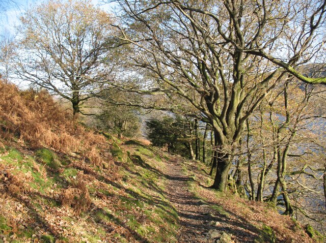
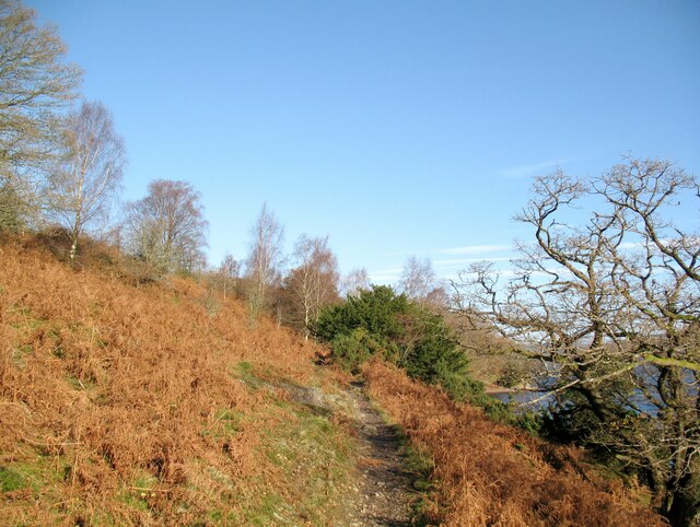
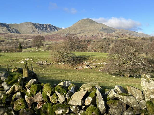
The copse is characterized by its dense and diverse woodland, which consists primarily of a mixture of deciduous and evergreen trees. Towering oaks, majestic beeches, and slender birches create a verdant canopy, casting dappled sunlight onto the forest floor. The rich undergrowth is awash with vibrant wildflowers, ferns, and mosses, adding to the area's natural beauty.

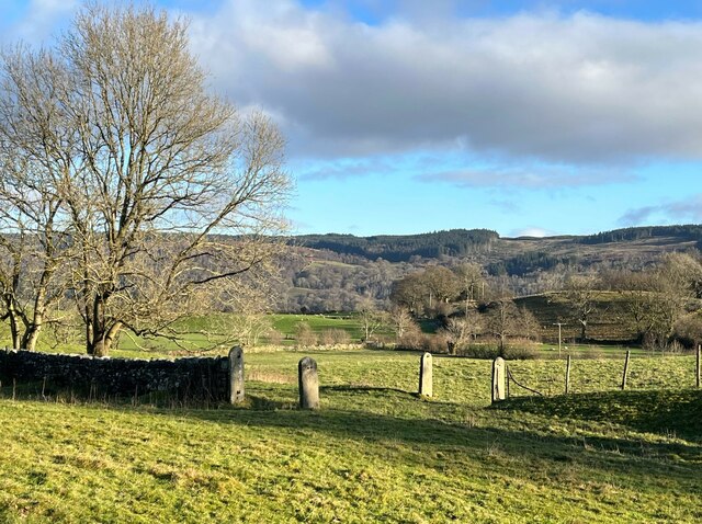
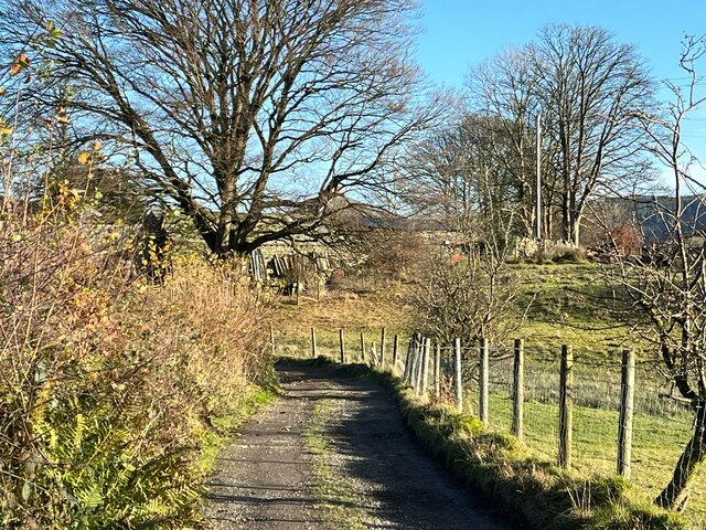
The wood is intersected by a network of well-maintained footpaths, allowing visitors to explore its depths and discover its hidden treasures. These paths wind their way through the trees, revealing secluded glades, babbling brooks, and charming clearings. Nature enthusiasts will delight in the diverse wildlife that calls Wheel Bank Coppice home. Deer, squirrels, and a variety of bird species can often be spotted amongst the foliage.

The coppice is not only a haven for flora and fauna but also holds historical significance. It is believed to have been used for centuries as a source of timber, with evidence of past woodland management techniques. The area's rich cultural heritage is evident in the remnants of charcoal pits and old boundary markers found within the wood.

Overall, Wheel Bank Coppice is a captivating woodland that offers a retreat into nature's embrace. Its stunning scenery, abundant wildlife, and historical significance make it a must-visit destination for nature lovers and history enthusiasts alike.

If you have any feedback on the listing, please let us know in the comments section below.

Wheel Bank Coppice Images

Images are sourced within 2km of 54.336797/-3.1147322 or Grid Reference SD2794. Thanks to Geograph Open Source API. All images are credited.

The Cumbria Way, Torver Back Common The Cumbria Way follows the public footpath from Delicars to Coniston above the shore of Coniston Water (next photograph <a href="https://www.geograph.org.uk/photo/7003403">SD2993 : The Cumbria Way near Bellman’s Hole</a>).
The Cumbria Way, Torver Back Common
The Cumbria Way follows the public footpath from Delicars to Coniston above the shore of Coniston Water (next photograph SD2993 : The Cumbria Way near Bellman’s Hole).
The Cumbria Way near Bellman’s Hole This path above the shore of Coniston Water is the public footpath from Delicars to Coniston. It is the route of The Cumbria Way long distance path from Ulverston to Carlisle (next photograph <a href="https://www.geograph.org.uk/photo/7003650">SD2993 : Moor Gill Foot Ford</a>).
The Cumbria Way near Bellman’s Hole
This path above the shore of Coniston Water is the public footpath from Delicars to Coniston. It is the route of The Cumbria Way long distance path from Ulverston to Carlisle (next photograph SD2993 : Moor Gill Foot Ford).
Cragg Cottage On the northern outskirts of Torver. In the process of making a new parking area.
Cragg Cottage
On the northern outskirts of Torver. In the process of making a new parking area.
Brocklebank holiday accommodation South of Torver, nestled below Brocklebank Ground
Brocklebank holiday accommodation
South of Torver, nestled below Brocklebank Ground
The Wilsons Arms, Torver Public House with attached Deli
The Wilsons Arms, Torver
Public House with attached Deli
Old Bridge Marker on Hollage Bridge, Torver Bridge Marker cut in the north parapet of Hollage Bridge, Torver Beck, on the A5084. Torver parish. Inscription reads C C HOLLAGE BRIDGE / REBUILT 1903.

Milestone Society National ID: LA_TORV01br
Old Bridge Marker on Hollage Bridge, Torver
Bridge Marker cut in the north parapet of Hollage Bridge, Torver Beck, on the A5084. Torver parish. Inscription reads C C HOLLAGE BRIDGE / REBUILT 1903. Milestone Society National ID: LA_TORV01br
A593 near Torver
A593 near Torver
Dow Crag and Coniston Old Man In winter sunshine, Dow Crag and Coniston Old Man are viewed from the lane near Grass Guards.
Dow Crag and Coniston Old Man
In winter sunshine, Dow Crag and Coniston Old Man are viewed from the lane near Grass Guards.
Occupation crossing, Little Arrow Still bearing their hinges but with the gates long gone, only four round topped slate gateposts remain from a farmer’s occupation crossing over the Coniston Branch railway at Little Arrow.
The last passenger service ran on 4 October 1958 with a final enthusiasts’ special train on the 27 August 1961. The last freight train ran during the week ending 29 April 1962 and the track was lifted early in 1963.
Occupation crossing, Little Arrow
Still bearing their hinges but with the gates long gone, only four round topped slate gateposts remain from a farmer’s occupation crossing over the Coniston Branch railway at Little Arrow. The last passenger service ran on 4 October 1958 with a final enthusiasts’ special train on the 27 August 1961. The last freight train ran during the week ending 29 April 1962 and the track was lifted early in 1963.
Wall near Scale Haw Above Crook Gill, the substantial dry stone wall bounds a narrow lane taking a public footpath from Little Arrow up to Little Arrow Intake and Banishead Quarries.  Dow Crag and Coniston Old Man are prominent in the background.
Wall near Scale Haw
Above Crook Gill, the substantial dry stone wall bounds a narrow lane taking a public footpath from Little Arrow up to Little Arrow Intake and Banishead Quarries. Dow Crag and Coniston Old Man are prominent in the background.
Path near Crook Gill An old path, known locally as a trod, above Crook Gill.  It is a public footpath.
Coniston Old Man is in the background.
Path near Crook Gill
An old path, known locally as a trod, above Crook Gill. It is a public footpath. Coniston Old Man is in the background.
The Wilson Arms With few patrons on a moody March day, The Wilson Arms catches a fleeting patch of sun beneath the lower slopes of The Coniston Fells.  The adjacent Torver Deli is an integral part of the pub and also serves as a useful village shop for the few remaining residents in a village consisting mainly of holiday homes.
The pub describes itself as The Wilson Arms but the pub sign reads The Wilsons; the website has both!  It is unusual to find a pub using two official names simultaneously.
The Wilson Arms
With few patrons on a moody March day, The Wilson Arms catches a fleeting patch of sun beneath the lower slopes of The Coniston Fells. The adjacent Torver Deli is an integral part of the pub and also serves as a useful village shop for the few remaining residents in a village consisting mainly of holiday homes. The pub describes itself as The Wilson Arms but the pub sign reads The Wilsons; the website has both! It is unusual to find a pub using two official names simultaneously.
Lane near Brackenbarrow Farm The access lane to Brackenbarrow (formerly spelled Bracken Barrow) Farm forms a part of the public footpath from Brigg House Bridge on the A593 to Napping Tree Coppice beside Coniston Water.
Lane near Brackenbarrow Farm
The access lane to Brackenbarrow (formerly spelled Bracken Barrow) Farm forms a part of the public footpath from Brigg House Bridge on the A593 to Napping Tree Coppice beside Coniston Water.
Dow Crag and Coniston Old Man Viewed from the minor road from Ellis Howe to Greenet Coppice near Brackenbarrow.
Dow Crag and Coniston Old Man
Viewed from the minor road from Ellis Howe to Greenet Coppice near Brackenbarrow.
Dow Crag and Coniston Old Man
The Coniston Branch near Torver Now a public bridleway from Torver to Little Arrow, the Coniston Branch railway was once part of the Furness Railway.
The last passenger service ran on 4 October 1958 with a final enthusiasts’ special train on the 27 August 1961. The last freight train ran during the week ending 29 April 1962 and the track was lifted early in 1963.
The Coniston Branch near Torver
Now a public bridleway from Torver to Little Arrow, the Coniston Branch railway was once part of the Furness Railway. The last passenger service ran on 4 October 1958 with a final enthusiasts’ special train on the 27 August 1961. The last freight train ran during the week ending 29 April 1962 and the track was lifted early in 1963.
The Cumbria Way, Delicars The Cumbria Way follows a public footpath along a farm track near Delicars (next photograph <a href="https://www.geograph.org.uk/photo/6965776">SD2892 : The Cumbria Way near Delicars</a>).
The Cumbria Way, Delicars
The Cumbria Way follows a public footpath along a farm track near Delicars (next photograph SD2892 : The Cumbria Way near Delicars).
Tranearth Tranearth is the club hut of Lancashire Climbing and Caving Club. It has no road access and users must make the walk there from a car park lower down towards Torver.
Tranearth
Tranearth is the club hut of Lancashire Climbing and Caving Club. It has no road access and users must make the walk there from a car park lower down towards Torver.
Show me another place!

Wheel Bank Coppice is located at Grid Ref: SD2794 (Lat: 54.336797, Lng: -3.1147322)

Administrative County: Cumbria

District: South Lakeland

Police Authority: Cumbria

What 3 Words

///adopting.nodded.deriving. Near Windermere, Cumbria

Related Wikis

Torver

Torver is a village and civil parish in the South Lakeland district of Cumbria, England, 3 miles (4.8 km) south west of the village of Coniston and 1 mile...

St Luke's Church, Torver

St Luke's Church is in the village of Torver, Cumbria, England. It is an active Anglican parish church in the deanery of Furness, the archdeaconry of...

Torver railway station

Torver railway station served the village of Torver, in Lancashire, England (now in Cumbria). It was on the branch line to Coniston. == History == Authorised...

Kelly Hall Tarn

Kelly Hall Tarn is a pool in Cumbria, England, to the west of Coniston Water. It is located about one km south-south-east of the village of Torver, on...

Nearby Amenities

Located within 500m of 54.336797,-3.1147322
Brocklebank Ground Holiday Cottages
Addr City: Torver
Addr Housename: Barn House Cottages
Addr Postcode: LA21 8BS
Phone: +44 15394 49588
Tourism: guest_house
Website: brocklebankground.com
Lat/Long: 54.3353772/-3.1143074
Barrier: kissing_gate
Lat/Long: 54.3374728/-3.111589
Brocklebank Ground
Place: locality
Lat/Long: 54.3349822/-3.1148414
Under Crag
Place: locality
Lat/Long: 54.3376335/-3.1112644
Southstead
Place: locality
Lat/Long: 54.3326178/-3.1168097
Wide Close
Place: locality
Lat/Long: 54.3412124/-3.1150671
Barrier: stile
Lat/Long: 54.3338611/-3.1114215
Barrier: stile
Lat/Long: 54.3331542/-3.1105417
Power: pole
Lat/Long: 54.3340184/-3.1117918
Power: pole
Lat/Long: 54.3342523/-3.1121398
Power: pole
Lat/Long: 54.3327255/-3.113959
Material: wood
Power: pole
Lat/Long: 54.3334148/-3.1133906
Material: wood
Power: pole
Lat/Long: 54.3345083/-3.1125007
Power: pole
Lat/Long: 54.3350622/-3.1120477
Power: pole
Lat/Long: 54.3356918/-3.1115313
Power: pole
Lat/Long: 54.3366736/-3.1107112
Power: pole
Lat/Long: 54.3374423/-3.1100893
Power: pole
Lat/Long: 54.3377642/-3.109823
Power: pole
Lat/Long: 54.3383/-3.1088747
Cafe
Undercrag Cafe
Addr City: Torver
Addr Postcode: LA21 8BS
Cuisine: cake;tea;coffee
Diet Vegan: yes
Diet Vegetarian: yes
Dogs: yes
Fhrs Id: 1380491
Opening Hours: Th-Su 10:30-16:00
Lat/Long: 54.3380519/-3.1111497
Undercrag Studio
Addr City: Torver
Addr Postcode: LA21 8BS
Shop: art
Lat/Long: 54.3380387/-3.1110998
Power: pole
Lat/Long: 54.3330532/-3.1106188
Power: pole
Lat/Long: 54.3328988/-3.1122399
The data included in this document is from www.openstreetmap.org. The data is made available under ODbL.

Have you been to Wheel Bank Coppice?

Leave your review of Wheel Bank Coppice below (or comments, questions and feedback).