Bull Haw Moss

Downs, Moorland in Lancashire South Lakeland

England

Bull Haw Moss

Torver Goods Yard The old railway goods yard at Torver is now used by a local builder for storage.  The stone built goods shed contained a loading platform upon which was mounted a 1 ton hand operated crane manufactured by R. Kitchen ironfounders in Warrington.  The crane has subsequently been relocated to the rear of The Wilson’s Arms.  The goods shed was used as a hay barn after the railway closed but lost its roof in a fire and stood derelict for a number of years before being repaired, altered and re-roofed and brought back into use.
Torver Goods Yard Credit: Adrian Taylor

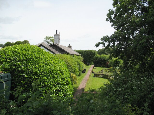
Bull Haw Moss is a picturesque area located in Lancashire, a county in North West England. Situated amidst the beautiful countryside, it is known for its striking landscape, comprising of downs and moorland. The area is a haven for nature enthusiasts and offers a serene retreat away from the bustling city life.

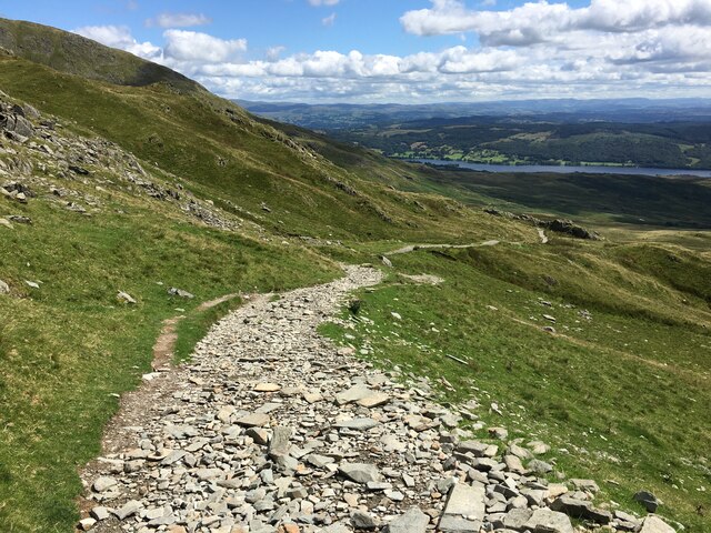
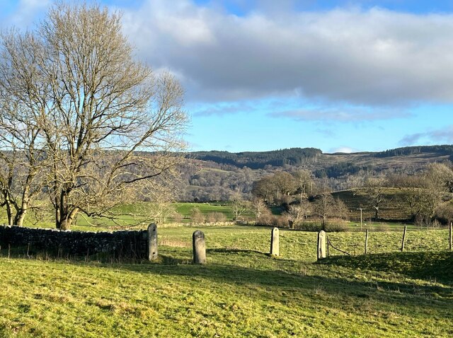
The terrain of Bull Haw Moss is characterized by rolling hills, vast expanses of heather moorland, and pockets of woodland. The diverse flora and fauna found here make it a popular spot for wildlife observation and bird watching. Visitors can expect to spot various species of birds, including curlews, lapwings, and red grouse, as well as small mammals like hares and rabbits.

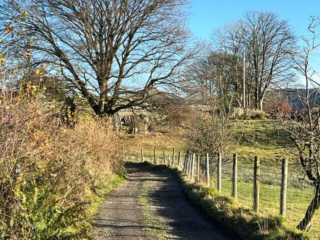
The stunning views from Bull Haw Moss are a major draw for photographers and hikers. The undulating hills provide a challenging yet rewarding experience for those seeking outdoor adventures. A network of well-marked trails allows visitors to explore the area on foot or by bike, immersing themselves in the tranquil surroundings.

In addition to its natural beauty, Bull Haw Moss has historical significance. The area boasts ancient burial mounds and remnants of stone circles, indicating human presence dating back thousands of years. These archaeological sites add an intriguing element to the already captivating landscape.

Overall, Bull Haw Moss in Lancashire is a haven for nature lovers and outdoor enthusiasts. Its breathtaking scenery, diverse wildlife, and rich history make it a must-visit destination for those seeking a peaceful and immersive experience in the heart of the English countryside.

If you have any feedback on the listing, please let us know in the comments section below.

Bull Haw Moss Images

Images are sourced within 2km of 54.343526/-3.1227443 or Grid Reference SD2794. Thanks to Geograph Open Source API. All images are credited.

Torver Goods Yard The old railway goods yard at Torver is now used by a local builder for storage.  The stone built goods shed contained a loading platform upon which was mounted a 1 ton hand operated crane manufactured by R. Kitchen ironfounders in Warrington.  The crane has subsequently been relocated to the rear of The Wilson’s Arms.  The goods shed was used as a hay barn after the railway closed but lost its roof in a fire and stood derelict for a number of years before being repaired, altered and re-roofed and brought back into use.
Torver Goods Yard
The old railway goods yard at Torver is now used by a local builder for storage. The stone built goods shed contained a loading platform upon which was mounted a 1 ton hand operated crane manufactured by R. Kitchen ironfounders in Warrington. The crane has subsequently been relocated to the rear of The Wilson’s Arms. The goods shed was used as a hay barn after the railway closed but lost its roof in a fire and stood derelict for a number of years before being repaired, altered and re-roofed and brought back into use.
Torver The road here passing in front of the cottages and The Wilson Arms was originally the A593 road until it was realigned between a point near Torver Station and Dalton Road Gates level crossing, taking advantage of the alignment of the former railway.
Torver
The road here passing in front of the cottages and The Wilson Arms was originally the A593 road until it was realigned between a point near Torver Station and Dalton Road Gates level crossing, taking advantage of the alignment of the former railway.
Torver Station The station building is now let as a holiday cottage and the old platform is still visible.  The platform and track bed have been converted into a garden with a fenced pond.
Torver station was on the Foxfield to Coniston branch of The Furness Railway.  It was only provided with a single low platform; the red sandstone coping stones still bear a few faint traces of white paint on the platform edge more than 60 years after the line closed to passengers.
Torver Station
The station building is now let as a holiday cottage and the old platform is still visible. The platform and track bed have been converted into a garden with a fenced pond. Torver station was on the Foxfield to Coniston branch of The Furness Railway. It was only provided with a single low platform; the red sandstone coping stones still bear a few faint traces of white paint on the platform edge more than 60 years after the line closed to passengers.
Cragg Cottage On the northern outskirts of Torver. In the process of making a new parking area.
Cragg Cottage
On the northern outskirts of Torver. In the process of making a new parking area.
Brocklebank holiday accommodation South of Torver, nestled below Brocklebank Ground
Brocklebank holiday accommodation
South of Torver, nestled below Brocklebank Ground
The Wilsons Arms, Torver Public House with attached Deli
The Wilsons Arms, Torver
Public House with attached Deli
Old Bridge Marker on Hollage Bridge, Torver Bridge Marker cut in the north parapet of Hollage Bridge, Torver Beck, on the A5084. Torver parish. Inscription reads C C HOLLAGE BRIDGE / REBUILT 1903.

Milestone Society National ID: LA_TORV01br
Old Bridge Marker on Hollage Bridge, Torver
Bridge Marker cut in the north parapet of Hollage Bridge, Torver Beck, on the A5084. Torver parish. Inscription reads C C HOLLAGE BRIDGE / REBUILT 1903. Milestone Society National ID: LA_TORV01br
Walna Scar Road
Walna Scar Road
Torver Bridge, Walna Scar Road
A593 near Torver
A593 near Torver
Occupation crossing, Little Arrow Still bearing their hinges but with the gates long gone, only four round topped slate gateposts remain from a farmer’s occupation crossing over the Coniston Branch railway at Little Arrow.
The last passenger service ran on 4 October 1958 with a final enthusiasts’ special train on the 27 August 1961. The last freight train ran during the week ending 29 April 1962 and the track was lifted early in 1963.
Occupation crossing, Little Arrow
Still bearing their hinges but with the gates long gone, only four round topped slate gateposts remain from a farmer’s occupation crossing over the Coniston Branch railway at Little Arrow. The last passenger service ran on 4 October 1958 with a final enthusiasts’ special train on the 27 August 1961. The last freight train ran during the week ending 29 April 1962 and the track was lifted early in 1963.
Wall near Scale Haw Above Crook Gill, the substantial dry stone wall bounds a narrow lane taking a public footpath from Little Arrow up to Little Arrow Intake and Banishead Quarries.  Dow Crag and Coniston Old Man are prominent in the background.
Wall near Scale Haw
Above Crook Gill, the substantial dry stone wall bounds a narrow lane taking a public footpath from Little Arrow up to Little Arrow Intake and Banishead Quarries. Dow Crag and Coniston Old Man are prominent in the background.
Path near Crook Gill An old path, known locally as a trod, above Crook Gill.  It is a public footpath.
Coniston Old Man is in the background.
Path near Crook Gill
An old path, known locally as a trod, above Crook Gill. It is a public footpath. Coniston Old Man is in the background.
The Wilson Arms With few patrons on a moody March day, The Wilson Arms catches a fleeting patch of sun beneath the lower slopes of The Coniston Fells.  The adjacent Torver Deli is an integral part of the pub and also serves as a useful village shop for the few remaining residents in a village consisting mainly of holiday homes.
The pub describes itself as The Wilson Arms but the pub sign reads The Wilsons; the website has both!  It is unusual to find a pub using two official names simultaneously.
The Wilson Arms
With few patrons on a moody March day, The Wilson Arms catches a fleeting patch of sun beneath the lower slopes of The Coniston Fells. The adjacent Torver Deli is an integral part of the pub and also serves as a useful village shop for the few remaining residents in a village consisting mainly of holiday homes. The pub describes itself as The Wilson Arms but the pub sign reads The Wilsons; the website has both! It is unusual to find a pub using two official names simultaneously.
Lane near Brackenbarrow Farm The access lane to Brackenbarrow (formerly spelled Bracken Barrow) Farm forms a part of the public footpath from Brigg House Bridge on the A593 to Napping Tree Coppice beside Coniston Water.
Lane near Brackenbarrow Farm
The access lane to Brackenbarrow (formerly spelled Bracken Barrow) Farm forms a part of the public footpath from Brigg House Bridge on the A593 to Napping Tree Coppice beside Coniston Water.
Dow Crag and Coniston Old Man Viewed from the minor road from Ellis Howe to Greenet Coppice near Brackenbarrow.
Dow Crag and Coniston Old Man
Viewed from the minor road from Ellis Howe to Greenet Coppice near Brackenbarrow.
Dow Crag and Coniston Old Man
The Coniston Branch near Torver Now a public bridleway from Torver to Little Arrow, the Coniston Branch railway was once part of the Furness Railway.
The last passenger service ran on 4 October 1958 with a final enthusiasts’ special train on the 27 August 1961. The last freight train ran during the week ending 29 April 1962 and the track was lifted early in 1963.
The Coniston Branch near Torver
Now a public bridleway from Torver to Little Arrow, the Coniston Branch railway was once part of the Furness Railway. The last passenger service ran on 4 October 1958 with a final enthusiasts’ special train on the 27 August 1961. The last freight train ran during the week ending 29 April 1962 and the track was lifted early in 1963.
Show me another place!

Bull Haw Moss is located at Grid Ref: SD2794 (Lat: 54.343526, Lng: -3.1227443)

Administrative County: Cumbria

District: South Lakeland

Police Authority: Cumbria

What 3 Words

///smarting.atoms.renting. Near Ambleside, Cumbria

Related Wikis

Torver railway station

Torver railway station served the village of Torver, in Lancashire, England (now in Cumbria). It was on the branch line to Coniston. == History == Authorised...

St Luke's Church, Torver

St Luke's Church is in the village of Torver, Cumbria, England. It is an active Anglican parish church in the deanery of Furness, the archdeaconry of...
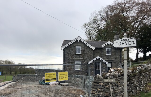
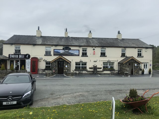
Torver

Torver is a village and civil parish in the South Lakeland district of Cumbria, England, 3 miles (4.8 km) south west of the village of Coniston and 1 mile...

Brown Pike

Brown Pike is a fell located in the Lake District National Park in Cumbria, England. Brown Pike is near the village of Coniston, and is most commonly approached...

Nearby Amenities

Located within 500m of 54.343526,-3.1227443
Barrier: stile
Lat/Long: 54.3432075/-3.1151526
Matthew Tranearth
Place: locality
Lat/Long: 54.3464903/-3.1191905
Ford: yes
Lat/Long: 54.3471237/-3.1241311
The data included in this document is from www.openstreetmap.org. The data is made available under ODbL.

Have you been to Bull Haw Moss?

Leave your review of Bull Haw Moss below (or comments, questions and feedback).