Orchard Wood

Wood, Forest in Lancashire South Lakeland

England

Orchard Wood

Torver Goods Yard The old railway goods yard at Torver is now used by a local builder for storage.  The stone built goods shed contained a loading platform upon which was mounted a 1 ton hand operated crane manufactured by R. Kitchen ironfounders in Warrington.  The crane has subsequently been relocated to the rear of The Wilson’s Arms.  The goods shed was used as a hay barn after the railway closed but lost its roof in a fire and stood derelict for a number of years before being repaired, altered and re-roofed and brought back into use.
Torver Goods Yard Credit: Adrian Taylor

Orchard Wood is a picturesque forest located in the county of Lancashire, England. Covering an area of approximately 100 acres, it is a haven for nature lovers and outdoor enthusiasts. The wood is situated in the rural village of Wood, which is nestled in the heart of the Lancashire countryside.

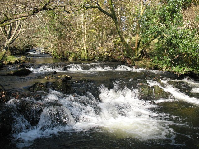
As the name suggests, Orchard Wood is known for its abundance of fruit trees, including apple, cherry, and pear trees. These orchards provide a stunning display of colors during the spring and autumn seasons, attracting visitors from near and far. Additionally, the wood is home to a diverse range of native flora and fauna, making it an ideal location for wildlife enthusiasts. Visitors may catch glimpses of squirrels, foxes, and a variety of bird species as they explore the forest trails.

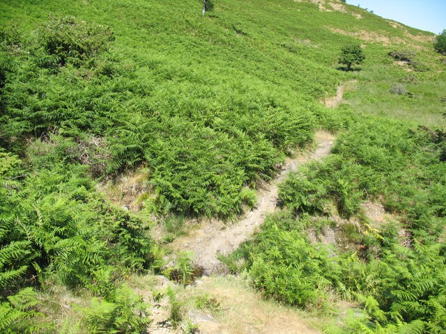
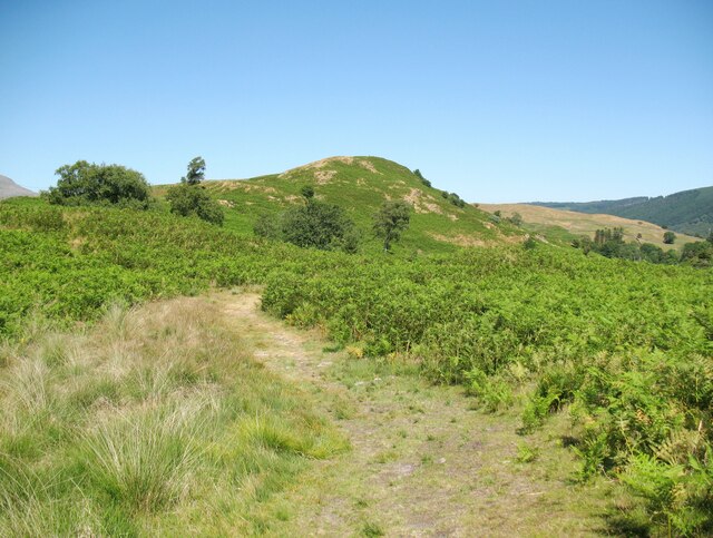
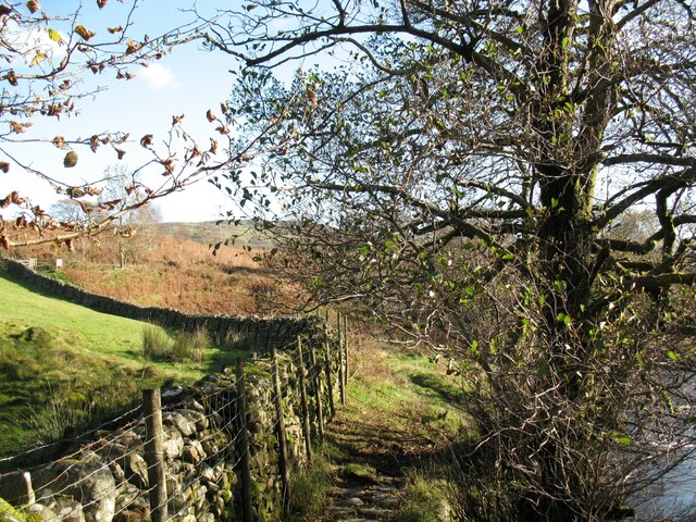
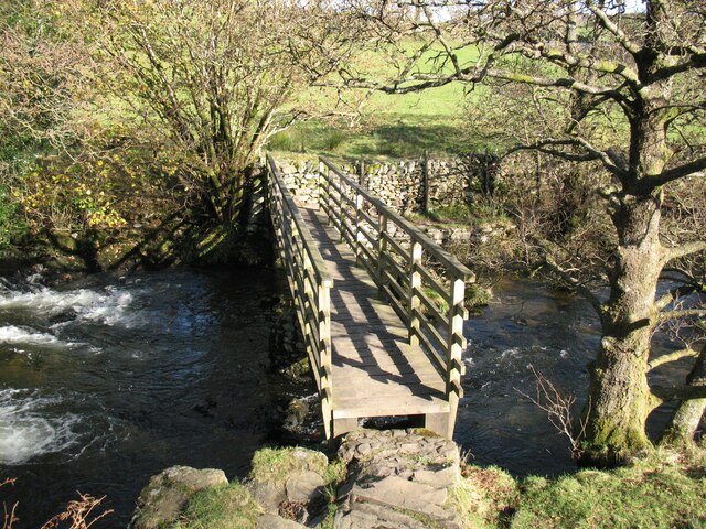
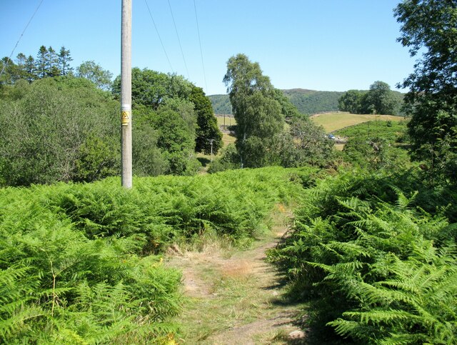
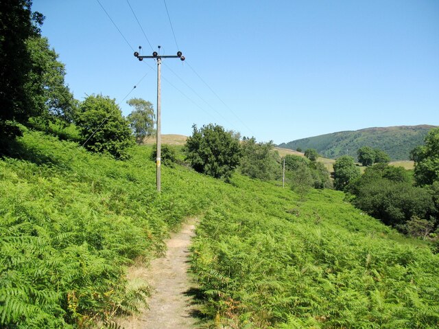
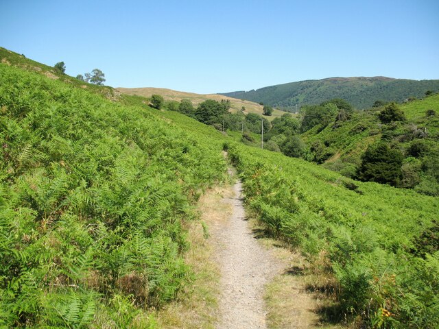
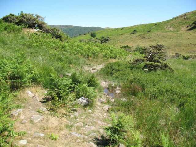
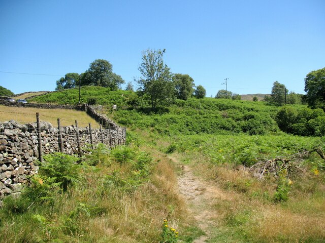
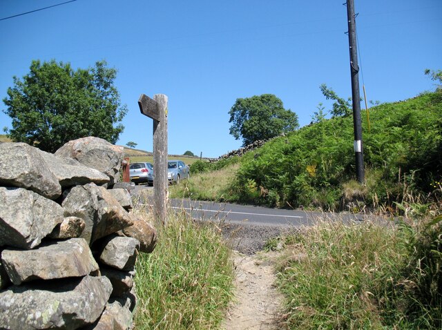
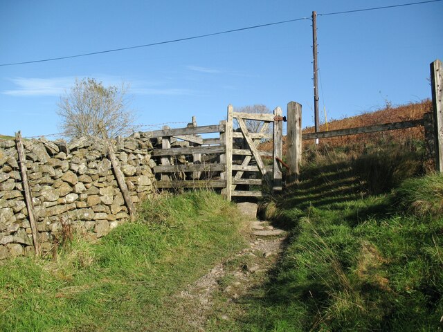
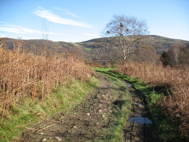
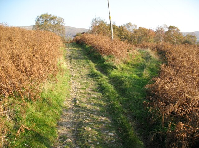
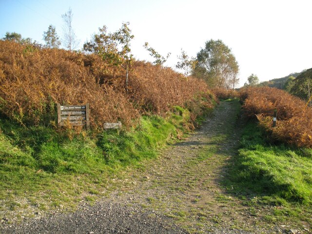
The wood offers a network of well-maintained trails, providing ample opportunities for walking, jogging, or cycling. These paths wind through the dense woodland, offering a peaceful and tranquil atmosphere. Along the way, visitors can discover hidden clearings and picnic spots, perfect for enjoying a leisurely break amidst nature.

Orchard Wood also boasts a designated children's play area, making it a popular destination for families. The playground features swings, slides, and climbing frames, providing entertainment for youngsters of all ages.

Overall, Orchard Wood in Lancashire offers a charming and idyllic setting for nature enthusiasts, providing a welcome escape from the hustle and bustle of everyday life. Its natural beauty, diverse wildlife, and recreational facilities make it a must-visit destination for locals and tourists alike.

If you have any feedback on the listing, please let us know in the comments section below.

Orchard Wood Images

Images are sourced within 2km of 54.338448/-3.1111315 or Grid Reference SD2794. Thanks to Geograph Open Source API. All images are credited.

Torver Goods Yard The old railway goods yard at Torver is now used by a local builder for storage.  The stone built goods shed contained a loading platform upon which was mounted a 1 ton hand operated crane manufactured by R. Kitchen ironfounders in Warrington.  The crane has subsequently been relocated to the rear of The Wilson’s Arms.  The goods shed was used as a hay barn after the railway closed but lost its roof in a fire and stood derelict for a number of years before being repaired, altered and re-roofed and brought back into use.
Torver Goods Yard
The old railway goods yard at Torver is now used by a local builder for storage. The stone built goods shed contained a loading platform upon which was mounted a 1 ton hand operated crane manufactured by R. Kitchen ironfounders in Warrington. The crane has subsequently been relocated to the rear of The Wilson’s Arms. The goods shed was used as a hay barn after the railway closed but lost its roof in a fire and stood derelict for a number of years before being repaired, altered and re-roofed and brought back into use.
Torver The road here passing in front of the cottages and The Wilson Arms was originally the A593 road until it was realigned between a point near Torver Station and Dalton Road Gates level crossing, taking advantage of the alignment of the former railway.
Torver
The road here passing in front of the cottages and The Wilson Arms was originally the A593 road until it was realigned between a point near Torver Station and Dalton Road Gates level crossing, taking advantage of the alignment of the former railway.
Ford on Throng Moss Beck The path from Mere Beck on Torver Low Common to Delicars crosses Throng Moss Beck by a small ford below the slopes of Anne Riggs.
This is the route of The Cumbria Way, a 74 mile long distance path between Ulverston and Carlisle (next photograph <a href="https://www.geograph.org.uk/photo/6939323">SD2892 : The Cumbria Way near Anne Riggs</a>).
There is little water in the ford after a prolonged period of dry weather.
Ford on Throng Moss Beck
The path from Mere Beck on Torver Low Common to Delicars crosses Throng Moss Beck by a small ford below the slopes of Anne Riggs. This is the route of The Cumbria Way, a 74 mile long distance path between Ulverston and Carlisle (next photograph SD2892 : The Cumbria Way near Anne Riggs). There is little water in the ford after a prolonged period of dry weather.
The Cumbria Way, Torver Low Common The Cumbria Way follows a well-defined path on Torver Low Common (next photograph <a href="https://www.geograph.org.uk/photo/6938183">SD2892 : Ford on Throng Moss Beck</a>).
The small fell in the background is Anne Riggs.
The Cumbria Way, Torver Low Common
The Cumbria Way follows a well-defined path on Torver Low Common (next photograph SD2892 : Ford on Throng Moss Beck). The small fell in the background is Anne Riggs.
Public footpath beside Torver Beck The footpath is the route of The Cumbria Way, a 74 mile long distance path from Ulverston to Carlisle (next photograph <a href="https://www.geograph.org.uk/photo/6957799">SD2892 : The Cumbria Way near Torver Beck</a>).
Public footpath beside Torver Beck
The footpath is the route of The Cumbria Way, a 74 mile long distance path from Ulverston to Carlisle (next photograph SD2892 : The Cumbria Way near Torver Beck).
Footbridge over Torver Beck The bridge takes a public footpath across Torver Beck which drains Goat’s Water and the Coniston Fells and is one of the three main feeders of Coniston Water.
The Cumbria Way long distance path crosses the bridge (next photograph <a href="https://www.geograph.org.uk/photo/6939286">SD2892 : Public footpath beside Torver Beck</a>).
Footbridge over Torver Beck
The bridge takes a public footpath across Torver Beck which drains Goat’s Water and the Coniston Fells and is one of the three main feeders of Coniston Water. The Cumbria Way long distance path crosses the bridge (next photograph SD2892 : Public footpath beside Torver Beck).
Footpath near Torver Beck The Cumbria Way long distance path follows a public footpath off Torver Low Common on the approach to Torver Beck.  Northbound walkers following the route of The Cumbria Way keep right at this path junction (next photograph <a href="https://www.geograph.org.uk/photo/6939295">SD2892 : Footbridge over Torver Beck</a>).
Footpath near Torver Beck
The Cumbria Way long distance path follows a public footpath off Torver Low Common on the approach to Torver Beck. Northbound walkers following the route of The Cumbria Way keep right at this path junction (next photograph SD2892 : Footbridge over Torver Beck).
The Cumbria Way below Anne Riggs The Cumbria Way descends the valley of Mere Beck beside power lines, following a public footpath on the slopes of Anne Riggs (next photograph <a href="https://www.geograph.org.uk/photo/6939302">SD2892 : Footpath near Torver Beck</a>).
The Cumbria Way below Anne Riggs
The Cumbria Way descends the valley of Mere Beck beside power lines, following a public footpath on the slopes of Anne Riggs (next photograph SD2892 : Footpath near Torver Beck).
The Cumbria Way below Anne Riggs The Cumbria Way descends the valley of Mere Beck, following a public footpath across the slopes of Anne Riggs (next photograph <a href="https://www.geograph.org.uk/photo/6939311">SD2892 : The Cumbria Way below Anne Riggs</a>).
The Cumbria Way below Anne Riggs
The Cumbria Way descends the valley of Mere Beck, following a public footpath across the slopes of Anne Riggs (next photograph SD2892 : The Cumbria Way below Anne Riggs).
The Cumbria Way near Anne Riggs The Cumbria Way long distance path from Ulverston to Carlisle on Torver Low Common near Anne Riggs (next photograph <a href="https://www.geograph.org.uk/photo/6939316">SD2892 : The Cumbria Way below Anne Riggs</a>).
The Cumbria Way near Anne Riggs
The Cumbria Way long distance path from Ulverston to Carlisle on Torver Low Common near Anne Riggs (next photograph SD2892 : The Cumbria Way below Anne Riggs).
The Cumbria Way near Torver Beck The Cumbria Way follows a field boundary wall on the approach to the road at Delicars (next photograph <a href="https://www.geograph.org.uk/photo/6961731">SD2892 : Footpath gate near Delicars</a>).
The Cumbria Way near Torver Beck
The Cumbria Way follows a field boundary wall on the approach to the road at Delicars (next photograph SD2892 : Footpath gate near Delicars).
Torver Beck Torver Beck drains Goat’s Water and the Coniston Fells and is one of the three main feeders of Coniston Water.
These modest waterfalls are beside The Cumbria Way, a 74 mile long distance path from Ulverston to Carlisle.
Torver Beck
Torver Beck drains Goat’s Water and the Coniston Fells and is one of the three main feeders of Coniston Water. These modest waterfalls are beside The Cumbria Way, a 74 mile long distance path from Ulverston to Carlisle.
The Cumbria Way, Delicars A public footpath from Torver Low Common climbs to join the A5084 road at Delicars, it is the route of The Cumbria Way long distance trail from Ulverston to Carlisle (next photograph <a href="https://www.geograph.org.uk/photo/6965796">SD2892 : A5084 road and car park, Delicars</a>).
The Cumbria Way, Delicars
A public footpath from Torver Low Common climbs to join the A5084 road at Delicars, it is the route of The Cumbria Way long distance trail from Ulverston to Carlisle (next photograph SD2892 : A5084 road and car park, Delicars).
Footpath gate near Delicars A public footpath from Torver Low Common climbs to join the A5084 road at Delicars, passing through a wooden gate before it reaches the road.
This is the route of The Cumbria Way (next photograph <a href="https://www.geograph.org.uk/photo/6961724">SD2892 : The Cumbria Way, Delicars</a>).
Footpath gate near Delicars
A public footpath from Torver Low Common climbs to join the A5084 road at Delicars, passing through a wooden gate before it reaches the road. This is the route of The Cumbria Way (next photograph SD2892 : The Cumbria Way, Delicars).
The Cumbria Way, Delicars The Cumbria Way follows a farm track near Delicars.
The track is also a public footpath from Delicars to Coniston (next photograph <a href="https://www.geograph.org.uk/photo/6972041">SD2892 : Gate on The Cumbria Way</a>).
The Cumbria Way, Delicars
The Cumbria Way follows a farm track near Delicars. The track is also a public footpath from Delicars to Coniston (next photograph SD2892 : Gate on The Cumbria Way).
The Cumbria Way near Delicars The Cumbria Way follows a public footpath along a farm track near Delicars.
Northbound walkers following The Cumbria way should keep left where the track divides 55m (60 yards) after leaving the car park at Delicars (next photograph <a href="https://www.geograph.org.uk/photo/6964835">SD2892 : The Cumbria Way, Delicars</a>).
The Cumbria Way near Delicars
The Cumbria Way follows a public footpath along a farm track near Delicars. Northbound walkers following The Cumbria way should keep left where the track divides 55m (60 yards) after leaving the car park at Delicars (next photograph SD2892 : The Cumbria Way, Delicars).
Farm track, Delicars This farm track leaves the south end of the small roadside car park at Delicars to serve nearby fields.  The track is also the route of The Cumbria Way long distance footpath from Ulverston to Carlisle
(next photograph <a href="https://www.geograph.org.uk/photo/7428706">SD2892 : The Cumbria Way, Delicars</a>).
Farm track, Delicars
This farm track leaves the south end of the small roadside car park at Delicars to serve nearby fields. The track is also the route of The Cumbria Way long distance footpath from Ulverston to Carlisle (next photograph SD2892 : The Cumbria Way, Delicars).
A5084 road and car park, Delicars The public footpath sign points along The Cumbria Way which joins the A5084 road at this point.  Northbound walkers on The Cumbria Way long distance trail cross the road to the small car park at Delicars and turn right onto a track leading up the bank; this is the start of a public footpath along the shores of Coniston Water to Coniston (next photograph <a href="https://www.geograph.org.uk/photo/6965781">SD2892 : Farm track, Delicars</a>).
A5084 road and car park, Delicars
The public footpath sign points along The Cumbria Way which joins the A5084 road at this point. Northbound walkers on The Cumbria Way long distance trail cross the road to the small car park at Delicars and turn right onto a track leading up the bank; this is the start of a public footpath along the shores of Coniston Water to Coniston (next photograph SD2892 : Farm track, Delicars).
Show me another place!

Orchard Wood is located at Grid Ref: SD2794 (Lat: 54.338448, Lng: -3.1111315)

Administrative County: Cumbria

District: South Lakeland

Police Authority: Cumbria

What 3 Words

///purse.thankful.competent. Near Windermere, Cumbria

Related Wikis

St Luke's Church, Torver

St Luke's Church is in the village of Torver, Cumbria, England. It is an active Anglican parish church in the deanery of Furness, the archdeaconry of...

Torver railway station

Torver railway station served the village of Torver, in Lancashire, England (now in Cumbria). It was on the branch line to Coniston. == History == Authorised...

Torver

Torver is a village and civil parish in the South Lakeland district of Cumbria, England, 3 miles (4.8 km) south west of the village of Coniston and 1 mile...

Kelly Hall Tarn

Kelly Hall Tarn is a pool in Cumbria, England, to the west of Coniston Water. It is located about one km south-south-east of the village of Torver, on...

Nearby Amenities

Located within 500m of 54.338448,-3.1111315
Post Box
Collection Times: Mo-Fr 16:00; Sa 10:15
Operator: Royal Mail
Post Box Type: lamp
Ref: LA21 28
Royal Cypher: EIIR
Royal Cypher Wikidata: Q33102113
Source: survey
Lat/Long: 54.3377953/-3.1036396
Barrier: stile
Lat/Long: 54.3404907/-3.105099
Brocklebank Ground Holiday Cottages
Addr City: Torver
Addr Housename: Barn House Cottages
Addr Postcode: LA21 8BS
Phone: +44 15394 49588
Tourism: guest_house
Website: brocklebankground.com
Lat/Long: 54.3353772/-3.1143074
Barrier: kissing_gate
Lat/Long: 54.3374728/-3.111589
Brocklebank Ground
Place: locality
Lat/Long: 54.3349822/-3.1148414
Under Crag
Place: locality
Lat/Long: 54.3376335/-3.1112644
Wide Close
Place: locality
Lat/Long: 54.3412124/-3.1150671
Generator Method: photovoltaic
Generator Output Electricity: yes
Generator Source: solar
Generator Type: solar_photovoltaic_panel
Location: roof
Power: generator
Lat/Long: 54.337698/-3.1048451
Barrier: stile
Lat/Long: 54.3363898/-3.1061482
Torver Deli
Addr City: Torver
Addr Postcode: LA21 8BB
Shop: deli
Lat/Long: 54.3380725/-3.1034422
Power: pole
Lat/Long: 54.3340184/-3.1117918
Power: pole
Lat/Long: 54.3342523/-3.1121398
Material: wood
Power: pole
Lat/Long: 54.3345083/-3.1125007
Power: pole
Lat/Long: 54.3350622/-3.1120477
Power: pole
Lat/Long: 54.3356918/-3.1115313
Power: pole
Lat/Long: 54.3366736/-3.1107112
Power: pole
Lat/Long: 54.3374423/-3.1100893
Power: pole
Lat/Long: 54.3377642/-3.109823
Power: pole
Lat/Long: 54.3383/-3.1088747
Power: pole
Lat/Long: 54.3391133/-3.1074213
Power: pole
Lat/Long: 54.3399672/-3.10589
Power: pole
Lat/Long: 54.3409373/-3.1057981
Power: pole
Lat/Long: 54.3408013/-3.1051434
Cafe
Undercrag Cafe
Addr City: Torver
Addr Postcode: LA21 8BS
Cuisine: cake;tea;coffee
Diet Vegan: yes
Diet Vegetarian: yes
Dogs: yes
Fhrs Id: 1380491
Opening Hours: Th-Su 10:30-16:00
Lat/Long: 54.3380519/-3.1111497
Undercrag Studio
Addr City: Torver
Addr Postcode: LA21 8BS
Shop: art
Lat/Long: 54.3380387/-3.1110998
Ford: yes
Lat/Long: 54.339583/-3.1081282
Power: pole
Lat/Long: 54.3393764/-3.1043657
The data included in this document is from www.openstreetmap.org. The data is made available under ODbL.

Have you been to Orchard Wood?

Leave your review of Orchard Wood below (or comments, questions and feedback).