High Stile Wood

Wood, Forest in Cumberland Allerdale

England

High Stile Wood

Rocks and bracken at summit area of High Doat The northward view from the high point of the modest hill, High Doat near to Seatoller in Borrowdale.
Castle Crag lies at the centre of the image with the Skiddaw group in the distance, the highest tops hidden in mist.
Rocks and bracken at summit area of High Doat Credit: Trevor Littlewood

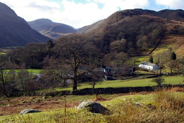
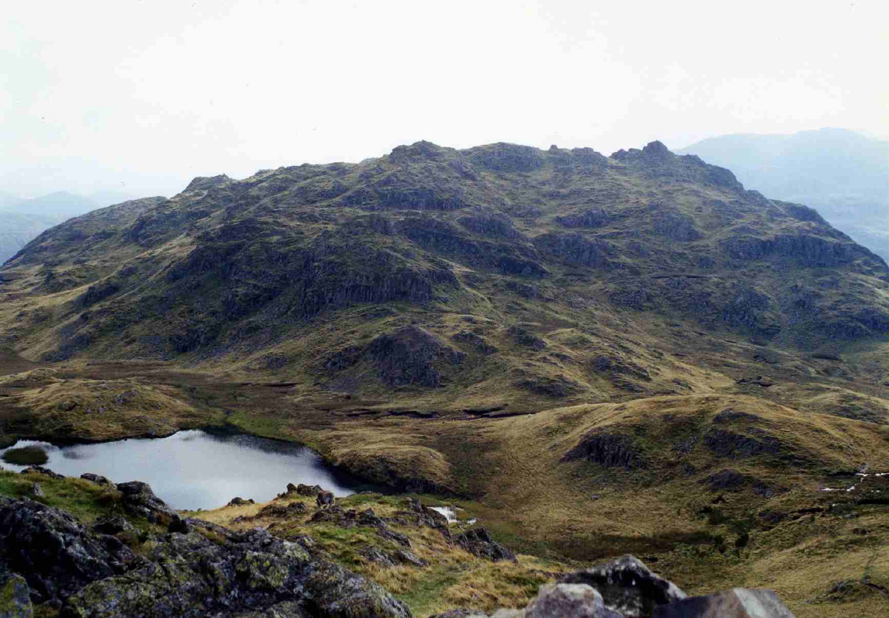
High Stile Wood is a picturesque forest located in Cumberland, England. Nestled in the Lake District National Park, it covers an area of approximately 200 hectares. The wood is renowned for its remarkable beauty and diverse range of flora and fauna.

The forest is predominantly composed of deciduous trees, including oak, ash, birch, and alder. These majestic trees create a lush canopy, providing shade and a habitat for a variety of wildlife. The forest floor is covered in a rich carpet of ferns, mosses, and wildflowers, adding to the woodland's enchanting atmosphere.

High Stile Wood is intersected by several walking trails, allowing visitors to explore its natural wonders. The paths wind through the forest, meandering beside babbling brooks and tranquil ponds. Along the way, hikers can spot an array of wildlife, including deer, rabbits, and a multitude of bird species.

The wood also offers breathtaking views of the surrounding landscape. From certain vantage points, visitors can marvel at the majestic peaks of the Lake District, including the towering High Stile mountain, which lends its name to the woodland.

High Stile Wood is a popular destination for nature enthusiasts, hikers, and photographers. Its serene atmosphere and stunning scenery make it an ideal place to escape the hustle and bustle of everyday life and immerse oneself in the beauty of nature.

If you have any feedback on the listing, please let us know in the comments section below.

High Stile Wood Images

Images are sourced within 2km of 54.511907/-3.1721526 or Grid Reference NY2413. Thanks to Geograph Open Source API. All images are credited.

Rocks and bracken at summit area of High Doat The northward view from the high point of the modest hill, High Doat near to Seatoller in Borrowdale.
Castle Crag lies at the centre of the image with the Skiddaw group in the distance, the highest tops hidden in mist.
Rocks and bracken at summit area of High Doat
The northward view from the high point of the modest hill, High Doat near to Seatoller in Borrowdale. Castle Crag lies at the centre of the image with the Skiddaw group in the distance, the highest tops hidden in mist.
Bracken covered slope descending towards Seatoller The slope is on the minor hill, High Doat, south-west of its summit.
The central, sunlit hill is known as Thornythwaite Fell which has little individual identity and is basically a rising ridge continuing to Glaramara, a summit on the skyline above.
Bracken covered slope descending towards Seatoller
The slope is on the minor hill, High Doat, south-west of its summit. The central, sunlit hill is known as Thornythwaite Fell which has little individual identity and is basically a rising ridge continuing to Glaramara, a summit on the skyline above.
Ford and stepping stones on River Derwent The river crossing just to the west of Rosthwaite.
Ford and stepping stones on River Derwent
The river crossing just to the west of Rosthwaite.
The B5289, Seatoller The main road which passes through Borrowdale and over the Honister Pass. An open-top stagecoach bus sits at its turning point on the edge of Seatoller after an early morning service along the narrow and twisty road from Keswick.
The B5289, Seatoller
The main road which passes through Borrowdale and over the Honister Pass. An open-top stagecoach bus sits at its turning point on the edge of Seatoller after an early morning service along the narrow and twisty road from Keswick.
Path to Dale Head summit from Honister Hause A public footpath follows the fence up the hill from Honister Hause to the top of Dale Head.
Path to Dale Head summit from Honister Hause
A public footpath follows the fence up the hill from Honister Hause to the top of Dale Head.
Path climbing to Dale Head The public footpath which climbs the fellside from Honister Hause to the summit of Dale Head.
Path climbing to Dale Head
The public footpath which climbs the fellside from Honister Hause to the summit of Dale Head.
South from Castle Crag Looking up Borrowdale from Castle Crag, with the relatively low wooded fell, High Doat, in the centre. Glaramara (centre), Great End and Scafell Pike (right) are beyond.
South from Castle Crag
Looking up Borrowdale from Castle Crag, with the relatively low wooded fell, High Doat, in the centre. Glaramara (centre), Great End and Scafell Pike (right) are beyond.
The River Derwent near New Bridge The pebbly bed of the River Derwent under the clear, cold water.
The River Derwent near New Bridge
The pebbly bed of the River Derwent under the clear, cold water.
Chapel House Farm, Borrowdale
New Bridge at Rosthwaite Lovely stone bridge across the River Derwent.
New Bridge at Rosthwaite
Lovely stone bridge across the River Derwent.
Path above Old Mill Cottage On the path from Strands Bridge to Glaramara.
Path above Old Mill Cottage
On the path from Strands Bridge to Glaramara.
Approaching The Combe On the path from Strands Bridge to Glaramara. Ahead is the intake wall and gate into The Combe. On the skyline ahead is Raven Crag and to the left, through the branches of the hawthorn, the pinnacle of Combe Head can be seen.
Approaching The Combe
On the path from Strands Bridge to Glaramara. Ahead is the intake wall and gate into The Combe. On the skyline ahead is Raven Crag and to the left, through the branches of the hawthorn, the pinnacle of Combe Head can be seen.
In The Combe A bunch of Herdwicks are sizing up their visitors.
In The Combe
A bunch of Herdwicks are sizing up their visitors.
Waterfall on Sour Milk Gill
View of Seathwaite
View of Seathwaite
Waterfall on Sour Milk Gill
Sheep movement in Borrowdale Traffic and pedestrians were asked politely to pause for a while as a large flock of sheep was moved from one field to another.
Sheep movement in Borrowdale
Traffic and pedestrians were asked politely to pause for a while as a large flock of sheep was moved from one field to another.
Show me another place!

High Stile Wood is located at Grid Ref: NY2413 (Lat: 54.511907, Lng: -3.1721526)

Administrative County: Cumbria

District: Allerdale

Police Authority: Cumbria

What 3 Words

///awakening.cheetahs.covers. Near Keswick, Cumbria

Related Wikis

Seatoller

Seatoller is a settlement in Borrowdale in the English Lake District. Historically part of Cumberland, it lies on the B5289 road at the east foot of the...

Lake District

The Lake District, also known as the Lakes or Lakeland, is a mountainous region and national park in North West England. It is primarily famous for its...
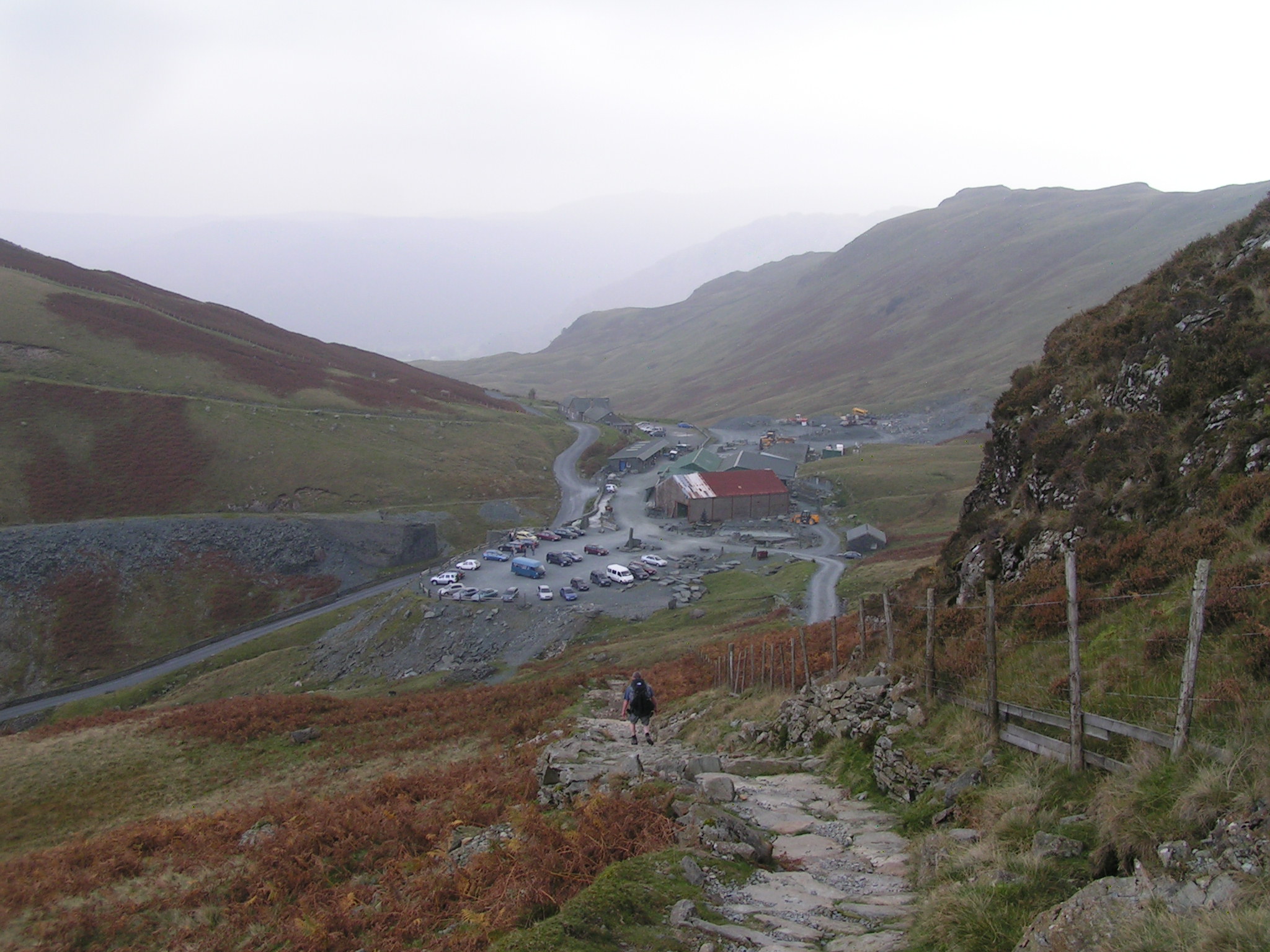
Honister Slate Mine

The Honister Slate Mine in Cumbria is the last working slate mine in England. Quarrying for Westmorland green slate has been taking place in the area since...
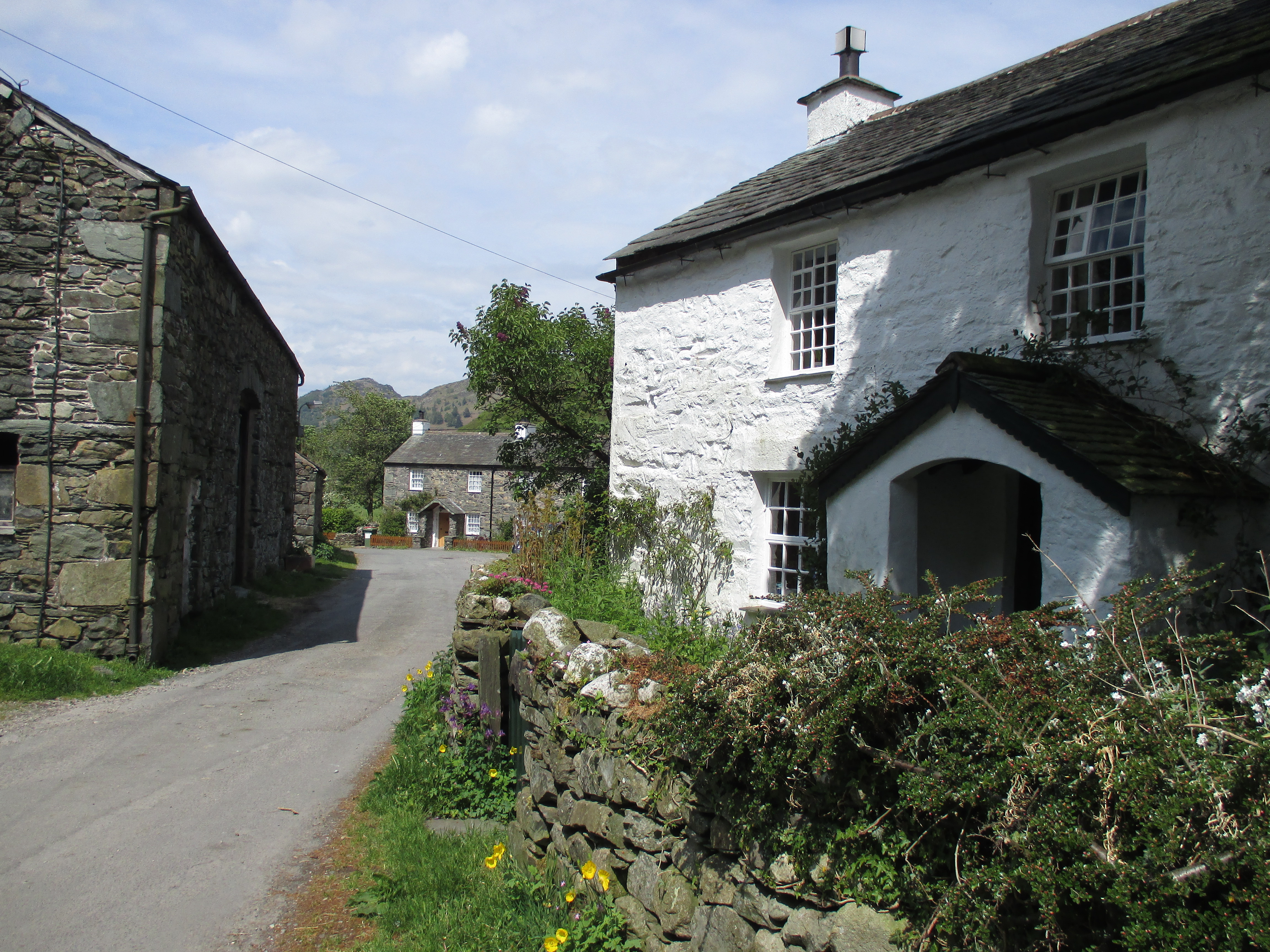
Stonethwaite

Stonethwaite is a small village in the Lake District in the English county of Cumbria, historically part of Cumberland, it is situated in the valley of...

Seathwaite, Cumberland

Seathwaite is a small hamlet in the Borrowdale civil parish of Cumberland, Cumbria, North West England. It is in the Lake District near Scafell Pike and...

Rosthwaite, Borrowdale

Rosthwaite is a settlement in the Borrowdale parish of Cumberland, Cumbria, England. It is also in Borrowdale in the English Lake District to the south...
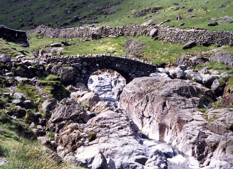
Stonethwaite Beck

Stonethwaite Beck is a minor river in Cumbria, England. It is a tributary of the River Derwent. Stonethwaite Beck is formed at the confluence of Langstrath...

Rosthwaite Fell

Rosthwaite Fell is a fell in the English Lake District. It is situated some 12 kilometres (7+1⁄2 miles) due south of Keswick and 2 kilometres (1+1⁄4 miles...

Nearby Amenities

Located within 500m of 54.511907,-3.1721526
Telephone
Booth: K6
Covered: booth
Listed Status: Grade II
Lat/Long: 54.5135251/-3.1676841
Bus Stop
National Trust car park (N bound);National Trust car park (S bound)
Local Ref: AT
Naptan AtcoCode: 090002113361;090002111393
Naptan Bearing: NW;S
Naptan BusStopType: CUS
Naptan CommonName: National Trust car park (N bound);National Trust car park (S bound)
Naptan Indicator: opp;at
Naptan Landmark: entrance to car park;entrance to Seatoller National Trust car park
Naptan NaptanCode: cumadgaj;cumadapj
Naptan Street: B5289
Naptan Verified: yes
Public Transport: platform
Shelter: yes
Shelter Type: public_transport
Source: naptan_import
Lat/Long: 54.5135728/-3.167184
Post Box
Post Box Type: lamp
Ref: CA12 126
Royal Cypher: EIIR
Royal Cypher Wikidata: Q33102113
Lat/Long: 54.5135926/-3.1673264
Turning Circle
Lat/Long: 54.5136111/-3.1692157
Seatoller
Place: village
Wikidata: Q2262383
Wikipedia: en:Seatoller
Lat/Long: 54.513839/-3.1678642
Thorneythwaite Farm
Addr City: Keswick
Addr Postcode: CA12 5XQ
Phone: +44 17687 77237
Tourism: guest_house
Lat/Long: 54.5100179/-3.1660729
Cafe
Honisters Yew Tree Coffee House
Addr City: Seatoller
Lat/Long: 54.5136921/-3.1681882
Honisters Gift Shop
Addr City: Seatoller
Shop: gift
Lat/Long: 54.5136327/-3.1681077
High Stile Wood
Natural: wood
Lat/Long: 54.5117703/-3.1728464
Low Style Wood
Natural: wood
Lat/Long: 54.5087964/-3.172196
Water Point
Lat/Long: 54.5111388/-3.1683648
Power: pole
Lat/Long: 54.5103028/-3.1652351
Power: pole
Lat/Long: 54.5135429/-3.1675297
Power: pole
Lat/Long: 54.5139203/-3.1687606
Bicycle Parking
Capacity: 6
Lat/Long: 54.5137145/-3.167046
Vending Machine
Lat/Long: 54.5136628/-3.1670335
The data included in this document is from www.openstreetmap.org. The data is made available under ODbL.

Have you been to High Stile Wood?

Leave your review of High Stile Wood below (or comments, questions and feedback).