Bellows Wood

Wood, Forest in Cumberland Allerdale

England

Bellows Wood

Blaithwaite House driveway In early May the trees are coming in to leaf and have not yet achieved their darker summer green.
Blaithwaite House driveway Credit: Adrian Taylor

Bellows Wood is a picturesque forest located in the county of Cumberland, England. Covering an area of approximately 500 acres, it is one of the largest woodlands in the region. The wood is situated on the western edge of the Lake District National Park and is easily accessible from nearby towns and villages.

Bellows Wood is characterized by its diverse ecosystem and rich biodiversity. The forest is primarily composed of broadleaf trees, such as oak, beech, and birch, which create a dense canopy overhead. These trees provide a habitat for a wide variety of wildlife, including deer, foxes, badgers, and a plethora of bird species.

Visitors to Bellows Wood can enjoy a range of activities and amenities. There are several well-maintained walking trails that crisscross the forest, offering stunning views of the surrounding countryside. Additionally, the wood is equipped with picnic areas and benches, providing a perfect spot for a peaceful lunch amidst nature.

The history of Bellows Wood dates back centuries, with evidence of human habitation in the area since ancient times. Archaeological remains, including prehistoric burial mounds and Roman artifacts, have been discovered within the wood, adding to its cultural significance.

Overall, Bellows Wood is a cherished natural treasure in Cumberland, offering visitors a chance to immerse themselves in the beauty of nature and explore the rich history of the region. Whether it's a leisurely stroll through the woodland or a picnic with family and friends, this enchanting forest provides a memorable experience for all who venture within its boundaries.

If you have any feedback on the listing, please let us know in the comments section below.

Bellows Wood Images

Images are sourced within 2km of 54.779553/-3.2092674 or Grid Reference NY2243. Thanks to Geograph Open Source API. All images are credited.

Blaithwaite House driveway In early May the trees are coming in to leaf and have not yet achieved their darker summer green.
Blaithwaite House driveway
In early May the trees are coming in to leaf and have not yet achieved their darker summer green.
Benchmark, Woodrow House Detail of the Ordnance Survey cut benchmark on the north face, north east corner of Woodrow House.  The benchmark marks a height of 58.8645m above mean sea level (Ordnance Datum Newlyn) last verified in 1971.
Benchmark, Woodrow House
Detail of the Ordnance Survey cut benchmark on the north face, north east corner of Woodrow House. The benchmark marks a height of 58.8645m above mean sea level (Ordnance Datum Newlyn) last verified in 1971.
Woodrow Hall View across the fields of the property that has outbuildings without roof tiles and at the other extreme solar panels on the house roof
Woodrow Hall
View across the fields of the property that has outbuildings without roof tiles and at the other extreme solar panels on the house roof
Direction Sign – Signpost near Flethchertown Located on the southwest side of the crossroads in Fletchertown. Allhallows parish. 4 modern arms and annulus finial.

Milestone Society National ID: CU_NY2042
Direction Sign – Signpost near Flethchertown
Located on the southwest side of the crossroads in Fletchertown. Allhallows parish. 4 modern arms and annulus finial. Milestone Society National ID: CU_NY2042
Direction Sign – Signpost near Brough Hill, Bolton Low Houses Located on the southeast side of the junction at Brough Hill, at the south end of Bolton Low Houses. Boltons parish. 3 arms and annulus finial.

Milestone Society National ID: CU_NY2344
Direction Sign – Signpost near Brough Hill, Bolton Low Houses
Located on the southeast side of the junction at Brough Hill, at the south end of Bolton Low Houses. Boltons parish. 3 arms and annulus finial. Milestone Society National ID: CU_NY2344
Old Milestone by the A595, east of Mealsgate Bridge Metal plate attached to stone post by the A595, in parish of BOLTONS (ALLERDALE District), Mealsgate, 50m East of Kelsey Hotel, (Pink House Hotel) East of Aldersceugh, on grass verge, on North side of road. Carlisle red stone and curved plate, erected by the Cockermouth & Carlisle turnpike trust in the 19th century. 

Inscription reads:-
CARLISLE
15 MILES
WIGTON
5 MILES
COCKERMOUTH
10½ MILES
Carved benchmark on top.

Grade II Listed. List Entry Number: 1238713

<span class="nowrap"><a title="https://historicengland.org.uk/listing/the-list/list-entry/1238713" rel="nofollow ugc noopener" href="https://historicengland.org.uk/listing/the-list/list-entry/1238713">Link</a><img style="margin-left:2px;" alt="External link" title="External link - shift click to open in new window" src="https://s1.geograph.org.uk/img/external.png" width="10" height="10"/></span>

Milestone Society National ID: CU_CLCM15.
Old Milestone by the A595, east of Mealsgate Bridge
Metal plate attached to stone post by the A595, in parish of BOLTONS (ALLERDALE District), Mealsgate, 50m East of Kelsey Hotel, (Pink House Hotel) East of Aldersceugh, on grass verge, on North side of road. Carlisle red stone and curved plate, erected by the Cockermouth & Carlisle turnpike trust in the 19th century. Inscription reads:- CARLISLE 15 MILES WIGTON 5 MILES COCKERMOUTH 10½ MILES Carved benchmark on top. Grade II Listed. List Entry Number: 1238713 LinkExternal link Milestone Society National ID: CU_CLCM15.
Old Milestone by the former A595 in Bolton Low Houses Metal plate attached to stone post by the UC road (was A595), in parish of BOLTONS (ALLERDALE District), Bolton Low Houses, by Rose Garth, opposite Solway View, in tarmac front of house, on North side of road. Carlisle red stone and curved plate, erected by the Cockermouth & Carlisle turnpike trust in the 19th century. 

Inscription reads:-
CARLISLE
13 MILES
WIGTON
3 MILES
COCKERMOUTH
12½ MILES 
Carved benchmark and rivet on top.

Grade II Listed. List Entry Number: 1144466 <span class="nowrap"><a title="https://historicengland.org.uk/listing/the-list/list-entry/1144466" rel="nofollow ugc noopener" href="https://historicengland.org.uk/listing/the-list/list-entry/1144466">Link</a><img style="margin-left:2px;" alt="External link" title="External link - shift click to open in new window" src="https://s1.geograph.org.uk/img/external.png" width="10" height="10"/></span>

Milestone Society National ID: CU_CLCM13.
Old Milestone by the former A595 in Bolton Low Houses
Metal plate attached to stone post by the UC road (was A595), in parish of BOLTONS (ALLERDALE District), Bolton Low Houses, by Rose Garth, opposite Solway View, in tarmac front of house, on North side of road. Carlisle red stone and curved plate, erected by the Cockermouth & Carlisle turnpike trust in the 19th century. Inscription reads:- CARLISLE 13 MILES WIGTON 3 MILES COCKERMOUTH 12½ MILES Carved benchmark and rivet on top. Grade II Listed. List Entry Number: 1144466 LinkExternal link Milestone Society National ID: CU_CLCM13.
Old Milestone by the A595, west of High Waverbridge Metal plate attached to stone post by the A595, in parish of BOLTONS (ALLERDALE District), High Waverbridge, 100m East of road junction to Bolton Gate, Percy Hill, in hedge, on North side of road. Carlisle red stone and curved plate, erected by the Cockermouth & Carlisle turnpike trust in the 19th century. 

Inscription reads:-
CARLISLE
14 MILES
WIGTON
4 MILES
COCKERMOUTH
11½ MILES 
Carved benchmark on top.

Grade II Listed. List Entry Number: 1144464
<span class="nowrap"><a title="https://historicengland.org.uk/listing/the-list/list-entry/1144464" rel="nofollow ugc noopener" href="https://historicengland.org.uk/listing/the-list/list-entry/1144464">Link</a><img style="margin-left:2px;" alt="External link" title="External link - shift click to open in new window" src="https://s1.geograph.org.uk/img/external.png" width="10" height="10"/></span>

Milestone Society National ID: CU_CLCM14.
Old Milestone by the A595, west of High Waverbridge
Metal plate attached to stone post by the A595, in parish of BOLTONS (ALLERDALE District), High Waverbridge, 100m East of road junction to Bolton Gate, Percy Hill, in hedge, on North side of road. Carlisle red stone and curved plate, erected by the Cockermouth & Carlisle turnpike trust in the 19th century. Inscription reads:- CARLISLE 14 MILES WIGTON 4 MILES COCKERMOUTH 11½ MILES Carved benchmark on top. Grade II Listed. List Entry Number: 1144464 LinkExternal link Milestone Society National ID: CU_CLCM14.
Entering Bolton Low Houses on road over River Waver Shaking Bridge
Benchmark on SE parapet of Shaking Bridge Ordnance Survey pivot benchmark levelled at 67.181m above Newlyn Datum verified 1971
Benchmark on SE parapet of Shaking Bridge
Ordnance Survey pivot benchmark levelled at 67.181m above Newlyn Datum verified 1971
River Waver viewed over SE parapet of Shaking Bridge There is an Ordnance Survey benchmark <a href="https://www.geograph.org.uk/photo/7686822">NY2344 : Benchmark on SE parapet of Shaking Bridge</a>  on top of the parapet at the left hand edge of  the patch of ivy
River Waver viewed over SE parapet of Shaking Bridge
There is an Ordnance Survey benchmark NY2344 : Benchmark on SE parapet of Shaking Bridge on top of the parapet at the left hand edge of the patch of ivy
Milestone on north side of main road through Bolton Low Houses The Ordnance Survey rivet benchmark on top of the milestone was levelled at 84.762m above Newlyn Datum  and verified in 1971
Milestone on north side of main road through Bolton Low Houses
The Ordnance Survey rivet benchmark on top of the milestone was levelled at 84.762m above Newlyn Datum and verified in 1971
Main road through Bolton Low Houses Now a relatively quiet road since the A595 was built bypassing the village. There is a milestone <a href="https://www.geograph.org.uk/photo/7686915">NY2344 : Milestone on north side of main road through Bolton Low Houses</a> on the pavement against a wall at the left hand side of the road
Main road through Bolton Low Houses
Now a relatively quiet road since the A595 was built bypassing the village. There is a milestone NY2344 : Milestone on north side of main road through Bolton Low Houses on the pavement against a wall at the left hand side of the road
River Waver from NW side of Shaking Bridge
A bungalow near Dryrigg Farm
The road to Fletchertown
The B5299 through Fletchertown
High Blaithwaite: track of old Maryport & Carlisle Mealsgate loop railway View SW, towards Aspatria. The line had been closed as far as Mealsgate since 1/8/21(!), Mealsgate - Aspatria since 1/12/52 (passenger service ceased 22/9/30).
High Blaithwaite: track of old Maryport & Carlisle Mealsgate loop railway
View SW, towards Aspatria. The line had been closed as far as Mealsgate since 1/8/21(!), Mealsgate - Aspatria since 1/12/52 (passenger service ceased 22/9/30).
Show me another place!

Bellows Wood is located at Grid Ref: NY2243 (Lat: 54.779553, Lng: -3.2092674)

Administrative County: Cumbria

District: Allerdale

Police Authority: Cumbria

What 3 Words

///bless.pioneered.comet. Near Wigton, Cumbria

Related Wikis

High Blaithwaite railway station

High Blaithwaite railway station was in the former county of Cumberland, now Cumbria, England. It was a stop on the Bolton Loop (sometimes referred to...
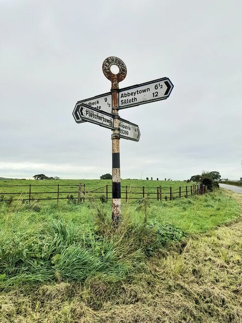
Fletchertown

Fletchertown is a small village in the Allerdale borough of Cumbria, England. It was historically within Cumberland. The village was originally built to...

Bolton Low Houses

Bolton Low Houses is a small village in Cumbria, England. Historically part of Cumberland, it is located 3.1 miles (5.0 km) by road to the southwest of...

Mealsgate railway station

Mealsgate railway station was in the former county of Cumberland, now Cumbria, England. It was a stop on the Bolton Loop (sometimes referred to as the...

Related Videos

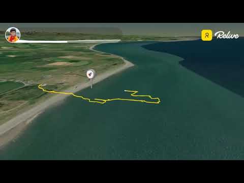
BLAITHWAITE 2020 CAMPING RELIVE MONTAGE

Hello Jamie here and with another video. A couple of weeks ago I went camping to Blaithwaite. And these are the walks that I did, ...

BLAITHWAITE ETC CAMPING 2020 PICTURE MONTAGE

Hello Jamie here and with another video. While I've already posted my Blaithwaite camping footage, this is a picture montage ...

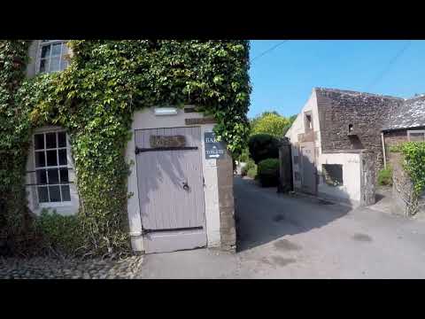
ARRIVING AT BLAITHWAITE

Hello Jamie here and with another video. So a couple of weeks ago I went to Blaithwaite camping for a couple of days, and this ...

Blaithwaite House Wigton Cumbria

Blaithwaite House Wigton Cumbria camping and caravan holidays. Lots of beautiful countryside to sit and relax.

Nearby Amenities

Located within 500m of 54.779553,-3.2092674
Power: pole
Lat/Long: 54.7755328/-3.2104955
Power: pole
Lat/Long: 54.7763255/-3.2108634
Power: pole
Lat/Long: 54.7772757/-3.2109874
Power: pole
Lat/Long: 54.7783152/-3.2117047
Power: pole
Lat/Long: 54.779394/-3.2124549
Power: pole
Lat/Long: 54.7804131/-3.2131742
The data included in this document is from www.openstreetmap.org. The data is made available under ODbL.

Have you been to Bellows Wood?

Leave your review of Bellows Wood below (or comments, questions and feedback).