Cragend Wood

Wood, Forest in Cumberland Copeland

England

Cragend Wood

Cattle Grid
Cattle Grid Credit: P Gaskell

Cragend Wood is a picturesque woodland located in the county of Cumberland, England. Situated in the heart of the North Pennines Area of Outstanding Natural Beauty, this ancient woodland spans an area of approximately 100 hectares.

The wood is characterized by its diverse range of tree species, including oak, birch, beech, and ash. The dense canopy of the trees creates a tranquil and shaded environment, perfect for leisurely walks or nature exploration. The forest floor is adorned with a rich carpet of wildflowers, with bluebells and primroses being particularly abundant during the spring months.

Cragend Wood is home to a plethora of wildlife, making it a haven for nature enthusiasts. Visitors may catch a glimpse of red squirrels scurrying between the trees or hear the distinctive call of the tawny owl in the evenings. The wood also provides a habitat for various bird species, such as woodpeckers, warblers, and finches.

The woodland is crisscrossed by a network of well-maintained footpaths, allowing visitors to explore its beauty at their own pace. These paths lead to a small stream that meanders through the wood, adding to its serene atmosphere. Additionally, there are several picnic spots dotted throughout the wood, providing the perfect opportunity to rest and enjoy the tranquil surroundings.

Cragend Wood is a true gem of the Cumberland countryside, offering visitors a chance to connect with nature and escape the hustle and bustle of everyday life. With its breathtaking scenery and abundant wildlife, it is a must-visit destination for anyone seeking tranquility and natural beauty.

If you have any feedback on the listing, please let us know in the comments section below.
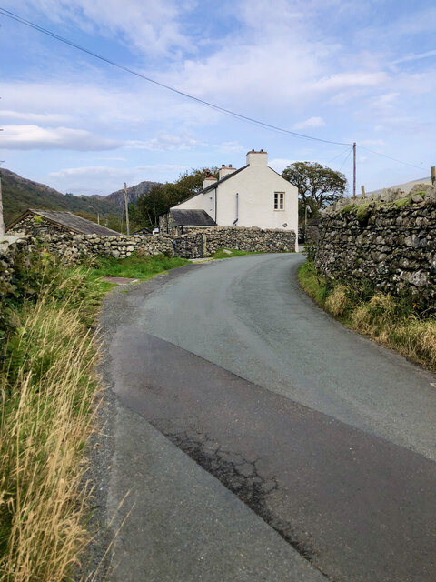
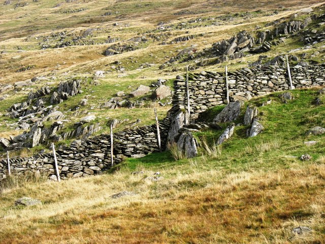
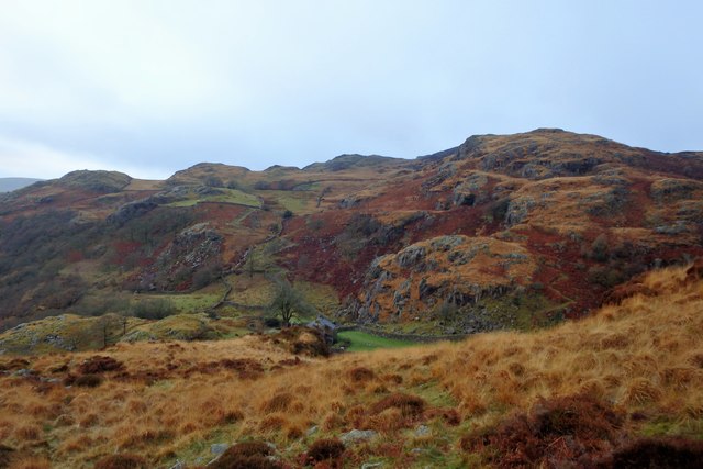
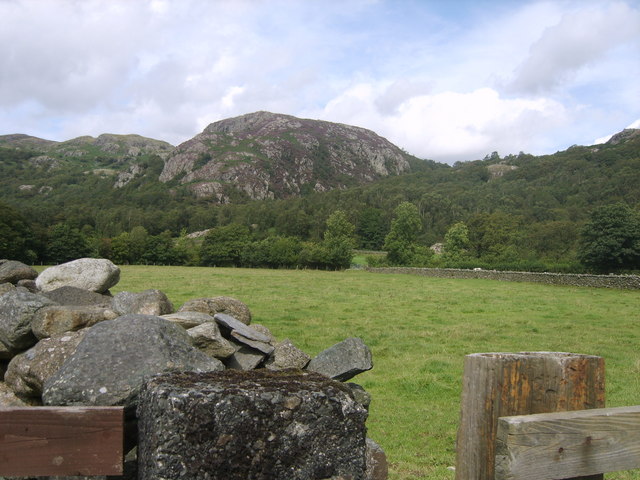
Cragend Wood Images

Images are sourced within 2km of 54.357294/-3.1967218 or Grid Reference SD2296. Thanks to Geograph Open Source API. All images are credited.

Cattle Grid
Cattle Grid
Road by Under Crag
Road by Under Crag
Snowy road
Snowy road
Building at Seathwaite
Vernacular farm building at Hall Dunnerdale
Green Pikes Green Pikes hardly appears prominent from close up, certainly compared to nearby Caw and Pikes.  Yet it is sufficiently noticeable when viewed from some directions to merit its own name. In the background is the upper Duddon valley, with Harter Fell on the left.
Green Pikes
Green Pikes hardly appears prominent from close up, certainly compared to nearby Caw and Pikes. Yet it is sufficiently noticeable when viewed from some directions to merit its own name. In the background is the upper Duddon valley, with Harter Fell on the left.
Tales of a Tarmac Lane—Barn, Bend, and Blue Pipe A glimpse down a paved path leading to a leftward bend, featuring a stone barn sporting a slate roof, with its barn entrance sealed shut by corrugated steel. A conspicuous coil of blue water pipe leans nonchalently against the barn's side wall.
Tales of a Tarmac Lane—Barn, Bend, and Blue Pipe
A glimpse down a paved path leading to a leftward bend, featuring a stone barn sporting a slate roof, with its barn entrance sealed shut by corrugated steel. A conspicuous coil of blue water pipe leans nonchalently against the barn's side wall.
Flanked by dry stone walls, a lane bearing the scar of road works
Confluence of Tarn Beck with the River Duddon
Tarn Beck
Tarn Beck
Footbridge over the River Duddon There are stepping stones a short distance downstream (to the right), but nobody in their right minds would risk them when this bridge, constructed in 1934, is available. The stones are large and often sloping, and a slip could easily result in a broken ankle, or worse.

For the acknowledgement to the bridge builder, see <a href="https://www.geograph.org.uk/photo/4699873">SD2296 : River Duddon footbridge plaque</a>.
Footbridge over the River Duddon
There are stepping stones a short distance downstream (to the right), but nobody in their right minds would risk them when this bridge, constructed in 1934, is available. The stones are large and often sloping, and a slip could easily result in a broken ankle, or worse. For the acknowledgement to the bridge builder, see SD2296 : River Duddon footbridge plaque.
River Duddon footbridge plaque The plaque on the bridge seen in <a href="https://www.geograph.org.uk/photo/4699863">SD2296 : Footbridge over the River Duddon</a> and <a href="https://www.geograph.org.uk/photo/3796711">SD2296 : Stone footbridge over River Duddon</a>. 

If anyone can tell me who A.F. and R.A.F. are, I would be interested. In context, they are clearly not just 'Air Force' and 'Royal Air Force'.
River Duddon footbridge plaque
The plaque on the bridge seen in SD2296 : Footbridge over the River Duddon and SD2296 : Stone footbridge over River Duddon. If anyone can tell me who A.F. and R.A.F. are, I would be interested. In context, they are clearly not just 'Air Force' and 'Royal Air Force'.
Postbox on Hall Bridge An unusual spot for a postbox, on a bridge over the River Duddon, but presumably convenient for local residents (and the postman!). The box is seen in more detail in <a href="https://www.geograph.org.uk/photo/1806956">SD2195 : Postbox, Hall Dunnerdale</a>.
Postbox on Hall Bridge
An unusual spot for a postbox, on a bridge over the River Duddon, but presumably convenient for local residents (and the postman!). The box is seen in more detail in SD2195 : Postbox, Hall Dunnerdale.
Descending to Seathwaite from Green Pikes Looking to the upper Duddon valley, with Hard Knott in the middle distance (just left of centre) and the Sca Fell range beyond.
Descending to Seathwaite from Green Pikes
Looking to the upper Duddon valley, with Hard Knott in the middle distance (just left of centre) and the Sca Fell range beyond.
Drystone walling on Green Pikes The way in which the waller has coped with the short cliff is impressive.
Drystone walling on Green Pikes
The way in which the waller has coped with the short cliff is impressive.
River Duddon From the footbridge near High Wallowbarrow
River Duddon
From the footbridge near High Wallowbarrow
Rake Beck Lovely stream cascading through the woods
Rake Beck
Lovely stream cascading through the woods
Above Low Stoneythwaite On High Wallowbarrow. A house in a great setting.
Above Low Stoneythwaite
On High Wallowbarrow. A house in a great setting.
Show me another place!

Cragend Wood is located at Grid Ref: SD2296 (Lat: 54.357294, Lng: -3.1967218)

Administrative County: Cumbria

District: Copeland

Police Authority: Cumbria

What 3 Words

///unsettled.bottled.motoring. Near Millom, Cumbria

Related Wikis

Wallowbarrow Crag

Wallowbarrow Crag is a hill of 292 metres (958 ft) in the Lake District, England. It is on the west of the Duddon Valley, across the valley from the village...

Dunnerdale-with-Seathwaite

Dunnerdale-with-Seathwaite is a civil parish in the Westmorland and Furness district of the ceremonial county of Cumbria, England. It includes the village...

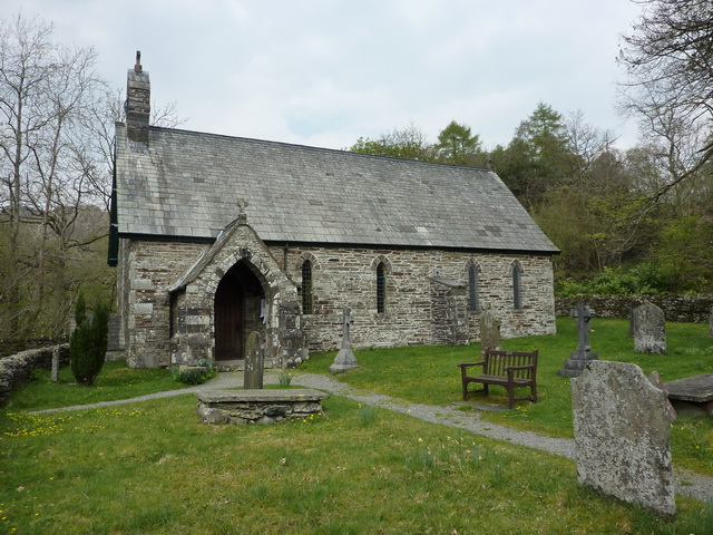
Holy Trinity Church, Seathwaite

Holy Trinity Church is in the village of Seathwaite, Cumbria, England. It is an active Anglican parish church in the deanery of Furness, the archdeaconry...

Seathwaite, Westmorland and Furness

Seathwaite is a village in the Dunnerdale-with-Seathwaite civil parish in the Westmorland and Furness district of Cumbria in North West England. It is...

Nearby Amenities

Located within 500m of 54.357294,-3.1967218
Barrier: stile
Lat/Long: 54.3580125/-3.1949582
Low Wallowbarrow
Place: locality
Lat/Long: 54.3546706/-3.2009896
High Wallowbarrow
Place: locality
Lat/Long: 54.3568526/-3.2011077
Wallowbarrow Crag
Place: locality
Lat/Long: 54.361492/-3.1976252
The data included in this document is from www.openstreetmap.org. The data is made available under ODbL.

Have you been to Cragend Wood?

Leave your review of Cragend Wood below (or comments, questions and feedback).