Tailacre Wood

Wood, Forest in Lancashire South Lakeland

England

Tailacre Wood

A595 at Galloper Pool Bridge
A595 at Galloper Pool Bridge Credit: Colin Pyle

Tailacre Wood, located in Lancashire, is a picturesque forest known for its natural beauty and tranquil ambiance. Spanning several acres, this enchanting woodland is a haven for nature lovers and outdoor enthusiasts alike.

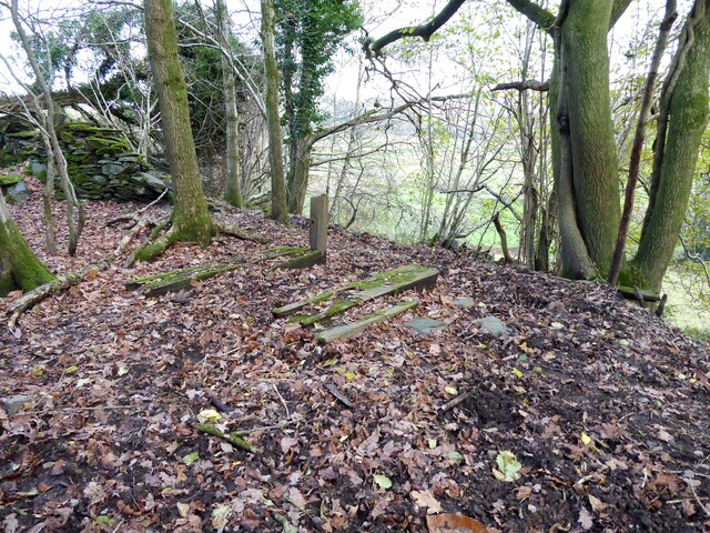
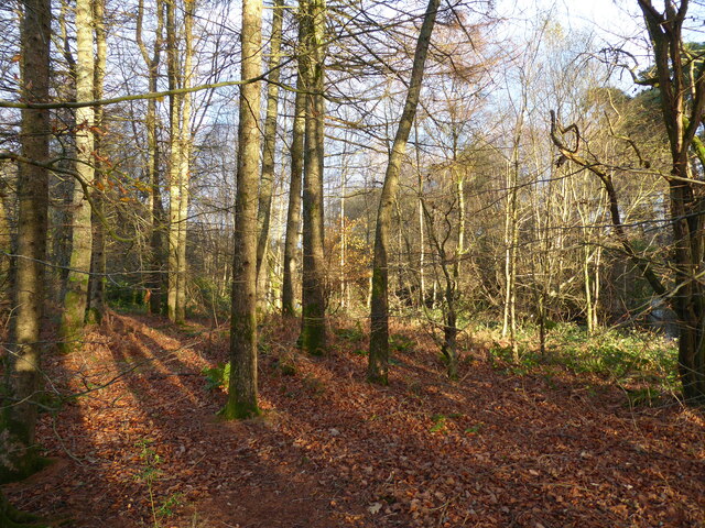
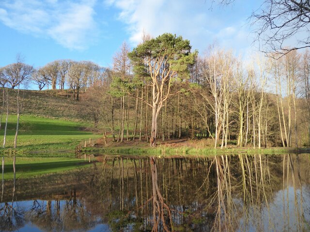
The wood features a diverse range of flora and fauna, with a rich array of deciduous and evergreen trees providing a stunning backdrop throughout the year. Oak, beech, and ash trees dominate the landscape, creating a dense canopy that offers shade and shelter for the woodland floor.

Walking through Tailacre Wood, visitors are treated to a sensory experience like no other. The air is infused with the earthy scent of damp moss and fallen leaves, while the gentle rustling of wildlife adds to the ethereal atmosphere. The forest floor is carpeted with a vibrant tapestry of wildflowers, including bluebells, primroses, and wood anemones, creating a burst of color that delights the eye.

For wildlife enthusiasts, Tailacre Wood offers a chance to spot a variety of animals. Squirrels scamper among the treetops, while rabbits and foxes can be seen darting through the undergrowth. Birdsong fills the air, with species such as thrushes, blackbirds, and woodpeckers making their homes in the wood.

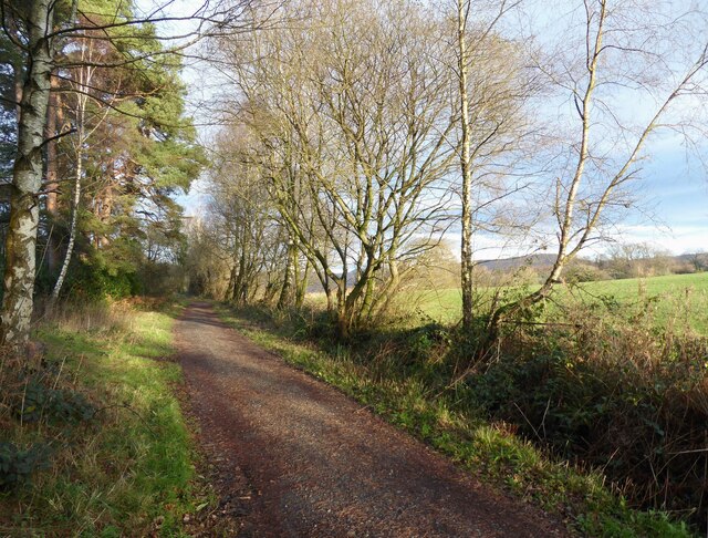
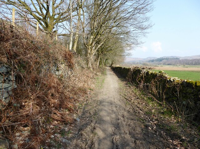
Visitors can explore the woodland via a network of well-maintained trails, allowing them to immerse themselves fully in the natural surroundings. Whether walking, cycling, or picnicking, Tailacre Wood offers a serene escape from the hustle and bustle of everyday life.

In conclusion, Tailacre Wood in Lancashire is a captivating forest, offering a sanctuary of tranquility and natural wonder. Its breathtaking beauty and abundant wildlife make it a must-visit destination for nature enthusiasts and those seeking solace in the great outdoors.

If you have any feedback on the listing, please let us know in the comments section below.

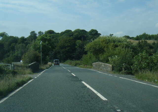
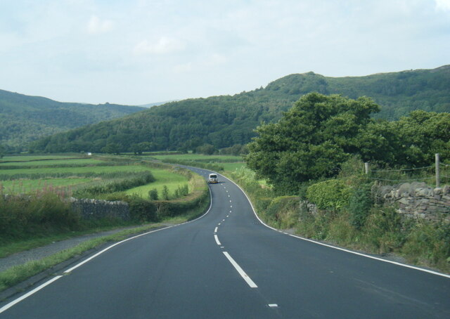
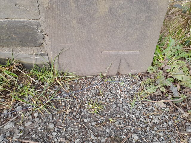
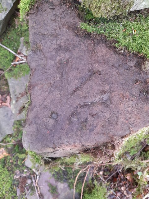
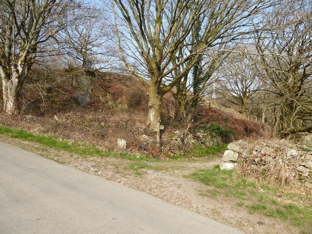
Tailacre Wood Images

Images are sourced within 2km of 54.281679/-3.1959263 or Grid Reference SD2287. Thanks to Geograph Open Source API. All images are credited.

A595 at Galloper Pool Bridge
A595 north west of High Cross
Remains of wooden ballast bin Only a few rotten pieces of wood remain from this ballast bin beside the former Furness Railway Coniston Branch near Moss Side.  Built from old wooden railway sleepers it is difficult to place an age on this ballast bin, but it is possible it pre-dates the formation of the London Midland and Scottish Railway in 1923 who later introduced concrete bins (see photograph <a href="https://www.geograph.org.uk/photo/6797992">NY2924 : LMS Standard Concrete Ballast Bin</a>).
Positioned approximately every mile, more frequently on curved track, ballast bins were used to store small stone chippings which were used by the railway Lengthsmen to pack and adjust the railway sleepers. Using only a jack and a shovel, an experienced Lengthsman could judge exactly the right quantity of chippings to use to obtain a perfect ‘top’ to the rail and they often took great pride in the quality of their work.
The Coniston Branch closed to passengers in October 1958 and to all traffic with effect from the 30 April 1962 although the last train had run during the preceding week.  The track bed in front of the ballast bin is deep in mud and trampled by cows.
Remains of wooden ballast bin
Only a few rotten pieces of wood remain from this ballast bin beside the former Furness Railway Coniston Branch near Moss Side. Built from old wooden railway sleepers it is difficult to place an age on this ballast bin, but it is possible it pre-dates the formation of the London Midland and Scottish Railway in 1923 who later introduced concrete bins (see photograph NY2924 : LMS Standard Concrete Ballast Bin). Positioned approximately every mile, more frequently on curved track, ballast bins were used to store small stone chippings which were used by the railway Lengthsmen to pack and adjust the railway sleepers. Using only a jack and a shovel, an experienced Lengthsman could judge exactly the right quantity of chippings to use to obtain a perfect ‘top’ to the rail and they often took great pride in the quality of their work. The Coniston Branch closed to passengers in October 1958 and to all traffic with effect from the 30 April 1962 although the last train had run during the preceding week. The track bed in front of the ballast bin is deep in mud and trampled by cows.
Woodland in East Park This woodland is in the grounds of the Broughton Tower Estate.
An ornamental lake can be glimpsed through the trees in the right background.
Woodland in East Park
This woodland is in the grounds of the Broughton Tower Estate. An ornamental lake can be glimpsed through the trees in the right background.
Ornamental lake, East Park This is the southernmost of two ornamental lakes in the East Park of the Broughton Tower Estate.  Although on private land the public has access from the public bridleway on the track bed of the former railway from Foxfield to Coniston which is adjacent.  There is also a public footpath crossing the narrow isthmus between the two lakes.
Ornamental lake, East Park
This is the southernmost of two ornamental lakes in the East Park of the Broughton Tower Estate. Although on private land the public has access from the public bridleway on the track bed of the former railway from Foxfield to Coniston which is adjacent. There is also a public footpath crossing the narrow isthmus between the two lakes.
Reading the charter, Broughton in Furness 1976 The granting of a royal charter to hold a fair in Broughton is commemorated annually on 1st August in the village square. In 1976 I assume that the ceremony was held on the 2nd August as the 1st fell on a Sunday.
Reading the charter, Broughton in Furness 1976
The granting of a royal charter to hold a fair in Broughton is commemorated annually on 1st August in the village square. In 1976 I assume that the ceremony was held on the 2nd August as the 1st fell on a Sunday.
Reading the charter, Broughton in Furness 1976 (2) The granting of a royal charter to hold a fair in Broughton is commemorated annually on 1st August in the village square. In 1976 I assume that the ceremony was held on the 2nd August as the 1st fell on a Sunday.
Reading the charter, Broughton in Furness 1976 (2)
The granting of a royal charter to hold a fair in Broughton is commemorated annually on 1st August in the village square. In 1976 I assume that the ceremony was held on the 2nd August as the 1st fell on a Sunday.
Reading the charter, Broughton in Furness 1976 (3) The granting of a royal charter to hold a fair in Broughton is commemorated annually on 1st August in the village square. In 1976 I assume that the ceremony was held on the 2nd August as the 1st fell on a Sunday.

After the reading, there was a general movement to the Manor Arms to claim the traditional free pint!
Reading the charter, Broughton in Furness 1976 (3)
The granting of a royal charter to hold a fair in Broughton is commemorated annually on 1st August in the village square. In 1976 I assume that the ceremony was held on the 2nd August as the 1st fell on a Sunday. After the reading, there was a general movement to the Manor Arms to claim the traditional free pint!
The Coniston Branch near Wall End Now only used by walkers and cyclists, this is the route of the former Furness Railway branch line from Foxfield to Coniston.
The last passenger service ran on 4 October 1958 with a final enthusiats’ special train on the 27 August 1961. The last freight train ran during the week ending 29 April 1962 and the track was lifted early in 1963.
The Coniston Branch near Wall End
Now only used by walkers and cyclists, this is the route of the former Furness Railway branch line from Foxfield to Coniston. The last passenger service ran on 4 October 1958 with a final enthusiats’ special train on the 27 August 1961. The last freight train ran during the week ending 29 April 1962 and the track was lifted early in 1963.
Broughton Tower Estate
Field near Wall End The broken ground to the right of the photograph is described on old Ordnance Survey maps as a marl pit.
The fell in the background, left of centre, is Great Burney, 298m (979ft).
Field near Wall End
The broken ground to the right of the photograph is described on old Ordnance Survey maps as a marl pit. The fell in the background, left of centre, is Great Burney, 298m (979ft).
Ordnance Survey Cut Mark This OS cut mark can be found on the north parapet of Galloper Pool Bridge. It marks a point 6.352m above mean sea level.
Ordnance Survey Cut Mark
This OS cut mark can be found on the north parapet of Galloper Pool Bridge. It marks a point 6.352m above mean sea level.
Ordnance Survey Rivet This OS rivet can be found on the stile SE side of the road. It marks a point 15.027m above mean sea level.
Ordnance Survey Rivet
This OS rivet can be found on the stile SE side of the road. It marks a point 15.027m above mean sea level.
Ordnance Survey Rivet This OS rivet can be found on the wall east side of the road. It marks a point 9.422m above mean sea level.
Ordnance Survey Rivet
This OS rivet can be found on the wall east side of the road. It marks a point 9.422m above mean sea level.
Public toilets, Broughton-in-Furness The public toilets on Knott Lane in Broughton-in-Furness.
Public toilets, Broughton-in-Furness
The public toilets on Knott Lane in Broughton-in-Furness.
Lane near Brookside The lane is a public footpath leading to Buttstead Wood.
Lane near Brookside
The lane is a public footpath leading to Buttstead Wood.
Lane entrance near Brookside Leading from the road near Brookside the lane leads to Buttstead Wood and carries a public footpath to Low Rosthwaite.
There is an Ordnance Survey rivet benchmark on the top of the low stone post partially hidden in the brambles to the left of the footpath signpost (photograph <a href="https://www.geograph.org.uk/photo/7260566">SD2389 : Rivet benchmark near Brookside</a>).
Lane entrance near Brookside
Leading from the road near Brookside the lane leads to Buttstead Wood and carries a public footpath to Low Rosthwaite. There is an Ordnance Survey rivet benchmark on the top of the low stone post partially hidden in the brambles to the left of the footpath signpost (photograph SD2389 : Rivet benchmark near Brookside).
Rivet benchmark near Brookside Detail of an Ordnance Survey rivet benchmark on the top of a low stone post near Brookside.  The benchmark marks a height of 11.0246m above mean sea level (Ordnance Datum Newlyn) last verified in 1972 (location photograph <a href="https://www.geograph.org.uk/photo/7260558">SD2389 : Lane entrance near Brookside</a>).
Rivet benchmark near Brookside
Detail of an Ordnance Survey rivet benchmark on the top of a low stone post near Brookside. The benchmark marks a height of 11.0246m above mean sea level (Ordnance Datum Newlyn) last verified in 1972 (location photograph SD2389 : Lane entrance near Brookside).
Show me another place!

Tailacre Wood is located at Grid Ref: SD2287 (Lat: 54.281679, Lng: -3.1959263)

Administrative County: Cumbria

District: South Lakeland

Police Authority: Cumbria

What 3 Words

///director.lectured.skins. Near Millom, Cumbria

Related Wikis

Broughton-in-Furness railway station

Broughton-in-Furness railway station served the market town of Broughton-in-Furness, in Lancashire, England (now in Cumbria). It was on the branch line...

Broughton-in-Furness

Broughton in Furness is a market town in the civil parish of Broughton West in the Westmorland and Furness district of Cumbria, England. It had a population...

St Mary Magdalene's Church, Broughton-in-Furness

St Mary Magdalene's Church is in Broughton-in-Furness, Cumbria, England. It is an active Anglican parish church in the deanery of Furness, the archdeaconry...

Eccle Riggs

Eccle Riggs is a country house located on Eccle Riggs, a ridge of land about 0.75 miles (1.2 km) to the south of Broughton-in-Furness, Cumbria, England...

Broughton West

Broughton West is a civil parish in the Westmorland and Furness district of Cumbria, England. In the 2001 census the parish had a population of 954, decreasing...

Broughton Mills

Broughton Mills is a village in Cumbria, England, located 3.5 kilometres from the larger town of Broughton-in-furness. The village consists of about 40...

Duddon Bridge

Duddon Bridge is a hamlet in Cumbria, England. == References ==

Bank End

Bank End is a village in Cumbria, England. == External links == Media related to Bank End, South Lakeland at Wikimedia Commons

Nearby Amenities

Located within 500m of 54.281679,-3.1959263
Bench
Lat/Long: 54.2825153/-3.201438
Barrier: stile
Lat/Long: 54.2839793/-3.199421
Ford: yes
Lat/Long: 54.2848138/-3.1984429
Power: pole
Lat/Long: 54.2802694/-3.1979804
Power: pole
Lat/Long: 54.2806173/-3.1972314
Power: pole
Lat/Long: 54.2809747/-3.1964502
Power: pole
Lat/Long: 54.2809709/-3.1950488
Power: pole
Lat/Long: 54.2852607/-3.1931706
Power: pole
Lat/Long: 54.2841173/-3.1936619
Power: pole
Lat/Long: 54.2830547/-3.1941403
Power: pole
Lat/Long: 54.2820288/-3.1945801
Power: pole
Lat/Long: 54.2802872/-3.1952969
Power: pole
Lat/Long: 54.2794954/-3.1955626
Power: pole
Lat/Long: 54.2784346/-3.1954354
Power: pole
Lat/Long: 54.2774133/-3.1952582
The data included in this document is from www.openstreetmap.org. The data is made available under ODbL.

Have you been to Tailacre Wood?

Leave your review of Tailacre Wood below (or comments, questions and feedback).