Crook Wood

Wood, Forest in Cumberland Copeland

England

Crook Wood

Vernacular farm building at Hall Dunnerdale
Vernacular farm building at Hall Dunnerdale Credit: P Gaskell

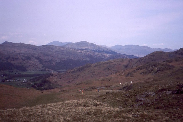
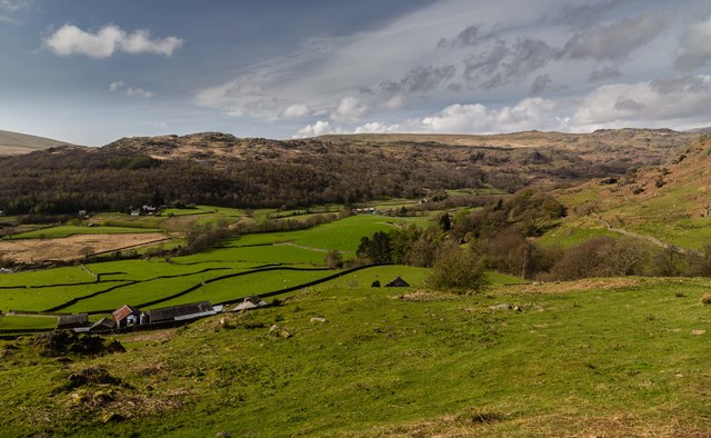
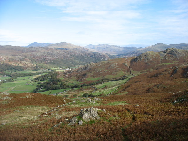
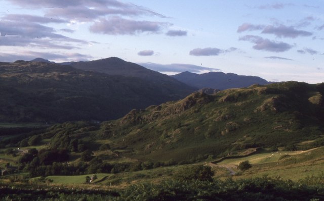
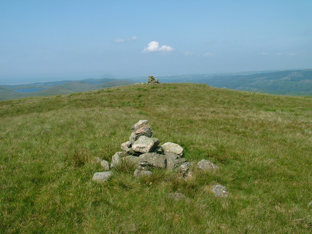
Crook Wood is a picturesque woodland located in the county of Cumberland, England. Spanning over a vast area, the woodland is known for its serene and tranquil atmosphere, making it a popular destination for nature enthusiasts and hikers alike. The wood is situated near the village of Crook, nestled within the undulating landscape of the Lake District National Park.

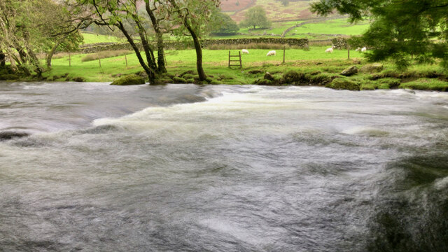
Characterized by its dense vegetation and diverse array of tree species, Crook Wood showcases the natural beauty of the region. The dominant trees in the woodland include oak, beech, and ash, which create a rich and vibrant canopy that provides shelter for a wide range of wildlife. The forest floor is adorned with an assortment of wildflowers, creating a colorful tapestry during the spring and summer months.

Crook Wood is crisscrossed by a network of well-maintained walking trails, allowing visitors to explore its hidden corners and discover its hidden treasures. These trails wind through the woodland, offering panoramic views of the surrounding countryside and glimpses of the occasional wildlife, such as squirrels, deer, and a variety of songbirds.

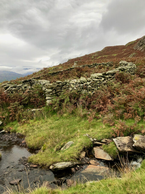
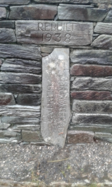
In addition to its natural beauty, Crook Wood also holds historical significance. The woodland was once part of the extensive hunting grounds of the local nobility, and remnants of their past can still be found in the form of old boundary walls and ancient oaks.

Overall, Crook Wood offers a captivating retreat for those seeking solace in nature. With its stunning landscapes, diverse wildlife, and rich history, it is a destination that truly captures the essence of Cumberland's natural heritage.

If you have any feedback on the listing, please let us know in the comments section below.

Crook Wood Images

Images are sourced within 2km of 54.344366/-3.2221904 or Grid Reference SD2095. Thanks to Geograph Open Source API. All images are credited.

Vernacular farm building at Hall Dunnerdale
Vernacular farm building at The Crook
Washfold, Hollow Moss Beck A pen for holding sheep waiting to be washed. The following is quoted from the Lake District National Park HER see <span class="nowrap"><a title="https://www.heritagegateway.org.uk/Gateway/Results_Single.aspx?uid=2900443&resourceID=801" rel="nofollow ugc noopener" href="https://www.heritagegateway.org.uk/Gateway/Results_Single.aspx?uid=2900443&resourceID=801">Link</a><img style="margin-left:2px;" alt="External link" title="External link - shift click to open in new window" src="https://s1.geograph.org.uk/img/external.png" width="10" height="10"/></span>

"An unusual circular fold 8m diameter with an internal partition forming two chambers. An 11m long driving wall has been built along naturally rocky outcrops to assist driving sheep into the fold. The wash dub measures 3m by 4m and apart from being partially silted up all the features are intact and in excellent condition. There is a dry stone built launching platform just outside the gate and the beck is masonry lined on the bank nearest the fold to prevent undermining of the structure. The remains of a dry stone dam are substantially complete on both banks of the beck. The fold is in excellent condition, walls are intact to full height and cams in place, however approximately half of the driving wall is partially collapsed. The wash dub features are one of the best preserved in the Western valleys and are also in excellent condition."
Washfold, Hollow Moss Beck
A pen for holding sheep waiting to be washed. The following is quoted from the Lake District National Park HER see LinkExternal link "An unusual circular fold 8m diameter with an internal partition forming two chambers. An 11m long driving wall has been built along naturally rocky outcrops to assist driving sheep into the fold. The wash dub measures 3m by 4m and apart from being partially silted up all the features are intact and in excellent condition. There is a dry stone built launching platform just outside the gate and the beck is masonry lined on the bank nearest the fold to prevent undermining of the structure. The remains of a dry stone dam are substantially complete on both banks of the beck. The fold is in excellent condition, walls are intact to full height and cams in place, however approximately half of the driving wall is partially collapsed. The wash dub features are one of the best preserved in the Western valleys and are also in excellent condition."
Stepping stones across the River Duddon
Site of Commonwood Quarries For more information see Heritagegateway.org.uk <<span class="nowrap"><a title="https://www.heritagegateway.org.uk/Gateway/Results_Single.aspx?resourceID=801&uid=2887969" rel="nofollow ugc noopener" href="https://www.heritagegateway.org.uk/Gateway/Results_Single.aspx?resourceID=801&uid=2887969">Link</a><img style="margin-left:2px;" alt="External link" title="External link - shift click to open in new window" src="https://s1.geograph.org.uk/img/external.png" width="10" height="10"/></span> > [accessed 14 October 2023]

‌
Site of Commonwood Quarries
For more information see Heritagegateway.org.uk <LinkExternal link > [accessed 14 October 2023] ‌
Tales of a Tarmac Lane—Barn, Bend, and Blue Pipe A glimpse down a paved path leading to a leftward bend, featuring a stone barn sporting a slate roof, with its barn entrance sealed shut by corrugated steel. A conspicuous coil of blue water pipe leans nonchalently against the barn&amp;#039;s side wall.
Tales of a Tarmac Lane—Barn, Bend, and Blue Pipe
A glimpse down a paved path leading to a leftward bend, featuring a stone barn sporting a slate roof, with its barn entrance sealed shut by corrugated steel. A conspicuous coil of blue water pipe leans nonchalently against the barn's side wall.
Flanked by dry stone walls, a lane bearing the scar of road works
Postbox on Hall Bridge An unusual spot for a postbox, on a bridge over the River Duddon, but presumably convenient for local residents (and the postman!). The box is seen in more detail in &lt;a href=&quot;https://www.geograph.org.uk/photo/1806956&quot;&gt;SD2195 : Postbox, Hall Dunnerdale&lt;/a&gt;.
Postbox on Hall Bridge
An unusual spot for a postbox, on a bridge over the River Duddon, but presumably convenient for local residents (and the postman!). The box is seen in more detail in SD2195 : Postbox, Hall Dunnerdale.
Orienteering, Dunnerdale Fells Looking back towards the start from a climb above Kiln Bank on Lakeland OC&amp;#039;s Stickle Pike map. I had already run and was walking up Stickle Pike.  The runners will have completed a loop north of the road before climbing to the southern part of the competition area here.
Orienteering, Dunnerdale Fells
Looking back towards the start from a climb above Kiln Bank on Lakeland OC's Stickle Pike map. I had already run and was walking up Stickle Pike. The runners will have completed a loop north of the road before climbing to the southern part of the competition area here.
Kiln Bank The Duddon Valley seen from Kiln Bank.
Kiln Bank
The Duddon Valley seen from Kiln Bank.
Sheepfold by Hollow Moss Beck A well constructed circular fold with an attached length of drystone wall - possibly a windbreak for the sheep? Looking up the Duddon towards snow-covered Crinkle Crags and Bow Fell and the cone of Harter Fell.
Sheepfold by Hollow Moss Beck
A well constructed circular fold with an attached length of drystone wall - possibly a windbreak for the sheep? Looking up the Duddon towards snow-covered Crinkle Crags and Bow Fell and the cone of Harter Fell.
A gorse bush above the Duddon A windswept gorse by Hollow Moss Beck with the snow-covered Crinkle Crags (right) and Bow Fell beyond.
A gorse bush above the Duddon
A windswept gorse by Hollow Moss Beck with the snow-covered Crinkle Crags (right) and Bow Fell beyond.
The upper Duddon valley Often known as Dunnerdale, although technically this name belongs to a minor valley just east of here. The photo is taken from the slopes of Stickle Pike.
The upper Duddon valley
Often known as Dunnerdale, although technically this name belongs to a minor valley just east of here. The photo is taken from the slopes of Stickle Pike.
Old Boundary Marker on Hall Bridge, Ulpha parish Parish Boundary Marker by the UC road, in parish of Ulpha (Copeland District), Hall Bridge, River Duddon, set into the North bridge parapet.

Inscription reads vertically:-
: ULPHA : : SEATHWAITE

To be surveyed

Milestone Society National ID: CU_ULPSEA02pb
Old Boundary Marker on Hall Bridge, Ulpha parish
Parish Boundary Marker by the UC road, in parish of Ulpha (Copeland District), Hall Bridge, River Duddon, set into the North bridge parapet. Inscription reads vertically:- : ULPHA : : SEATHWAITE To be surveyed Milestone Society National ID: CU_ULPSEA02pb
Kiln Bank View up the Duddon towards Harter Fell
Kiln Bank
View up the Duddon towards Harter Fell
Crosbythwaite Farm. Big sheep gathering day when this one was taken.
Crosbythwaite Farm.
Big sheep gathering day when this one was taken.
St Johns Church Ulpha A second burial ground is across the road.
St Johns Church Ulpha
A second burial ground is across the road.
Bridleway To Holehouse from the Birker fell Road. Hesk Fell in view.
Bridleway
To Holehouse from the Birker fell Road. Hesk Fell in view.
Show me another place!

Crook Wood is located at Grid Ref: SD2095 (Lat: 54.344366, Lng: -3.2221904)

Administrative County: Cumbria

District: Copeland

Police Authority: Cumbria

What 3 Words

///forgotten.capers.strapping. Near Millom, Cumbria

Related Wikis

Ulpha

Ulpha is a small village and civil parish in the Duddon Valley in the Lake District National Park in Cumbria, England. Historically in Cumberland, it forms...

Great Worm Crag

Great Worm Crag is a hill in south west of the English Lake District, north of Ulpha, Cumbria. It is the subject of a chapter of Wainwright's book The...
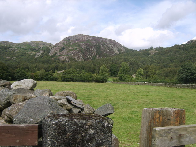
Wallowbarrow Crag

Wallowbarrow Crag is a hill of 292 metres (958 ft) in the Lake District, England. It is on the west of the Duddon Valley, across the valley from the village...

Caw (hill)

Caw is a hill in Cumbria, England, near the village of Seathwaite above the Duddon Valley, reaching 1,735 feet (529 m) and having a trig point at the summit...

Seathwaite, Westmorland and Furness

Seathwaite is a village in the Dunnerdale-with-Seathwaite civil parish in the Westmorland and Furness district of Cumbria in North West England. It is...

Dunnerdale-with-Seathwaite

Dunnerdale-with-Seathwaite is a civil parish in the Westmorland and Furness district of the ceremonial county of Cumbria, England. It includes the village...

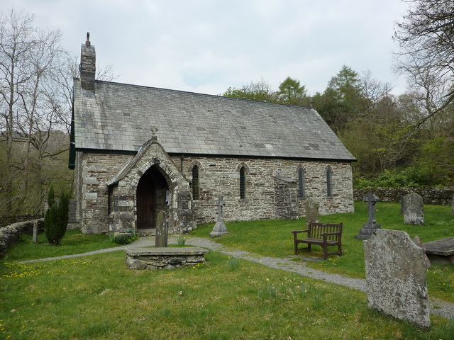
Holy Trinity Church, Seathwaite

Holy Trinity Church is in the village of Seathwaite, Cumbria, England. It is an active Anglican parish church in the deanery of Furness, the archdeaconry...

Hesk Fell

Hesk Fell is a hill in the south-west of the English Lake District, between the Duddon Valley and Eskdale near Ulpha, Cumbria. It is the subject of a chapter...

Nearby Amenities

Located within 500m of 54.344366,-3.2221904
Disused: yes
Historic: mine
Man Made: mine
Lat/Long: 54.3415267/-3.2260907
The Crook
Place: locality
Lat/Long: 54.3439647/-3.2197822
Barrier: stile
Lat/Long: 54.3446849/-3.2192114
The data included in this document is from www.openstreetmap.org. The data is made available under ODbL.

Have you been to Crook Wood?

Leave your review of Crook Wood below (or comments, questions and feedback).