Bank End Wood

Wood, Forest in Lancashire South Lakeland

England

Bank End Wood

Elizabeth II postbox on the A595, Buckman Brow  Postbox No. LA18 134.
Elizabeth II postbox on the A595, Buckman Brow Credit: JThomas

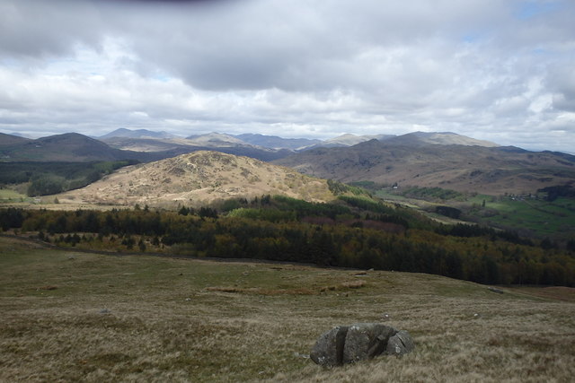
Bank End Wood is a picturesque woodland located in the county of Lancashire, England. Situated in the western part of the county, near the village of Bank End, this enchanting forest is a haven for nature lovers and outdoor enthusiasts.

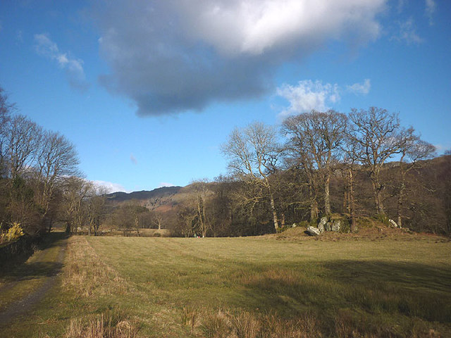
Covering an area of approximately 50 acres, Bank End Wood boasts a diverse range of flora and fauna. The woodland is predominantly composed of mature deciduous trees, including oak, beech, and birch, which create a dense canopy and provide a habitat for a variety of wildlife species.

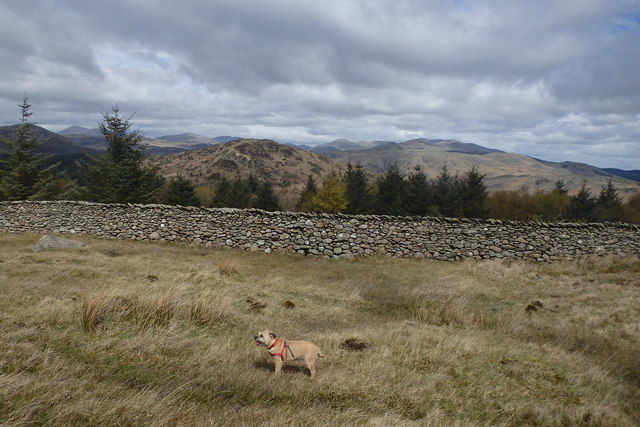
Visitors to Bank End Wood can explore a network of well-maintained walking trails that wind through the forest, offering stunning views of the surrounding countryside. These paths cater to different levels of fitness and provide easy access to the various sections of the wood.

Birdwatchers will be delighted by the abundance of avian species that call Bank End Wood their home. From songbirds such as thrushes and warblers to raptors like buzzards and sparrowhawks, there is always something to spot for bird enthusiasts.

In addition to its natural beauty, Bank End Wood also offers recreational opportunities. There are designated picnic areas where visitors can relax and enjoy the tranquility of the surroundings. The forest is also a popular spot for nature photography and wildlife observation.

Managed by the local authorities, Bank End Wood is well-preserved and cared for, ensuring that it remains a cherished natural asset for both locals and tourists alike.

If you have any feedback on the listing, please let us know in the comments section below.

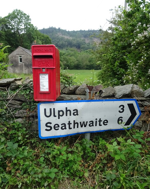
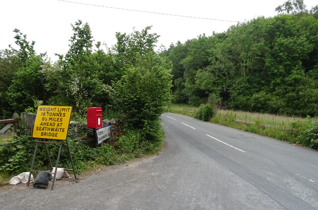
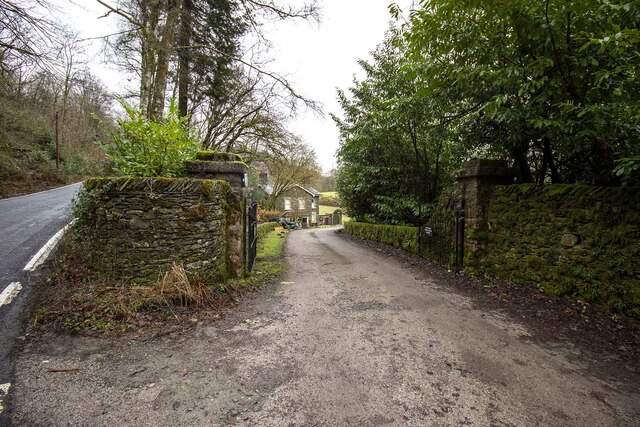
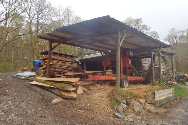
Bank End Wood Images

Images are sourced within 2km of 54.285124/-3.2305279 or Grid Reference SD1988. Thanks to Geograph Open Source API. All images are credited.

Elizabeth II postbox on the A595, Buckman Brow  Postbox No. LA18 134.
Elizabeth II postbox on the A595, Buckman Brow
Postbox No. LA18 134.
Elizabeth II postbox on the A595, Duddon Bridge Postbox No. LA20 68.

See <a href="https://www.geograph.org.uk/photo/6899751">SD1988 : Smithy Lane, Duddon Bridge</a> for context.
Elizabeth II postbox on the A595, Duddon Bridge
Postbox No. LA20 68. See SD1988 : Smithy Lane, Duddon Bridge for context.
Smithy Lane, Duddon Bridge Showing position of Postbox No. LA20 68.

See <a href="https://www.geograph.org.uk/photo/6899749">SD1988 : Elizabeth II postbox on the A595, Duddon Bridge</a> for postbox.
Smithy Lane, Duddon Bridge
Showing position of Postbox No. LA20 68. See SD1988 : Elizabeth II postbox on the A595, Duddon Bridge for postbox.
A595 at Buckman Brow
Entrance to Duddon Hall
Recent felling on Coops Wood has opened up a view of the bridge over the Duddon
Sawmill at Beckfoot On The edge of the hamlet of Beckfoot on the delightful Ulpha Park path.
Sawmill at Beckfoot
On The edge of the hamlet of Beckfoot on the delightful Ulpha Park path.
Bluebells, Furnace Wood In deepest Duddon
Bluebells, Furnace Wood
In deepest Duddon
Dry Tarn, Barrow The drought has dried up this tiny tarn. I suspect it is the same as <a href="https://www.geograph.org.uk/photo/3741119">SD1888 : Small tarn on Barrow</a>
Dry Tarn, Barrow
The drought has dried up this tiny tarn. I suspect it is the same as SD1888 : Small tarn on Barrow
Ascending Barrow Looking towards the Duddon estuary
Ascending Barrow
Looking towards the Duddon estuary
On Barrow A rarely frequented top
On Barrow
A rarely frequented top
On Barrow Looks like the top
On Barrow
Looks like the top
Descending Barrow Penn, our next objective in shot
Descending Barrow
Penn, our next objective in shot
Forest Edge Under Barrow
Forest Edge
Under Barrow
Duddon iron furnace (disused) A charcoal burning blast furnace dating from 1736. Isaac Wilkinson's cylinder bellows powered by water were first applied here. It is a Scheduled Ancient Monument but is temporarily closed to the public while structural issues are considered. There is a good view from the bridleway that goes past the site.
Duddon iron furnace (disused)
A charcoal burning blast furnace dating from 1736. Isaac Wilkinson's cylinder bellows powered by water were first applied here. It is a Scheduled Ancient Monument but is temporarily closed to the public while structural issues are considered. There is a good view from the bridleway that goes past the site.
Pasture by the Duddon The track from Beckfoot skirts this on the west with the Duddon flowing to Rawfold Bridge on the right.
Pasture by the Duddon
The track from Beckfoot skirts this on the west with the Duddon flowing to Rawfold Bridge on the right.
Pivot type mark This Pivot style mark can be found on the SE parapet of the bridge.
Pivot type mark
This Pivot style mark can be found on the SE parapet of the bridge.
Ordnance Survey Flush Bracket (G3075) This OS Flush Bracket can be found on a roadside building at Duddon Bridge Farm. It marks a point 10.398m above mean sea level.
Ordnance Survey Flush Bracket (G3075)
This OS Flush Bracket can be found on a roadside building at Duddon Bridge Farm. It marks a point 10.398m above mean sea level.
Show me another place!

Bank End Wood is located at Grid Ref: SD1988 (Lat: 54.285124, Lng: -3.2305279)

Administrative County: Cumbria

District: South Lakeland

Police Authority: Cumbria

What 3 Words

///sculpture.validated.elbow. Near Millom, Cumbria

Related Wikis

Bank End

Bank End is a village in Cumbria, England. == External links == Media related to Bank End, South Lakeland at Wikimedia Commons

Duddon furnace

The Duddon furnace (Grid Reference SD 197883) is a surviving charcoal-fuelled blast furnace near Broughton-in-Furness in Cumbria. It is on the west side...

Duddon Bridge

Duddon Bridge is a hamlet in Cumbria, England. == References ==

Broughton-in-Furness

Broughton in Furness is a market town in the civil parish of Broughton West in the Westmorland and Furness district of Cumbria, England. It had a population...

St Mary Magdalene's Church, Broughton-in-Furness

St Mary Magdalene's Church is in Broughton-in-Furness, Cumbria, England. It is an active Anglican parish church in the deanery of Furness, the archdeaconry...

Duddon Valley

The Duddon Valley is a valley in the southern Lake District National Park in Cumbria, England. The River Duddon flows through the valley, rising in the...

Broughton-in-Furness railway station

Broughton-in-Furness railway station served the market town of Broughton-in-Furness, in Lancashire, England (now in Cumbria). It was on the branch line...

Eccle Riggs

Eccle Riggs is a country house located on Eccle Riggs, a ridge of land about 0.75 miles (1.2 km) to the south of Broughton-in-Furness, Cumbria, England...

Nearby Amenities

Located within 500m of 54.285124,-3.2305279
Traffic Signals
Lat/Long: 54.2833121/-3.2306255
Traffic Signals
Lat/Long: 54.2828017/-3.232028
Bus Stop
Ulpha Road End (E bound)
Bench: no
Bin: no
Lit: no
Local Ref: AT
Naptan AtcoCode: 090050201166
Naptan Bearing: N
Naptan BusStopType: CUS
Naptan CommonName: Ulpha Road End (E bound)
Naptan Indicator: at
Naptan Landmark: post box
Naptan NaptanCode: cumawdpw
Naptan Street: A595
Naptan Verified: no
Shelter: no
Source: naptan_import
Tactile Paving: no
Lat/Long: 54.2833813/-3.2306067
Bus Stop
Ulpha Road End (W bound)
Bench: no
Bin: no
Lit: no
Naptan AtcoCode: 090050203284
Naptan Bearing: W
Naptan BusStopType: CUS
Naptan CommonName: Ulpha Road End (W bound)
Naptan Indicator: opp
Naptan Landmark: post box
Naptan NaptanCode: cumawdta
Naptan Street: A595
Naptan Verified: no
Shelter: no
Source: naptan_import
Tactile Paving: no
Lat/Long: 54.2832287/-3.2305868
Duddon Furnace
Historic: ruins
Wikidata: Q5311681
Wikipedia: en:Duddon furnace
Lat/Long: 54.284023/-3.2354975
Post Box
Collection Times: Mo-Fr 16:15; Sa 10:45
Drive Through: no
Ref: LA20 68
Royal Cypher: EIIR
Royal Cypher Wikidata: Q33102113
Lat/Long: 54.2834006/-3.2306051
Material: wood
Power: pole
Lat/Long: 54.2825993/-3.2314767
Material: wood
Power: pole
Lat/Long: 54.2823581/-3.2329197
Material: wood
Power: pole
Lat/Long: 54.282142/-3.2340087
Material: wood
Power: pole
Lat/Long: 54.2815/-3.2335956
Material: wood
Power: pole
Lat/Long: 54.2825742/-3.234808
Material: wood
Power: pole
Lat/Long: 54.2825536/-3.2350957
Material: wood
Power: pole
Lat/Long: 54.2826206/-3.235613
Material: wood
Power: pole
Lat/Long: 54.2831041/-3.2305092
Material: wood
Power: pole
Lat/Long: 54.2834944/-3.2306983
Material: wood
Power: pole
Lat/Long: 54.2835714/-3.2299925
Duddon Bridge
Place: hamlet
Lat/Long: 54.2827289/-3.2341533
Glade Haw
Place: locality
Lat/Long: 54.2880424/-3.2290499
Stop
Direction: forward
Lat/Long: 54.2833475/-3.2305024
Bank End
Place: locality
Lat/Long: 54.284391/-3.2298483
Harry Wood
Natural: wood
Lat/Long: 54.28902/-3.2339173
Dower House
Addr City: High Duddon
Addr Postcode: LA20 6ET
Phone: +44 1229 716279
Tourism: guest_house
Website: http://www.dowerhouse.biz/
Lat/Long: 54.2824833/-3.2365484
Generator Method: photovoltaic
Generator Output Electricity: yes
Generator Source: solar
Generator Type: solar_photovoltaic_panel
Location: roof
Power: generator
Lat/Long: 54.2827927/-3.2363661
Generator Method: photovoltaic
Generator Output Electricity: yes
Generator Source: solar
Generator Type: solar_photovoltaic_panel
Location: roof
Power: generator
Lat/Long: 54.2827457/-3.2362964
Parking
Parking: layby
Lat/Long: 54.2845044/-3.2313631
The data included in this document is from www.openstreetmap.org. The data is made available under ODbL.

Have you been to Bank End Wood?

Leave your review of Bank End Wood below (or comments, questions and feedback).