Forge Wood

Wood, Forest in Cumberland Copeland

England

Forge Wood

Sawmill at Beckfoot On The edge of the hamlet of Beckfoot on the delightful Ulpha Park path.
Sawmill at Beckfoot Credit: Michael Graham

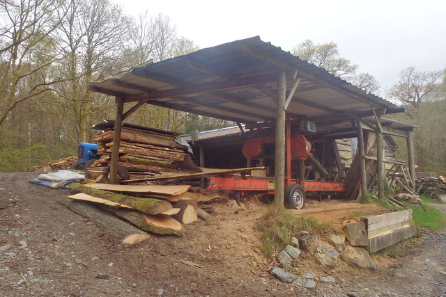
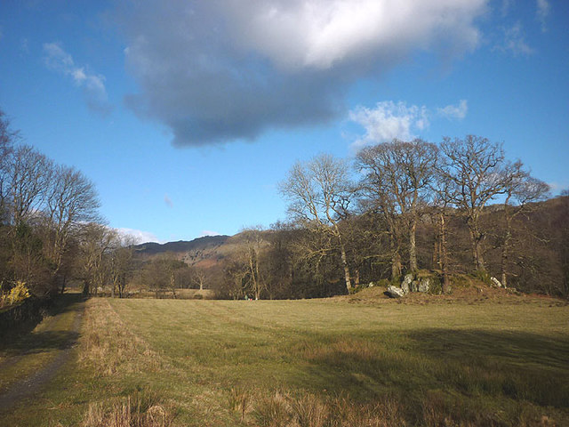
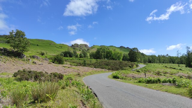
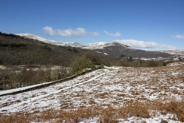
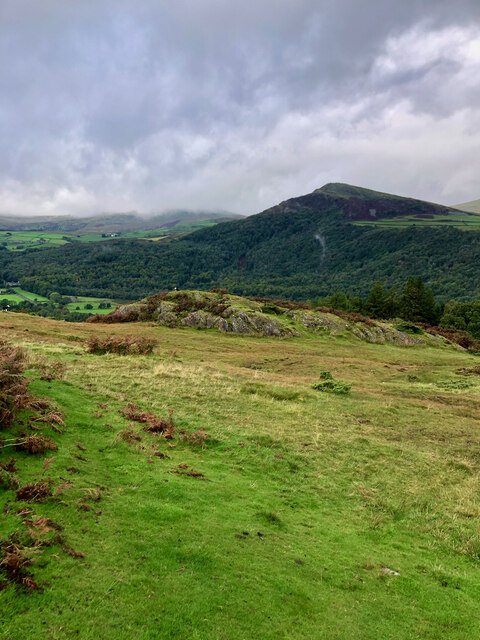
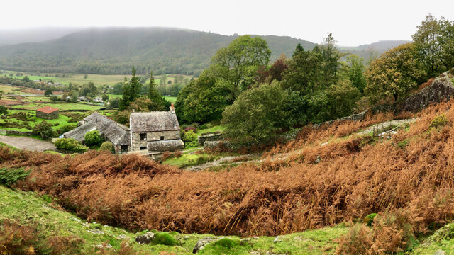
Forge Wood is a dense forest located in Cumberland, England. Covering an area of approximately 500 acres, it is known for its rich biodiversity and stunning natural beauty. The forest is characterized by its tall, mature trees, including oak, beech, and birch, which create a dense canopy that provides shelter for a wide variety of wildlife.

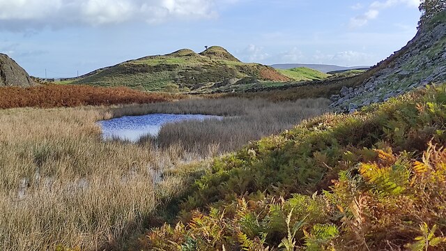
The forest floor is covered in a thick layer of leaf litter and moss, creating a damp and fertile environment. This rich soil supports a diverse range of plant species, including bluebells, wild garlic, and ferns. The undergrowth is home to numerous small mammals, such as voles and shrews, which find shelter and food among the fallen leaves and dense vegetation.

Forge Wood is also a haven for birdwatchers, with a wide variety of bird species inhabiting the forest. Visitors may spot woodpeckers, owls, and various songbirds flitting through the trees or nesting in the branches. The forest is particularly notable for its population of red kites, a majestic bird of prey that was successfully reintroduced to the area in recent years.

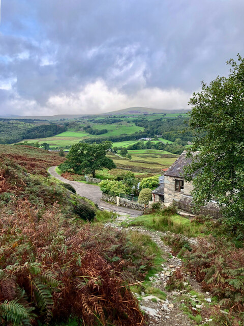
The forest is crisscrossed by a network of walking trails, allowing visitors to explore its natural wonders. These trails wind through the towering trees and offer breathtaking views of the surrounding landscape. Forge Wood is a popular destination for nature enthusiasts, hikers, and photographers, offering a peaceful and serene escape from the hustle and bustle of everyday life.

If you have any feedback on the listing, please let us know in the comments section below.

Forge Wood Images

Images are sourced within 2km of 54.313589/-3.2418611 or Grid Reference SD1991. Thanks to Geograph Open Source API. All images are credited.

Sawmill at Beckfoot On The edge of the hamlet of Beckfoot on the delightful Ulpha Park path.
Sawmill at Beckfoot
On The edge of the hamlet of Beckfoot on the delightful Ulpha Park path.
Pasture by the Duddon The track from Beckfoot skirts this on the west with the Duddon flowing to Rawfold Bridge on the right.
Pasture by the Duddon
The track from Beckfoot skirts this on the west with the Duddon flowing to Rawfold Bridge on the right.
Ordnance Survey Rivet This OS rivet can be found on a boulder NE side of the road. It marks a point 128.778m above mean sea level.
Ordnance Survey Rivet
This OS rivet can be found on a boulder NE side of the road. It marks a point 128.778m above mean sea level.
Ordnance Survey Pivot This OS pivot can be found on a boulder north side of the road. It marks a point 151.068m above mean sea level.
Ordnance Survey Pivot
This OS pivot can be found on a boulder north side of the road. It marks a point 151.068m above mean sea level.
Dunnerdale Fells above Stonestar There is an old postcard of this scene called "Dunnerdale Fells". This is a recent picture of the same from the same location. Peaks include Cat's Crag and Raven's Crag, and what rock-climbers call Stonestar Crag.
This picture is a reverse view of <a href="https://www.geograph.org.uk/photo/7300826">SD1992 : Duddon Valley south of Ulpha</a>.
Dunnerdale Fells above Stonestar
There is an old postcard of this scene called "Dunnerdale Fells". This is a recent picture of the same from the same location. Peaks include Cat's Crag and Raven's Crag, and what rock-climbers call Stonestar Crag. This picture is a reverse view of SD1992 : Duddon Valley south of Ulpha.
Vernacular farm building
On Dunnerdale Fells near Gowther Barrow I can't work out what these mounds are called. They might be part of Potherilt Hill or Gowther Barrow. They don't seem to be so distinctive when viewed from other angles.
On Dunnerdale Fells near Gowther Barrow
I can't work out what these mounds are called. They might be part of Potherilt Hill or Gowther Barrow. They don't seem to be so distinctive when viewed from other angles.
Fellside above Birks
A far away view of Birks
Cattle grid and gate Coming off the open fell of Thwaite Fell, one has the choice of using the cattle grid or the gate before entering wooded valley of the River Duddon.
Cattle grid and gate
Coming off the open fell of Thwaite Fell, one has the choice of using the cattle grid or the gate before entering wooded valley of the River Duddon.
Sheep The road to the right goes to Ulpha whilst the other one carries on to Waberthwaite over Corney Fell
Sheep
The road to the right goes to Ulpha whilst the other one carries on to Waberthwaite over Corney Fell
9pm  Corney Fell Cattle grid leading down to Duddon Bridge.
9pm Corney Fell
Cattle grid leading down to Duddon Bridge.
On the Corney Fell Road Looking towards Penn from the path to Smallthwaite
On the Corney Fell Road
Looking towards Penn from the path to Smallthwaite
Rapid under Rawfold bridge Rawfold bridge marks one of the hardest individual rapids on the Lower Duddon where the river splits either side of a rock, then recombines in a drop into a deep pool under the bridge with a fairly narrow outlet. Taking the river right line, as Jim Pullen has here, is usually more difficult as the water tries to push one into a river left eddy under the bridge from which escape is problematical. Jim had paddled his own boat down the easier left line, but to save a portage, took this boat for someone else and chose the other line for this second run. This view was taken at about the lowest level you'd want to run the river (the forecast had lied to us...)
Rapid under Rawfold bridge
Rawfold bridge marks one of the hardest individual rapids on the Lower Duddon where the river splits either side of a rock, then recombines in a drop into a deep pool under the bridge with a fairly narrow outlet. Taking the river right line, as Jim Pullen has here, is usually more difficult as the water tries to push one into a river left eddy under the bridge from which escape is problematical. Jim had paddled his own boat down the easier left line, but to save a portage, took this boat for someone else and chose the other line for this second run. This view was taken at about the lowest level you'd want to run the river (the forecast had lied to us...)
Bridge over Logan Beck at Beckfoot
The queen of all she surveys A Herdwick ewe surveys her surroundings atop an outcrop above the Duddon Valley.
The queen of all she surveys
A Herdwick ewe surveys her surroundings atop an outcrop above the Duddon Valley.
Small tarn, Tarn Hill One of a collection of gems that gives the hill its name and makes this an ideal place to wander at will.
Small tarn, Tarn Hill
One of a collection of gems that gives the hill its name and makes this an ideal place to wander at will.
Show me another place!

Forge Wood is located at Grid Ref: SD1991 (Lat: 54.313589, Lng: -3.2418611)

Administrative County: Cumbria

District: Copeland

Police Authority: Cumbria

What 3 Words

///dramatic.airbrush.noses. Near Millom, Cumbria

Related Wikis

Dunnerdale Fells

Dunnerdale Fells is an upland area in the English Lake District, between Ulpha and Broughton Mills, Cumbria. It is the subject of a chapter of Wainwright...

Duddon Valley

The Duddon Valley is a valley in the southern Lake District National Park in Cumbria, England. The River Duddon flows through the valley, rising in the...

Great Stickle

Great Stickle is a fell located in the southern Lake District of England with an altitude of 305 m (1,001 ft). Alfred Wainwright included it in the Stickle...

Ulpha

Ulpha is a small village and civil parish in the Duddon Valley in the Lake District National Park in Cumbria, England. Historically in Cumberland, it forms...

Bank End

Bank End is a village in Cumbria, England. == External links == Media related to Bank End, South Lakeland at Wikimedia Commons

Blacksmiths Arms, Broughton Mills

The Blacksmiths Arms is a Grade II listed public house at Broughton Mills, Cumbria, England.It is on the Campaign for Real Ale's National Inventory of...

Broughton Mills

Broughton Mills is a village in Cumbria, England, located 3.5 kilometres from the larger town of Broughton-in-furness. The village consists of about 40...

Duddon furnace

The Duddon furnace (Grid Reference SD 197883) is a surviving charcoal-fuelled blast furnace near Broughton-in-Furness in Cumbria. It is on the west side...

Nearby Amenities

Located within 500m of 54.313589,-3.2418611
Power: pole
Lat/Long: 54.3163207/-3.2479563
Power: pole
Lat/Long: 54.3163697/-3.2462702
Power: pole
Lat/Long: 54.3164227/-3.2442279
Power: pole
Lat/Long: 54.3164491/-3.2426689
Power: pole
Lat/Long: 54.3164571/-3.2420335
Power: pole
Lat/Long: 54.3164981/-3.2399911
Power: pole
Lat/Long: 54.3174631/-3.2402702
Power: pole
Lat/Long: 54.3160083/-3.2398186
Power: pole
Lat/Long: 54.3154709/-3.2385297
Power: pole
Lat/Long: 54.3150036/-3.2374427
Power: pole
Lat/Long: 54.3151439/-3.2358564
The data included in this document is from www.openstreetmap.org. The data is made available under ODbL.

Have you been to Forge Wood?

Leave your review of Forge Wood below (or comments, questions and feedback).