Rainsbarrow Wood

Wood, Forest in Cumberland Copeland

England

Rainsbarrow Wood

Birks
Birks Credit: Mick Garratt

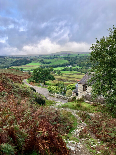
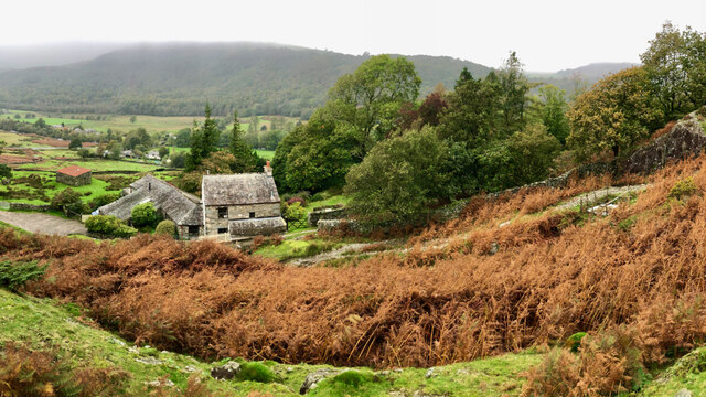
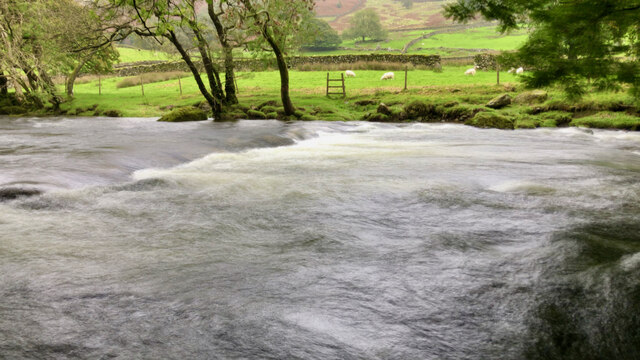
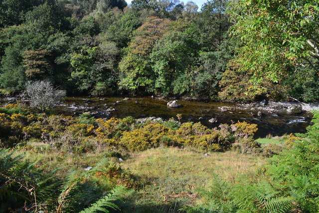
Rainsbarrow Wood, located in Cumberland, is a captivating forest that covers an extensive area of land in North West England. With its lush greenery and abundant wildlife, it is a haven for nature enthusiasts and an ideal destination for those seeking a peaceful retreat in the midst of nature.

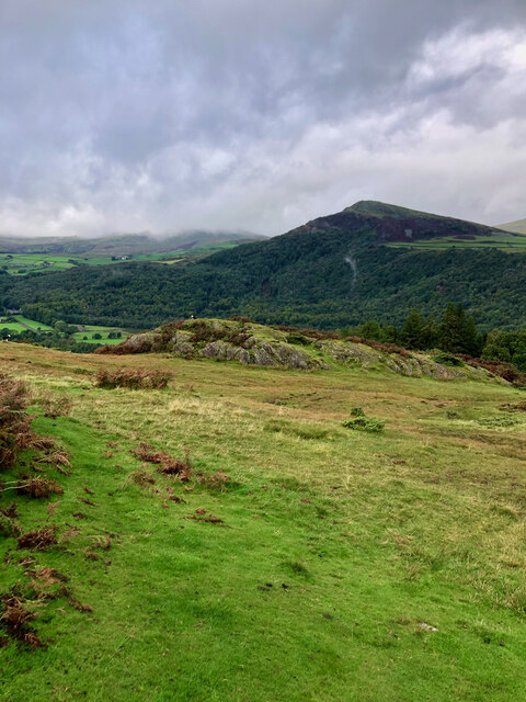
This enchanting woodland is renowned for its diverse range of flora and fauna. The forest floor is carpeted with an array of wildflowers, ferns, and moss, creating a picturesque landscape. Towering trees, including oak, beech, and ash, dominate the wood, forming a dense canopy that filters sunlight, casting a magical ambiance throughout the forest.

Rainsbarrow Wood is home to a variety of wildlife species. The forest provides a habitat for deer, foxes, badgers, and numerous bird species, making it an excellent spot for birdwatching. The melodious songs of thrushes, warblers, and woodpeckers can be heard echoing through the trees, adding to the tranquil atmosphere.

Visitors can explore the wood through a network of well-maintained trails, allowing them to discover the hidden wonders of this natural gem. The trails wind through the forest, leading to secluded clearings and idyllic streams, providing ample opportunities for hiking, picnicking, or simply immersing oneself in nature.

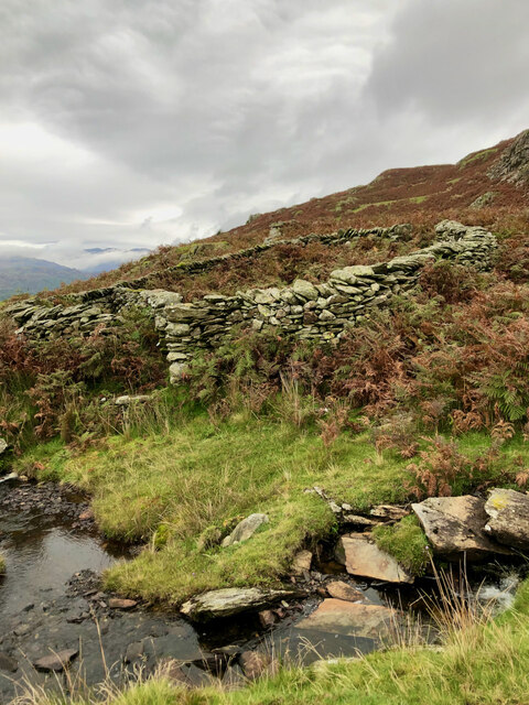
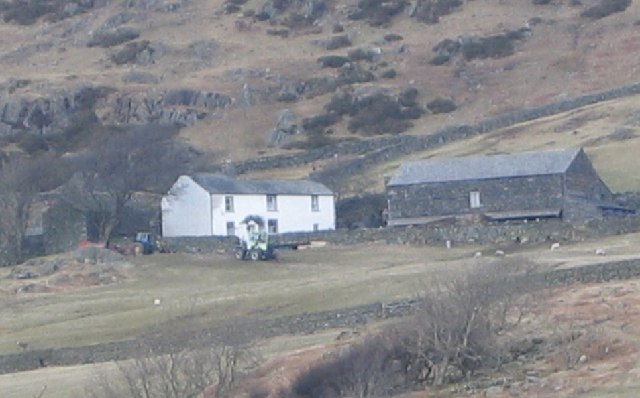
The wood is also steeped in history, with remnants of ancient settlements and archaeological sites scattered throughout the area. This adds an extra layer of fascination for those interested in the region's past.

In summary, Rainsbarrow Wood is an enchanting forest in Cumberland that offers a breathtaking escape into nature. Its diverse flora and fauna, coupled with its peaceful ambiance and historical significance, make it a must-visit destination for nature lovers and history enthusiasts alike.

If you have any feedback on the listing, please let us know in the comments section below.

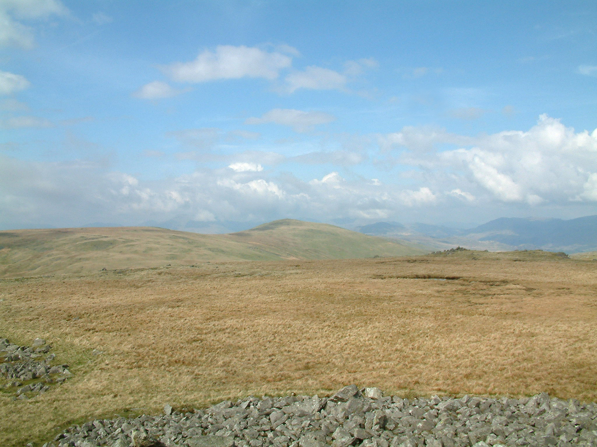
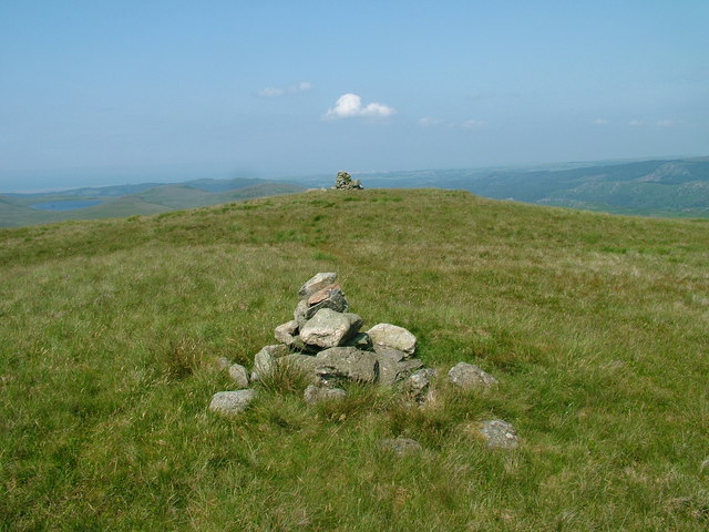
Rainsbarrow Wood Images

Images are sourced within 2km of 54.327633/-3.2448677 or Grid Reference SD1993. Thanks to Geograph Open Source API. All images are credited.
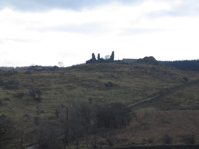
Washfold, Hollow Moss Beck A pen for holding sheep waiting to be washed. The following is quoted from the Lake District National Park HER see <span class="nowrap"><a title="https://www.heritagegateway.org.uk/Gateway/Results_Single.aspx?uid=2900443&resourceID=801" rel="nofollow ugc noopener" href="https://www.heritagegateway.org.uk/Gateway/Results_Single.aspx?uid=2900443&resourceID=801">Link</a><img style="margin-left:2px;" alt="External link" title="External link - shift click to open in new window" src="https://s1.geograph.org.uk/img/external.png" width="10" height="10"/></span>

"An unusual circular fold 8m diameter with an internal partition forming two chambers. An 11m long driving wall has been built along naturally rocky outcrops to assist driving sheep into the fold. The wash dub measures 3m by 4m and apart from being partially silted up all the features are intact and in excellent condition. There is a dry stone built launching platform just outside the gate and the beck is masonry lined on the bank nearest the fold to prevent undermining of the structure. The remains of a dry stone dam are substantially complete on both banks of the beck. The fold is in excellent condition, walls are intact to full height and cams in place, however approximately half of the driving wall is partially collapsed. The wash dub features are one of the best preserved in the Western valleys and are also in excellent condition."
Washfold, Hollow Moss Beck
A pen for holding sheep waiting to be washed. The following is quoted from the Lake District National Park HER see LinkExternal link "An unusual circular fold 8m diameter with an internal partition forming two chambers. An 11m long driving wall has been built along naturally rocky outcrops to assist driving sheep into the fold. The wash dub measures 3m by 4m and apart from being partially silted up all the features are intact and in excellent condition. There is a dry stone built launching platform just outside the gate and the beck is masonry lined on the bank nearest the fold to prevent undermining of the structure. The remains of a dry stone dam are substantially complete on both banks of the beck. The fold is in excellent condition, walls are intact to full height and cams in place, however approximately half of the driving wall is partially collapsed. The wash dub features are one of the best preserved in the Western valleys and are also in excellent condition."
Fellside above Birks
A far away view of Birks
Stepping stones across the River Duddon
Site of Commonwood Quarries For more information see Heritagegateway.org.uk <<span class="nowrap"><a title="https://www.heritagegateway.org.uk/Gateway/Results_Single.aspx?resourceID=801&uid=2887969" rel="nofollow ugc noopener" href="https://www.heritagegateway.org.uk/Gateway/Results_Single.aspx?resourceID=801&uid=2887969">Link</a><img style="margin-left:2px;" alt="External link" title="External link - shift click to open in new window" src="https://s1.geograph.org.uk/img/external.png" width="10" height="10"/></span> > [accessed 14 October 2023]

‌
Site of Commonwood Quarries
For more information see Heritagegateway.org.uk <LinkExternal link > [accessed 14 October 2023] ‌
Sheepfold by Hollow Moss Beck A well constructed circular fold with an attached length of drystone wall - possibly a windbreak for the sheep? Looking up the Duddon towards snow-covered Crinkle Crags and Bow Fell and the cone of Harter Fell.
Sheepfold by Hollow Moss Beck
A well constructed circular fold with an attached length of drystone wall - possibly a windbreak for the sheep? Looking up the Duddon towards snow-covered Crinkle Crags and Bow Fell and the cone of Harter Fell.
A gorse bush above the Duddon A windswept gorse by Hollow Moss Beck with the snow-covered Crinkle Crags (right) and Bow Fell beyond.
A gorse bush above the Duddon
A windswept gorse by Hollow Moss Beck with the snow-covered Crinkle Crags (right) and Bow Fell beyond.
River Duddon
River Duddon
Ordnance Survey Rivet This OS rivet can be found on a rock west side of the road. It marks a point 44.790m above mean sea level.
Ordnance Survey Rivet
This OS rivet can be found on a rock west side of the road. It marks a point 44.790m above mean sea level.
Crosbythwaite Farm. Big sheep gathering day when this one was taken.
Crosbythwaite Farm.
Big sheep gathering day when this one was taken.
St Johns Church Ulpha A second burial ground is across the road.
St Johns Church Ulpha
A second burial ground is across the road.
Pike Side Farm
Pike Side Farm
Bigert Mire Farm. A very difficult set of buildings to date as they have all been modernised.
Bigert Mire Farm.
A very difficult set of buildings to date as they have all been modernised.
Frith Hall from the North. Note the track running past to the right.
Frith Hall from the North.
Note the track running past to the right.
Long Garth Farm House.
Crag Hall A bit worse for wear.
Crag Hall
A bit worse for wear.
Old Hall Ulpha. Yes the pile of rocks used to be a dwelling.
Old Hall Ulpha.
Yes the pile of rocks used to be a dwelling.
Show me another place!

Rainsbarrow Wood is located at Grid Ref: SD1993 (Lat: 54.327633, Lng: -3.2448677)

Administrative County: Cumbria

District: Copeland

Police Authority: Cumbria

What 3 Words

///wrong.sunk.woodstove. Near Millom, Cumbria

Related Wikis

Ulpha

Ulpha is a small village and civil parish in the Duddon Valley in the Lake District National Park in Cumbria, England. Historically in Cumberland, it forms...

Dunnerdale Fells

Dunnerdale Fells is an upland area in the English Lake District, between Ulpha and Broughton Mills, Cumbria. It is the subject of a chapter of Wainwright...

Hesk Fell

Hesk Fell is a hill in the south-west of the English Lake District, between the Duddon Valley and Eskdale near Ulpha, Cumbria. It is the subject of a chapter...

Great Stickle

Great Stickle is a fell located in the southern Lake District of England with an altitude of 305 m (1,001 ft). Alfred Wainwright included it in the Stickle...

Whitfell

Whitfell (or sometimes Whit Fell) is a hill of 573 metres (1,880 ft) in the southwestern part of the Lake District. It is the highest point between Black...

Duddon Valley

The Duddon Valley is a valley in the southern Lake District National Park in Cumbria, England. The River Duddon flows through the valley, rising in the...

Great Worm Crag

Great Worm Crag is a hill in south west of the English Lake District, north of Ulpha, Cumbria. It is the subject of a chapter of Wainwright's book The...

Woodend, Ulpha

Woodend is situated between the Duddon Valley and the village of Ulpha and the valley of Eskdale, high up on Birker Fell, approximately 950 feet above...

Nearby Amenities

Located within 500m of 54.327633,-3.2448677
Ulpha
Place: village
Source: npe
Wikidata: Q3242458
Wikipedia: en:Ulpha
Lat/Long: 54.328018/-3.2389363
Barrier: stile
Lat/Long: 54.3270962/-3.2522238
Barrier: stile
Lat/Long: 54.3277863/-3.250263
Bleak Haw
Place: locality
Lat/Long: 54.3287872/-3.2437224
Abandoned: yes
Historic: mine
Man Made: mine
Lat/Long: 54.3302114/-3.2488121
Barrier: stile
Lat/Long: 54.3291672/-3.2485665
Pike Wood
Place: locality
Lat/Long: 54.3264746/-3.251754
Loft Sty
Place: locality
Lat/Long: 54.3285374/-3.2504899
The data included in this document is from www.openstreetmap.org. The data is made available under ODbL.

Have you been to Rainsbarrow Wood?

Leave your review of Rainsbarrow Wood below (or comments, questions and feedback).