Hanging Copse
Wood, Forest in Devon Somerset West and Taunton
England
Hanging Copse
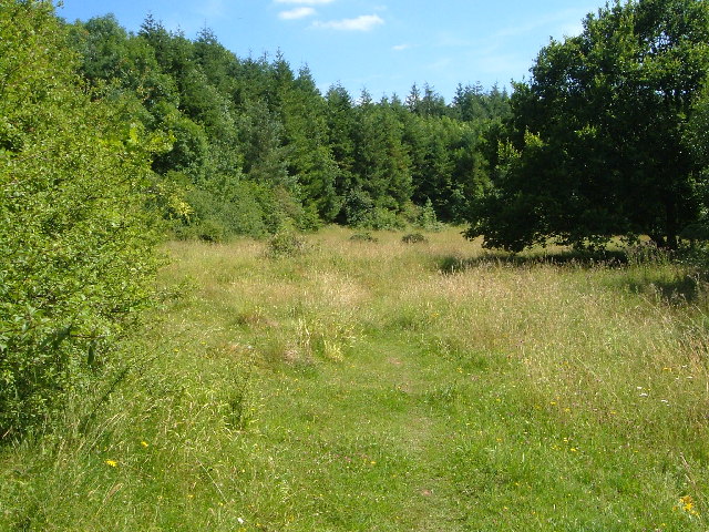
Hanging Copse, located in Devon, is a picturesque woodland area that offers a serene and enchanting natural experience. Spanning over several acres, this densely populated forest is known for its rich biodiversity and stunning scenic beauty.
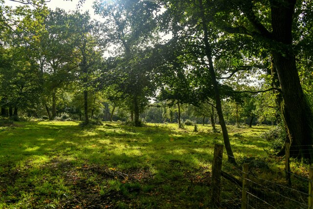
The copse is predominantly composed of deciduous trees such as oak, beech, and ash, which provide a lush green canopy during the warmer months. The forest floor is adorned with a vibrant carpet of wildflowers, ferns, and mosses, creating a magical ambiance. The interplay of sunlight filtering through the foliage creates mesmerizing patterns and dappled shades, making Hanging Copse a favorite spot for nature photographers and artists.
The copse is also home to a diverse range of wildlife, including deer, badgers, foxes, and various bird species. Nature enthusiasts can often spot these creatures while exploring the extensive network of walking trails that crisscross the forest. These trails offer visitors the opportunity to immerse themselves in the tranquility of nature, enjoying a peaceful walk or a picnic amidst the breathtaking surroundings.
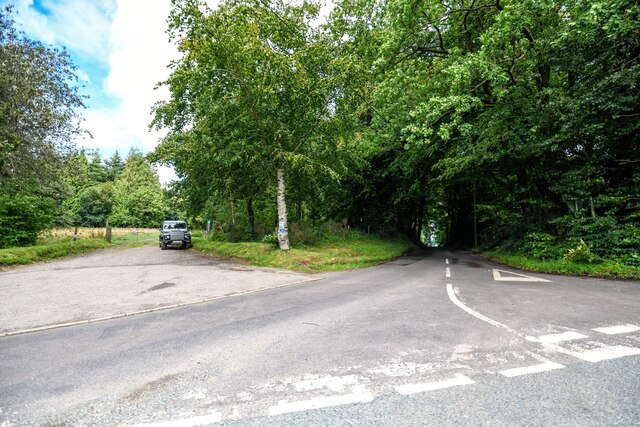
Hanging Copse is well-maintained, with designated picnic areas, benches, and informative signage that educates visitors about the flora and fauna found in the area. The copse is easily accessible, with ample parking facilities and well-marked entrance points.
Overall, Hanging Copse is a true haven for nature lovers, offering a delightful escape from the hustle and bustle of everyday life. Whether it is for a leisurely stroll, a family outing, or simply to reconnect with nature, this woodland paradise in Devon promises a memorable experience for all who visit.
If you have any feedback on the listing, please let us know in the comments section below.
Hanging Copse Images
Images are sourced within 2km of 50.931433/-3.1674071 or Grid Reference ST1815. Thanks to Geograph Open Source API. All images are credited.


Hanging Copse is located at Grid Ref: ST1815 (Lat: 50.931433, Lng: -3.1674071)
Administrative County: Somerset
District: Somerset West and Taunton
Police Authority: Avon and Somerset
What 3 Words
///jars.soups.messy. Near Hemyock, Devon
Nearby Locations
Related Wikis

Ringdown SSSI, Somerset
Ringdown (grid reference ST178155) is a 4.0 hectare (9.9 acre) biological Site of Special Scientific Interest west of Burnworthy in the Blackdown Hills...

Churchstanton
Churchstanton is a village and civil parish in Somerset, England, situated within the Blackdown Hills Area of Outstanding Natural Beauty, on the River...
Clayhidon
Clayhidon () is a village and civil parish in Mid Devon, England. The parish church is St. Andrews. The parish is in the Blackdown Hills and its northern...
Quants Reserve
Quants Reserve is a nature reserve north west of Burnworthy in Somerset, England. It consists of a grassland clearing in a forestry plantation. It is well...
Nearby Amenities
Located within 500m of 50.931433,-3.1674071Have you been to Hanging Copse?
Leave your review of Hanging Copse below (or comments, questions and feedback).