Ash Hagg

Wood, Forest in Cumberland Copeland

England

Ash Hagg

Eskdale Heron Seen in the meadow, close to the River Esk, which lies immediately beyond the tree line.
Eskdale Heron Credit: Peter Trimming

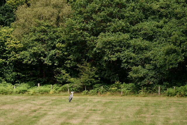
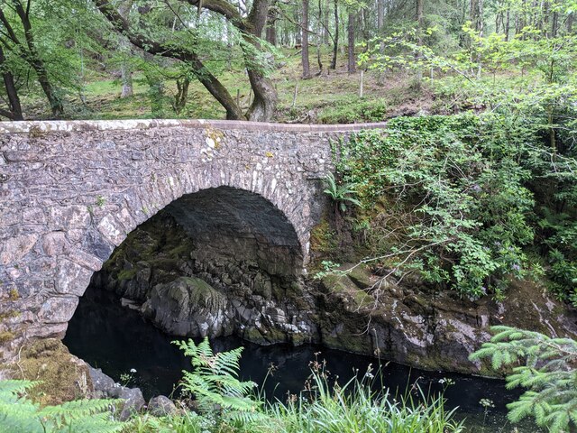
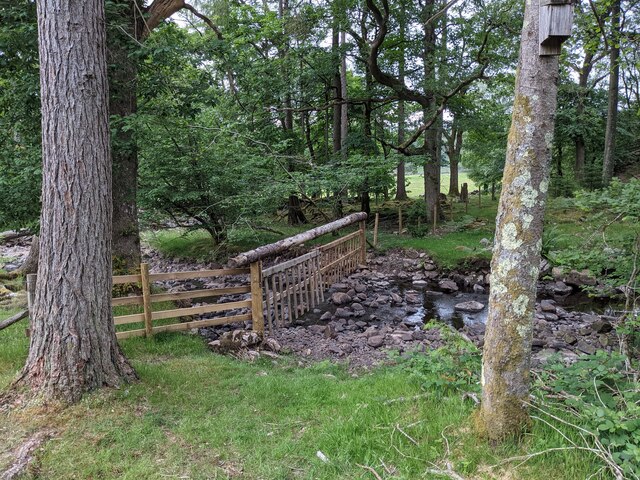
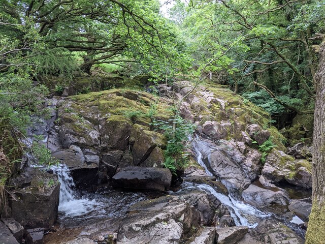
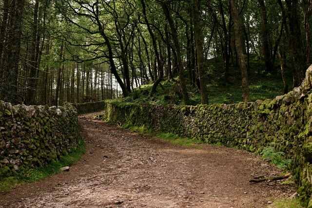
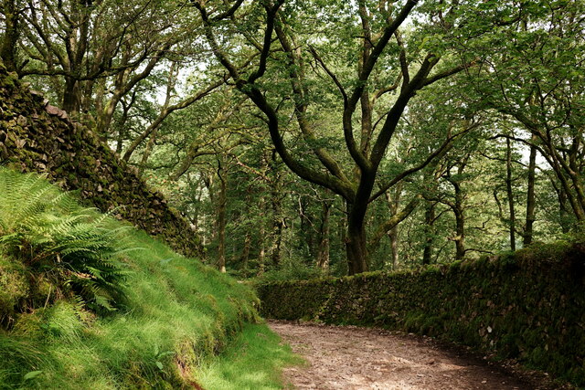
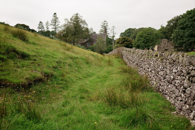
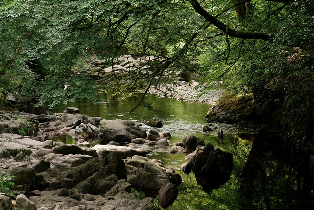
Ash Hagg is a small woodland area located in Cumberland, England. Situated within the larger forest region, it is known for its dense concentration of ash trees, hence the name "Ash Hagg." The woodland covers an area of approximately 50 acres and is a popular destination for nature enthusiasts and hikers.

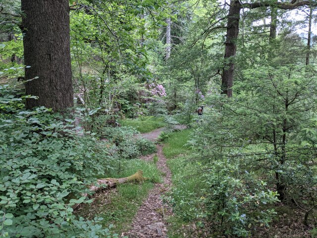
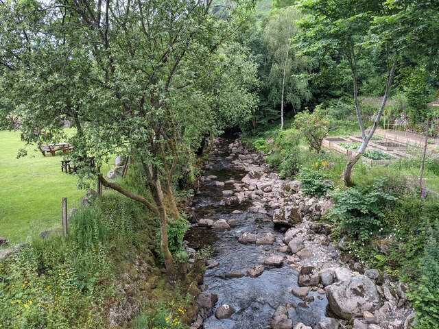
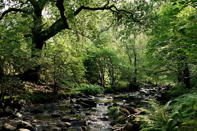
The forest is characterized by its thick undergrowth, which consists of ferns, brambles, and wildflowers. This creates a vibrant and diverse ecosystem, providing habitat for various species of birds, insects, and small mammals. The towering ash trees that dominate the landscape provide ample shade and contribute to the forest's tranquil ambiance.

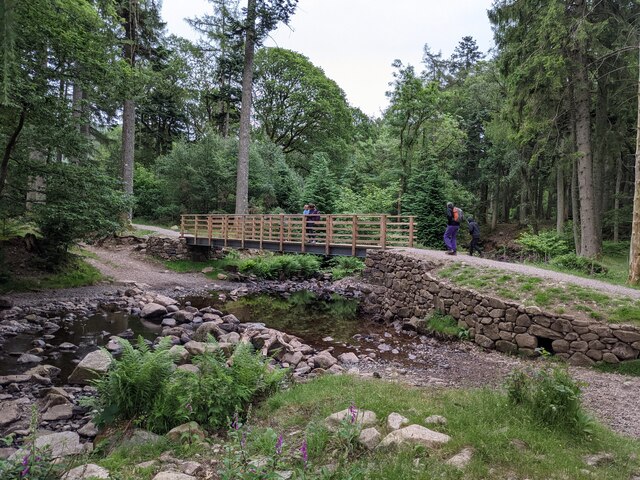
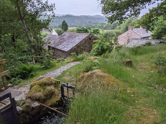
Ash Hagg is well-maintained, with clearly marked trails that wind through the woodland, allowing visitors to explore its natural beauty. These paths are suitable for all skill levels, making it accessible for both novice and experienced hikers.

The woodland also features a small picnic area, providing visitors with an opportunity to relax and enjoy the peaceful surroundings. Additionally, there are several benches strategically placed along the trails, offering resting spots for those in need of a break.

Ash Hagg is a haven for those seeking solace in nature, as it provides a serene environment away from the hustle and bustle of urban life. With its picturesque scenery and abundant wildlife, it offers a perfect escape for individuals and families looking to immerse themselves in the beauty of Cumberland's woodlands.

If you have any feedback on the listing, please let us know in the comments section below.

Ash Hagg Images

Images are sourced within 2km of 54.390394/-3.2767681 or Grid Reference NY1700. Thanks to Geograph Open Source API. All images are credited.

Eskdale Heron Seen in the meadow, close to the River Esk, which lies immediately beyond the tree line.
Eskdale Heron
Seen in the meadow, close to the River Esk, which lies immediately beyond the tree line.
A fine bridge over the River Esk
A path through the woods near Dalegarth
A new bridge over Birker Beck I think the previous bridge (see: <a title="https://www.geograph.org.uk/photo/4455179)" href="https://www.geograph.org.uk/photo/4455179)">Link</a> was probably damaged by floods.
Curiously the beck, referred to in some other geographs as Stanley Ghyll Beck, is named on the OS 1:50k map, but not on the 1:25k map.
A new bridge over Birker Beck
I think the previous bridge (see: Link was probably damaged by floods. Curiously the beck, referred to in some other geographs as Stanley Ghyll Beck, is named on the OS 1:50k map, but not on the 1:25k map.
A hanging fence across Birker Beck To discourage sheep from using the stream bed as an escape to greener pastures.
A hanging fence across Birker Beck
To discourage sheep from using the stream bed as an escape to greener pastures.
The stepping stones - a fun way to cross the Esk
The bridleway to the footbridge across the Esk
Wildflowers and trees Near Esk View Farm.
Wildflowers and trees
Near Esk View Farm.
Diverted power source The water wheels at Eskdale Mill are not in use today, so the water is spilled back into the stream.
Diverted power source
The water wheels at Eskdale Mill are not in use today, so the water is spilled back into the stream.
Water-smoothed rocks in Whillan Beck
Top of the power supply The water is extracted here to drive the water wheels at Eskdale Mill, whose rooftops are visible.
Top of the power supply
The water is extracted here to drive the water wheels at Eskdale Mill, whose rooftops are visible.
Whillan Beck from the mill bridge
Stanley Ghyll Beck Seen from the start of the climb up to the waterfall.
Stanley Ghyll Beck
Seen from the start of the climb up to the waterfall.
Eskdale Track up to the new Stanley Force viewing platform. Most walkers take the path in the ravine to reach the viewing platform, returning via this track.
Eskdale
Track up to the new Stanley Force viewing platform. Most walkers take the path in the ravine to reach the viewing platform, returning via this track.
Eskdale Track down to the road, from the new Stanley Force viewing platform.
Eskdale
Track down to the road, from the new Stanley Force viewing platform.
Eskdale View towards Dalegarth Hall, from the track.
Eskdale
View towards Dalegarth Hall, from the track.
Eskdale Trough House bridge and the River Esk.
Eskdale
Trough House bridge and the River Esk.
Eskdale River Esk from Trough House Bridge.
Eskdale
River Esk from Trough House Bridge.
Show me another place!

Ash Hagg is located at Grid Ref: NY1700 (Lat: 54.390394, Lng: -3.2767681)

Administrative County: Cumbria

District: Copeland

Police Authority: Cumbria

What 3 Words

///sculpting.locked.misty. Near Seascale, Cumbria

Nearby Locations

Ash Hagg Newhall Coppice

Related Wikis

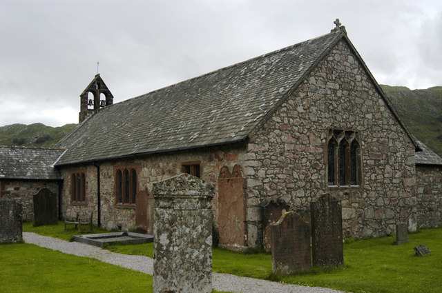
St Catherine's Church, Boot

St Catherine's Church is in the village of Boot, Cumbria, England. It is the Anglican parish church of Eskdale, Cumbria, and is in the deanery of Calder...

Beckfoot railway station

Beckfoot railway station is a railway station on the 15" gauge Ravenglass & Eskdale Railway in Cumbria. It is situated within a 1⁄2 mile (0.80 km) walk...

Dalegarth railway station

Dalegarth railway station is the easterly terminus of the 15-inch gauge Ravenglass and Eskdale Railway in Cumbria, England. It has a café and shop for...

Eskdale, Cumbria

Eskdale is a glacial valley and civil parish in the western Lake District National Park in Cumbria, England. It forms part of the Borough of Copeland...

Boot, Cumbria

Boot is a small village in Eskdale, Cumbria, in the Lake District of England. It forms part of the Borough of Copeland. There are two roads from which...

Blea Tarn (Eskdale)

Blea Tarn is a lake in Cumbria, England, located about half a mile north of Beckfoot. Located at an elevation of 217 m (712 ft), the lake has an area...

Fisherground railway station

Fisherground railway station, also known as Fisherground Halt, is on the 15-inch (380 mm) gauge Ravenglass & Eskdale Railway in Cumbria, England. Its main...

Woolpack walk

The Woolpack Walk is a challenge walk which starts and finishes at the Woolpack Inn, Eskdale in the Lake District of England. The route covers 30 km (18...

Nearby Amenities

Located within 500m of 54.390394,-3.2767681
Beckfoot
Place: hamlet
Source: npe
Lat/Long: 54.3919655/-3.2821119
Beckfoot
Naptan AtcoCode: 940GZZREBCK
Operator: Ravenglass & Eskdale Railway
Railway: station
Source: Bing
Usage: tourism
Website: https://ravenglass-railway.co.uk/
Wikidata: Q4878703
Wikipedia: en:Beckfoot railway station
Lat/Long: 54.392606/-3.2824194
Bus Stop
Beckfoot Bridge
Local Ref: AT
Naptan AtcoCode: 090050081307
Naptan Bearing: E
Naptan BusStopType: CUS
Naptan CommonName: Beckfoot Bridge
Naptan Indicator: at
Naptan Landmark: Beckfoot Bridge
Naptan NaptanCode: cumatwda
Naptan Street: No name
Naptan Verified: no
Source: naptan_import
Lat/Long: 54.3928358/-3.281781
Bicycle: yes
Foot: yes
Ford: yes
Horse: yes
Mtb Scale: 3
Lat/Long: 54.3903598/-3.2746083
Description: War memorial
Historic: memorial
Lat/Long: 54.3938089/-3.2777678
Ford: yes
Lat/Long: 54.3906012/-3.2710381
Bicycle: yes
Foot: yes
Ford: yes
Horse: yes
Mtb Scale: 0
Note: shallow and trivial to cross after good weather
Lat/Long: 54.3896453/-3.2715937
Crossing Barrier: no
Crossing Bell: no
Crossing Light: no
Railway: level_crossing
Lat/Long: 54.3929455/-3.2818994
Dalegarth
Place: hamlet
Lat/Long: 54.3947869/-3.2751662
Bench
Lat/Long: 54.3937857/-3.2777944
Bench
Lat/Long: 54.3938094/-3.2778061
Barrier: stile
Lat/Long: 54.3941667/-3.2776882
High Bank
Place: locality
Lat/Long: 54.387111/-3.2797808
Leisure: picnic_table
Lat/Long: 54.3897413/-3.2745066
Force Wood
Natural: wood
Lat/Long: 54.3887624/-3.2797854
Ash Hagg
Place: locality
Lat/Long: 54.3909344/-3.2764721
Dalegarth Hall
Tourism: guest_house
Website: https://www.sallyscottages.co.uk/cottages/dalegarth-hall
Lat/Long: 54.3897789/-3.2797971
Power: pole
Lat/Long: 54.3932539/-3.2821919
The data included in this document is from www.openstreetmap.org. The data is made available under ODbL.

Have you been to Ash Hagg?

Leave your review of Ash Hagg below (or comments, questions and feedback).