Thackray Wood

Wood, Forest in Cumberland Allerdale

England

Thackray Wood

B5301 east of Moota Hill
B5301 east of Moota Hill Credit: Colin Pyle

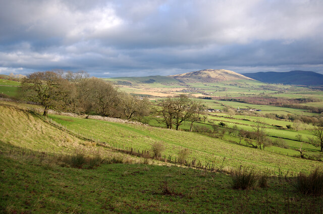
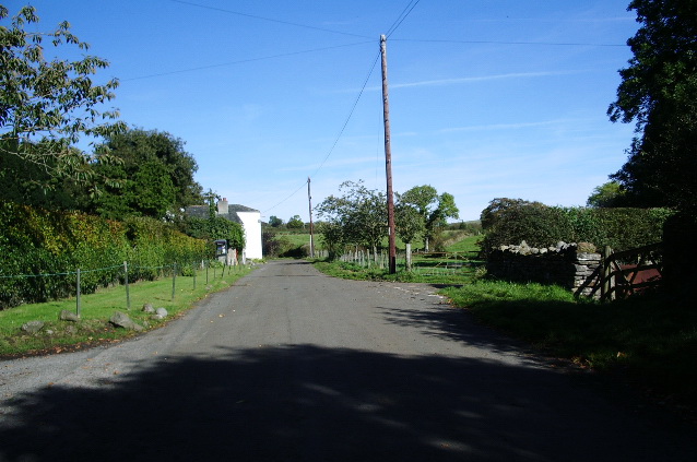
Thackray Wood is a picturesque forest located in the county of Cumberland, England. Spanning an area of approximately 200 acres, this woodland is renowned for its natural beauty and diverse ecosystem. The wood is situated near the village of Thackray and is easily accessible by a network of walking trails and paths.

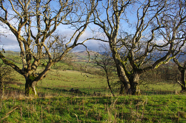
The forest is predominantly composed of mature oak and ash trees, interspersed with birch and beech trees, which create a stunning canopy of foliage throughout the year. The woodland floor is covered in a rich carpet of mosses, ferns, and wildflowers, providing a habitat for a wide range of flora and fauna.

Thackray Wood is a haven for wildlife enthusiasts, offering opportunities for birdwatching, with species such as great spotted woodpeckers, tawny owls, and nuthatches commonly sighted. The forest is also home to various small mammals, including badgers, foxes, and squirrels, adding to its biodiversity.

Visitors to Thackray Wood can enjoy a peaceful and tranquil atmosphere as they explore the forest. The well-maintained trails cater to hikers of all abilities, ensuring that everyone can appreciate the natural beauty of the surroundings. Along the way, visitors may come across hidden ponds and streams, providing a refreshing spot to rest and enjoy the serene environment.

Thackray Wood is not only a popular destination for nature lovers but also serves as an important educational resource. Local schools often organize field trips to the forest, where students can learn about the delicate balance of ecosystems and the importance of conservation.

Overall, Thackray Wood is an enchanting woodland that offers visitors a chance to escape the hustle and bustle of everyday life and immerse themselves in the wonders of nature.

If you have any feedback on the listing, please let us know in the comments section below.

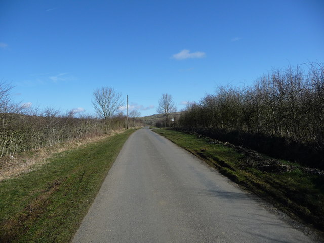
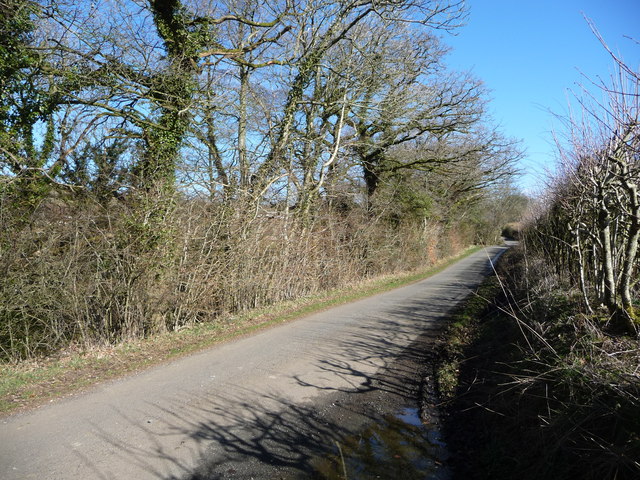
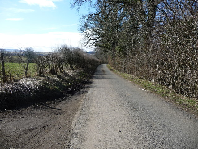
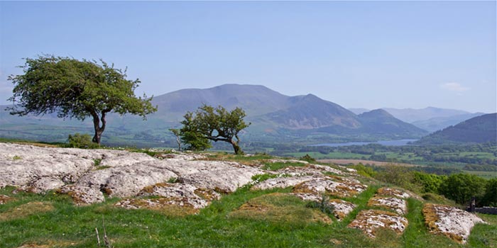
Thackray Wood Images

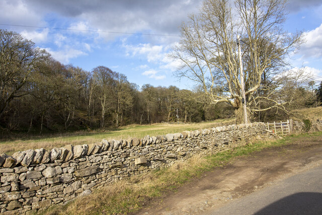
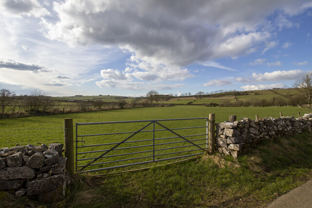
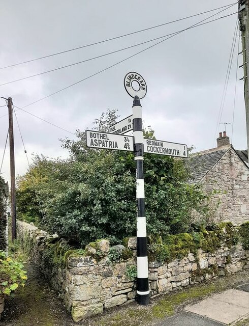
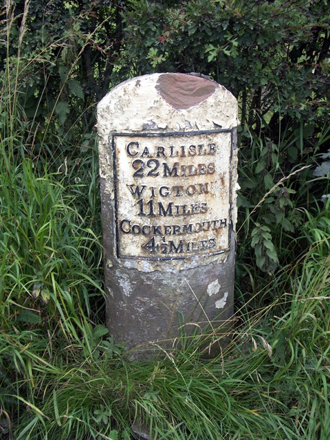
Images are sourced within 2km of 54.703465/-3.3005831 or Grid Reference NY1635. Thanks to Geograph Open Source API. All images are credited.

B5301 east of Moota Hill
Trees on Clints Crags Looking east to Binsey.
Trees on Clints Crags
Looking east to Binsey.
Eastern slopes of Clints Crags Binsey is in the distance.
Eastern slopes of Clints Crags
Binsey is in the distance.
Blindcrake Looking west along unnamed road, towards the village green.
Blindcrake
Looking west along unnamed road, towards the village green.
Blindcrake Looking south, on the road to Isel. Gill Beck is on the right. 
The temporary 'Works access 150 yards' sign refers to the recently installed United Utilities Thirlmere to West Cumbria pipeline.
Blindcrake
Looking south, on the road to Isel. Gill Beck is on the right. The temporary 'Works access 150 yards' sign refers to the recently installed United Utilities Thirlmere to West Cumbria pipeline.
Road Junction near Linskeldfield
The lane from Blindcrake to Sunderland Bewsgill Wood
The lane from Blindcrake to Sunderland
Bewsgill Wood
New hedge planted
New hedge planted
Looking toward Park Wood
Ellers Wood Gateway to field by Ellers wood
Ellers Wood
Gateway to field by Ellers wood
Gateway to field Gateway to field on road to Laal Moota
Gateway to field
Gateway to field on road to Laal Moota
Direction Sign - Signpost in Blindcrake Located on the southwest side of a junction in the village centre by a grit bin, a litter bin and a bus shelter. Blindcrake parish. 3 arms and annulus finial. See also <span class="nowrap"><a title="http://www.geog.port.ac.uk/webmap/thelakes/photos/bvz04.jpg" rel="nofollow ugc noopener" href="http://www.geog.port.ac.uk/webmap/thelakes/photos/bvz04.jpg">Link</a><img style="margin-left:2px;" alt="External link" title="External link - shift click to open in new window" src="https://s1.geograph.org.uk/img/external.png" width="10" height="10"/></span>.

Milestone Society National ID: CU_NY1434B
Direction Sign - Signpost in Blindcrake
Located on the southwest side of a junction in the village centre by a grit bin, a litter bin and a bus shelter. Blindcrake parish. 3 arms and annulus finial. See also LinkExternal link. Milestone Society National ID: CU_NY1434B
Old Milestone by the A595 at Laal Moota Metal plate attached to stone post by the A595, in parish of BLINDCRAKE (ALLERDALE District), Moota Quarry, North of Blindcrake; opposite Moota Inn, on grass verge, on North side of road. Carlisle red stone and curved plate, erected by the Cockermouth & Carlisle turnpike trust in the 19th century. 

Inscription reads:-
CARLISLE
22 MILES
WIGTON
11 MILES
COCKERMOUTH
4½ MILES 

Grade II Listed. List Entry Number: 1312023
<span class="nowrap"><a title="https://historicengland.org.uk/listing/the-list/list-entry/1312023" rel="nofollow ugc noopener" href="https://historicengland.org.uk/listing/the-list/list-entry/1312023">Link</a><img style="margin-left:2px;" alt="External link" title="External link - shift click to open in new window" src="https://s1.geograph.org.uk/img/external.png" width="10" height="10"/></span>

Milestone Society National ID: CU_CLCM22.
Old Milestone by the A595 at Laal Moota
Metal plate attached to stone post by the A595, in parish of BLINDCRAKE (ALLERDALE District), Moota Quarry, North of Blindcrake; opposite Moota Inn, on grass verge, on North side of road. Carlisle red stone and curved plate, erected by the Cockermouth & Carlisle turnpike trust in the 19th century. Inscription reads:- CARLISLE 22 MILES WIGTON 11 MILES COCKERMOUTH 4½ MILES Grade II Listed. List Entry Number: 1312023 LinkExternal link Milestone Society National ID: CU_CLCM22.
The road to Sunderland (Allerdale, Cumbria) Heading north near Linskeldfield.
The road to Sunderland (Allerdale, Cumbria)
Heading north near Linskeldfield.
Sheep pasture near Linskeldfield On the west side of the road to Sunderland. About 120 metres above sea level.
Sheep pasture near Linskeldfield
On the west side of the road to Sunderland. About 120 metres above sea level.
Hedge strengthened with wire mesh, near Linskeldfield Otherwise the sheep would get through.
Hedge strengthened with wire mesh, near Linskeldfield
Otherwise the sheep would get through.
The road to Sunderland (Allerdale, Cumbria) The roadside trees are watered by Kiln Beck.
The road to Sunderland (Allerdale, Cumbria)
The roadside trees are watered by Kiln Beck.
The road from Sunderland (Allerdale, Cumbria) Descending to Blumer Bridge.
The road from Sunderland (Allerdale, Cumbria)
Descending to Blumer Bridge.
Show me another place!

Thackray Wood is located at Grid Ref: NY1635 (Lat: 54.703465, Lng: -3.3005831)

Administrative County: Cumbria

District: Allerdale

Police Authority: Cumbria

What 3 Words

///coconut.frightens.cartoons. Near Cockermouth, Cumbria

Related Wikis

Clints Crags

Clints Crags is a small fell in the north of the English Lake District near Blindcrake, Cumbria. It has its own chapter in Alfred Wainwright's The Outlying...

Blindcrake

Blindcrake is a village and civil parish within the Isel Valley, in the Lake District National Park, in Cumbria, England, historically part of Cumberland...
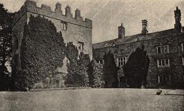
Isel Hall

Isel Hall is an ancient Cumbrian residence that sits on a steep rise on the northern banks of the River Derwent, two miles (3.2 km) south of Bassenthwaite...

Sunderland, Cumbria

Sunderland is a hamlet and former civil parish, within the Lake District National Park, now in the parish of Blindcrake in the Allerdale district of the...

Nearby Amenities

Located within 500m of 54.703465,-3.3005831
Ele: 245.1
Man Made: survey_point
Source: NPE
Lat/Long: 54.705468/-3.3060008
Clints Crags
Place: locality
Lat/Long: 54.7058547/-3.3023793
Clints Park
Place: locality
Lat/Long: 54.7064424/-3.3061081
Thackray Cottage
Building: ruins
Lat/Long: 54.704937/-3.2984373
Park Wood
Natural: wood
Lat/Long: 54.7021048/-3.2933795
Clints Crags
Ele: 245
Natural: peak
Source: NPE
Lat/Long: 54.7054121/-3.3059955
Ele: 245
Natural: peak
Lat/Long: 54.7058437/-3.3025154
Salkeldclose Crags
Place: locality
Lat/Long: 54.7062709/-3.2997217
The data included in this document is from www.openstreetmap.org. The data is made available under ODbL.

Have you been to Thackray Wood?

Leave your review of Thackray Wood below (or comments, questions and feedback).