Sweetcombe Wood

Wood, Forest in Devon East Devon

England

Sweetcombe Wood

Entrance to Hatway Stables An isolated block of stables at the top of Buckton  Hill.
Entrance to Hatway Stables Credit: Anthony Vosper

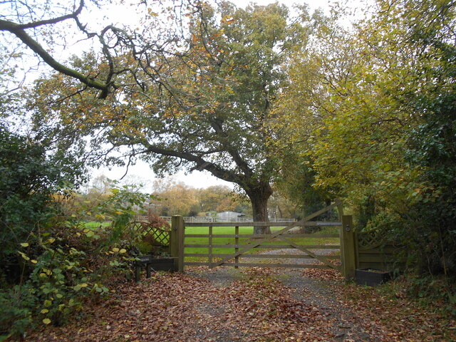
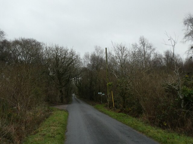
Sweetcombe Wood is a picturesque woodland located in the county of Devon, England. Covering an area of approximately 50 acres, it is nestled within the beautiful landscape of the East Devon Area of Outstanding Natural Beauty. The wood is part of a larger forested area known as Sweetcombe Forest.

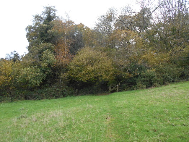
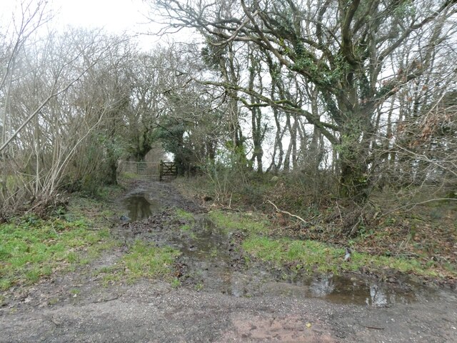
The wood is characterized by a diverse range of tree species, including oak, beech, ash, and birch. These trees create a dense canopy, providing a sheltered and tranquil atmosphere for visitors. The forest floor is covered in a rich carpet of mosses, ferns, and wildflowers, creating a vibrant and enchanting undergrowth.

Sweetcombe Wood is home to a variety of wildlife, making it a popular spot for nature enthusiasts. Birdwatchers can spot a range of species, including woodpeckers, owls, and various songbirds. Squirrels and rabbits can often be seen scurrying through the underbrush, while deer occasionally make appearances in the early morning or evening.

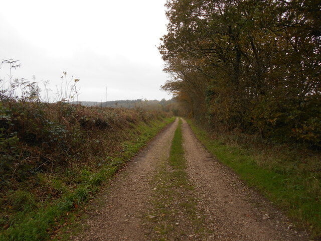
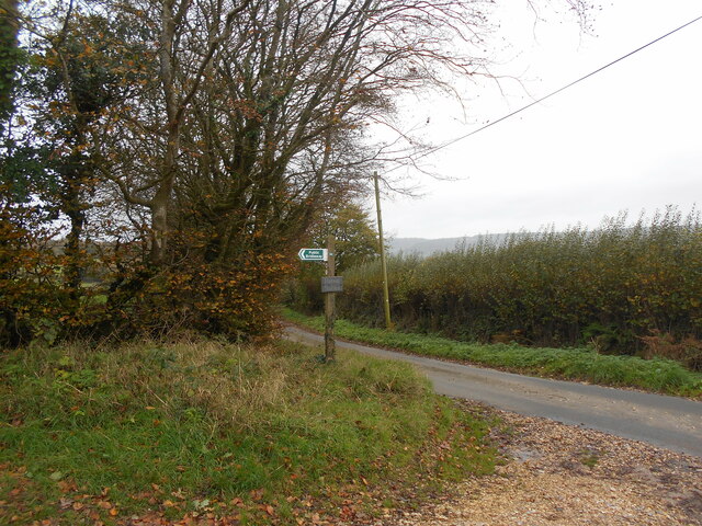
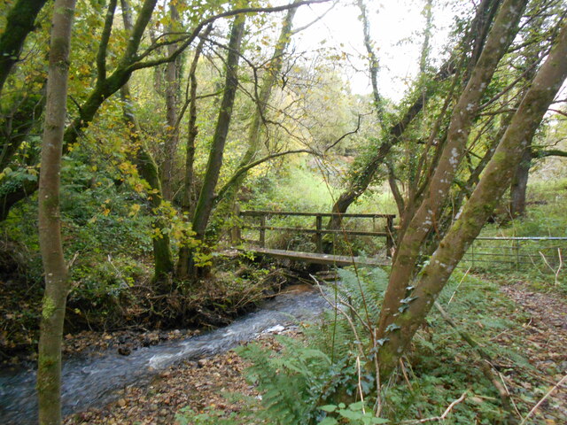
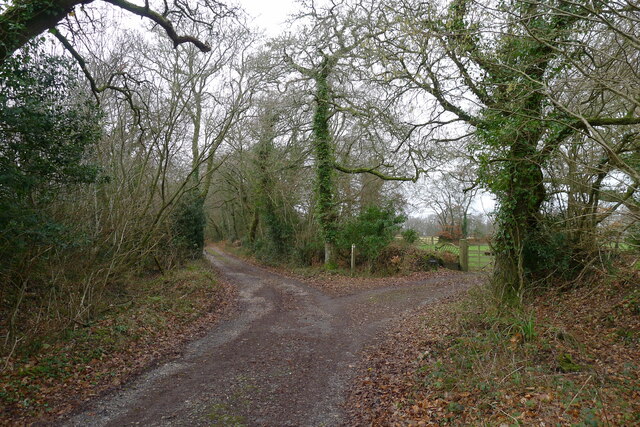
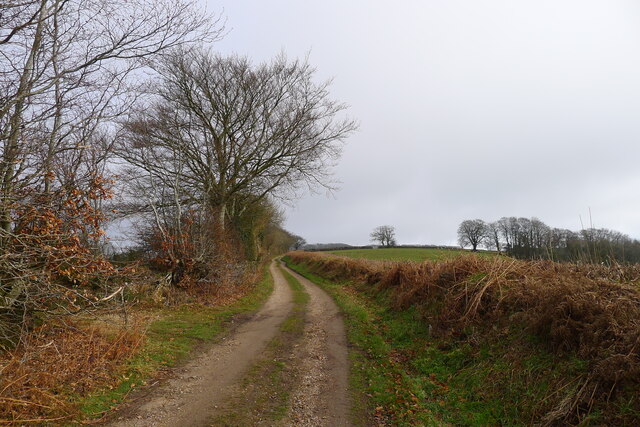
The wood offers several walking trails, allowing visitors to explore its natural wonders. These trails wind through the forest, offering breathtaking views of the surrounding countryside and glimpses of the nearby river. The wood is also intersected by a small stream, adding to its picturesque charm.

Sweetcombe Wood provides a peaceful retreat for those seeking solace in nature. Its natural beauty, diverse wildlife, and tranquil atmosphere make it a must-visit destination for nature lovers and outdoor enthusiasts alike.

If you have any feedback on the listing, please let us know in the comments section below.

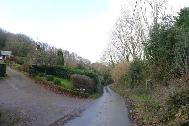
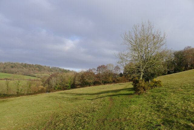
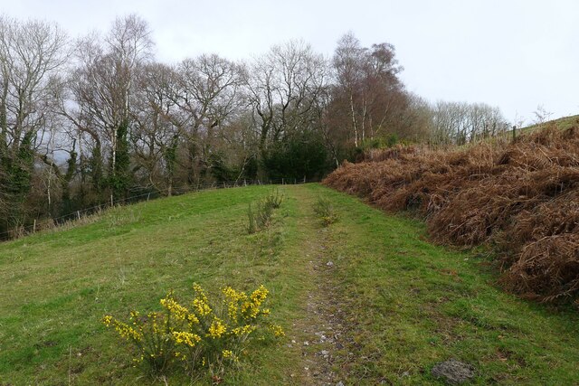
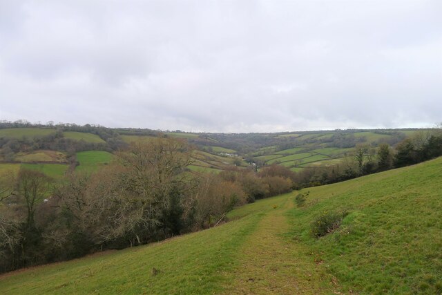
Sweetcombe Wood Images

Images are sourced within 2km of 50.730563/-3.1874999 or Grid Reference SY1693. Thanks to Geograph Open Source API. All images are credited.

Entrance to Hatway Stables An isolated block of stables at the top of Buckton  Hill.
Entrance to Hatway Stables
An isolated block of stables at the top of Buckton Hill.
Trackway on Buckton Hill Whilst now serving forestry workings . This may have been a prehistoric ridgeway. Similar to the nearby Farway plain site.
Trackway on Buckton Hill
Whilst now serving forestry workings . This may have been a prehistoric ridgeway. Similar to the nearby Farway plain site.
Trackway to Hatway stables Possibly following the course of a much older ridgeway route.
Trackway to Hatway stables
Possibly following the course of a much older ridgeway route.
Footpath to Tailmoor Coppice The route is described as a conservation walk. Dedicated to the memory of john and Norah Bourne.
Footpath to Tailmoor Coppice
The route is described as a conservation walk. Dedicated to the memory of john and Norah Bourne.
Footbridge over the Roncombe stream The OS map describes the location as having a ford.
It is hard to imagine there being one at this location.
Footbridge over the Roncombe stream
The OS map describes the location as having a ford. It is hard to imagine there being one at this location.
Junction by the woodland at Long Chimney
Road north-west of Long Chimney
Sign for footpath to Chelson Farm
Minor road on Broad Down
Minor road to Ball Hill
Signs for track crossing the road on edge of Broad Down The track is a bridleway <a href="https://www.geograph.org.uk/photo/808329">SY1794 : Bridleway, Broad Down</a>
Signs for track crossing the road on edge of Broad Down
The track is a bridleway SY1794 : Bridleway, Broad Down
Muddy bridleway on Broad Down
The East Devon Way on Green Way Passing the entrance to Hatway Stables
The East Devon Way on Green Way
Passing the entrance to Hatway Stables
Green Lane, Hatway Hill The East Devon Way following a Greensand ridge north-east of Sidbury
Green Lane, Hatway Hill
The East Devon Way following a Greensand ridge north-east of Sidbury
Hatway Hill
Hatway Hill
The East Devon Way approaching Sandcombe Wood Walking along the western slope of a Greensand escarpment
The East Devon Way approaching Sandcombe Wood
Walking along the western slope of a Greensand escarpment
The East Devon Way approaching Mincombe Wood Walking along the western slope of a Greensand escarpment
The East Devon Way approaching Mincombe Wood
Walking along the western slope of a Greensand escarpment
The East Devon Way dropping down to the valley of Roncombe Stream The Way drops down from a ridge of Cretaceous Greensand to softer Triassic mudstones in the valley, before climbing up to another Greensand ridge in the distance <span class="nowrap"><a title="https://geologyviewer.bgs.ac.uk/" rel="nofollow ugc noopener" href="https://geologyviewer.bgs.ac.uk/">Link</a><img style="margin-left:2px;" alt="External link" title="External link - shift click to open in new window" src="https://s1.geograph.org.uk/img/external.png" width="10" height="10"/></span>
The East Devon Way dropping down to the valley of Roncombe Stream
The Way drops down from a ridge of Cretaceous Greensand to softer Triassic mudstones in the valley, before climbing up to another Greensand ridge in the distance LinkExternal link
Show me another place!

Sweetcombe Wood is located at Grid Ref: SY1693 (Lat: 50.730563, Lng: -3.1874999)

Administrative County: Devon

District: East Devon

Police Authority: Devon and Cornwall

What 3 Words

///typified.grips.question. Near Sidmouth, Devon

Nearby Locations

Sweetcombe Wood

Related Wikis

Wiscombe Park

Wiscombe Park is a 19th-century Gothic country house in Southleigh, Devon, UK which stands in parkland some 3 miles west of Colyton. The house is a grade...

Wiscombe Park Hillclimb

Wiscombe Park Hillclimb is a British hillclimb, situated in Colyton, Devon. The course, which is 1000 yards (914 metres) in length — the same as Shelsley...

Blackbury Camp

Blackbury Camp, also known as Blackbury Castle, is an Iron Age hill fort in Devon, England. It is managed by English Heritage. == Location == Blackbury...

Sidbury

Sidbury is a large village and former civil parish north of Sidmouth, now in the parish of Sidmouth, in the East Devon district, in the county of Devon...

Nearby Amenities

Located within 500m of 50.730563,-3.1874999
Barrier: stile
Lat/Long: 50.7308212/-3.1855173
Power: pole
Source: bing
Lat/Long: 50.73302/-3.1907156
Power: pole
Source: bing
Lat/Long: 50.7336448/-3.1912829
Power: pole
Source: bing
Lat/Long: 50.7313105/-3.1831209
Power: pole
Source: bing
Lat/Long: 50.7305567/-3.1856999
Power: pole
Source: bing
Lat/Long: 50.7286399/-3.1852023
Power: pole
Source: bing
Lat/Long: 50.7293317/-3.1853807
Power: pole
Source: bing
Lat/Long: 50.7306543/-3.1851929
Power: pole
Source: bing
Lat/Long: 50.7309259/-3.1843346
Generator Method: wind_turbine
Generator Output Electricity: yes
Generator Source: wind
Power: generator
Lat/Long: 50.7323045/-3.1823686
Generator Method: wind_turbine
Generator Output Electricity: yes
Generator Source: wind
Power: generator
Lat/Long: 50.7328859/-3.1828313
Power: pole
Source: bing
Lat/Long: 50.7269615/-3.1916691
Power: pole
Source: bing
Lat/Long: 50.7278665/-3.1917
Power: pole
Source: bing
Transformer: distribution
Lat/Long: 50.7290278/-3.1933281
Power: pole
Source: bing
Lat/Long: 50.7297528/-3.1909627
Power: pole
Source: bing
Lat/Long: 50.7322281/-3.1900504
Power: pole
Source: bing
Lat/Long: 50.7314675/-3.1903321
Power: pole
Source: bing
Lat/Long: 50.7305915/-3.1906512
Power: pole
Source: bing
Lat/Long: 50.7284794/-3.1914425
Power: pole
Source: bing
Transformer: distribution
Lat/Long: 50.7290176/-3.1896776
Power: pole
Source: bing
Lat/Long: 50.7290227/-3.1903321
Power: pole
Source: bing
Lat/Long: 50.7290312/-3.1922981
Power: pole
Source: bing
Lat/Long: 50.7290312/-3.1912306
The data included in this document is from www.openstreetmap.org. The data is made available under ODbL.

Have you been to Sweetcombe Wood?

Leave your review of Sweetcombe Wood below (or comments, questions and feedback).