Alder Copse

Wood, Forest in Somerset Somerset West and Taunton

England

Alder Copse

Meadowside Cottages, Combe Florey See also <a href="https://www.geograph.org.uk/photo/5028206">ST1531 : Combe Florey View</a>.
Meadowside Cottages, Combe Florey Credit: Stephen Craven

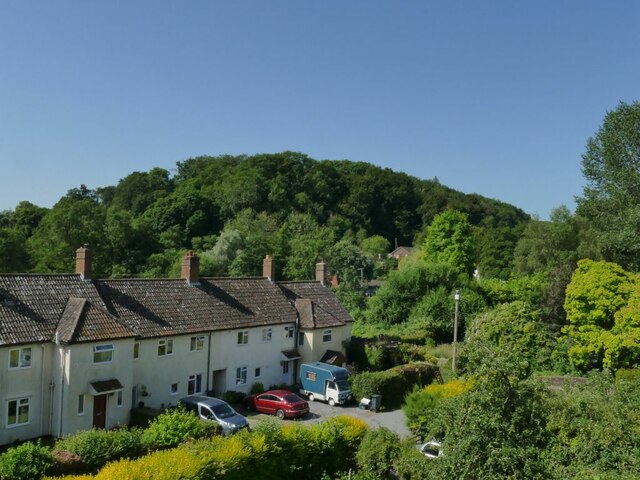
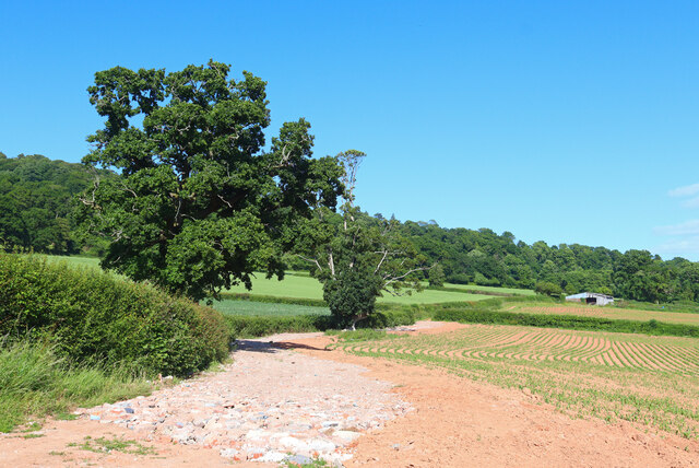
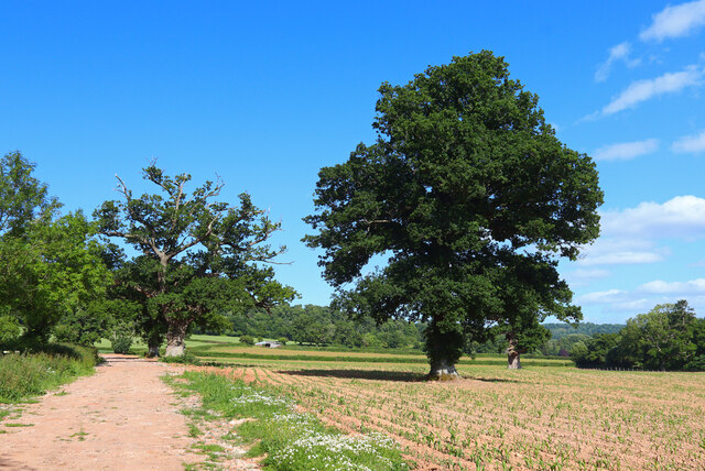
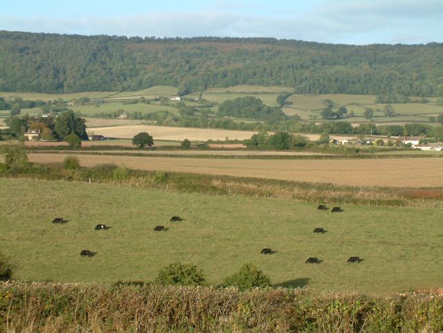
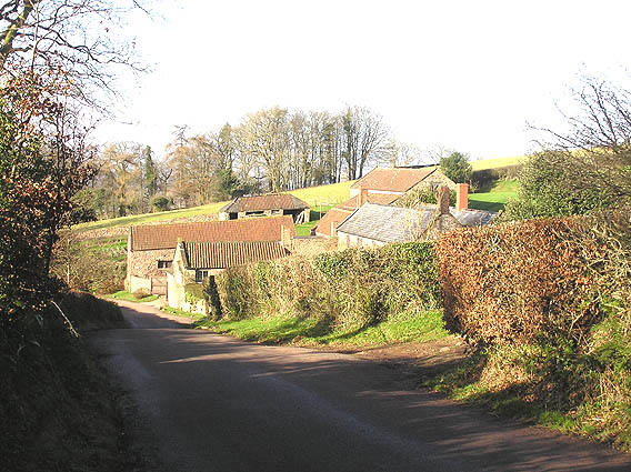
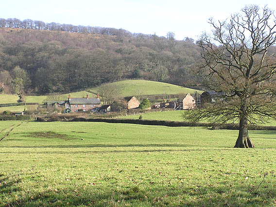
Alder Copse is a picturesque woodland located in Somerset, England. Covering an area of approximately 20 hectares, it is a thriving example of a mixed deciduous forest. The copse is primarily composed of alder trees, which lend their name to the woodland. However, it also boasts a diverse range of other tree species, including oak, beech, and birch, creating a rich tapestry of colors throughout the seasons.

Situated on a gently sloping hillside, Alder Copse offers visitors a peaceful and idyllic setting. The forest floor is covered with a lush carpet of ferns, bluebells, and wildflowers, attracting a wide variety of wildlife. Birdsong fills the air, with species such as woodpeckers, tits, and thrushes making their homes among the branches.

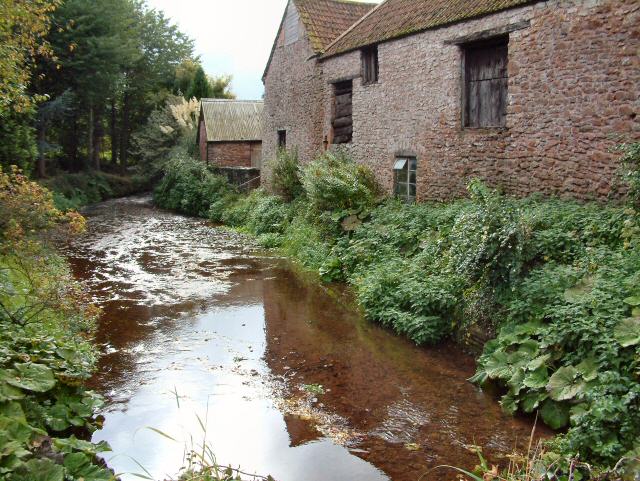
Alder Copse is intersected by a network of well-maintained footpaths, allowing visitors to explore its beauty at their leisure. These paths wind through the woodland, offering glimpses of hidden clearings and babbling brooks. The copse is particularly popular with nature enthusiasts, photographers, and those seeking a tranquil escape from the hustle and bustle of everyday life.

Managed by the local conservation trust, Alder Copse is carefully monitored to ensure its ecological integrity is preserved. The trust organizes regular guided walks and educational programs to promote awareness of the woodland's unique biodiversity.

In conclusion, Alder Copse is a stunning example of a woodland ecosystem in Somerset. With its diverse tree species, vibrant undergrowth, and peaceful atmosphere, it provides a haven for both nature and outdoor enthusiasts alike.

If you have any feedback on the listing, please let us know in the comments section below.

Alder Copse Images

Images are sourced within 2km of 51.087819/-3.1971419 or Grid Reference ST1632. Thanks to Geograph Open Source API. All images are credited.

Meadowside Cottages, Combe Florey See also <a href="https://www.geograph.org.uk/photo/5028206">ST1531 : Combe Florey View</a>.
Meadowside Cottages, Combe Florey
Somerset County Council fingerpost - on the A358 Combe Florey SCC fingerpost condition in January 2022 prior to refurbishment, which is due to take place in the Summer of 2022. The post is on the A358 at the junction with the road leading into Combe Florey village.
Somerset County Council fingerpost - on the A358 Combe Florey
SCC fingerpost condition in January 2022 prior to refurbishment, which is due to take place in the Summer of 2022. The post is on the A358 at the junction with the road leading into Combe Florey village.
Somerset County Council fingerpost - A358 Combe Florey Somerset County Council fingerpost - on the A358 at the Combe Florey junction which was refurbished in July 2022 as part of the Somerset County Council fingerpost restoration project. Repainting was undertaken by 2 volunteers working on behalf of Combe Florey parish council which provided the paints and materials.
Somerset County Council fingerpost - A358 Combe Florey
Somerset County Council fingerpost - on the A358 at the Combe Florey junction which was refurbished in July 2022 as part of the Somerset County Council fingerpost restoration project. Repainting was undertaken by 2 volunteers working on behalf of Combe Florey parish council which provided the paints and materials.
Ordnance Survey Cut Mark This OS cut mark can be found on the porch of St Peter's Church. It marks a point 80.164m above mean sea level.
Ordnance Survey Cut Mark
This OS cut mark can be found on the porch of St Peter's Church. It marks a point 80.164m above mean sea level.
Near Crowcombe Field and trees near Crowcombe.
Near Crowcombe
Field and trees near Crowcombe.
Kennel Lane Entrance to the Stockham Lane kennels.
Kennel Lane
Entrance to the Stockham Lane kennels.
Footpath near Crowcombe Trees by the footpath off New Road.
Footpath near Crowcombe
Trees by the footpath off New Road.
West Somerset Railway, Churchlands Bridge, Combe Florey The steam-hauled train is heading up the grade to Crowcombe Heathfield
West Somerset Railway, Churchlands Bridge, Combe Florey
The steam-hauled train is heading up the grade to Crowcombe Heathfield
Nethercott Bridge The bridge carries the West Somerset Railway high above the quiet hamlet of Nethercott...
Nethercott Bridge
The bridge carries the West Somerset Railway high above the quiet hamlet of Nethercott...
Combe Florey: the West Somerset Railway near Nethercott Locomotive 9351 on a demonstration freight train from Bishop’s Lydeard to Williton. Note – a Photographer’s Lineside Pass has to be obtained from the WSR office at Minehead for access to railway property other than the trains and stations
Combe Florey: the West Somerset Railway near Nethercott
Locomotive 9351 on a demonstration freight train from Bishop’s Lydeard to Williton. Note – a Photographer’s Lineside Pass has to be obtained from the WSR office at Minehead for access to railway property other than the trains and stations
Railway Cutting near Trebles Holford
Combe Florey: West Somerset Railway at Nethercott 5553 heads a demonstration freight train on this heritage line. Note: a Photographer’s Lineside Pass has to be obtained from the railway’s office at Minehead for shots such as this on railway property
Combe Florey: West Somerset Railway at Nethercott
5553 heads a demonstration freight train on this heritage line. Note: a Photographer’s Lineside Pass has to be obtained from the railway’s office at Minehead for shots such as this on railway property
Farm at Nethercott Nearby was a notice about planning permission to convert the old stone barn into three dwellings...
Farm at Nethercott
Nearby was a notice about planning permission to convert the old stone barn into three dwellings...
Tilbury Farm, Bagborough
The Rising Sun, Bagborough In small words below the "Rising Sun", it says Established 1573!
The Rising Sun, Bagborough
In small words below the "Rising Sun", it says Established 1573!
Bagborough House from the church path
Smokeham Farm
Smokeham Farm
Show me another place!

Alder Copse is located at Grid Ref: ST1632 (Lat: 51.087819, Lng: -3.1971419)

Administrative County: Somerset

District: Somerset West and Taunton

Police Authority: Avon and Somerset

What 3 Words

///weeknight.torso.gong. Near Bishops Lydeard, Somerset

Nearby Locations

Alder Copse Shopnoller

Related Wikis

Cockercombe tuff

Cockercombe Tuff is a greenish-grey, hard pyroclastic rock, formed by the compression of volcanic ash containing high quantities of chlorite, which gives...

Cockercombe

Cockercombe is a hamlet within the civil parish of West Bagborough in the Somerset West and Taunton district of Somerset, England, approximately 8.3 miles...

West Bagborough

West Bagborough is a village and civil parish in Somerset, England, about 5 miles (8.0 km) north of Taunton. In 2011, the village had a population of 358...

Church of St Pancras, West Bagborough

The Anglican Church of St Pancras in West Bagborough, Somerset, England was built in the 15th century. It is a Grade II* listed building. == History... ==
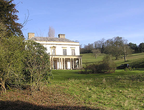
Bagborough House

Bagborough House in West Bagborough, Somerset, England was built circa 1730. It was designated a Grade II* listed building on 4 May 1984.Bagborough House...

West Bagborough Hoard

The West Bagborough Hoard is a hoard of 670 Roman coins and 72 pieces of hacksilver found in October 2001 by metal detectorist James Hawkesworth near...
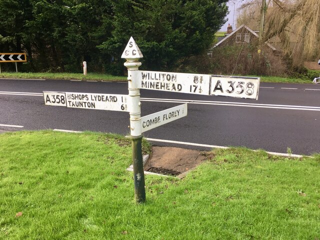
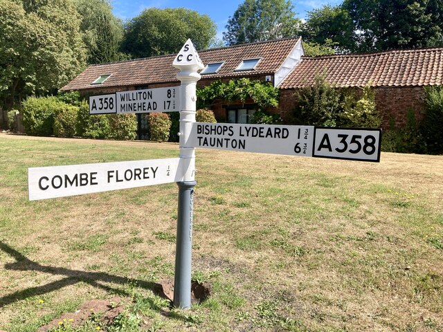
Combe Florey

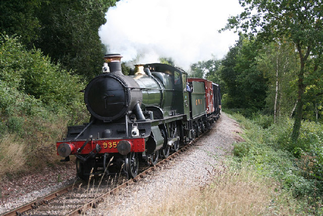
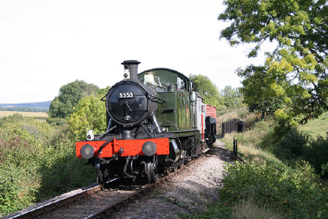
Combe Florey is a village and civil parish in Somerset, England, situated 6 miles (9.7 km) northwest of Taunton, on the West Somerset Railway. The village...

Combe Florey House

Combe Florey House in Combe Florey, Somerset, England is a country house dating from the early 18th century. It replaced an Elizabethan manor house which...

Nearby Amenities

Located within 500m of 51.087819,-3.1971419
Brand: National Grid
Brand Wikidata: Q1465461
Material: wood
Operator: National Grid Electricity Distribution Plc
Operator Old: Western Power Distribution
Operator Wikidata: Q7988183
Owner: National Grid Electricity Distribution (South West) Plc
Owner Wikidata: Q114397866
Power: pole
Lat/Long: 51.0906009/-3.1942243
Branch Type: split
Brand: National Grid
Brand Wikidata: Q1465461
Guyed: yes
Material: wood
Operator: National Grid Electricity Distribution Plc
Operator Old: Western Power Distribution
Operator Wikidata: Q7988183
Owner: National Grid Electricity Distribution (South West) Plc
Owner Wikidata: Q114397866
Pole: branch
Power: pole
Lat/Long: 51.0901993/-3.1962198
Brand: National Grid
Brand Wikidata: Q1465461
Material: wood
Operator: National Grid Electricity Distribution Plc
Operator Old: Western Power Distribution
Operator Wikidata: Q7988183
Owner: National Grid Electricity Distribution (South West) Plc
Owner Wikidata: Q114397866
Power: pole
Lat/Long: 51.0909359/-3.1925209
Brand: National Grid
Brand Wikidata: Q1465461
Guyed: yes
Material: wood
Operator: National Grid Electricity Distribution Plc
Operator Old: Western Power Distribution
Operator Wikidata: Q7988183
Owner: National Grid Electricity Distribution (South West) Plc
Owner Wikidata: Q114397866
Power: pole
Lat/Long: 51.0897613/-3.198564
Brand: National Grid
Brand Wikidata: Q1465461
Material: wood
Operator: National Grid Electricity Distribution Plc
Operator Old: Western Power Distribution
Operator Wikidata: Q7988183
Owner: National Grid Electricity Distribution (South West) Plc
Owner Wikidata: Q114397866
Power: pole
Lat/Long: 51.089394/-3.1958496
Brand: National Grid
Brand Wikidata: Q1465461
Material: wood
Operator: National Grid Electricity Distribution Plc
Operator Old: Western Power Distribution
Operator Wikidata: Q7988183
Owner: National Grid Electricity Distribution (South West) Plc
Owner Wikidata: Q114397866
Power: pole
Lat/Long: 51.088742/-3.195737
Brand: National Grid
Brand Wikidata: Q1465461
Material: wood
Operator: National Grid Electricity Distribution Plc
Operator Old: Western Power Distribution
Operator Wikidata: Q7988183
Owner: National Grid Electricity Distribution (South West) Plc
Owner Wikidata: Q114397866
Power: pole
Lat/Long: 51.0890999/-3.1995355
Power: pole
Lat/Long: 51.0901261/-3.2031487
Brand: National Grid
Brand Wikidata: Q1465461
Material: wood
Operator: National Grid Electricity Distribution Plc
Operator Old: Western Power Distribution
Operator Wikidata: Q7988183
Owner: National Grid Electricity Distribution (South West) Plc
Owner Wikidata: Q114397866
Power: pole
Lat/Long: 51.0883603/-3.2006701
Power: pole
Lat/Long: 51.0911515/-3.20101
Brand: National Grid
Brand Wikidata: Q1465461
Frequency: 50
Location Transition: yes
Material: wood
Operator: National Grid Electricity Distribution Plc
Operator Old: Western Power Distribution
Operator Wikidata: Q7988183
Owner: National Grid Electricity Distribution (South West) Plc
Owner Wikidata: Q114397866
Phases: 1
Power: pole
Transformer: distribution
Lat/Long: 51.0902944/-3.2016787
Brand: National Grid
Brand Wikidata: Q1465461
Material: wood
Operator: National Grid Electricity Distribution Plc
Operator Old: Western Power Distribution
Operator Wikidata: Q7988183
Owner: National Grid Electricity Distribution (South West) Plc
Owner Wikidata: Q114397866
Power: pole
Lat/Long: 51.0875836/-3.2019066
Post Box
Operator: Royal Mail
Operator Wikidata: Q638098
Post Box Type: wall
Ref: TA4 156
Royal Cypher: EVIIR
Royal Cypher Wikidata: Q33102324
Lat/Long: 51.0907085/-3.2003255
Crossing
Bicycle: no
Crossing: unmarked
Horse: no
Tactile Paving: no
Lat/Long: 51.0849987/-3.2026722
Access: customers
Entrance: main
Female: yes
Male: no
Lat/Long: 51.0867898/-3.2040789
Access: customers
Entrance: main
Female: no
Male: yes
Lat/Long: 51.0867818/-3.2040883
Bbq
Covered: no
Fuel: charcoal
Lat/Long: 51.0865147/-3.203609
Covered: no
Leisure: picnic_table
Lat/Long: 51.0865341/-3.2036801
Covered: no
Leisure: picnic_table
Lat/Long: 51.08666/-3.2037491
Noexit: yes
Lat/Long: 51.0871979/-3.2034595
Noexit: yes
Lat/Long: 51.087224/-3.2037746
Brand: National Grid
Brand Wikidata: Q1465461
Material: wood
Operator: National Grid Electricity Distribution Plc
Operator Old: Western Power Distribution
Operator Wikidata: Q7988183
Owner: National Grid Electricity Distribution (South West) Plc
Owner Wikidata: Q114397866
Power: pole
Lat/Long: 51.087272/-3.2039597
Branch Type: split
Brand: National Grid
Brand Wikidata: Q1465461
Design: two-level
Guyed: yes
Material: wood
Operator: National Grid Electricity Distribution Plc
Operator Old: Western Power Distribution
Operator Wikidata: Q7988183
Owner: National Grid Electricity Distribution (South West) Plc
Owner Wikidata: Q114397866
Pole: branch
Power: pole
Lat/Long: 51.0866137/-3.2034346
Passing Place
Side: right
Lat/Long: 51.0852494/-3.2029606
Give Way
Direction: backward
Lat/Long: 51.0871208/-3.1961109
Give Way
Direction: forward
Lat/Long: 51.0904052/-3.2006116
The data included in this document is from www.openstreetmap.org. The data is made available under ODbL.

Have you been to Alder Copse?

Leave your review of Alder Copse below (or comments, questions and feedback).