Cletterwood

Settlement in Montgomeryshire

Wales

Cletterwood

Car on the A458 The A458 runs 87 miles across the West Midlands and Wales, from Quinton to Mallwyd.
<span class="nowrap"><a title="http://www.sabre-roads.org.uk/wiki/index.php?title=A458" rel="nofollow ugc noopener" href="http://www.sabre-roads.org.uk/wiki/index.php?title=A458">Link</a><img style="margin-left:2px;" alt="External link" title="External link - shift click to open in new window" src="https://s1.geograph.org.uk/img/external.png" width="10" height="10"/></span>
Car on the A458 Credit: N Chadwick

Cletterwood is a small village located in the county of Montgomeryshire, Wales. Situated in the picturesque countryside, it is nestled between rolling hills and lush green fields, offering a tranquil and idyllic setting for its residents. With a population of around 500 people, Cletterwood maintains a close-knit community atmosphere.

The village itself is characterized by a charming collection of traditional Welsh stone cottages, showcasing the local architectural heritage. The main street is lined with small, independent shops, including a post office, a local grocery store, and a cozy café where locals gather to socialize.

Cletterwood boasts a rich history, evident in the village's historical landmarks. The St. Mary's Church, with its striking medieval architecture, stands prominently at the heart of the village, serving as a reminder of the area's religious heritage. Additionally, the nearby Cletterwood Manor, a well-preserved 17th-century manor house, offers visitors a glimpse into the region's past.

Nature enthusiasts will be delighted by the surrounding countryside, which provides ample opportunities for outdoor activities. The nearby Cletterwood Forest is a popular destination for hiking, with its well-maintained trails and stunning vistas. The village also benefits from its proximity to the Montgomeryshire Canal, offering scenic walks along the water's edge.

Overall, Cletterwood is a charming village that appeals to those seeking a peaceful and close community in a picturesque rural setting. Its rich history and natural beauty make it a hidden gem within Montgomeryshire.

If you have any feedback on the listing, please let us know in the comments section below.
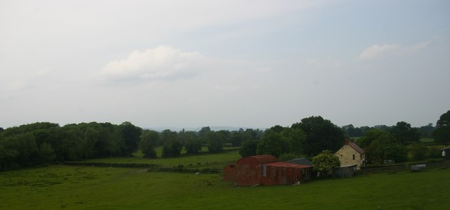
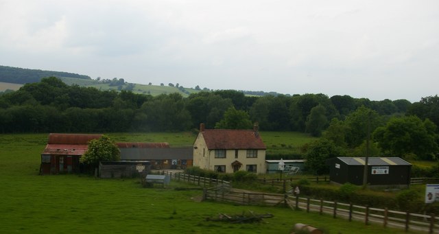
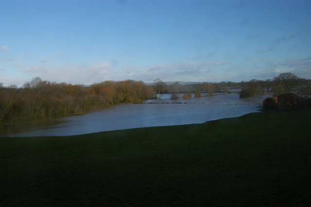
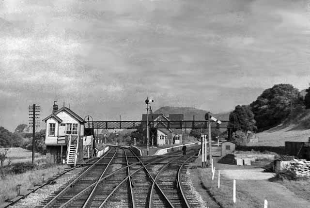
Cletterwood Images

Images are sourced within 2km of 52.669951/-3.092831 or Grid Reference SJ2608. Thanks to Geograph Open Source API. All images are credited.

Car on the A458 The A458 runs 87 miles across the West Midlands and Wales, from Quinton to Mallwyd.
<span class="nowrap"><a title="http://www.sabre-roads.org.uk/wiki/index.php?title=A458" rel="nofollow ugc noopener" href="http://www.sabre-roads.org.uk/wiki/index.php?title=A458">Link</a><img style="margin-left:2px;" alt="External link" title="External link - shift click to open in new window" src="https://s1.geograph.org.uk/img/external.png" width="10" height="10"/></span>
Car on the A458
The A458 runs 87 miles across the West Midlands and Wales, from Quinton to Mallwyd. LinkExternal link
Cefn Cottage
Cefn Cottage
Cefn, near Welshpool: Lower Cefn and Severn valley, from the train
Farm land and stream towards Sale Lane Viewed from railway near Trewern
Farm land and stream towards Sale Lane
Viewed from railway near Trewern
Silhouette of Moel y Golfa at dusk in December The shapeliness of this hill from this angle has to be seen to be believed. What a beauty.

Yes, the sheep thinks I'm mad too....
Silhouette of Moel y Golfa at dusk in December
The shapeliness of this hill from this angle has to be seen to be believed. What a beauty. Yes, the sheep thinks I'm mad too....
Moel y Golfa from the A458 road over the railway Moel y Golfa can be appreciated as the highest and most shapely of the wonderful Breidden Hills from this angle.
Moel y Golfa from the A458 road over the railway
Moel y Golfa can be appreciated as the highest and most shapely of the wonderful Breidden Hills from this angle.
A458 approaching Cefn railway bridge
Cefn, near Welshpool: Lower Cefn and flooded Severn valley, from the train Taken after the very wet start to 2014, when flooding affected many areas of the UK.  Compare a view taken in June the following year, when the flood waters were gone: <a href="https://www.geograph.org.uk/photo/4560702">SJ2610 : Cefn, near Welshpool: Lower Cefn and Severn valley, from the train</a>.
Cefn, near Welshpool: Lower Cefn and flooded Severn valley, from the train
Taken after the very wet start to 2014, when flooding affected many areas of the UK. Compare a view taken in June the following year, when the flood waters were gone: SJ2610 : Cefn, near Welshpool: Lower Cefn and Severn valley, from the train.
Cefn, near Welshpool: flooded Severn valley, from the train The line of trees to the left of the floodwaters marks the embankment of the disused railway to Oswestry.
Cefn, near Welshpool: flooded Severn valley, from the train
The line of trees to the left of the floodwaters marks the embankment of the disused railway to Oswestry.
Countryside near Cefn
Lower Cefn
Lower Cefn
Farmland near Cefn
Farmland near Cefn
Disused railway line
Cefn, near Welshpool: Lower Cefn and Severn valley, from the train Compare a view taken in February the previous year, after the very wet start to 2014, when the flood waters filled the Severn valley behind the farm: <a href="https://www.geograph.org.uk/photo/3847850">SJ2610 : Cefn, near Welshpool: Lower Cefn and flooded Severn valley, from the train</a>.
Cefn, near Welshpool: Lower Cefn and Severn valley, from the train
Compare a view taken in February the previous year, after the very wet start to 2014, when the flood waters filled the Severn valley behind the farm: SJ2610 : Cefn, near Welshpool: Lower Cefn and flooded Severn valley, from the train.
Lower Cefn
Lower Cefn
View to Breidden Hill View across the meadows beside to River Severn to the distinctively shaped Breidden Hill from near Buttington Cross.
View to Breidden Hill
View across the meadows beside to River Severn to the distinctively shaped Breidden Hill from near Buttington Cross.
View to Yr Allt View across the meadows beside the River Severn to Yr Allt from near Buttington Cross, both the River Severn and the Montgomery Canal pass through this landscape.
View to Yr Allt
View across the meadows beside the River Severn to Yr Allt from near Buttington Cross, both the River Severn and the Montgomery Canal pass through this landscape.
Show me another place!

Cletterwood is located at Grid Ref: SJ2608 (Lat: 52.669951, Lng: -3.092831)

Unitary Authority: Powys

Police Authority: Dyfed Powys

What 3 Words

///puff.paying.greyhound. Near Welshpool, Powys

Related Wikis

Battle of Buttington

The Battle of Buttington was fought in 893 between a Viking army and an alliance of Anglo-Saxons and Welsh. The annals for 893 reported that a large Viking...

Buttington railway station

Buttington railway station was a station in Buttington, Powys, Wales. The station was opened in November 1860, several months after the line that served...

Buttington Oak

The Buttington Oak was a tree near to Offa's Dyke at Buttington, Wales, said to have been planted to mark the site of the Battle of Buttington between...
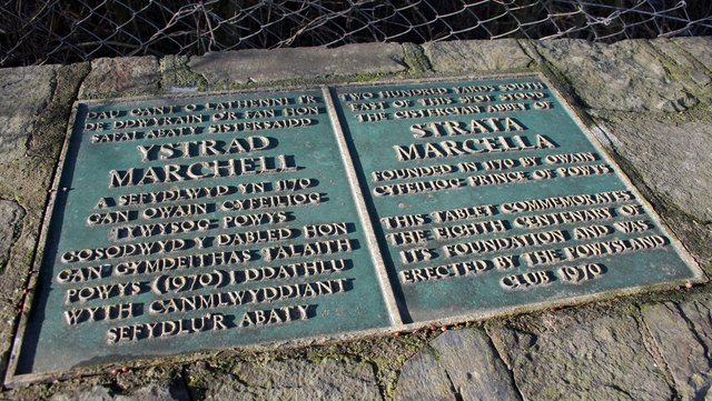
Strata Marcella

The Abbey of Strata Marcella (Welsh: Abaty Ystrad Marchell) was a medieval Cistercian monastery situated at Ystrad Marchell (Strata Marcella being the...
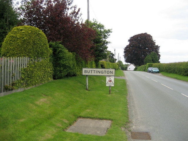
Buttington

Buttington (Welsh: Tal-y-bont) is a village in Powys, Wales, less than 3 km from Welshpool and about 300 m from the River Severn, in the community of Trewern...

Long Mountain transmitting station

The Long Mountain transmitting station is sited on a 400 metres (1,300 ft) ridge about 4 kilometres (2.5 mi) east of Welshpool in Powys, Mid Wales and...

Pool Quay

Pool Quay (Welsh: Cei'r Trallwng) is a small village in Powys, Mid Wales. == Location == It is situated on the A483 road, between the towns of Welshpool...

Siege of Exeter (c. 630)

According to some early medieval sources, the siege of Exeter or siege of Caer-Uisc was a military conflict that took place in or around 630 CE, between...

Nearby Amenities

Located within 500m of 52.669951,-3.092831
Power: pole
Lat/Long: 52.6693452/-3.100094
Power: pole
Lat/Long: 52.669935/-3.0990183
Power: pole
Lat/Long: 52.6707939/-3.0981397
Power: pole
Lat/Long: 52.6716784/-3.0971791
Power: pole
Lat/Long: 52.6724676/-3.0963346
Power: pole
Lat/Long: 52.6731162/-3.0963132
Power: pole
Lat/Long: 52.674152/-3.0945539
The data included in this document is from www.openstreetmap.org. The data is made available under ODbL.

Have you been to Cletterwood?

Leave your review of Cletterwood below (or comments, questions and feedback).