Anslow

Settlement in Staffordshire East Staffordshire

England

Anslow

B5017 heading east from Needwood
B5017 heading east from Needwood Credit: Colin Pyle

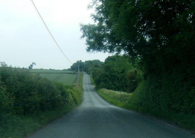
Anslow is a small village situated in the county of Staffordshire, England. It is located about 5 miles west of the town of Burton upon Trent and approximately 20 miles southwest of Derby. The village is nestled in a picturesque rural setting, surrounded by lush green fields and rolling hills.

Anslow has a rich history dating back centuries, with evidence of human settlement in the area since the Roman times. The village is home to several historic buildings, including St. Mary's Church, a beautiful Grade II listed structure dating back to the 13th century. The church is renowned for its stunning stained glass windows and intricate stone carvings.

The village itself is relatively small, with a population of around 1,000 residents. It has a tight-knit community feel, with friendly locals and a strong sense of community spirit. Despite its size, Anslow boasts a range of amenities, including a primary school, a village hall, and a local pub that serves as a popular meeting place for residents.

Anslow is also well-connected, with good transport links to nearby towns and cities. The A38 road passes close to the village, providing easy access to Burton upon Trent, Derby, and the wider Midlands region. Additionally, Anslow is served by several bus routes, offering convenient public transportation options for both residents and visitors.

Overall, Anslow is a charming village that offers a peaceful and idyllic setting, combined with a rich history and a strong sense of community.

If you have any feedback on the listing, please let us know in the comments section below.

Anslow Images

Images are sourced within 2km of 52.825279/-1.686632 or Grid Reference SK2125. Thanks to Geograph Open Source API. All images are credited.

B5017 heading east from Needwood
Belmot Road near Belmot Green
Picnic bench, Belmot Green Open access land managed by Staffordshire County Council. All the maps back to the 1880s call it Belmot Green, but the entry sign says Belmot Common. Perhaps it is common land?
Picnic bench, Belmot Green
Open access land managed by Staffordshire County Council. All the maps back to the 1880s call it Belmot Green, but the entry sign says Belmot Common. Perhaps it is common land?
Picnic area, Belmot Green Open access land managed by Staffordshire County Council. All the maps back to the 1880s call it Belmot Green, but the entry sign says Belmot Common. Perhaps it is common land?
Picnic area, Belmot Green
Open access land managed by Staffordshire County Council. All the maps back to the 1880s call it Belmot Green, but the entry sign says Belmot Common. Perhaps it is common land?
Woodland path, Belmot Green Open access land managed by Staffordshire County Council. All the maps back to the 1880s call it Belmot Green, but the entry sign says Belmot Common. Perhaps it is common land?
Woodland path, Belmot Green
Open access land managed by Staffordshire County Council. All the maps back to the 1880s call it Belmot Green, but the entry sign says Belmot Common. Perhaps it is common land?
Sheep and Ducks Both the sheep and the ducks are taking a drink from the pond on the left.  The gate gives access to one of those bridleways that stop halfway across a field and continue as a footpath.  No problem carrying a bike, but a horse?
Sheep and Ducks
Both the sheep and the ducks are taking a drink from the pond on the left. The gate gives access to one of those bridleways that stop halfway across a field and continue as a footpath. No problem carrying a bike, but a horse?
Holy Trinity Church This small church in Anslow is dedicated to The Holy Trinity.
Holy Trinity Church
This small church in Anslow is dedicated to The Holy Trinity.
Entrance to Lower Castle Hayes Farm
Looking across Private Land, Belmot Road The nets at the golf driving range next door to this smallholding, can just be seen between the barns.
Looking across Private Land, Belmot Road
The nets at the golf driving range next door to this smallholding, can just be seen between the barns.
Red Brick Barn at Bell House, Anslow Gate Although this is a farm, it is called Bell House. The house on the other side of the road is called Bell House Farm. I was told that this causes all sorts of confusion if the paramedics are called out.
Red Brick Barn at Bell House, Anslow Gate
Although this is a farm, it is called Bell House. The house on the other side of the road is called Bell House Farm. I was told that this causes all sorts of confusion if the paramedics are called out.
Holy Trinity churchyard, Anslow Gate I didn't intrude any further, as the volunteer gardeners were at work.
Holy Trinity churchyard, Anslow Gate
I didn't intrude any further, as the volunteer gardeners were at work.
Slow on Hanbury Road, at Anslow Gate No parking north of Holy Trinity church.
Slow on Hanbury Road, at Anslow Gate
No parking north of Holy Trinity church.
Farmland at Anslow Gate North of Holy Trinity church.
Farmland at Anslow Gate
North of Holy Trinity church.
Postbox on Hanbury Road, at Anslow Gate At the 99 metre spot height.
Postbox on Hanbury Road, at Anslow Gate
At the 99 metre spot height.
Tree in field, Anslow  Off Hanbury Road.
Tree in field, Anslow
Off Hanbury Road.
Hanbury Road towards Anslow Looking south east.
Hanbury Road towards Anslow
Looking south east.
Entering Anslow Looking south east on Hanbury Road.
Entering Anslow
Looking south east on Hanbury Road.
House, Anslow Gate
House, Anslow Gate
Show me another place!

Anslow is located at Grid Ref: SK2125 (Lat: 52.825279, Lng: -1.686632)

Administrative County: Staffordshire

District: East Staffordshire

Police Authority: Staffordshire

What 3 Words

///reference.spoiled.admit. Near Burton upon Trent, Staffordshire

Related Wikis

Anslow

Anslow is a village and civil parish in the East Staffordshire district of Staffordshire, England, about three miles [4.8 km] north-west of Burton upon...

Anslow Gate

Anslow Gate is a village in Staffordshire, England, situated to the west of Anslow on the road to Hanbury. According to the 2001 census, the parish of...

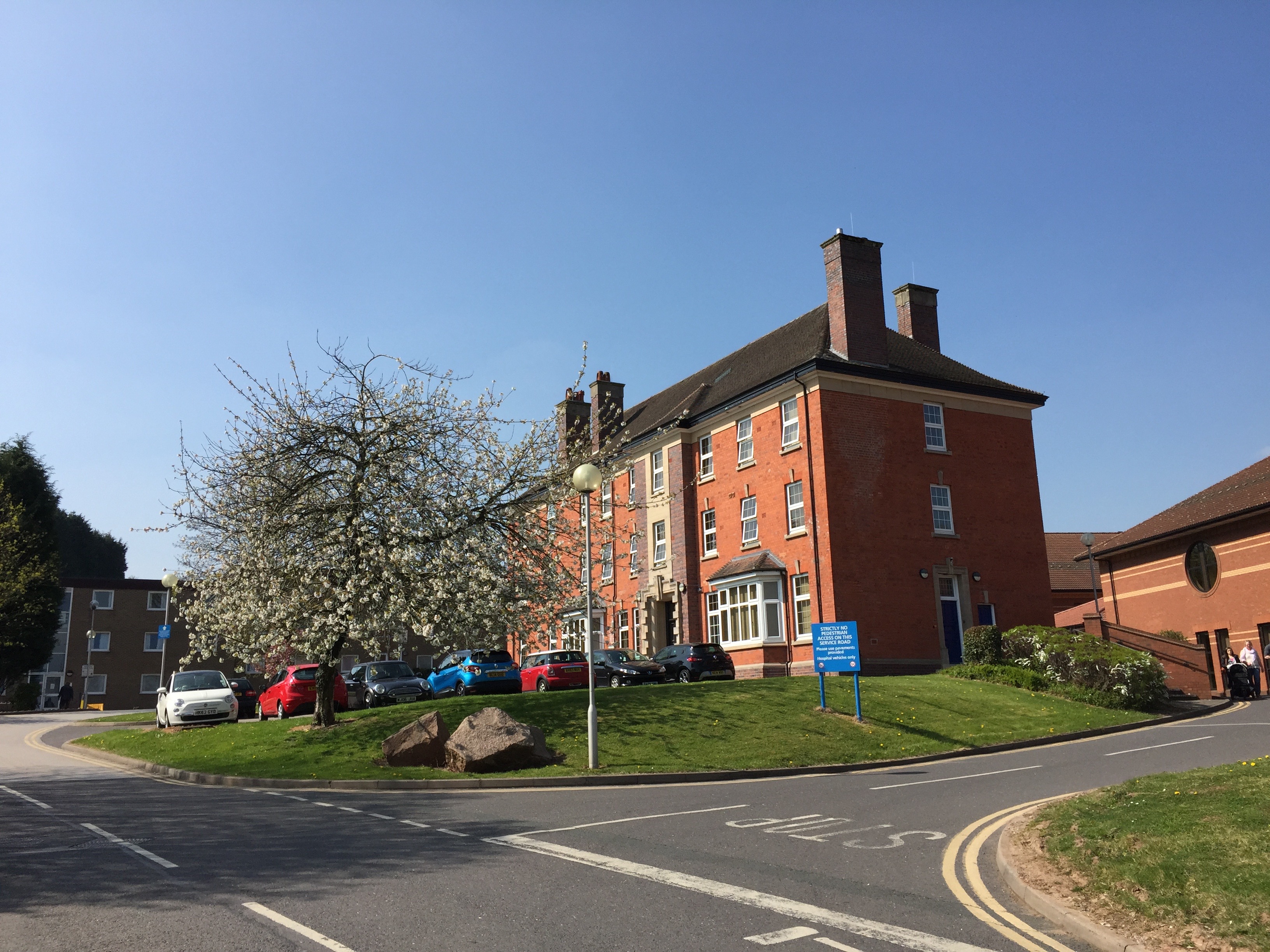
Queen's Hospital, Burton upon Trent

Queen's Hospital is a health facility on Belvedere Road in Burton upon Trent, Staffordshire. It is managed by University Hospitals of Derby and Burton...

Outwoods, East Staffordshire

Outwoods is a civil parish in the English county of Staffordshire. Once a village it is now a suburb on the flanks of the town of Burton upon Trent separated...

Sinai Park House

Sinai Park House is a grade II* listed building in Burton upon Trent, Staffordshire, England. Consisting of a central range with two wings the building...

Horninglow and Eton

Horninglow and Eton is a civil parish in the East Staffordshire district, in the county of Staffordshire, England. It covers an area located in the west...

Ind Coope Ground

The Ind Coope Ground was a cricket ground in Burton, England where Derbyshire CCC played between 1938 and 1980. In most years, the ground would host at...

Shobnall

Shobnall is a settlement and civil parish located in Staffordshire, England. It covers an area located in the west of Burton upon Trent. The population...

Related Videos

A walk to the local pub on a sunny bank holiday

We are often asked if there is a nice walk directly off site, well there is and it leads to our local pub The Bell Inn. Fantastic for a ...

Getting out of the bus 🚌 #shorts

shorts #travel #bus @england.

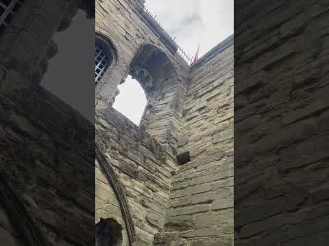
Climbing Tutbury Castle Hill

Tutbury Castle in Staffordshire is actually more impressive when you view it from the marshes to the north west of the site. Across ...

Nearby Amenities

Located within 500m of 52.825279,-1.686632
Pub
The Bell Inn
Addr City: Burton-on-Trent
Addr Postcode: DE13 9QD
Addr Street: Main Road
Addr Village: Anslow
Brand: Marston's
Brand Wikidata: Q6773982
Contact Facebook: https://www.facebook.com/thebellinnatanslow/
Fhrs Id: 1557258
Food: yes
Real Ale: yes
Website: https://bellinn-anslow.co.uk/
Lat/Long: 52.8243534/-1.6871087
Anslow
Place: village
Wikidata: Q3198223
Lat/Long: 52.8254801/-1.6881868
Post Box
Operator: Royal Mail
Ref: DE13 1117
Lat/Long: 52.8254564/-1.6861642
Barrier: stile
Lat/Long: 52.8246898/-1.6852369
Barrier: stile
Lat/Long: 52.8245588/-1.6862594
Bus Stop
Mosley Primary School
Naptan AtcoCode: 3800C300400
Naptan NaptanCode: stadajpt
Public Transport: platform
Lat/Long: 52.8246794/-1.6870585
Bus Stop
Mosley Primary School
Naptan AtcoCode: 3800C300401
Public Transport: platform
Lat/Long: 52.824775/-1.6869271
Bus Stop
Anslow Park Farm
Public Transport: platform
Lat/Long: 52.8273543/-1.6810209
Bus Stop
Anslow Park Farm
Naptan AtcoCode: 3800C345401
Naptan NaptanCode: stadjagm
Public Transport: platform
Lat/Long: 52.8273049/-1.6809672
Power: pole
Lat/Long: 52.8256421/-1.6845079
Power: pole
Lat/Long: 52.8263277/-1.6835448
Power: pole
Lat/Long: 52.8250976/-1.6852509
Place Of Worship
Source: OS-OpenData_StreetView
Lat/Long: 52.8253811/-1.6870923
Power: pole
Lat/Long: 52.8268349/-1.6820181
Addr Housename: The Laurels
Lat/Long: 52.8267263/-1.6833325
Barrier: stile
Lat/Long: 52.8249154/-1.6835436
Barrier: kissing_gate
Lat/Long: 52.8244486/-1.6803511
Barrier: kissing_gate
Lat/Long: 52.8245092/-1.6805085
Power: pole
Lat/Long: 52.824545/-1.6860229
Barrier: stile
Lat/Long: 52.8249422/-1.6837209
Barrier: stile
Lat/Long: 52.8251025/-1.6852274
The data included in this document is from www.openstreetmap.org. The data is made available under ODbL.

Have you been to Anslow?

Leave your review of Anslow below (or comments, questions and feedback).