Birks Plantation

Wood, Forest in Cumberland Copeland

England

Birks Plantation

Irton Road Station: Ravenglass and Eskdale Railway The station is situated in the very top of the grid square.
Irton Road Station: Ravenglass and Eskdale Railway Credit: Pam Brophy

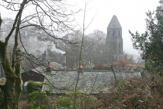
Birks Plantation is a sprawling woodland located in Cumberland, a county in northwest England. Spanning over a vast area, the plantation is a diverse mix of woodlands, forests, and lush greenery. It is a natural haven that offers a serene and tranquil atmosphere for visitors to immerse themselves in the beauty of nature.

The plantation is known for its rich biodiversity, with a wide variety of plant and animal species calling it home. The woodlands are predominantly composed of deciduous trees such as oak, beech, and birch, which create a stunning canopy overhead. These trees provide a habitat for numerous bird species, including woodpeckers, thrushes, and owls, making it an ideal spot for birdwatching enthusiasts.

Visitors to Birks Plantation can explore its many walking trails and footpaths, which wind their way through the enchanting forest. The plantation also features picnic areas, allowing visitors to relax and enjoy a leisurely lunch amidst the picturesque surroundings. The tranquil atmosphere makes it an excellent spot for individuals seeking solace and a connection with nature.

Birks Plantation is managed and maintained by local authorities, ensuring the preservation of its natural beauty. The woodland is open to the public year-round, with seasonal variations in foliage and wildlife, making each visit a unique experience.

Overall, Birks Plantation in Cumberland is a breathtaking natural retreat, offering a sanctuary for wildlife and a place of respite for visitors seeking to escape the hustle and bustle of everyday life.

If you have any feedback on the listing, please let us know in the comments section below.

Birks Plantation Images

Images are sourced within 2km of 54.370176/-3.3466883 or Grid Reference SD1298. Thanks to Geograph Open Source API. All images are credited.

Irton Road Station: Ravenglass and Eskdale Railway The station is situated in the very top of the grid square.
Irton Road Station: Ravenglass and Eskdale Railway
The station is situated in the very top of the grid square.
Trig Point on Hooker Crag This is the highest point on Muncaster Fell.
Scafell in the distance one way and a lovely view of a well known Nuclear Reprocessing Plant in the other.
Trig Point on Hooker Crag
This is the highest point on Muncaster Fell. Scafell in the distance one way and a lovely view of a well known Nuclear Reprocessing Plant in the other.
Muncaster Fell View of the summit, looking east.
Muncaster Fell
View of the summit, looking east.
Gate and stile at Brantrake. Gate at SD 145 985 where footpath enters wood near river Esk.
Gate and stile at Brantrake.
Gate at SD 145 985 where footpath enters wood near river Esk.
Farmland at Murthwaite Only sheep here. The soil and climate are too poor for much else.
Farmland at Murthwaite
Only sheep here. The soil and climate are too poor for much else.
Forest How A bed-and-breakfast establishment in a quiet location.
Forest How
A bed-and-breakfast establishment in a quiet location.
Footpath on Muncaster Fell A relatively dry bit.
Footpath on Muncaster Fell
A relatively dry bit.
Squidgy Bog on Muncaster Fell. The humans go through this bog, because that's where the footpath is. The sheep follow a dry route round the rocky outcrop, near to Ross's Camp.
Squidgy Bog on Muncaster Fell.
The humans go through this bog, because that's where the footpath is. The sheep follow a dry route round the rocky outcrop, near to Ross's Camp.
Footpath alongside Chapel Wood This part of the wood is a relatively new extension of the original, which was more of an ornamental surround for the artificial tarn.
Footpath alongside Chapel Wood
This part of the wood is a relatively new extension of the original, which was more of an ornamental surround for the artificial tarn.
Chapels and Monument, Muncaster Above Chapel Woods. A "private" sign, fencing and wire prevent legal access from the track above. Muncaster Castle has a website, for further information.
Chapels and Monument, Muncaster
Above Chapel Woods. A "private" sign, fencing and wire prevent legal access from the track above. Muncaster Castle has a website, for further information.
Rough Grazing Looking south-east
Rough Grazing
Looking south-east
Golf Course Looking south from the bridleway.
Golf Course
Looking south from the bridleway.
New Golf Course The house with mini pond and mini bridge is High Eskholme.
New Golf Course
The house with mini pond and mini bridge is High Eskholme.
Timber Harvesting, Muncaster Fell
Roman Tile Kilns The sign reads "These Roman Tile kilns are protected as a monument of national importance under the Ancient Monuments Acts 1913-53. Ministry of Public Buildings & Works". More than imagination is required here. Even the latest OS map omits its earlier symbol.
Roman Tile Kilns
The sign reads "These Roman Tile kilns are protected as a monument of national importance under the Ancient Monuments Acts 1913-53. Ministry of Public Buildings & Works". More than imagination is required here. Even the latest OS map omits its earlier symbol.
Rough Grazing Land
Rough Grazing Land
High Coppice The older High Coppice wood now has a backdrop of more recent plantings.
High Coppice
The older High Coppice wood now has a backdrop of more recent plantings.
Stock's Bridge An unusual design, using galvanised steel, wire and timber. Crosses the River Esk.
Stock's Bridge
An unusual design, using galvanised steel, wire and timber. Crosses the River Esk.
Show me another place!

Birks Plantation is located at Grid Ref: SD1298 (Lat: 54.370176, Lng: -3.3466883)

Administrative County: Cumbria

District: Copeland

Police Authority: Cumbria

What 3 Words

///totals.voted.servicing. Near Seascale, Cumbria

Related Wikis

Muncaster Fell

Muncaster Fell is a fell at the far western edge of the Lake District National Park, in Cumbria, England. Muncaster Fell is a long, narrow ridge of land...

Murthwaite Halt railway station

Murthwaite Halt railway station is a small intermediate railway station on the 15" gauge Ravenglass & Eskdale Railway in Cumbria, England. It is named...

Irton Road railway station

Irton Road railway station is a railway station on the 15 in gauge Ravenglass & Eskdale Railway in the Lake District National Park and the English county...

Miteside Halt railway station

Miteside Halt railway station is a railway station on the 15" gauge Ravenglass & Eskdale Railway in Cumbria, England. It is located where public footpath...

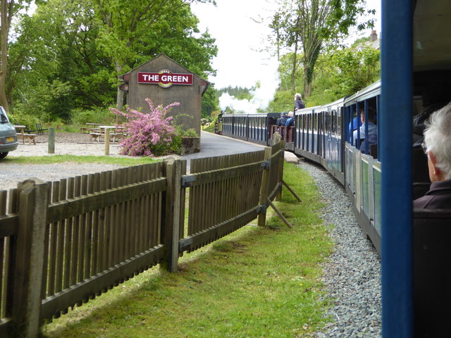
The Green railway station

The Green is a railway station on the 15-inch gauge Ravenglass & Eskdale Railway in the Lake District National Park and the English county of Cumbria....

St Michael's Church, Muncaster

St Michael's Church is in the grounds of Muncaster Castle, near Ravenglass, Cumbria, England. It is an active Anglican parish church in the deanery of...
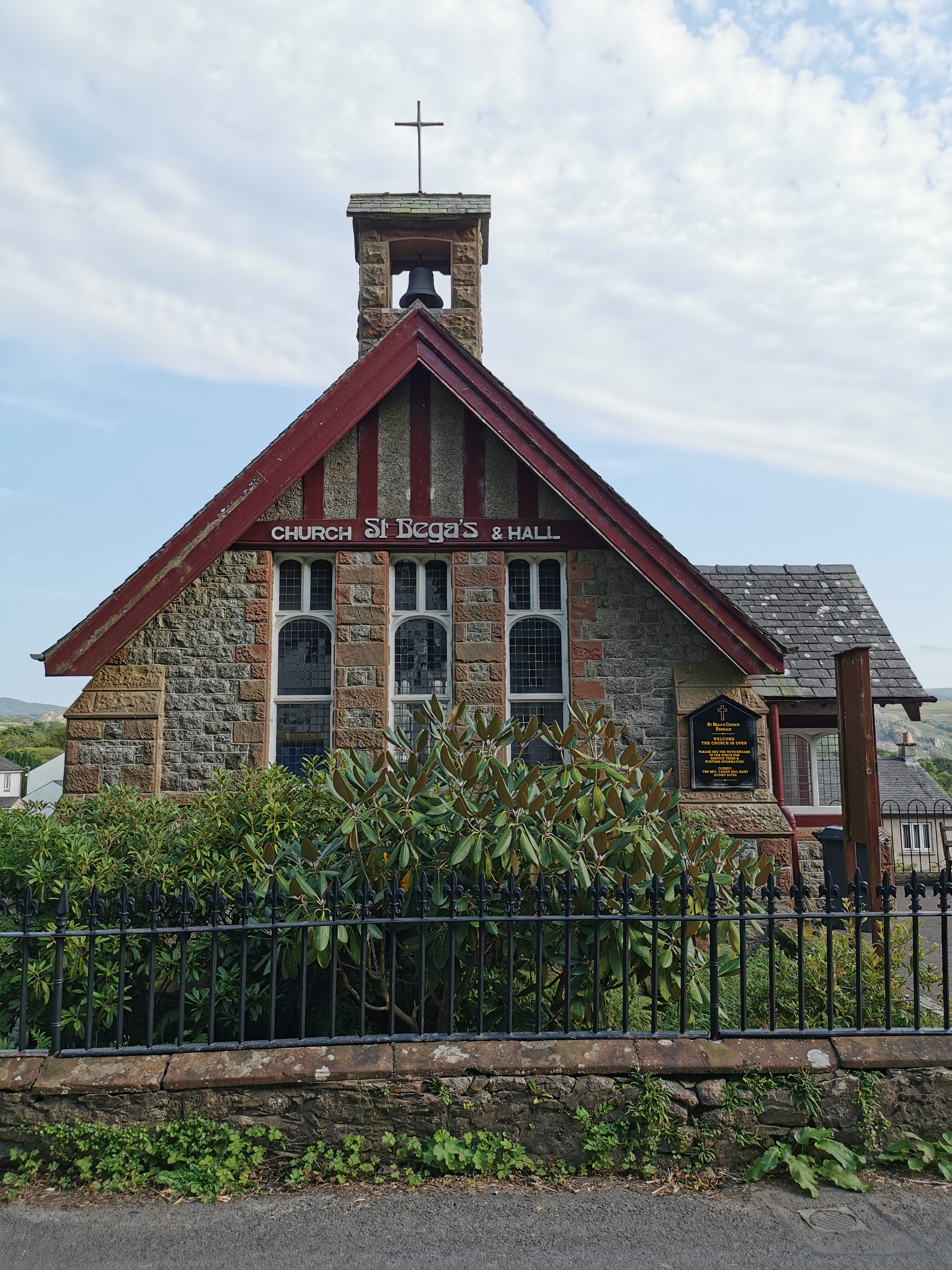
St Bega, Eskdale

St Bega is in Eskdale, Cumbria, England. It is an active Anglican parish church in the deanery of Calder, and the diocese of Carlisle. Its benefice is...
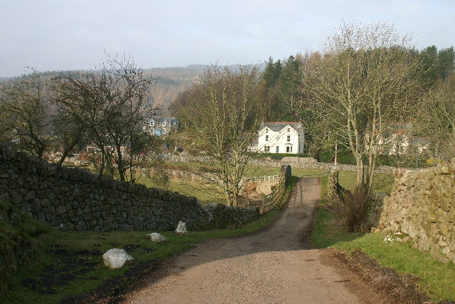
Eskdale Green

Eskdale Green is a village in Cumbria, England, 10 miles west of Coniston. Historically in Cumberland, it lies off the A595 road and is one of the few...

Nearby Amenities

Located within 500m of 54.370176,-3.3466883
Parkhouse Moss
Natural: wood
Lat/Long: 54.3724772/-3.3450306
Birks Plantation
Natural: wood
Lat/Long: 54.3719885/-3.3489894
Cropple How
Place: locality
Lat/Long: 54.3673931/-3.3428966
The data included in this document is from www.openstreetmap.org. The data is made available under ODbL.

Have you been to Birks Plantation?

Leave your review of Birks Plantation below (or comments, questions and feedback).