Chalway's Copse

Wood, Forest in Somerset Somerset West and Taunton

England

Chalway's Copse

Direction Sign - Signpost at Mount Pleasant Farm Located on the east side of the junction at Mount Pleasant Farm, southeast of Pitsford Hill, in Brompton Ralph parish. 3 arms, 1 missing, and pyramid finial. An arm PITSFORD HILL ¼ / BROMPTON RALPH 1¼ has been lost some time after 2009.

Milestone Society National ID: SO_ST1030A
Direction Sign - Signpost at Mount Pleasant Farm Credit: J Dowding

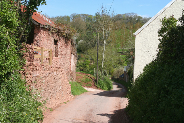
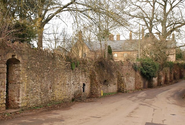
Chalway's Copse, located in Somerset, England, is a picturesque woodland area that covers an approximate area of 50 acres. Nestled in the beautiful countryside, this copse offers a tranquil and serene environment for nature enthusiasts and visitors seeking to escape the hustle and bustle of city life.

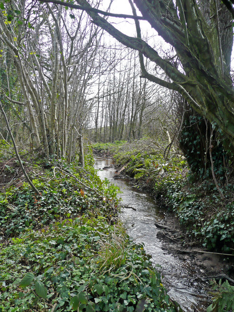
The copse is primarily composed of deciduous trees, including oak, beech, ash, and birch, which create a dense canopy providing ample shade during the summer months. The forest floor is covered with a rich carpet of ferns, mosses, and wildflowers, adding to the copse's natural beauty.

Chalway's Copse is home to a diverse range of wildlife, making it a haven for nature lovers. The copse provides a conducive habitat for various bird species, including woodpeckers, owls, and songbirds, which can be heard chirping and singing throughout the woodland. Additionally, small mammals like rabbits, squirrels, and hedgehogs can be spotted darting among the undergrowth.

The copse is crisscrossed with a network of well-maintained footpaths and trails, offering visitors the opportunity to explore the area at their own pace. These paths lead visitors through a variety of landscapes, from open glades and meadows to dense, shaded areas. The copse is also intersected by a gentle stream, adding to its charm.

Chalway's Copse is a popular destination for outdoor activities such as walking, jogging, and picnicking. It offers a peaceful retreat for families and individuals alike, providing a refreshing escape from the demands of modern life. Whether visitors are seeking a leisurely stroll or a peaceful spot to sit and reflect, Chalway's Copse offers a slice of natural beauty in the heart of Somerset.

If you have any feedback on the listing, please let us know in the comments section below.

Chalway's Copse Images

Images are sourced within 2km of 51.06802/-3.2543339 or Grid Reference ST1230. Thanks to Geograph Open Source API. All images are credited.

Direction Sign - Signpost at Mount Pleasant Farm Located on the east side of the junction at Mount Pleasant Farm, southeast of Pitsford Hill, in Brompton Ralph parish. 3 arms, 1 missing, and pyramid finial. An arm PITSFORD HILL ¼ / BROMPTON RALPH 1¼ has been lost some time after 2009.

Milestone Society National ID: SO_ST1030A
Direction Sign - Signpost at Mount Pleasant Farm
Located on the east side of the junction at Mount Pleasant Farm, southeast of Pitsford Hill, in Brompton Ralph parish. 3 arms, 1 missing, and pyramid finial. An arm PITSFORD HILL ¼ / BROMPTON RALPH 1¼ has been lost some time after 2009. Milestone Society National ID: SO_ST1030A
Direction Sign - Signpost on the B3224 south of Lydeard St Lawrence Located on the west side of the junction of the B3224 and the minor road north to the village in Lydeard St Lawrence parish. 4 arms and pyramid finial. See also <a title="https://www.geograph.org.uk/photo/2151544" href="https://www.geograph.org.uk/photo/2151544">Link</a>.

Milestone Society National ID: SO_ST1231A
Direction Sign - Signpost on the B3224 south of Lydeard St Lawrence
Located on the west side of the junction of the B3224 and the minor road north to the village in Lydeard St Lawrence parish. 4 arms and pyramid finial. See also Link. Milestone Society National ID: SO_ST1231A
Direction Sign – Signpost near Gaulden Manor Located on the northeast side of a T junction southeast of Gaulden Manor and west of Handy Cross in Lydeard St Lawrence parish. 4 arms, 1 missing, and pyramid finial. See also <a title="https://www.geograph.org.uk/photo/4099886" href="https://www.geograph.org.uk/photo/4099886">Link</a>.

Milestone Society National ID: SO_ST1131
Direction Sign – Signpost near Gaulden Manor
Located on the northeast side of a T junction southeast of Gaulden Manor and west of Handy Cross in Lydeard St Lawrence parish. 4 arms, 1 missing, and pyramid finial. See also Link. Milestone Society National ID: SO_ST1131
Fitzhead: north west from the village Landscape with woods and fields. Looking north towards the Quantocks
Fitzhead: north west from the village
Landscape with woods and fields. Looking north towards the Quantocks
Lydeard St Lawrence: Chapel Leigh Chapel Leigh is a hamlet consisting of two farms and a number of cottages. Looking east-north-east
Lydeard St Lawrence: Chapel Leigh
Chapel Leigh is a hamlet consisting of two farms and a number of cottages. Looking east-north-east
Fitzhead: limekiln near Burrow Hill Farm Looking south
Fitzhead: limekiln near Burrow Hill Farm
Looking south
Fitzhead: towards Pitsford Hill The field nearest the camera adjoins the lane from Fitzhead to Oakhampton Farm. In the distance is Willett Hill. Looking north-north-west
Fitzhead: towards Pitsford Hill
The field nearest the camera adjoins the lane from Fitzhead to Oakhampton Farm. In the distance is Willett Hill. Looking north-north-west
Hoccombe Farm Hoccombe Farm seen from the meadow behind it. Leat running in the foreground. Date: 22/04/2006.
Hoccombe Farm
Hoccombe Farm seen from the meadow behind it. Leat running in the foreground. Date: 22/04/2006.
Hoccombe Farm Hoccombe Farm and buildings, seen from the orchard.
Hoccombe Farm
Hoccombe Farm and buildings, seen from the orchard.
Burrow Hill Viewed from the bridge south of Moor Mill Farm.
Burrow Hill
Viewed from the bridge south of Moor Mill Farm.
Somerset stream One of the head streams of the Tone which arise from the Brendon Hills east of Exmoor.
Somerset stream
One of the head streams of the Tone which arise from the Brendon Hills east of Exmoor.
Cottage, Chapel Leigh The cottage is on the lane south of Chapel Leigh, in a side valley of the Halse Water.
Cottage, Chapel Leigh
The cottage is on the lane south of Chapel Leigh, in a side valley of the Halse Water.
Higher Chapel Leigh Farm The attractive farmhouse is on Chapel Leigh Lane, a no through road climbing a little valley towards Sanding's Farm.
Higher Chapel Leigh Farm
The attractive farmhouse is on Chapel Leigh Lane, a no through road climbing a little valley towards Sanding's Farm.
Track and lane, Chapel Leigh This scene can be glimpsed on the left of <a href="https://www.geograph.org.uk/photo/1741956">ST1229 : Higher Chapel Leigh Farm</a>, further up Chapel Leigh Lane, with a field access track branching off the sunken lane, which continues between banks.
Track and lane, Chapel Leigh
This scene can be glimpsed on the left of ST1229 : Higher Chapel Leigh Farm, further up Chapel Leigh Lane, with a field access track branching off the sunken lane, which continues between banks.
Sheep by Sanding's Lane Sanding's Lane is a byway that twists and turns across the countryside between Chapel Leigh Lane and Hoccombe. Here, tree-lined, it runs along two sides of a sloping pentagonal field in which sheep graze. In the background, Brimball Copse, in <a href="https://www.geograph.org.uk/gridref/ST1130">ST1130</a>, overlooks the Halse Water valley.
Sheep by Sanding's Lane
Sanding's Lane is a byway that twists and turns across the countryside between Chapel Leigh Lane and Hoccombe. Here, tree-lined, it runs along two sides of a sloping pentagonal field in which sheep graze. In the background, Brimball Copse, in ST1130, overlooks the Halse Water valley.
Approaching Hoccombe Sanding's Lane approaches Hoccombe Farm.
Approaching Hoccombe
Sanding's Lane approaches Hoccombe Farm.
Cottage at Burrow Hill Footpath WG 5/4 passes by this cottage, seen from the lane to Pitsford Hill.
Cottage at Burrow Hill
Footpath WG 5/4 passes by this cottage, seen from the lane to Pitsford Hill.
Lane to Moor Mill The lane from Burrow Hill to Moor Mill descends between hedges towards a tributary of the Halse Water.
Lane to Moor Mill
The lane from Burrow Hill to Moor Mill descends between hedges towards a tributary of the Halse Water.
Show me another place!

Chalway's Copse is located at Grid Ref: ST1230 (Lat: 51.06802, Lng: -3.2543339)

Administrative County: Somerset

District: Somerset West and Taunton

Police Authority: Avon and Somerset

What 3 Words

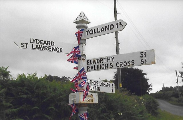
///trace.brains.unloads. Near Bishops Lydeard, Somerset

Related Wikis

Gaulden Manor

Gaulden Manor (also Gavelden or Gaveldene) is a Grade II* listed country house to the southeast of Tolland, Somerset, England. It is a double storied building...

Lydeard St Lawrence

Lydeard St Lawrence or St Lawrence Lydiard is a village and civil parish in Somerset, England, situated 7 miles (11.3 km) north west of Taunton. The village...

Fitzhead Court and The Manor

Fitzhead Court and The Manor in Fitzhead, Somerset, England was built in the late 16th century and has now been split into two buildings. It is a Grade...

Ruby Country

Ruby Country is the name given to the rural inland hinterland of north-west Devon, UK. It covers 45 parishes around the market towns of Holsworthy and...

Nearby Amenities

Located within 500m of 51.06802,-3.2543339
West Leigh
Place: hamlet
Lat/Long: 51.0670612/-3.2578513
Ford: yes
Lat/Long: 51.0644375/-3.2581933
Give Way
Direction: backward
Lat/Long: 51.069324/-3.2476039
Brand: National Grid
Brand Wikidata: Q1465461
Material: wood
Operator: National Grid Electricity Distribution Plc
Operator Old: Western Power Distribution
Operator Wikidata: Q7988183
Owner: National Grid Electricity Distribution (South West) Plc
Owner Wikidata: Q114397866
Power: pole
Lat/Long: 51.068664/-3.2543269
Brand: National Grid
Brand Wikidata: Q1465461
Design: h-frame
Devices: 1
Frequency: 50
Guyed: yes
Line Management: split
Material: wood
Operator: National Grid Electricity Distribution Plc
Operator Old: Western Power Distribution
Operator Wikidata: Q7988183
Owner: National Grid Electricity Distribution (South West) Plc
Owner Wikidata: Q114397866
Phases: 3
Power: pole
Transformer: distribution
Lat/Long: 51.0684124/-3.25705
Brand: National Grid
Brand Wikidata: Q1465461
Material: wood
Operator: National Grid Electricity Distribution Plc
Operator Old: Western Power Distribution
Operator Wikidata: Q7988183
Owner: National Grid Electricity Distribution (South West) Plc
Owner Wikidata: Q114397866
Power: pole
Lat/Long: 51.0685186/-3.2557411
Brand: National Grid
Brand Wikidata: Q1465461
Material: wood
Operator: National Grid Electricity Distribution Plc
Operator Old: Western Power Distribution
Operator Wikidata: Q7988183
Owner: National Grid Electricity Distribution (South West) Plc
Owner Wikidata: Q114397866
Power: pole
Lat/Long: 51.0687411/-3.2533526
Brand: National Grid
Brand Wikidata: Q1465461
Material: wood
Operator: National Grid Electricity Distribution Plc
Operator Old: Western Power Distribution
Operator Wikidata: Q7988183
Owner: National Grid Electricity Distribution (South West) Plc
Owner Wikidata: Q114397866
Power: pole
Lat/Long: 51.0688169/-3.252336
Brand: National Grid
Brand Wikidata: Q1465461
Material: wood
Operator: National Grid Electricity Distribution Plc
Operator Old: Western Power Distribution
Operator Wikidata: Q7988183
Owner: National Grid Electricity Distribution (South West) Plc
Owner Wikidata: Q114397866
Power: pole
Lat/Long: 51.0689696/-3.2506543
Brand: National Grid
Brand Wikidata: Q1465461
Material: wood
Operator: National Grid Electricity Distribution Plc
Operator Old: Western Power Distribution
Operator Wikidata: Q7988183
Owner: National Grid Electricity Distribution (South West) Plc
Owner Wikidata: Q114397866
Power: pole
Lat/Long: 51.0690537/-3.2496645
Brand: National Grid
Brand Wikidata: Q1465461
Material: wood
Operator: National Grid Electricity Distribution Plc
Operator Old: Western Power Distribution
Operator Wikidata: Q7988183
Owner: National Grid Electricity Distribution (South West) Plc
Owner Wikidata: Q114397866
Power: pole
Lat/Long: 51.0691271/-3.2487968
Brand: National Grid
Brand Wikidata: Q1465461
Cables: 3
Location: outdoor
Material: wood
Operator: National Grid Electricity Distribution Plc
Operator Old: Western Power Distribution
Operator Wikidata: Q7988183
Owner: National Grid Electricity Distribution (South West) Plc
Owner Wikidata: Q114397866
Power: switch
Switch: mechanical
Lat/Long: 51.0692282/-3.2477038
Brand: National Grid
Brand Wikidata: Q1465461
Guyed: yes
Material: wood
Operator: National Grid Electricity Distribution Plc
Operator Old: Western Power Distribution
Operator Wikidata: Q7988183
Owner: National Grid Electricity Distribution (South West) Plc
Owner Wikidata: Q114397866
Power: pole
Lat/Long: 51.0695215/-3.2476656
Brand: National Grid
Brand Wikidata: Q1465461
Material: wood
Operator: National Grid Electricity Distribution Plc
Operator Old: Western Power Distribution
Operator Wikidata: Q7988183
Owner: National Grid Electricity Distribution (South West) Plc
Owner Wikidata: Q114397866
Power: pole
Lat/Long: 51.0673607/-3.2592192
Brand: National Grid
Brand Wikidata: Q1465461
Material: wood
Operator: National Grid Electricity Distribution Plc
Operator Old: Western Power Distribution
Operator Wikidata: Q7988183
Owner: National Grid Electricity Distribution (South West) Plc
Owner Wikidata: Q114397866
Power: pole
Lat/Long: 51.0667749/-3.2599729
Give Way
Direction: backward
Lat/Long: 51.0670535/-3.2578305
White Hill
Ele: 135
Place: locality
Lat/Long: 51.071447/-3.254461
Disused: yes
Historic: yes
Man Made: kiln
Product: lime
Lat/Long: 51.0721464/-3.255735
Guyed: yes
Material: wood
Operator: Wessex Water
Power: pole
Lat/Long: 51.0693559/-3.255908
Brand: National Grid
Brand Wikidata: Q1465461
Material: wood
Operator: National Grid Electricity Distribution Plc
Operator Old: Western Power Distribution
Operator Wikidata: Q7988183
Owner: National Grid Electricity Distribution (South West) Plc
Owner Wikidata: Q114397866
Power: pole
Lat/Long: 51.067198/-3.2578003
Brand: National Grid
Brand Wikidata: Q1465461
Material: wood
Operator: National Grid Electricity Distribution Plc
Operator Old: Western Power Distribution
Operator Wikidata: Q7988183
Owner: National Grid Electricity Distribution (South West) Plc
Owner Wikidata: Q114397866
Power: pole
Lat/Long: 51.0678343/-3.2586265
Brand: National Grid
Brand Wikidata: Q1465461
Material: wood
Operator: National Grid Electricity Distribution Plc
Operator Old: Western Power Distribution
Operator Wikidata: Q7988183
Owner: National Grid Electricity Distribution (South West) Plc
Owner Wikidata: Q114397866
Power: pole
Lat/Long: 51.0674896/-3.2578292
Brand: National Grid
Brand Wikidata: Q1465461
Guyed: yes
Material: wood
Operator: National Grid Electricity Distribution Plc
Operator Old: Western Power Distribution
Operator Wikidata: Q7988183
Owner: National Grid Electricity Distribution (South West) Plc
Owner Wikidata: Q114397866
Power: pole
Lat/Long: 51.067991/-3.2578459
Brand: National Grid
Brand Wikidata: Q1465461
Guyed: yes
Material: wood
Operator: National Grid Electricity Distribution Plc
Operator Old: Western Power Distribution
Operator Wikidata: Q7988183
Owner: National Grid Electricity Distribution (South West) Plc
Owner Wikidata: Q114397866
Power: pole
Lat/Long: 51.0682485/-3.2577433
Brand: National Grid
Brand Wikidata: Q1465461
Guyed: yes
Material: wood
Operator: National Grid Electricity Distribution Plc
Operator Old: Western Power Distribution
Operator Wikidata: Q7988183
Owner: National Grid Electricity Distribution (South West) Plc
Owner Wikidata: Q114397866
Power: pole
Lat/Long: 51.0682986/-3.2574778
Brand: National Grid
Brand Wikidata: Q1465461
Guyed: yes
Material: wood
Operator: National Grid Electricity Distribution Plc
Operator Old: Western Power Distribution
Operator Wikidata: Q7988183
Owner: National Grid Electricity Distribution (South West) Plc
Owner Wikidata: Q114397866
Power: pole
Lat/Long: 51.0683349/-3.2579754
Access: private
Entrance: yes
Lat/Long: 51.0684712/-3.2586521
Watering Place
Access: private
Lat/Long: 51.0700835/-3.2516561
The data included in this document is from www.openstreetmap.org. The data is made available under ODbL.

Have you been to Chalway's Copse?

Leave your review of Chalway's Copse below (or comments, questions and feedback).