Bridge Wood
Wood, Forest in Cumberland Copeland
England
Bridge Wood
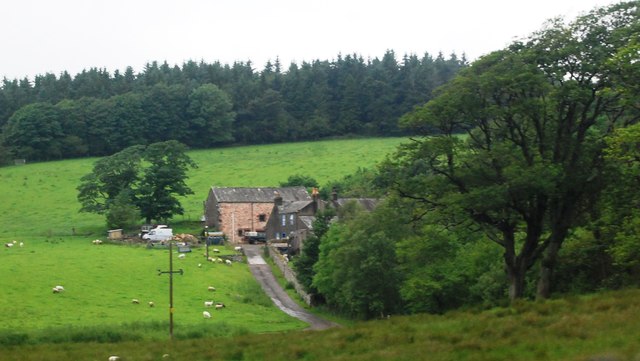
Bridge Wood is a serene and picturesque forest located in the heart of Cumberland, England. Covering an expansive area of approximately 500 acres, this woodland is a nature lover's paradise. The forest is situated near the village of Bridge, and it derives its name from the historic bridge that spans across the River Caldew, connecting the village to the woodland.
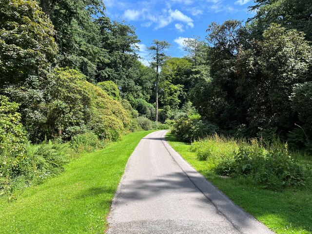
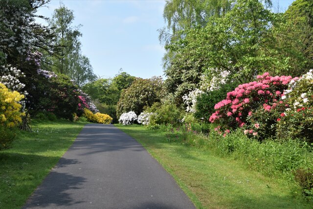
Bridge Wood is home to a diverse range of flora and fauna, making it a haven for wildlife enthusiasts and botany enthusiasts alike. The forest is characterized by a mix of deciduous and coniferous trees, with oak, beech, and birch being the predominant species. These towering trees create a dense canopy, allowing only dappled sunlight to filter through to the forest floor. This provides an ideal habitat for a variety of woodland plants, including bluebells, primroses, and foxgloves, which paint the forest with vibrant colors during the spring and summer months.
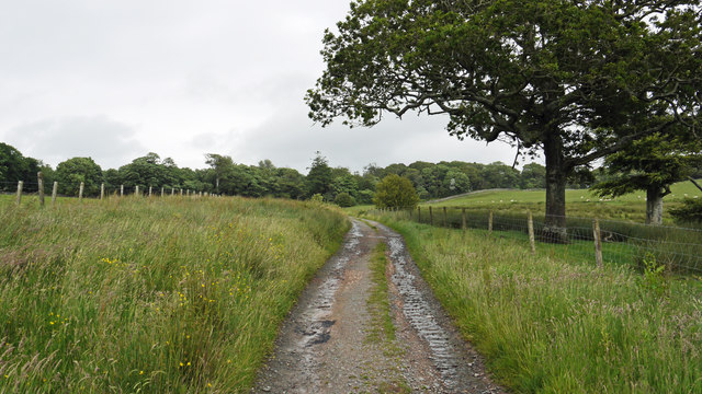
The woodland is crisscrossed by a network of trails and footpaths, making it a popular destination for hikers, walkers, and nature enthusiasts. These pathways lead visitors through enchanting groves, babbling brooks, and tranquil meadows, offering a truly immersive experience in nature. The forest also houses several picnic areas and a small visitor center, providing amenities for families and groups looking to spend a day surrounded by nature.
Bridge Wood is not only a haven for wildlife and outdoor enthusiasts but also holds great historical significance. The forest has witnessed centuries of human activity, and remnants of ancient settlements and historic structures can still be found within its boundaries. These remnants serve as a testament to the rich cultural heritage of the region and provide a glimpse into the lives of those who once called this woodland their home.
In conclusion, Bridge Wood in Cumberland is a captivating forest that offers a blend of natural beauty, recreational opportunities, and historical intrigue. Its tranquility and diverse ecosystem make it a must-visit destination for those seeking solace in nature or a
If you have any feedback on the listing, please let us know in the comments section below.
Bridge Wood Images
Images are sourced within 2km of 54.355272/-3.3660357 or Grid Reference SD1196. Thanks to Geograph Open Source API. All images are credited.


Bridge Wood is located at Grid Ref: SD1196 (Lat: 54.355272, Lng: -3.3660357)
Administrative County: Cumbria
District: Copeland
Police Authority: Cumbria
What 3 Words
///energetic.replayed.asteroid. Near Seascale, Cumbria
Nearby Locations
Related Wikis

St Michael's Church, Muncaster
St Michael's Church is in the grounds of Muncaster Castle, near Ravenglass, Cumbria, England. It is an active Anglican parish church in the deanery of...

Muncaster Castle
Muncaster Castle is a privately owned castle overlooking the River Esk, about a mile east of the west-coastal town of Ravenglass in Cumbria, England. It...

Muncaster
Muncaster is a civil parish in Cumbria, North West England. The parish is 41 miles (66 km) south west of the city of Carlisle, in the Copeland district...

St John's Church, Waberthwaite
St John's Church is situated on the south bank of the River Esk in the hamlet of Hall Waberthwaite in the former civil parish of Waberthwaite (now part...

Muncaster Fell
Muncaster Fell is a fell at the far western edge of the Lake District National Park, in Cumbria, England. Muncaster Fell is a long, narrow ridge of land...

Broad Oak, Cumbria
Broad Oak is a hamlet in Cumbria, England. It is located along the A595 road, 14.4 miles (23.2 km) by road south of Egremont. == See also == List of places...

Miteside Halt railway station
Miteside Halt railway station is a railway station on the 15" gauge Ravenglass & Eskdale Railway in Cumbria, England. It is located where public footpath...

Muncaster Mill railway station
Muncaster Mill railway station is a railway station on the 15 in (381 mm) gauge Ravenglass & Eskdale Railway in Cumbria, England. The station is located...
Nearby Amenities
Located within 500m of 54.355272,-3.3660357Have you been to Bridge Wood?
Leave your review of Bridge Wood below (or comments, questions and feedback).