Gaterigghow Coppice

Wood, Forest in Cumberland Copeland

England

Gaterigghow Coppice

Farm track east of Rainors A farm track passing between the farms of Rainors and Julian Holme. A public bridleway follows the track.
Farm track east of Rainors Credit: Graham Robson

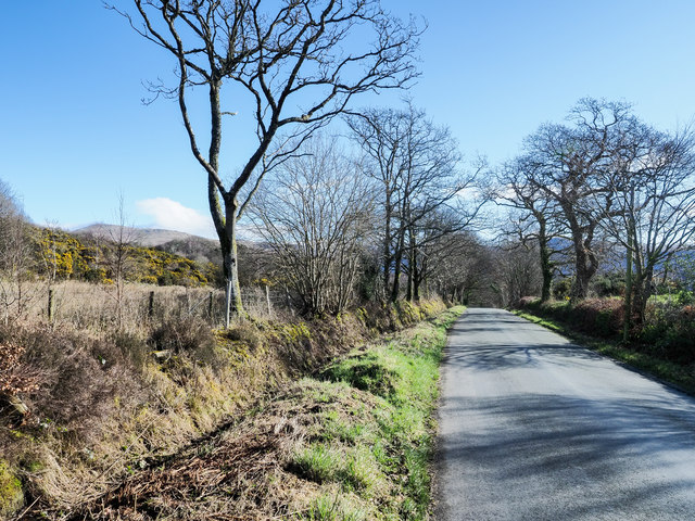
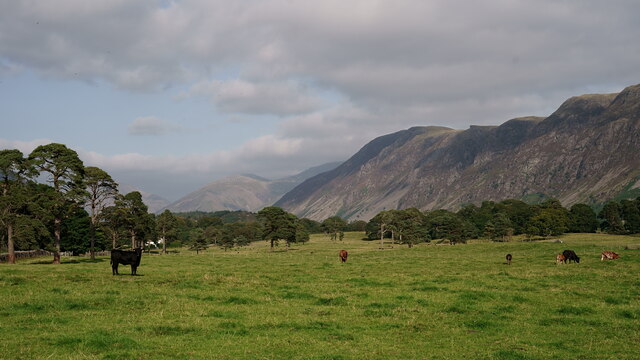
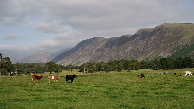
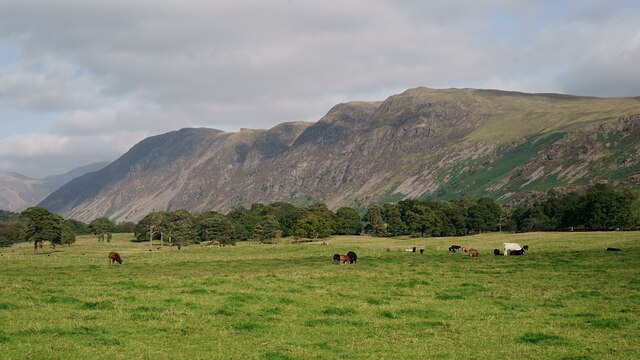
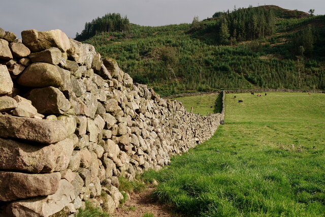
Gaterigghow Coppice is a picturesque woodland located in the county of Cumberland, in the northwest region of England. Situated in the heart of the Lake District National Park, this ancient forest covers an area of approximately 100 hectares and is renowned for its natural beauty and diverse wildlife.

The coppice, which is a term used to describe a woodland area managed for the production of timber, has a rich history dating back centuries. It was once an important source of wood for the local community, providing timber for construction, fuel, and even charcoal production. Today, it continues to be managed sustainably, ensuring the preservation of its unique ecosystem.

The wood is dominated by a mix of deciduous tree species, including oak, birch, ash, and beech. The dense canopy created by these trees provides a sheltered and tranquil atmosphere, making it a popular destination for nature lovers, hikers, and birdwatchers. The forest floor is carpeted with a diverse range of plants and wildflowers, adding to its visual appeal.

Gaterigghow Coppice is also home to a variety of wildlife, including red squirrels, roe deer, and a wide array of bird species. Visitors may be lucky enough to spot woodpeckers, nuthatches, and even the elusive tawny owl. The forest is a designated Site of Special Scientific Interest (SSSI), recognizing its ecological importance and the need for its protection.

Overall, Gaterigghow Coppice offers a unique opportunity to immerse oneself in the natural beauty of the Lake District. Whether it's a leisurely walk through the woods, a picnic amidst the trees, or a chance to observe the local wildlife, the coppice provides a truly enchanting experience for all who visit.

If you have any feedback on the listing, please let us know in the comments section below.

Gaterigghow Coppice Images

Images are sourced within 2km of 54.423896/-3.3722636 or Grid Reference NY1104. Thanks to Geograph Open Source API. All images are credited.

Farm track east of Rainors A farm track passing between the farms of Rainors and Julian Holme. A public bridleway follows the track.
Farm track east of Rainors
A farm track passing between the farms of Rainors and Julian Holme. A public bridleway follows the track.
Hawkbarrow Farm Looking down the short lane to the farm buildings and house at Hawkbarrow Farm. The large pond in front of the steading appears to be a recent addition.
Hawkbarrow Farm
Looking down the short lane to the farm buildings and house at Hawkbarrow Farm. The large pond in front of the steading appears to be a recent addition.
Minor road north of Hawkbarrow Farm The minor road passing to the north of Hawkbarrow Farm.
Minor road north of Hawkbarrow Farm
The minor road passing to the north of Hawkbarrow Farm.
Minor road heading west The road connects Wasdale Head with Gosforth.
Seatallan is the hill on the horizon to the left of the most prominent tree.
Minor road heading west
The road connects Wasdale Head with Gosforth. Seatallan is the hill on the horizon to the left of the most prominent tree.
Julian Holme Farm The Denwoods are clearly proud of their herd.
Julian Holme Farm
The Denwoods are clearly proud of their herd.
Hawkbarrow Farm Just off the minor road that leads from Gosforth to Nether Wasdale.
Hawkbarrow Farm
Just off the minor road that leads from Gosforth to Nether Wasdale.
A camping field at Church Stile site
Wasdale View Looking towards The Screes from behind the wall boundary.
Wasdale View
Looking towards The Screes from behind the wall boundary.
Wasdale View Looking towards The Screes from behind the wall boundary.
Wasdale View
Looking towards The Screes from behind the wall boundary.
Wasdale View Looking towards The Screes from behind the wall boundary.
Wasdale View
Looking towards The Screes from behind the wall boundary.
Wasdale Wall Looking towards the road which leads to Nether Wasdale.
Wasdale Wall
Looking towards the road which leads to Nether Wasdale.
Wasdale Wall Looking in the direction of Latterbarrow. A plantation of diseased larch was felled in 2013 and subsequently re-planted (probably spruce).
Wasdale Wall
Looking in the direction of Latterbarrow. A plantation of diseased larch was felled in 2013 and subsequently re-planted (probably spruce).
Wasdale View from a footpath in Nether Wasdale, with Great Gable in the centre of picture.
Wasdale
View from a footpath in Nether Wasdale, with Great Gable in the centre of picture.
Wasdale View from a footpath in Nether Wasdale, with The Screes to the right of picture.
Wasdale
View from a footpath in Nether Wasdale, with The Screes to the right of picture.
Wasdale View from a footpath in Nether Wasdale, with Great Gable towards the right of picture.
Wasdale
View from a footpath in Nether Wasdale, with Great Gable towards the right of picture.
Wasdale View towards Yewbarrow, from the path at the base of Latterbarrow.
Wasdale
View towards Yewbarrow, from the path at the base of Latterbarrow.
Wasdale View from a footpath in Nether Wasdale. Great Gable is to the right of picture and 'The Flass' is the white building to the extreme left.
Wasdale
View from a footpath in Nether Wasdale. Great Gable is to the right of picture and 'The Flass' is the white building to the extreme left.
Wasdale View towards The Screes, from a footpath in Nether Wasdale.
Wasdale
View towards The Screes, from a footpath in Nether Wasdale.
Show me another place!

Gaterigghow Coppice is located at Grid Ref: NY1104 (Lat: 54.423896, Lng: -3.3722636)

Administrative County: Cumbria

District: Copeland

Police Authority: Cumbria

What 3 Words

///impaled.jammy.cringe. Near Seascale, Cumbria

Related Wikis

River Bleng

The River Bleng is a tributary of the River Irt in the county of Cumbria in northern England.The river gives its name to the valley that it flows through...

Borough of Copeland

The Borough of Copeland was a local government district with borough status in western Cumbria, England. Its council was based in Whitehaven. It was...

Copeland (UK Parliament constituency)

Copeland is a constituency in Cumbria created in 1983 and represented in the House of Commons of the UK Parliament. The constituency is represented in...

Nether Wasdale

Nether Wasdale is a village in Cumbria, England, located in the valley and civil parish of Wasdale, near the River Irt and just over a mile to the west...

St Michael & All Angels, Nether Wasdale

St Michael & All Angels' Church in Nether Wasdale, Cumbria, England, is an active Anglican parish church in the deanery of Calder, and the diocese of Carlisle...

Wasdale

Wasdale (; traditionally ) is a valley and civil parish in the western part of the Lake District National Park in Cumbria, England. The River Irt flows...

Wasdale, Eskdale and Duddon

Wasdale, Eskdale and Duddon is an area of protected countryside, now held as National Trust property: it is part of the Lake District, located in south...

Bamse's Wood

Bamse's Wood is a newly planted forest and nature reserve that sits between Gosforth and Nether Wasdale in the Lake District, Cumbria, England. The 17...

Nearby Amenities

Located within 500m of 54.423896,-3.3722636
Foxbield Wood
Natural: wood
Lat/Long: 54.420378/-3.3736727
Gaterigghow
Place: locality
Lat/Long: 54.4229801/-3.3768016
Power: pole
Lat/Long: 54.4253491/-3.3651381
Power: pole
Lat/Long: 54.4257847/-3.3668721
Power: pole
Lat/Long: 54.4262337/-3.3687071
Power: pole
Lat/Long: 54.4272558/-3.3696694
Power: pole
Lat/Long: 54.4206474/-3.3775841
Power: pole
Lat/Long: 54.4213602/-3.3768866
Power: pole
Lat/Long: 54.422082/-3.376174
The data included in this document is from www.openstreetmap.org. The data is made available under ODbL.

Have you been to Gaterigghow Coppice?

Leave your review of Gaterigghow Coppice below (or comments, questions and feedback).