Calfclose Wood

Wood, Forest in Cumberland Copeland

England

Calfclose Wood

Whitecroft, Santon Santon is a tiny hamlet about half a mile from Santon Bridge on the road to Gosforth. This row of cottages, which includes holiday lets, is the most prominent building.
Whitecroft, Santon Credit: Stephen McKay

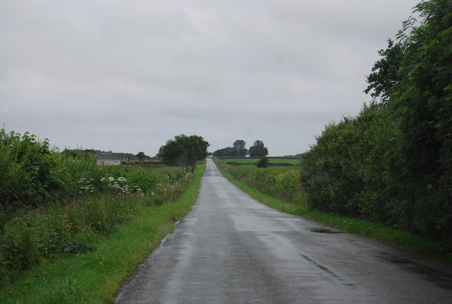
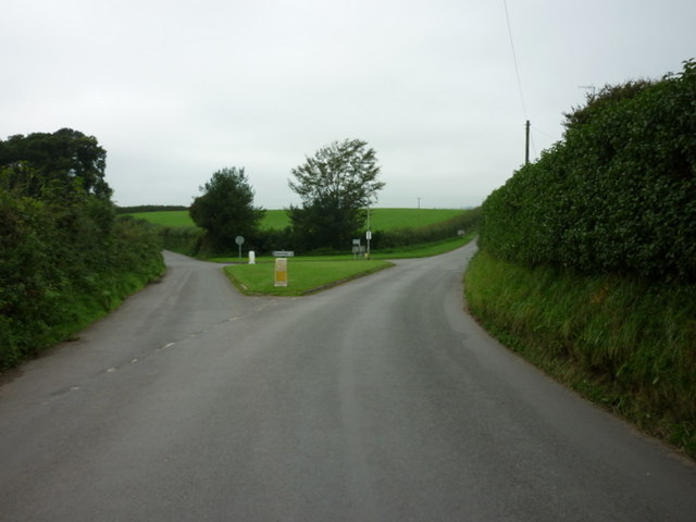
Calfclose Wood is a picturesque woodland located in the county of Cumberland, England. Situated in the heart of the Lake District National Park, this enchanting forest covers an area of approximately 200 acres. The wood is nestled between the beautiful valleys of Eskdale and Wasdale, offering visitors stunning views of the surrounding mountains and lush green landscapes.

Calfclose Wood is predominantly composed of native broadleaf trees, including oak, ash, birch, and beech. These towering trees create a dense canopy, providing shelter for a diverse range of wildlife. The woodland floor is adorned with a vibrant carpet of wildflowers, ferns, and mosses, adding to its natural splendor.

As visitors explore the woodland, they will come across a network of well-maintained footpaths, allowing for easy access to the various attractions within. One such attraction is the picturesque Calfclose Bay, a tranquil spot where visitors can relax and enjoy the soothing sounds of the nearby cascading waterfalls.

Nature enthusiasts will be delighted by the abundance of wildlife that calls Calfclose Wood home. The woodland provides a sanctuary for a variety of bird species, including woodpeckers, owls, and various songbirds. If lucky, visitors may even catch a glimpse of red deer, foxes, or squirrels, which are known to frequent the area.

Calfclose Wood is not only a haven for wildlife but also a popular destination for outdoor activities such as hiking and picnicking. The carefully maintained paths offer an opportunity for visitors to immerse themselves in the beauty of nature while enjoying a leisurely stroll through the wood.

In conclusion, Calfclose Wood in Cumberland is a captivating forest that showcases the natural beauty of the Lake District National Park. With its diverse flora and fauna, breathtaking scenery, and recreational opportunities, it is a must-visit destination for nature lovers and outdoor enthusiasts alike.

If you have any feedback on the listing, please let us know in the comments section below.

Calfclose Wood Images

Images are sourced within 2km of 54.389751/-3.3730334 or Grid Reference NY1000. Thanks to Geograph Open Source API. All images are credited.

Whitecroft, Santon Santon is a tiny hamlet about half a mile from Santon Bridge on the road to Gosforth. This row of cottages, which includes holiday lets, is the most prominent building.
Whitecroft, Santon
Santon is a tiny hamlet about half a mile from Santon Bridge on the road to Gosforth. This row of cottages, which includes holiday lets, is the most prominent building.
Graveyard Of St Paul's Church The graveyard contains the historic Irton High Cross and a copy in the form of the Brocklebank Memorial
Graveyard Of St Paul's Church
The graveyard contains the historic Irton High Cross and a copy in the form of the Brocklebank Memorial
Road junction in Santon
Irton Cross Situated in the graveyard of St Paul's Church, the Irton Cross is 10 feet tall and was erected in the early 9th Century. The cross has fine carvings and is one of the most important crosses in Cumbria.
Irton Cross
Situated in the graveyard of St Paul's Church, the Irton Cross is 10 feet tall and was erected in the early 9th Century. The cross has fine carvings and is one of the most important crosses in Cumbria.
Church of St Paul, Irton Built in 1857 with additions in 1866 and 1872, St Paul’s Church stands in an isolated position and is a good example of a small Victorian Church. It is a Grade II* Listed Building. <span class="nowrap"><a title="http://www.britishlistedbuildings.co.uk/101086671-church-of-st-paul-irton-with-santon#.WYzZbTGWw5s" rel="nofollow ugc noopener" href="http://www.britishlistedbuildings.co.uk/101086671-church-of-st-paul-irton-with-santon#.WYzZbTGWw5s">Link</a><img style="margin-left:2px;" alt="External link" title="External link - shift click to open in new window" src="https://s1.geograph.org.uk/img/external.png" width="10" height="10"/></span>
Church of St Paul, Irton
Built in 1857 with additions in 1866 and 1872, St Paul’s Church stands in an isolated position and is a good example of a small Victorian Church. It is a Grade II* Listed Building. LinkExternal link
Old Wayside Cross in St Pauls churchyard, Irton Irton Cross, in St Pauls churchyard, parish of Irton with Santon (Copeland District), South side of church.

Scheduled Monument.
List Entry Number: 1012642 <span class="nowrap"><a title="https://historicengland.org.uk/listing/the-list/list-entry/1012642" rel="nofollow ugc noopener" href="https://historicengland.org.uk/listing/the-list/list-entry/1012642">Link</a><img style="margin-left:2px;" alt="External link" title="External link - shift click to open in new window" src="https://s1.geograph.org.uk/img/external.png" width="10" height="10"/></span>

To be surveyed

Milestone Society National ID: CBCL_IRT
Old Wayside Cross in St Pauls churchyard, Irton
Irton Cross, in St Pauls churchyard, parish of Irton with Santon (Copeland District), South side of church. Scheduled Monument. List Entry Number: 1012642 LinkExternal link To be surveyed Milestone Society National ID: CBCL_IRT
Straight road near Parsonage Field
St Paul's Church Irton Viewed from the public footpath. Some geographs name this church St Peters, St Pauls or St Paul's. St Paul's Church is an excellent example of a Victorian Church. The existing church was demolished in 1865 and work started on this one. In the churchyard is the 10 feet high Irton Cross erected in the early 9th Century.

In the tower is a peal of eight bells and there are memorials to the Brocklebank family, and to Admiral Lutwidge. There are many stained glass windows in the church.
Source: Visit Cumbria
St Paul's Church Irton
Viewed from the public footpath. Some geographs name this church St Peters, St Pauls or St Paul's. St Paul's Church is an excellent example of a Victorian Church. The existing church was demolished in 1865 and work started on this one. In the churchyard is the 10 feet high Irton Cross erected in the early 9th Century. In the tower is a peal of eight bells and there are memorials to the Brocklebank family, and to Admiral Lutwidge. There are many stained glass windows in the church. Source: Visit Cumbria
The road junction at Santon
St Paul's Church, Irton
St Paul's Church, Irton, War Memorial
St Paul's Church, Irton, Lychgate
St Paul's Church, Irton, Stained glass window
St Paul's Church, Irton, Font
St Paul's Church, Irton, War Memorial
St Paul's Church, Irton, Banner
St Paul's Church, Irton, Banner and Memorial
Show me another place!

Calfclose Wood is located at Grid Ref: NY1000 (Lat: 54.389751, Lng: -3.3730334)

Administrative County: Cumbria

District: Copeland

Police Authority: Cumbria

What 3 Words

///continued.fines.blanket. Near Seascale, Cumbria

Related Wikis

Murthwaite Halt railway station

Murthwaite Halt railway station is a small intermediate railway station on the 15" gauge Ravenglass & Eskdale Railway in Cumbria, England. It is named...

Santon Bridge

Santon Bridge is a small village in Copeland, Cumbria, England, at a bridge over the River Irt. The civil parish is called Irton with Santon. The population...

Irton with Santon

Irton with Santon is a civil parish in Copeland, Cumbria, England, which includes the village of Santon Bridge. It has a parish council. It had a population...

Irton Pike

Irton Pike is a hill in the west of the English Lake District, near Santon Bridge, Cumbria. It is the subject of a chapter of Alfred Wainwright's book...
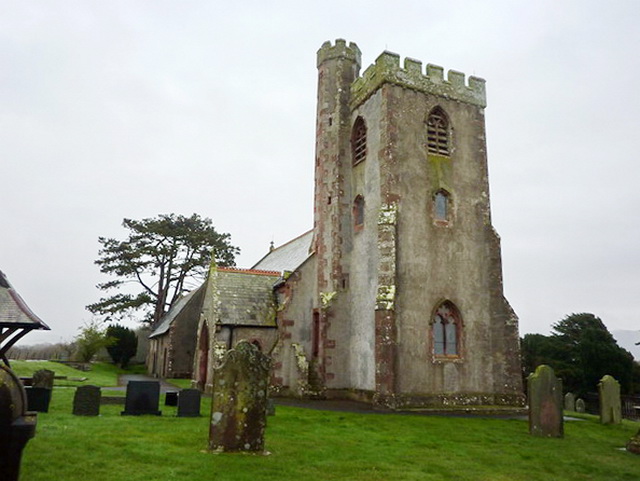
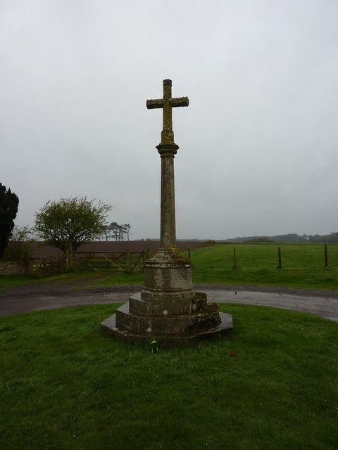
Irton Cross

Irton Cross is an Anglo-Saxon cross in the graveyard of St Paul's Church, in the parish of Irton with Santon, Cumbria, England. Dating from the early...
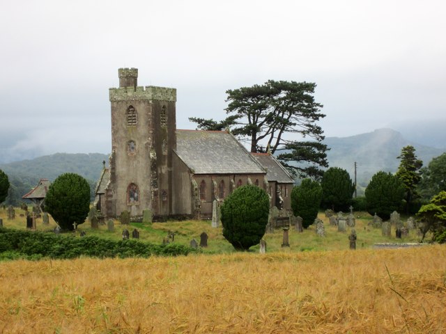
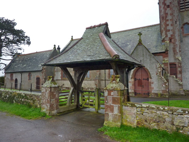
St Paul, Irton

St Paul, Irton is an active parish church in the civil parish of Irton with Santon, Cumbria, England. It is in the Calder Deanery of the Anglican diocese...

Muncaster Fell

Muncaster Fell is a fell at the far western edge of the Lake District National Park, in Cumbria, England. Muncaster Fell is a long, narrow ridge of land...

Miteside Halt railway station

Miteside Halt railway station is a railway station on the 15" gauge Ravenglass & Eskdale Railway in Cumbria, England. It is located where public footpath...

Nearby Amenities

Located within 500m of 54.389751,-3.3730334
Bus Stop
The Lodge-Irton Hall
Naptan AtcoCode: 090050111344
Naptan Bearing: N
Naptan BusStopType: CUS
Naptan CommonName: The Lodge-Irton Hall
Naptan Indicator: o/s
Naptan Landmark: The Lodge Irton Hall
Naptan NaptanCode: cumatwgp
Naptan Street: No name
Naptan Verified: no
Source: naptan_import
Lat/Long: 54.3919236/-3.3784616
Post Box
Brand: Royal Mail
Brand Wikidata: Q638098
Mapillary: 4578112312209234
Operator: Royal Mail
Operator Wikidata: Q638098
Post Box Mounting: pier
Post Box Type: lamp
Ref: CA19 76
Survey Date: 2021-09-15
Lat/Long: 54.3892269/-3.3791014
Barrier: stile
Lat/Long: 54.3890822/-3.3803927
Barley Croft
Place: locality
Lat/Long: 54.3932465/-3.3690102
Horseclose Wood
Natural: wood
Lat/Long: 54.3923496/-3.3671186
Barrier: stile
Lat/Long: 54.38676/-3.369533
Barrier: stile
Lat/Long: 54.3869539/-3.3692502
Parkgate
Place: locality
Lat/Long: 54.3896856/-3.3671866
Information: guidepost
Tourism: information
Lat/Long: 54.3884767/-3.3728509
Information: route_marker
Tourism: information
Lat/Long: 54.3901078/-3.3679465
Information: route_marker
Tourism: information
Lat/Long: 54.3894515/-3.3681179
Barrier: stile
Lat/Long: 54.3856648/-3.3735532
Sanitary Dump Station
Access: customers
Fee: no
Opening Hours: 24/7
Sanitary Dump Station Basin: yes
Lat/Long: 54.3893362/-3.3676447
Drinking Water
Lat/Long: 54.3893128/-3.3682452
Drinking Water
Indoor: yes
Lat/Long: 54.3892842/-3.3679326
Drinking Water
Lat/Long: 54.3889197/-3.3676687
Drinking Water
Lat/Long: 54.3893363/-3.3679875
Power: pole
Lat/Long: 54.387576/-3.3673809
Power: pole
Lat/Long: 54.3881507/-3.3681412
Power: pole
Lat/Long: 54.3888142/-3.3690292
Power: pole
Lat/Long: 54.3893269/-3.3704316
Power: pole
Lat/Long: 54.3896386/-3.3712701
Power: pole
Lat/Long: 54.3902034/-3.3717922
Power: pole
Lat/Long: 54.3908491/-3.3723581
Power: pole
Lat/Long: 54.3913473/-3.3738254
Power: pole
Lat/Long: 54.391608/-3.3746162
Power: pole
Lat/Long: 54.392094/-3.3760587
Power: pole
Lat/Long: 54.3922859/-3.3772154
Power: pole
Lat/Long: 54.3923658/-3.3781719
The data included in this document is from www.openstreetmap.org. The data is made available under ODbL.

Have you been to Calfclose Wood?

Leave your review of Calfclose Wood below (or comments, questions and feedback).