The Belt

Wood, Forest in Somerset Somerset West and Taunton

England

The Belt

Liddymore Lane or Doniford Road? I am in no doubt as to the location of this photo, but OpenStreetMap labels it Liddymore Lane while the OS and Google Map call it Doniford Road. What do locals call it?
Liddymore Lane or Doniford Road? Credit: Stephen Craven

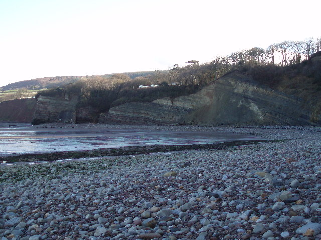
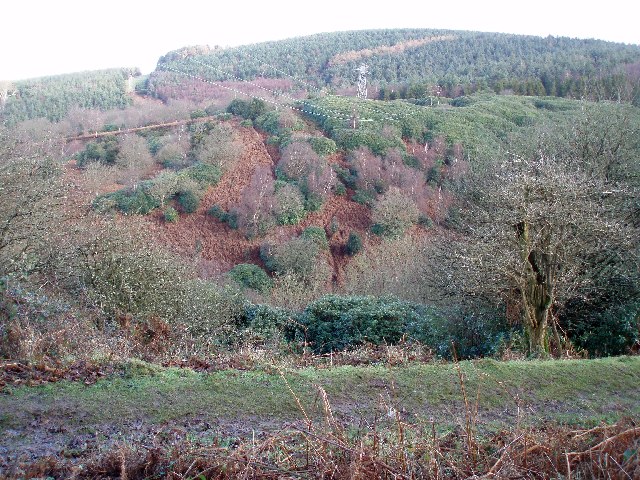
The Belt, Somerset, also referred to as Wood or Forest, is a picturesque and diverse area located in the county of Somerset, England. Nestled amidst the rolling hills and valleys of the region, The Belt boasts a rich natural landscape that spans over a vast expanse of approximately 200 square miles.

The area is characterized by its dense woodlands, encompassing a variety of tree species such as oak, beech, and ash. These ancient woodlands provide a haven for wildlife, with numerous species of birds, mammals, and insects inhabiting the area. The Belt is particularly renowned for its diverse bird population, making it a popular destination for birdwatchers and nature enthusiasts.

In addition to its woodlands, The Belt is also home to several rivers and streams, which meander through the landscape, adding to its beauty and tranquility. The rivers not only serve as a scenic backdrop but also provide habitats for aquatic creatures and support a thriving ecosystem.

The area is crisscrossed by a network of walking trails and footpaths, making it an ideal destination for outdoor activities such as hiking, cycling, and picnicking. Visitors can explore the woodlands and enjoy the peaceful ambiance of the surroundings, taking in the sights and sounds of nature.

The Belt, Somerset, is a true gem of natural beauty, offering a serene and idyllic escape for those seeking to immerse themselves in the splendor of the English countryside. With its diverse flora and fauna, picturesque woodlands, and tranquil rivers, this enchanting area is a must-visit for nature lovers and adventurers alike.

If you have any feedback on the listing, please let us know in the comments section below.
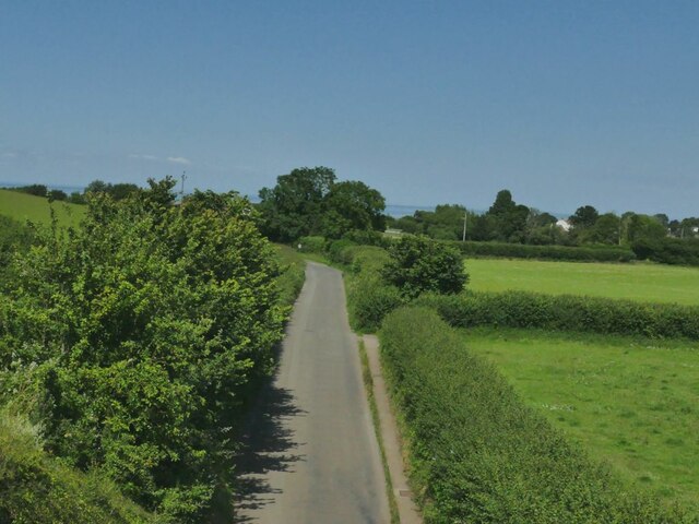
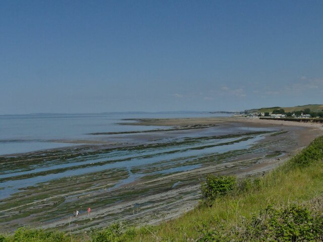
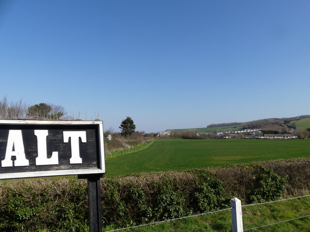
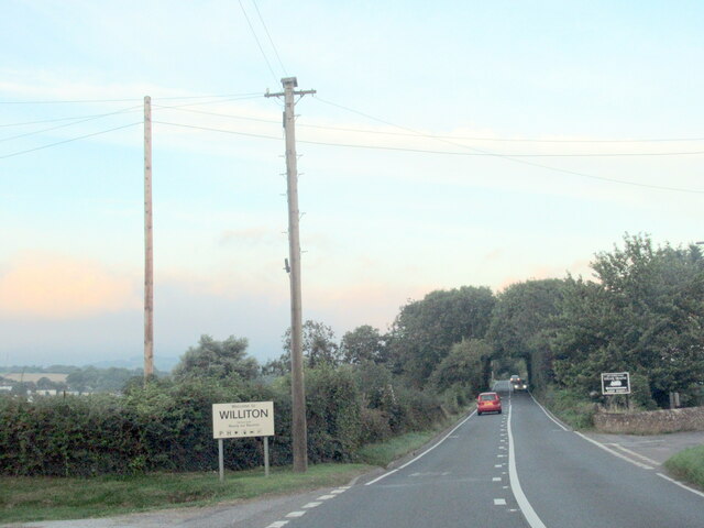
The Belt Images

Images are sourced within 2km of 51.178478/-3.2847412 or Grid Reference ST1042. Thanks to Geograph Open Source API. All images are credited.

Liddymore Lane or Doniford Road? I am in no doubt as to the location of this photo, but OpenStreetMap labels it Liddymore Lane while the OS and Google Map call it Doniford Road. What do locals call it?
Liddymore Lane or Doniford Road?
I am in no doubt as to the location of this photo, but OpenStreetMap labels it Liddymore Lane while the OS and Google Map call it Doniford Road. What do locals call it?
Helwell Bay Viewed from the West Somerset Railway at the point where it runs closest to the coast. <a href="https://www.geograph.org.uk/photo/6624589">ST0843 : On the rocks in Helwell Bay</a> and <a href="https://www.geograph.org.uk/photo/2486365">ST0843 : Interesting rock formation at Helwell Bay</a> show a closer view on the ground. A local geological guide describes the rocks here as Triassic-Jurassic transition beds.
Helwell Bay
Viewed from the West Somerset Railway at the point where it runs closest to the coast. ST0843 : On the rocks in Helwell Bay and ST0843 : Interesting rock formation at Helwell Bay show a closer view on the ground. A local geological guide describes the rocks here as Triassic-Jurassic transition beds.
View across a field from Donniford Halt, West Somerset Railway The photo was taken from a train heading for Minehead.
View across a field from Donniford Halt, West Somerset Railway
The photo was taken from a train heading for Minehead.
Wave-cut platform at Donniford, seen from the West Somerset Railway
Williton village sign on the A39 west
Arrival at Doniford Beach Halt, West Somerset Railway Large GWR 2-6-2T 6106 approaches Doniford Beach Halt with a train for Minehead in 1991. The halt had been opened by the WSR in 1987 to serve the local community and holiday campsites. Four years on and there are no passenger facilities. However, the concrete slab behind the platform shows the planned location of a waiting shelter that will be built here. It will be a typical GWR 'Pagoda' shelter of corrugated iron as shown in this 2004 photo: <a href="https://www.geograph.org.uk/photo/101544">ST0842 : Doniford Halt, West Somerset Railway</a>. This also shows that the halt is now simply 'Doniford Halt'.
Arrival at Doniford Beach Halt, West Somerset Railway
Large GWR 2-6-2T 6106 approaches Doniford Beach Halt with a train for Minehead in 1991. The halt had been opened by the WSR in 1987 to serve the local community and holiday campsites. Four years on and there are no passenger facilities. However, the concrete slab behind the platform shows the planned location of a waiting shelter that will be built here. It will be a typical GWR 'Pagoda' shelter of corrugated iron as shown in this 2004 photo: ST0842 : Doniford Halt, West Somerset Railway. This also shows that the halt is now simply 'Doniford Halt'.
Approaching Doniford Beach Halt, West Somerset Railway On leaving Watchet Station southbound trains follow the coastline of Helwell Bay before turning inland and passing beneath Doniford Road bridge from where this photo was taken. Immediately beyond the bridge is Doniford Beach Halt, <a href="https://www.geograph.org.uk/photo/7477140">ST0842 : Arrival at Doniford Beach Halt, West Somerset Railway</a> (but nowadays simply 'Doniford Halt'). Here, GWR small 'Prairie' 4561 heads a train from Minehead to Bishops Lydeard.
Approaching Doniford Beach Halt, West Somerset Railway
On leaving Watchet Station southbound trains follow the coastline of Helwell Bay before turning inland and passing beneath Doniford Road bridge from where this photo was taken. Immediately beyond the bridge is Doniford Beach Halt, ST0842 : Arrival at Doniford Beach Halt, West Somerset Railway (but nowadays simply 'Doniford Halt'). Here, GWR small 'Prairie' 4561 heads a train from Minehead to Bishops Lydeard.
St Etheldreda's Church
The Orangery at St Audries Park
St. Audries Church A charming little church, next to the A39 in West Quantoxhead
St. Audries Church
A charming little church, next to the A39 in West Quantoxhead
The Orangery, St Audries Park At one time St. Audries Park was a posh girls'-school, or is that posh-girls' school?  Anyway it is now a business that specialises in weddings.  The service takes place in the Orangery and the rest of the festivities take place in the house, behind us.
The Orangery, St Audries Park
At one time St. Audries Park was a posh girls'-school, or is that posh-girls' school? Anyway it is now a business that specialises in weddings. The service takes place in the Orangery and the rest of the festivities take place in the house, behind us.
St Audries Park The house was once a girl's school, but is now used for weddings.
St Audries Park
The house was once a girl's school, but is now used for weddings.
Waterfall between Doniford and St. Audries Bay This waterfall plunges straight down onto the beach and can only be reached on foot at low tide. There will soon be some more falls of vegetation and rock from the top. The horizontal strata are very well defined.
Waterfall between Doniford and St. Audries Bay
This waterfall plunges straight down onto the beach and can only be reached on foot at low tide. There will soon be some more falls of vegetation and rock from the top. The horizontal strata are very well defined.
Eastwards from Doniford. The waterfall in the other photograph for this square plunges from the striped cliff face on the extreme left of the picture.
Eastwards from Doniford.
The waterfall in the other photograph for this square plunges from the striped cliff face on the extreme left of the picture.
Changing face of the Quantocks. The photograph shows how the rhododendron bushes are encroaching into areas that were previously bracken, even on very steep slopes. Some efforts are being made to cut them down but are probably doomed to failure. They do look stunning in the spring though!
Changing face of the Quantocks.
The photograph shows how the rhododendron bushes are encroaching into areas that were previously bracken, even on very steep slopes. Some efforts are being made to cut them down but are probably doomed to failure. They do look stunning in the spring though!
Wibble Farm Nurseries. This is a traditional working family nursery where plants are grown on from cuttings until ready for sale. The emphasis is on hardy perennials, shrubs and trees. Being in the South West and very near the coast lots of plants can be grown that wouldn't be hardy in other areas of the country.
Wibble Farm Nurseries.
This is a traditional working family nursery where plants are grown on from cuttings until ready for sale. The emphasis is on hardy perennials, shrubs and trees. Being in the South West and very near the coast lots of plants can be grown that wouldn't be hardy in other areas of the country.
Caravan Park St Audrie's Bay Holiday Club
Caravan Park
St Audrie's Bay Holiday Club
Field on a Hillside
Field on a Hillside
Show me another place!

The Belt is located at Grid Ref: ST1042 (Lat: 51.178478, Lng: -3.2847412)

Administrative County: Somerset

District: Somerset West and Taunton

Police Authority: Avon and Somerset

What 3 Words

///aimlessly.polar.ironclad. Near Williton, Somerset

Related Wikis

St Audries Park

St Audries Park Manor house at West Quantoxhead in the Quantock Hills of Somerset, England, was the manor house of the Acland family. It was rebuilt on...

West Quantoxhead

West Quantoxhead is a small village and civil parish in the Somerset West and Taunton district of Somerset, England. It lies on the route of the Coleridge...

Church of St Etheldreda, West Quantoxhead

The Church of St Etheldreda, also known as the Church of St Audries, is a Church of England parish church in West Quantoxhead, Somerset, England. Designed...

Doniford Halt railway station

Doniford Halt railway station, sometimes known as Doniford Beach Halt, is a request stop situated on the West Somerset Railway, a heritage railway in...

Williton railway station

Williton railway station in Williton, Somerset, England, was opened by the West Somerset Railway in 1862 and closed by British Rail in 1971. It was reopened...

Williton

Williton is a large village and civil parish in Somerset, England, at the junction of the A39, A358 and B3191 roads, on the coast 2 miles (3.2 km) south...

Williton Rural District

Williton was a rural district in Somerset, England, from 1894 to 1974. It was created in 1894 under the Local Government Act 1894. In 1974 it was abolished...

Lilstock Formation

The Lilstock Formation is a geologic formation in England. It preserves bivalve, insect and other invertebrate fossils, as well as fossil fish of Agkistracanthus...

Nearby Amenities

Located within 500m of 51.178478,-3.2847412
Source: PGS
Lat/Long: 51.1796403/-3.278383
Source: PGS
Lat/Long: 51.1797586/-3.2788102
Source: PGS
Lat/Long: 51.1804926/-3.2838521
Source: PGS
Lat/Long: 51.1806224/-3.2840415
Source: PGS
Lat/Long: 51.180842/-3.2844615
Source: PGS
Lat/Long: 51.1810612/-3.2847545
Source: PGS
Lat/Long: 51.1814803/-3.2851471
Source: PGS
Lat/Long: 51.1817363/-3.2854067
Source: PGS
Lat/Long: 51.1819039/-3.2859002
Source: PGS
Lat/Long: 51.181955/-3.2862252
Source: PGS
Lat/Long: 51.1819407/-3.2865623
Source: PGS
Lat/Long: 51.181833/-3.2873151
Source: PGS
Lat/Long: 51.1816633/-3.2885472
Source: PGS
Lat/Long: 51.1817316/-3.2889705
Source: PGS
Lat/Long: 51.1808834/-3.2839513
Waterway: waterfall
Lat/Long: 51.1804909/-3.279979
Parking
Day Visitors
Lat/Long: 51.1796211/-3.28119
Direction: 30
Tourism: viewpoint
Lat/Long: 51.1802323/-3.2809041
The data included in this document is from www.openstreetmap.org. The data is made available under ODbL.

Have you been to The Belt?

Leave your review of The Belt below (or comments, questions and feedback).