Clay Mills
Settlement in Derbyshire South Derbyshire
England
Clay Mills

Clay Mills is a small village located in the southern part of Derbyshire, England. Situated near the River Trent, it is part of the East Staffordshire district. The village is known for its historical significance and its picturesque surroundings.
One of the main attractions of Clay Mills is the Clay Mills Pumping Station, a Victorian-era steam-powered waterworks. Built in 1885, the pumping station played a crucial role in supplying clean water to the local area. Today, it stands as a testament to the industrial heritage of the region and is open to visitors who can explore the impressive machinery and learn about its operation.
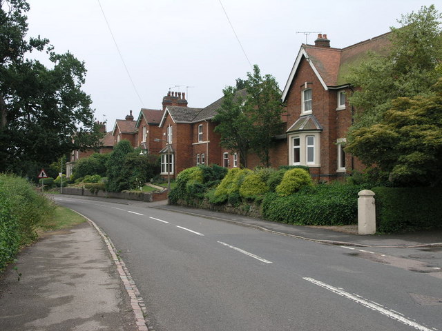
The village itself is characterized by its quaint charm and traditional architecture. It is home to a tight-knit community that takes pride in its close connections and local events. Clay Mills has a small number of residential properties, predominantly traditional cottages and farmhouses, which add to its rustic appeal.
Nature enthusiasts are drawn to Clay Mills for its proximity to the beautiful countryside. The village is surrounded by rolling hills, lush green fields, and scenic walking trails, making it an ideal destination for outdoor activities such as hiking, cycling, and birdwatching.
While Clay Mills is a quiet and peaceful village, it enjoys good transport links, with the nearby A38 providing easy access to larger towns and cities in the region. Additionally, the village is within a short distance of popular tourist attractions such as Alton Towers and the National Memorial Arboretum, making it a convenient base for exploring the wider area.
In summary, Clay Mills is a charming village in Derbyshire, offering a glimpse into the region's industrial past and providing a tranquil retreat for those seeking natural beauty and a sense of community.
If you have any feedback on the listing, please let us know in the comments section below.
Clay Mills Images
Images are sourced within 2km of 52.83989/-1.6154581 or Grid Reference SK2627. Thanks to Geograph Open Source API. All images are credited.


Clay Mills is located at Grid Ref: SK2627 (Lat: 52.83989, Lng: -1.6154581)
Administrative County: Derbyshire
District: South Derbyshire
Police Authority: Derbyshire
What 3 Words
///trouser.dramatic.commended. Near Burton upon Trent, Staffordshire
Nearby Locations
Related Wikis
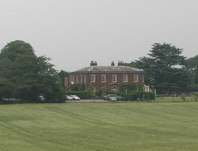
Dovecliff Hall
Dovecliff Hall (alternatively known as Dove Cliff Hall or Dovecliffe Hall) is a large Georgian country house in Stretton, East Staffordshire, England which...
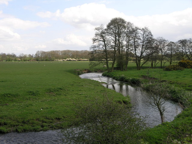
Hilton Brook
The Hilton Brook or Sutton Brook is a tributary of the River Dove in Derbyshire, England, and is 26 kilometres (16 miles) long. Like many watercourses...

Winshill
Winshill is an area to the east of the town of Burton upon Trent, in the borough of East Staffordshire, England. Flanked to the north and east by the South...
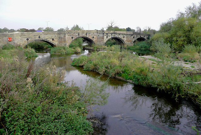
Monks Bridge, River Dove
Monks Bridge is a road bridge across the River Dove between Stretton, Staffordshire, and Egginton, Derbyshire. A bridge has existed here since the early...
Nearby Amenities
Located within 500m of 52.83989,-1.6154581Have you been to Clay Mills?
Leave your review of Clay Mills below (or comments, questions and feedback).