Syndercombe Wood
Wood, Forest in Somerset Somerset West and Taunton
England
Syndercombe Wood
Syndercombe Wood is a picturesque forest located in Somerset, England. Covering an area of approximately 100 acres, this ancient woodland is a haven for nature enthusiasts and hikers alike. The wood is situated on the southern slopes of the Quantock Hills, offering stunning views of the surrounding countryside.
The woodland is predominantly composed of native species such as oak, beech, and birch trees. These towering trees create a dense canopy that provides shade and shelter for a diverse range of flora and fauna. Bluebells, primroses, and wild garlic carpet the forest floor in spring, adding bursts of color to the landscape.
The forest is crisscrossed by a network of well-maintained trails, making it easily accessible to visitors. These paths wind through the woodland, allowing visitors to explore its hidden corners and discover its natural wonders. Along the way, there are several viewpoints that offer panoramic vistas of the rolling hills and valleys.
Syndercombe Wood is not only a haven for plant and animal life but also a site of historical significance. The wood has remnants of ancient earthworks and burial mounds, indicating human occupation dating back thousands of years. Archaeological excavations have uncovered artifacts from the Bronze Age and Iron Age, further enhancing the cultural and historical value of this woodland.
In conclusion, Syndercombe Wood is a beautiful and diverse forest in Somerset that offers a tranquil escape from the hustle and bustle of modern life. With its rich biodiversity, stunning views, and historical significance, it is a must-visit destination for nature lovers and history enthusiasts alike.
If you have any feedback on the listing, please let us know in the comments section below.
Syndercombe Wood Images
Images are sourced within 2km of 51.080013/-3.3768905 or Grid Reference ST0332. Thanks to Geograph Open Source API. All images are credited.


Syndercombe Wood is located at Grid Ref: ST0332 (Lat: 51.080013, Lng: -3.3768905)
Administrative County: Somerset
District: Somerset West and Taunton
Police Authority: Avon and Somerset
What 3 Words
///profited.frightens.expecting. Near Wiveliscombe, Somerset
Nearby Locations
Related Wikis

Clatworthy Camp
Clatworthy Camp is an Iron Age hill fort 3 miles (4.8 km) North West of Wiveliscombe, Somerset, England. It has been scheduled as an Ancient Monument....

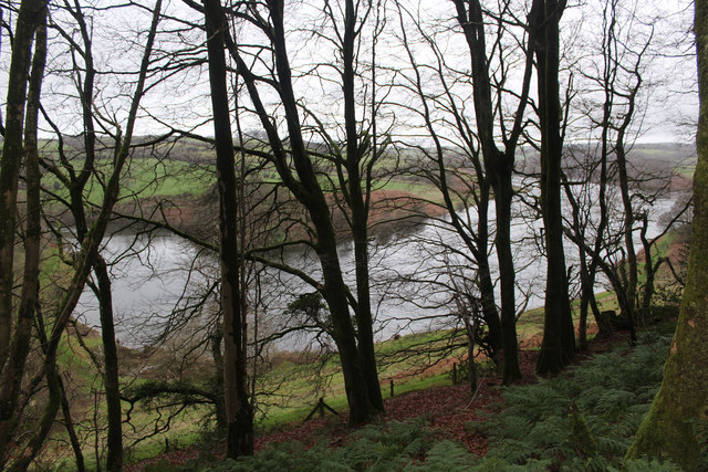
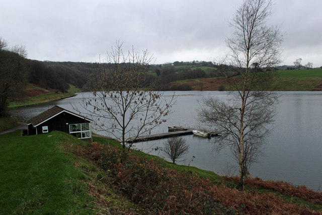
Clatworthy Reservoir
Clatworthy Reservoir is situated near Clatworthy in the Brendon Hills on the edge of the Exmoor National Park in west Somerset, England. It is run by Wessex...

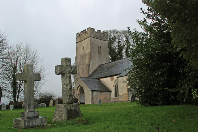
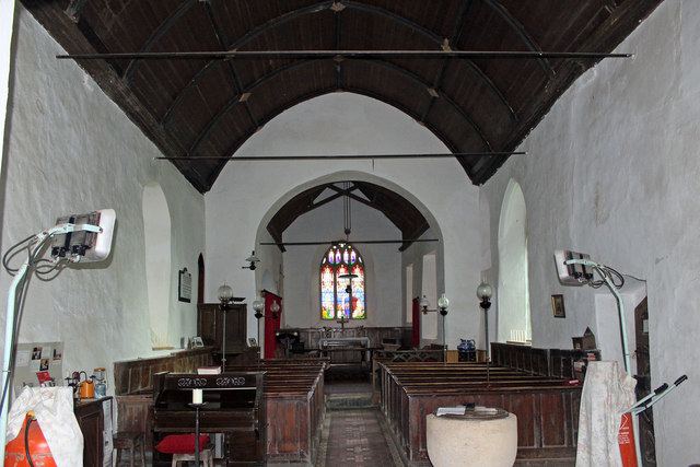
Church of St Mary Magdalene, Clatworthy
The Anglican Church of Mary Magdalene in Clatworthy, Somerset, England was built in the 12th century. It is a Grade II* listed building. == History... ==
Clatworthy
Clatworthy is a village and civil parish in the Somerset West and Taunton district of Somerset, England. It is situated 10 miles (16 km) from Wellington...

Brendon Hill railway station
Brendon Hill (occasionally referred to as "Raleigh's Cross") was an intermediate station on the West Somerset Mineral Railway (WSMR), which was built primarily...

Huish Champflower
Huish Champflower is a village and civil parish in Somerset, England, three miles north-west of Wiveliscombe and ten miles north of Wellington. It has...

Comberow railway station
Comberow was an intermediate station on the West Somerset Mineral Railway (WSMR), which was built primarily to carry iron ore from mines to Watchet harbour...
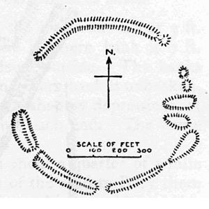
Elworthy Barrows
Elworthy Barrows is an unfinished Iron Age hill fort, rather than Bronze Age barrows, which is designated a scheduled ancient monument (No:188401). It...
Nearby Amenities
Located within 500m of 51.080013,-3.3768905Have you been to Syndercombe Wood?
Leave your review of Syndercombe Wood below (or comments, questions and feedback).