Pit Copse

Wood, Forest in Somerset Somerset West and Taunton

England

Pit Copse

Comberow Incline A view down an incline of the West Somerset Mineral Railway below the winch house
Comberow Incline Credit: Kevin Waterhouse

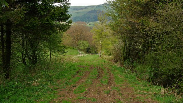
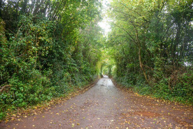
Pit Copse is a picturesque woodland located in Somerset, England. It covers an area of approximately 50 acres, encompassing a variety of tree species and serving as a valuable habitat for wildlife. The copse is situated in an idyllic rural setting, surrounded by rolling hills and meadows, contributing to its serene and tranquil atmosphere.

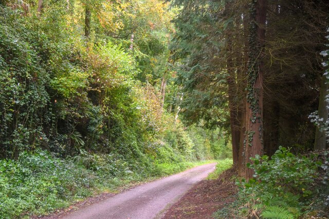
The woodland primarily consists of deciduous trees, such as oak, beech, and ash, creating a diverse and vibrant ecosystem. The trees provide shelter and nesting sites for a range of bird species, including woodpeckers, nuthatches, and tawny owls. Additionally, the copse is home to numerous mammals, including badgers, foxes, and deer, making it an important sanctuary for local wildlife.

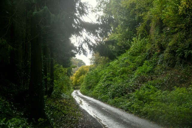
Visitors to Pit Copse can enjoy a variety of recreational activities, including walking, birdwatching, and photography. The well-maintained footpaths wind through the woodland, allowing visitors to explore the beauty of the ancient trees and discover hidden clearings and streams. Nature enthusiasts can also spot a variety of wildflowers and fungi that thrive in the rich soil of the copse.

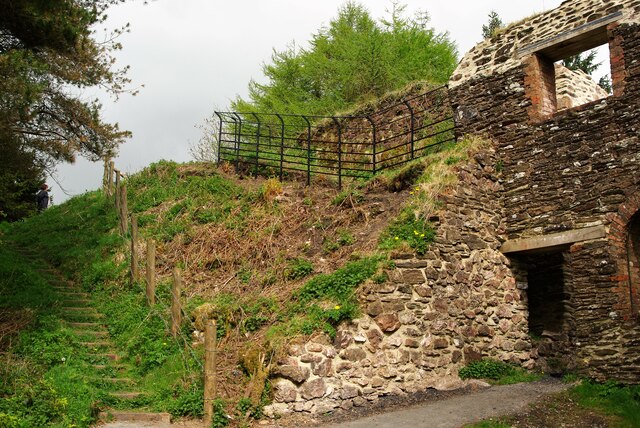
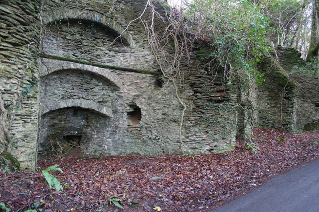
Pit Copse holds significant historical importance, as it was once part of a larger ancient forest that covered much of Somerset. The woodland has been carefully preserved over the years, and efforts have been made to maintain its natural integrity and biodiversity.

Overall, Pit Copse in Somerset offers a tranquil and captivating experience for nature lovers, providing a glimpse into the beauty and diversity of English woodlands.

If you have any feedback on the listing, please let us know in the comments section below.

Pit Copse Images

Images are sourced within 2km of 51.114718/-3.3782077 or Grid Reference ST0335. Thanks to Geograph Open Source API. All images are credited.

Comberow Incline A view down an incline of the West Somerset Mineral Railway below the winch house
Comberow Incline
A view down an incline of the West Somerset Mineral Railway below the winch house
Steps down to the Winch House The winding equipment was below the rail level on the West Somerset Mineral Railway at the top of Comberow Incline
Steps down to the Winch House
The winding equipment was below the rail level on the West Somerset Mineral Railway at the top of Comberow Incline
Old Cleve : Road A small country lane.
Old Cleve : Road
A small country lane.
Old Cleve : Road A road heads through the countryside.
Old Cleve : Road
A road heads through the countryside.
Nettlecombe : Harper's Lane Looking along a country lane.
Nettlecombe : Harper's Lane
Looking along a country lane.
Nettlecombe : Field A grassy field beyond the gate.
Nettlecombe : Field
A grassy field beyond the gate.
Nettlecombe : Field A grassy field beyond the gate.
Nettlecombe : Field
A grassy field beyond the gate.
Leighland Chapel Ford There are warnings at either end of this narrow byway with photographs of stranded delivery vans. On the day of our visit the ford was muddy but 'dry' and passable in both directions.
Leighland Chapel Ford
There are warnings at either end of this narrow byway with photographs of stranded delivery vans. On the day of our visit the ford was muddy but 'dry' and passable in both directions.
West Somerset : Track A track heading down the hillside with plenty of surroundings to see from this vantage point.
West Somerset : Track
A track heading down the hillside with plenty of surroundings to see from this vantage point.
West Somerset : Countryside Scenery Looking out across from the Brendon Hills with the Bristol Channel and beyond, Cardiff Airport stands out on the Welsh landscape.
West Somerset : Countryside Scenery
Looking out across from the Brendon Hills with the Bristol Channel and beyond, Cardiff Airport stands out on the Welsh landscape.
West Somerset : Countryside Scenery Looking out across the fields and out beyond the Bristol Channel to the South Wales coastline.
West Somerset : Countryside Scenery
Looking out across the fields and out beyond the Bristol Channel to the South Wales coastline.
West Somerset : Countryside Scenery Looking out across the Bristol Channel with Steep Holm in view.
West Somerset : Countryside Scenery
Looking out across the Bristol Channel with Steep Holm in view.
West Somerset : Bristol Channel Looking out across the Bristol Channel with Flat Holm in view.
West Somerset : Bristol Channel
Looking out across the Bristol Channel with Flat Holm in view.
West Somerset : Bristol Channel In the very distance you can pick out the Severn Bridge.
West Somerset : Bristol Channel
In the very distance you can pick out the Severn Bridge.
West Somerset : Bristol Channel Looking across the Bristol Channel towards Wales.
West Somerset : Bristol Channel
Looking across the Bristol Channel towards Wales.
West Somerset : Bristol Channel Looking out across the Bristol Channel and Welsh coastline.
West Somerset : Bristol Channel
Looking out across the Bristol Channel and Welsh coastline.
West Somerset : Track A farm track and surrounding countryside. The lights of South Wales can be seen.
West Somerset : Track
A farm track and surrounding countryside. The lights of South Wales can be seen.
Old Direction Sign - Signpost by the B3190, Ralegh's Cross Inn Pyramid finial - 4 arms; Somerset SCC pyramid by the B3190, in parish of Nettlecombe (West Somerset District), junction with the B3224 by "Ralegh's Cross Inn" PH.

Surveyed

Milestone Society National ID: SO_ST0334
Old Direction Sign - Signpost by the B3190, Ralegh's Cross Inn
Pyramid finial - 4 arms; Somerset SCC pyramid by the B3190, in parish of Nettlecombe (West Somerset District), junction with the B3224 by "Ralegh's Cross Inn" PH. Surveyed Milestone Society National ID: SO_ST0334
Show me another place!

Pit Copse is located at Grid Ref: ST0335 (Lat: 51.114718, Lng: -3.3782077)

Administrative County: Somerset

District: Somerset West and Taunton

Police Authority: Avon and Somerset

What 3 Words

///movements.visions.duplicate. Near Williton, Somerset

Related Wikis

Comberow railway station

Comberow was an intermediate station on the West Somerset Mineral Railway (WSMR), which was built primarily to carry iron ore from mines to Watchet harbour...

Brendon Hill railway station

Brendon Hill (occasionally referred to as "Raleigh's Cross") was an intermediate station on the West Somerset Mineral Railway (WSMR), which was built primarily...

Roadwater railway station

The Roadwater railway station was an intermediate station on the West Somerset Mineral Railway (WSMR), which was built primarily to carry iron ore from...

Treborough

Treborough is a small village and civil parish 7 miles (11 km) south of Dunster, lying amongst the Brendon Hills within the Exmoor National Park in the...

Roadwater

Roadwater is a village 3 miles (5 km) south-west of Williton, on the northern edge of the Exmoor National Park, in Somerset, England. == History == The...

St Peter's Church, Treborough

The Anglican St Peter's Church at Treborough within the English county of Somerset dates from the 14th century. It is a Grade II* listed building.Although...

Church of St Peter, Williton

The Anglican Church of St Peter in Williton in the English county of Somerset is recorded in the National Heritage List for England as a designated Grade...

Nettlecombe Court

Nettlecombe Court and park is an old estate on the northern fringes of the Brendon Hills, within the Exmoor National Park. They are within the civil parish...

Nearby Amenities

Located within 500m of 51.114718,-3.3782077
Hook Hill Farm
Note Retag: CS #48756035
Place: isolated_dwelling
Lat/Long: 51.1145629/-3.3737405
The data included in this document is from www.openstreetmap.org. The data is made available under ODbL.

Have you been to Pit Copse?

Leave your review of Pit Copse below (or comments, questions and feedback).