South Close Copse
Wood, Forest in Somerset Somerset West and Taunton
England
South Close Copse
South Close Copse is a picturesque woodland located in Somerset, England. Situated in the heart of the county, this serene forest spans over a vast area, offering a peaceful retreat for nature enthusiasts and hikers alike.
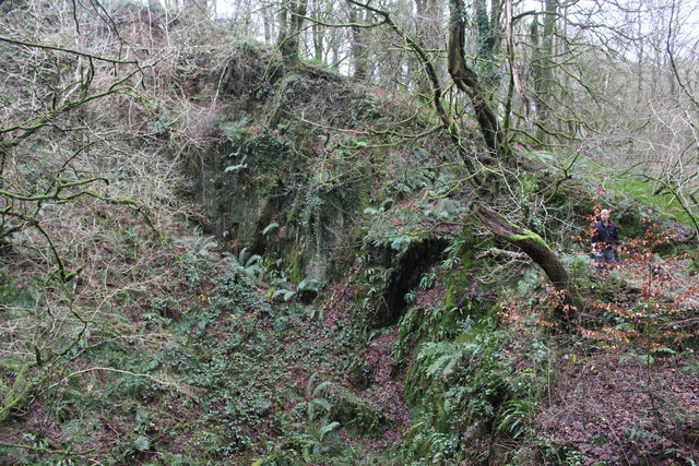
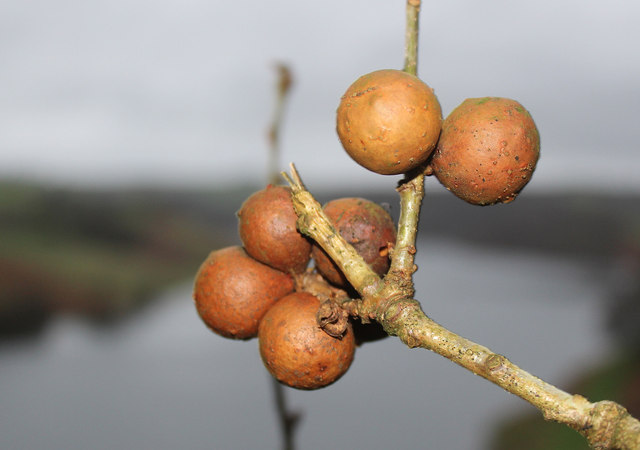
The copse is characterized by its dense and diverse tree cover, featuring a variety of species such as oak, beech, and birch. These towering trees create a captivating canopy that filters sunlight, casting enchanting patterns on the forest floor below. The woodland is also rich in flora, with an array of wildflowers, ferns, and mosses carpeting the ground, adding to its natural beauty.
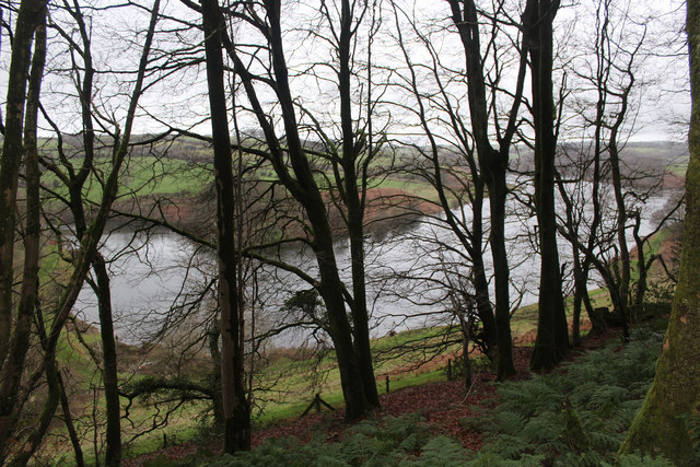
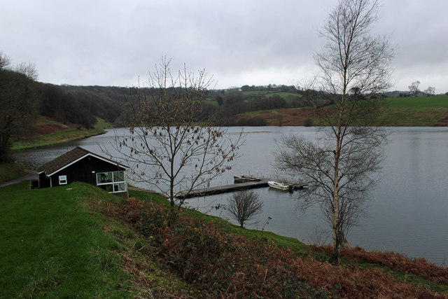
Tranquil streams meander through South Close Copse, providing a soothing soundtrack and creating small pockets of wetland habitats. These water sources attract a range of wildlife, including birds, butterflies, and small mammals. Nature lovers can spot species such as woodpeckers, deer, and foxes while exploring the forest's trails.
South Close Copse offers a network of well-maintained footpaths that wind their way through the trees, allowing visitors to explore the woodland at their leisure. These paths lead to hidden clearings and viewpoints, providing stunning vistas of the surrounding countryside and glimpses of neighboring fields and meadows.
As a designated nature reserve, South Close Copse is carefully managed to preserve its ecological balance and protect its wildlife. It serves as an important habitat for both resident and migratory species, contributing to the overall biodiversity of the region.
Whether one seeks solitude, a leisurely stroll, or a closer connection with nature, South Close Copse offers an idyllic setting for all to enjoy. Its tranquil ambiance, diverse flora and fauna, and well-preserved landscape make it a must-visit destination for anyone seeking to immerse themselves in the beauty of Somerset's natural environment.
If you have any feedback on the listing, please let us know in the comments section below.
South Close Copse Images
Images are sourced within 2km of 51.064475/-3.3828657 or Grid Reference ST0330. Thanks to Geograph Open Source API. All images are credited.


South Close Copse is located at Grid Ref: ST0330 (Lat: 51.064475, Lng: -3.3828657)
Administrative County: Somerset
District: Somerset West and Taunton
Police Authority: Avon and Somerset
What 3 Words
///character.alongside.alternate. Near Wiveliscombe, Somerset
Nearby Locations
Related Wikis

Clatworthy Reservoir
Clatworthy Reservoir is situated near Clatworthy in the Brendon Hills on the edge of the Exmoor National Park in west Somerset, England. It is run by Wessex...

Clatworthy Camp
Clatworthy Camp is an Iron Age hill fort 3 miles (4.8 km) North West of Wiveliscombe, Somerset, England. It has been scheduled as an Ancient Monument....

Huish Champflower
Huish Champflower is a village and civil parish in Somerset, England, three miles north-west of Wiveliscombe and ten miles north of Wellington. It has...

Church of St Mary Magdalene, Clatworthy
The Anglican Church of Mary Magdalene in Clatworthy, Somerset, England was built in the 12th century. It is a Grade II* listed building. == History... ==
Clatworthy
Clatworthy is a village and civil parish in the Somerset West and Taunton district of Somerset, England. It is situated 10 miles (16 km) from Wellington...

Church of All Saints, Chipstable
The Church of All Saints is an Anglican church in Chipstable, Somerset, England which probably dates from the early 13th century. It is located in the...

Chipstable
Chipstable is a village and civil parish in Somerset, England, situated beside Heydon Hill 10 miles (16.1 km) west of Taunton. The parish has a population...

Brendon Hill railway station
Brendon Hill (occasionally referred to as "Raleigh's Cross") was an intermediate station on the West Somerset Mineral Railway (WSMR), which was built primarily...
Have you been to South Close Copse?
Leave your review of South Close Copse below (or comments, questions and feedback).