Alma Bank Wood

Wood, Forest in Cumberland Copeland

England

Alma Bank Wood

Standing Stones Trigpoint and Golf Course, Whitehaven Easy road side Trig <span class="nowrap"><a title="http://www.trigpointinguk.com/trigs/trig-details.php?t=6154" rel="nofollow ugc noopener" href="http://www.trigpointinguk.com/trigs/trig-details.php?t=6154">Link</a><img style="margin-left:2px;" alt="External link" title="External link - shift click to open in new window" src="https://s1.geograph.org.uk/img/external.png" width="10" height="10"/></span> near the golf course
Standing Stones Trigpoint and Golf Course, Whitehaven Credit: Brian Deegan

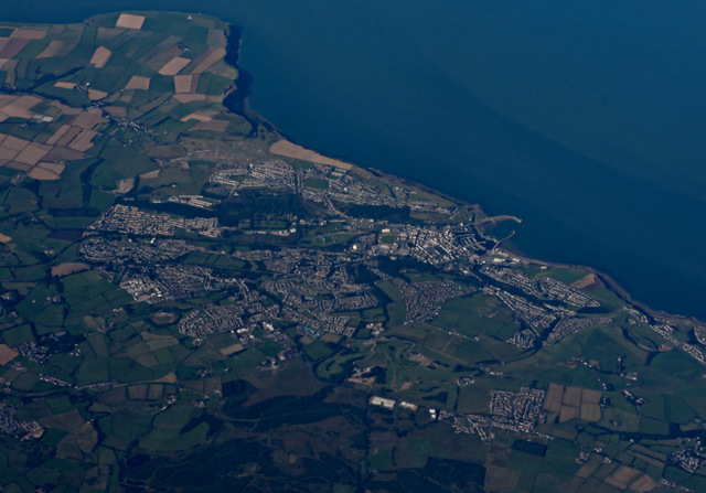
Alma Bank Wood, located in Cumberland, is a serene and picturesque forest that spans a vast area of land. Known for its natural beauty and biodiversity, the wood is a popular destination for nature enthusiasts and hikers alike.

The forest features a diverse range of tree species, including oak, beech, and birch, which create a dense canopy overhead, providing shade and shelter for the various wildlife that call the wood home. The forest floor is covered in a thick layer of leaf litter, creating a soft carpet underfoot and providing nutrients for the numerous plant species that thrive in this environment.

Visitors to Alma Bank Wood can expect to encounter a variety of wildlife during their exploration. Squirrels, rabbits, and deer are commonly spotted, while birdwatchers can delight in the sight of woodpeckers, owls, and various songbirds that inhabit the area. The wood is also home to a number of elusive creatures, such as badgers and foxes, which add to its sense of wilderness.

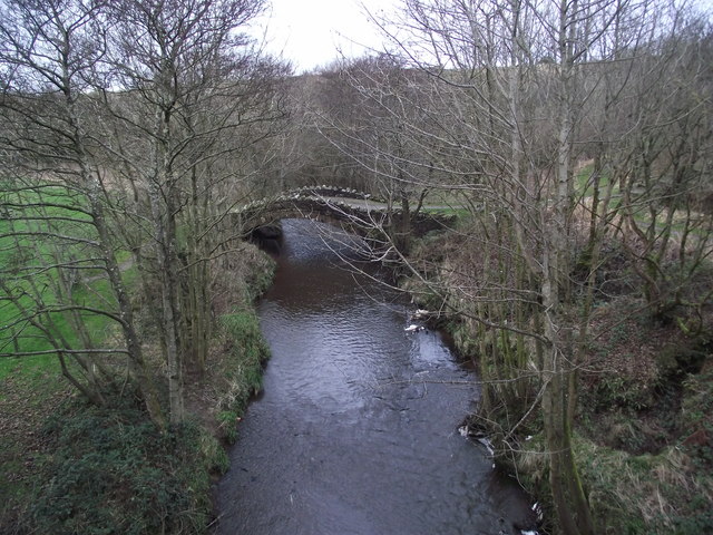
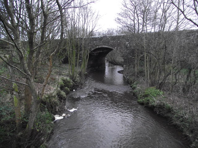
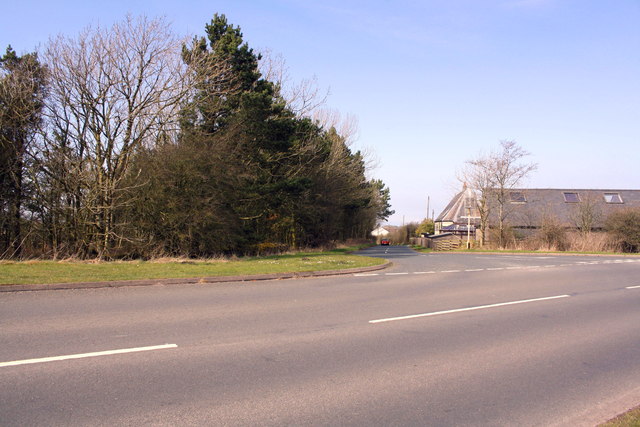
Trails wind their way through the wood, allowing visitors to immerse themselves in the tranquil surroundings. These paths offer different levels of difficulty, catering to both casual walkers and more avid hikers. The forest also contains a small stream, enhancing the peaceful ambiance and providing a refreshing spot for visitors to relax and enjoy the natural sounds of running water.

Alma Bank Wood is not only a haven for nature enthusiasts but also an important ecological site. Its protection and preservation ensure the continued existence of the diverse flora and fauna that thrive within its boundaries.

If you have any feedback on the listing, please let us know in the comments section below.

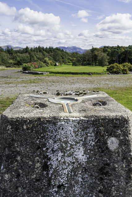
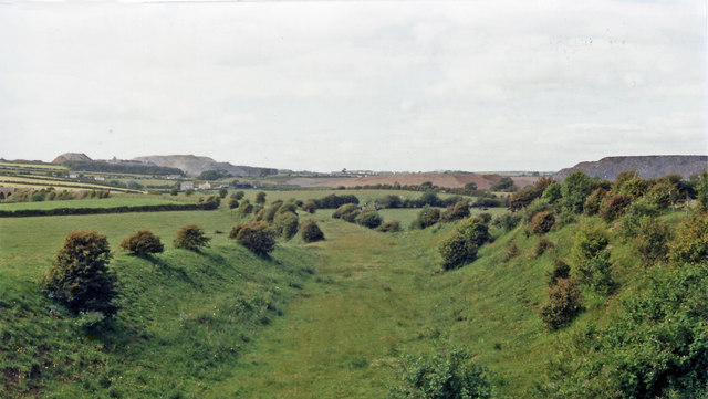
Alma Bank Wood Images

Images are sourced within 2km of 54.541193/-3.546684 or Grid Reference NY0017. Thanks to Geograph Open Source API. All images are credited.

Standing Stones Trigpoint and Golf Course, Whitehaven Easy road side Trig <span class="nowrap"><a title="http://www.trigpointinguk.com/trigs/trig-details.php?t=6154" rel="nofollow ugc noopener" href="http://www.trigpointinguk.com/trigs/trig-details.php?t=6154">Link</a><img style="margin-left:2px;" alt="External link" title="External link - shift click to open in new window" src="https://s1.geograph.org.uk/img/external.png" width="10" height="10"/></span> near the golf course
Standing Stones Trigpoint and Golf Course, Whitehaven
Easy road side Trig LinkExternal link near the golf course
Near site of Cleator Moor station, 1986 A view along the course of the former Cleator & Workington Junction line, which was built, along with various other lines, for transporting haematite iron ore from the rich mines in the area to the iron and steel works in the Workington and Harrington Districts. For 100 years from the 1860s this area, nowadays almost reclaimed by nature, had been heavily industrialised and honeycombed by railways: the remnants of spoil-heaps from the iron and coal mines can be seen on the horizon. Keekle Viaduct can also be seen in the extreme left background.
Near site of Cleator Moor station, 1986
A view along the course of the former Cleator & Workington Junction line, which was built, along with various other lines, for transporting haematite iron ore from the rich mines in the area to the iron and steel works in the Workington and Harrington Districts. For 100 years from the 1860s this area, nowadays almost reclaimed by nature, had been heavily industrialised and honeycombed by railways: the remnants of spoil-heaps from the iron and coal mines can be seen on the horizon. Keekle Viaduct can also be seen in the extreme left background.
Old Keekle Bridge The Old Keekle Bridge is a packhorse bridge over the River Keekle and was restored in 1994.
Old Keekle Bridge
The Old Keekle Bridge is a packhorse bridge over the River Keekle and was restored in 1994.
Keekle Low Bridge Keekle Low Bridge carries the B5295 over the River Keekle
Keekle Low Bridge
Keekle Low Bridge carries the B5295 over the River Keekle
Keekle viaduct
Keekle viaduct
Keekle Ford This ford on the River Keekle is found at Keekle.
<span class="nowrap"><a title="https://youtu.be/YpPmZAMMhAA" rel="nofollow ugc noopener" href="https://youtu.be/YpPmZAMMhAA">Link</a><img style="margin-left:2px;" alt="External link" title="External link - shift click to open in new window" src="https://s1.geograph.org.uk/img/external.png" width="10" height="10"/></span>
A much better photograph can be viewed at:
<a title="https://www.geograph.org.uk/photo/5988043" href="https://www.geograph.org.uk/photo/5988043">Link</a>
Keekle Ford
This ford on the River Keekle is found at Keekle. LinkExternal link A much better photograph can be viewed at: Link
The River Keekle in spate Taken from the footbridge next to the ford.
The River Keekle in spate
Taken from the footbridge next to the ford.
Keekle Ford Looking towards Millhill Farm. The ford is an unattractive prospect in comparison with: <a title="https://www.geograph.org.uk/photo/4387418" href="https://www.geograph.org.uk/photo/4387418">Link</a>
Keekle Ford
Looking towards Millhill Farm. The ford is an unattractive prospect in comparison with: Link
Whitehaven from the air Whitehaven Commercial park and Whitehaven Golf Club are in the foreground. North Head and St Bees Head are in the distance.
Whitehaven from the air
Whitehaven Commercial park and Whitehaven Golf Club are in the foreground. North Head and St Bees Head are in the distance.
T-junction at SE end of Victoria Road
Benchmark on vertical element in stone wall Ordnance Survey cut mark benchmark levelled at 147.932m above Newlyn Datum
Benchmark on vertical element in stone wall
Ordnance Survey cut mark benchmark levelled at 147.932m above Newlyn Datum
Stone wall beside minor road at Scilly Bank There is an OS benchmark <a href="https://www.geograph.org.uk/photo/5959921">NX9919 : Benchmark on vertical element in stone wall</a> on a post in the wall at the centre of the image
Stone wall beside minor road at Scilly Bank
There is an OS benchmark NX9919 : Benchmark on vertical element in stone wall on a post in the wall at the centre of the image
Potholes on Galemire lane
Summergrove Halls
Summergrove Halls
Road junction at Summergrove
Benchmark on 'Standing Stones' trig point Ordnance Survey flush bracket (serial identifier S5758) described on the OS Database as NX 9914 1809 FLUSH BRACKET FL BR S5758 STANDING STONES TP 143.256m ODN
Benchmark on 'Standing Stones' trig point
Ordnance Survey flush bracket (serial identifier S5758) described on the OS Database as NX 9914 1809 FLUSH BRACKET FL BR S5758 STANDING STONES TP 143.256m ODN
Triangulation pillar at entrance to Whitehaven Golf Course Detailed information about the pillar is at <span class="nowrap"><a title="http://trigpointing.uk/trig/6154" rel="nofollow ugc noopener" href="http://trigpointing.uk/trig/6154">Link</a><img style="margin-left:2px;" alt="External link" title="External link - shift click to open in new window" src="https://s1.geograph.org.uk/img/external.png" width="10" height="10"/></span> . The pillar's flush bracket benchmark <a href="https://www.geograph.org.uk/photo/5991114">NX9918 : Benchmark on 'Standing Stones' trig point</a> is visible through the gap between the stone wall and the end wooden fence post
Triangulation pillar at entrance to Whitehaven Golf Course
Detailed information about the pillar is at LinkExternal link . The pillar's flush bracket benchmark NX9918 : Benchmark on 'Standing Stones' trig point is visible through the gap between the stone wall and the end wooden fence post
Whitehaven Golf Course There is an Ordnance Survey trig point pillar <a href="https://www.geograph.org.uk/photo/5991128">NX9918 : Triangulation pillar at entrance to Whitehaven Golf Course</a> at the entrance
Whitehaven Golf Course
There is an Ordnance Survey trig point pillar NX9918 : Triangulation pillar at entrance to Whitehaven Golf Course at the entrance
Show me another place!

Alma Bank Wood is located at Grid Ref: NY0017 (Lat: 54.541193, Lng: -3.546684)

Administrative County: Cumbria

District: Copeland

Police Authority: Cumbria

What 3 Words

///respected.swimmer.boom. Near Whitehaven, Cumbria

Related Wikis

The Whitehaven Academy

The Whitehaven Academy (formerly Whitehaven School) is a comprehensive co-educational secondary school with academy status, located in Whitehaven, in west...

St Benedict's Catholic High School, Hensingham

St Benedict's Catholic High School is a co-educational 11–18 comprehensive school on the edge of Whitehaven, Cumbria, England. It is located between the...

Keekle Colliers' Platform railway station

Keekle Colliers' Platform railway station was opened by the Cleator and Workington Junction Railway (C&WJR) in July 1910, closed the following January...
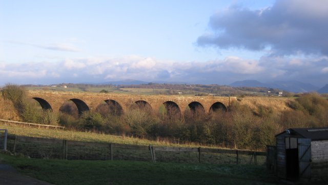
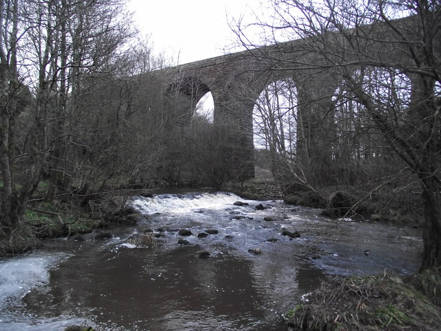
Keekle Viaduct

Keekle Viaduct is a former railway viaduct near Keekle, Cumbria, England. == Context == The viaduct is a substantial structure which carried the double...

Hensingham

Hensingham is a suburb of Whitehaven and former civil parish, now in the parish of Whitehaven, in the Cumberland district, in the ceremonial county of...

Keekle

Keekle is a hamlet in Cumbria, England. It is located just to the northeast of Goose Butts (which is approximately 22 km (14 mi) from Cockermouth) along...

Moresby Junction Halt railway station

Moresby Junction Halt railway station was opened by the Cleator and Workington Junction Railway (C&WJR) in 1910. Very few people lived near the halt, which...

West Cumberland Hospital

West Cumberland Hospital is a hospital in Hensingham, a suburb of Whitehaven in Cumbria, England, and was the first district general hospital to be built...

Nearby Amenities

Located within 500m of 54.541193,-3.546684
Power: tower
Lat/Long: 54.5378043/-3.5505034
Power: tower
Lat/Long: 54.5390698/-3.546081
Power: tower
Lat/Long: 54.5432719/-3.5515275
Power: tower
Lat/Long: 54.5395633/-3.5526169
Power: tower
Lat/Long: 54.5412622/-3.5489225
Low Wreah
Place: hamlet
Lat/Long: 54.5377795/-3.542469
Whelpside
Place: locality
Lat/Long: 54.5386279/-3.5492072
New Monkray
Place: locality
Lat/Long: 54.5435133/-3.5523672
Power: pole
Lat/Long: 54.5418551/-3.552779
Power: pole
Lat/Long: 54.5413751/-3.5514969
Power: pole
Lat/Long: 54.5405084/-3.5508531
Power: pole
Lat/Long: 54.538943/-3.5495898
Power: pole
Lat/Long: 54.5382023/-3.5490614
Power: pole
Lat/Long: 54.5374491/-3.5484928
Power: pole
Lat/Long: 54.5374749/-3.5451931
Power: pole
Lat/Long: 54.5383669/-3.5448751
Power: pole
Lat/Long: 54.5392412/-3.5446057
Power: pole
Lat/Long: 54.5407101/-3.5444963
Power: pole
Lat/Long: 54.5382317/-3.5429142
Power: pole
Lat/Long: 54.5392248/-3.5432444
Power: pole
Lat/Long: 54.5398652/-3.5435118
Power: pole
Lat/Long: 54.5399675/-3.5439412
The data included in this document is from www.openstreetmap.org. The data is made available under ODbL.

Have you been to Alma Bank Wood?

Leave your review of Alma Bank Wood below (or comments, questions and feedback).