Little Kilnmoor Copse

Wood, Forest in Devon Mid Devon

England

Little Kilnmoor Copse

Morebath : Timewell Hill, B3190 Looking along the road.
Morebath : Timewell Hill, B3190 Credit: Lewis Clarke

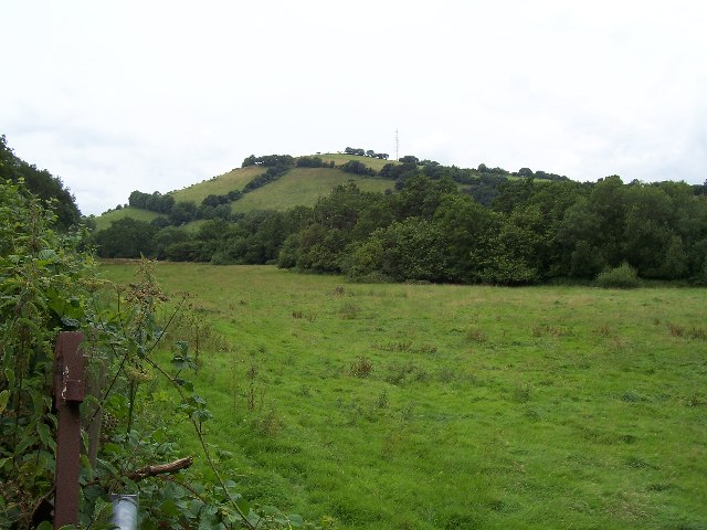
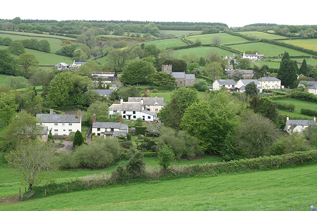
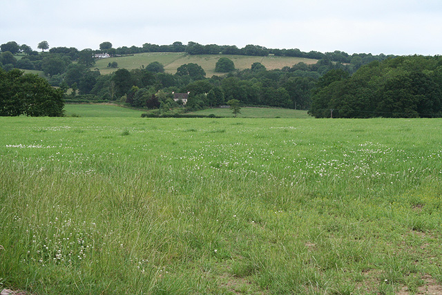
Little Kilnmoor Copse is a charming woodland located in the county of Devon, England. Situated near the village of Kilnmoor, the copse covers an area of approximately 20 acres, offering visitors a peaceful retreat within a rural setting.

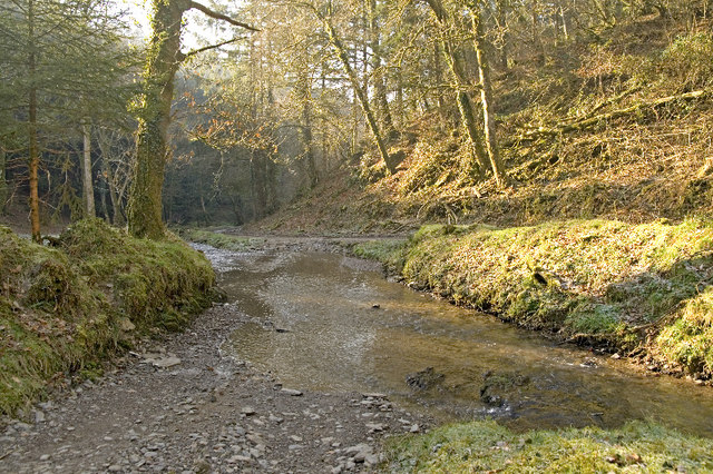
This woodland is predominantly composed of native deciduous trees, including oak, ash, and beech, which create a diverse and visually appealing landscape. The dense canopy provides shade and shelter for a variety of wildlife species, making it an ideal spot for nature enthusiasts and birdwatchers.

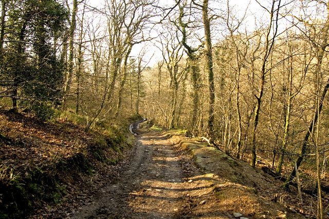
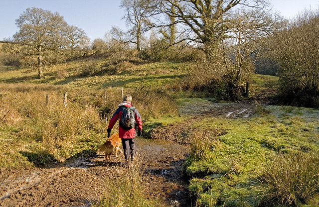
The copse is crisscrossed by a network of well-maintained footpaths, allowing visitors to explore the area at their leisure. These paths wind through the woodland, leading to hidden clearings and picturesque glades, where visitors can relax and immerse themselves in the tranquil surroundings.

Little Kilnmoor Copse is particularly renowned for its vibrant display of wildflowers during the spring and summer months. Bluebells, primroses, and wood anemones carpet the forest floor, creating a stunning tapestry of colors. This seasonal spectacle attracts not only hikers and photographers but also a myriad of insects, including butterflies and bees.

The copse is open to the public year-round and is managed by the local council, ensuring that it remains accessible and well-preserved. Whether you're seeking a peaceful stroll, a picnic spot, or a chance to connect with nature, Little Kilnmoor Copse offers a tranquil haven in the heart of Devon's countryside.

If you have any feedback on the listing, please let us know in the comments section below.

Little Kilnmoor Copse Images

Images are sourced within 2km of 51.016971/-3.4607486 or Grid Reference SS9725. Thanks to Geograph Open Source API. All images are credited.

Morebath : Timewell Hill, B3190 Looking along the road.
Morebath : Timewell Hill, B3190
Looking along the road.
Morebath : Timewell Hill, B3190 A car tries to barge through cattle which have escaped onto the road.
Morebath : Timewell Hill, B3190
A car tries to barge through cattle which have escaped onto the road.
Morebath : Timewell Hill, B3190 Looking along the road where cows have caused some traffic issues.
Morebath : Timewell Hill, B3190
Looking along the road where cows have caused some traffic issues.
Morebath : Timewell Hill, B3190 Looking along a road with cows in it.
Morebath : Timewell Hill, B3190
Looking along a road with cows in it.
Claypits Claypits is a widespread collection of dwellings near Morebath.
Claypits
Claypits is a widespread collection of dwellings near Morebath.
River Batherm Valley The River Batherm flows beneath the trees in the middle distance
River Batherm Valley
The River Batherm flows beneath the trees in the middle distance
Shillingford The village of Shillingford is situated on the B3227
Shillingford
The village of Shillingford is situated on the B3227
Morebath Station (disused) The old stone buildings of Morebath station are visible behind the hedge at the top of the field. Morebath is over 1 mile away.
Morebath Station (disused)
The old stone buildings of Morebath station are visible behind the hedge at the top of the field. Morebath is over 1 mile away.
Court Farm Some of the buildings of Court Farm are just visible at the end of this track
Court Farm
Some of the buildings of Court Farm are just visible at the end of this track
Bampton: near Way Farm Looking north east on the B3227 road to Wiveliscombe
Bampton: near Way Farm
Looking north east on the B3227 road to Wiveliscombe
Bampton: above Quartley Farm Looking south west. The town of Bampton is beyond the first hill on the left
Bampton: above Quartley Farm
Looking south west. The town of Bampton is beyond the first hill on the left
Skilgate: towards the village Seen from the track and public footpath from Haynes Down. Looking north
Skilgate: towards the village
Seen from the track and public footpath from Haynes Down. Looking north
Morebath: Timewell House Looking north on the Bampton-Watchet road
Morebath: Timewell House
Looking north on the Bampton-Watchet road
Morebath: the Devon border Seen from the Somerset parish of Skilgate. Looking south-south-west on the road from Watchet to Bampton
Morebath: the Devon border
Seen from the Somerset parish of Skilgate. Looking south-south-west on the road from Watchet to Bampton
Morebath: near Keens Barn Looking north-north-west
Morebath: near Keens Barn
Looking north-north-west
Ben Brook, Skilgate Wood The bridleway crosses the Ben Brook at a ford which necessitates travelling downstream several metres before gaining the far bank.
Ben Brook, Skilgate Wood
The bridleway crosses the Ben Brook at a ford which necessitates travelling downstream several metres before gaining the far bank.
Bridleway, Skilgate Wood The path passes several pheasant rearing pens and there was plenty of game to be seen.
Bridleway, Skilgate Wood
The path passes several pheasant rearing pens and there was plenty of game to be seen.
Stream crossing  below Skilgate Wood Unfortunately there is no right-of-way for a circular walk from Skilgate but the woodland rides cry out for permitted status.
Stream crossing below Skilgate Wood
Unfortunately there is no right-of-way for a circular walk from Skilgate but the woodland rides cry out for permitted status.
Show me another place!

Little Kilnmoor Copse is located at Grid Ref: SS9725 (Lat: 51.016971, Lng: -3.4607486)

Administrative County: Devon

District: Mid Devon

Police Authority: Devon and Cornwall

What 3 Words

///masterful.pampered.enclosing. Near Dulverton, Somerset

Related Wikis

Shillingford, Devon

Shillingford is a village two miles (3 km) northeast of Bampton on the River Batherm in Mid Devon, England, close to the border with West Somerset. It...

Morebath

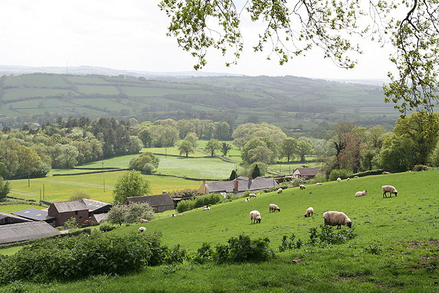
Morebath is an upland village in the county of Devon, England. It is mostly given over to sheep-farming, and situated on the southern edge of Exmoor. An...

St George's Church, Morebath

St George's Church, Morebath is a Grade II* listed parish church in the Church of England Diocese of Exeter in Morebath, Devon. It is part of the Hukeley...

Church of St John, Skilgate

The Anglican Church of St John in Skilgate, Somerset, England was built in the 14th century. It is a Grade II* listed building. == History == The church...

Skilgate

Skilgate is a village and civil parish 5 miles (8 km) east of Dulverton and 8 miles (13 km) west of Wiveliscombe in the Somerset West and Taunton district...

Morebath Junction railway station

Morebath Junction Halt was a railway halt near the junction of the Devon and Somerset Railway and Exe Valley Railway in Devon, South West England. �...

Petton, Devon

Petton, also known as Petton Cross, is an English village in the civil parish of Bampton, the district of Mid Devon, and the county of Devon. It lies on...

Bampton Castle, Devon

Bampton Castle in the parish of Bampton, Devon was the seat of the feudal barony of Bampton. It is located on a spur that overlooks the River Batherm....

Nearby Amenities

Located within 500m of 51.016971,-3.4607486
Power: pole
Lat/Long: 51.0140787/-3.4647113
Power: pole
Lat/Long: 51.0144769/-3.4629974
Power: pole
Lat/Long: 51.014919/-3.4613076
Power: pole
Lat/Long: 51.0153409/-3.4594891
Power: pole
Lat/Long: 51.0161019/-3.4564447
The data included in this document is from www.openstreetmap.org. The data is made available under ODbL.

Have you been to Little Kilnmoor Copse?

Leave your review of Little Kilnmoor Copse below (or comments, questions and feedback).