Longmead Copse

Wood, Forest in Devon Mid Devon

England

Longmead Copse

Morebath : Timewell Hill, B3190 Looking along the road.
Morebath : Timewell Hill, B3190 Credit: Lewis Clarke

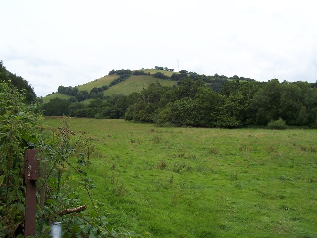
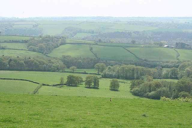
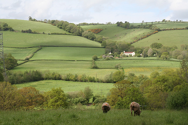
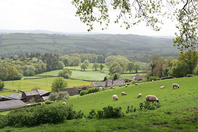
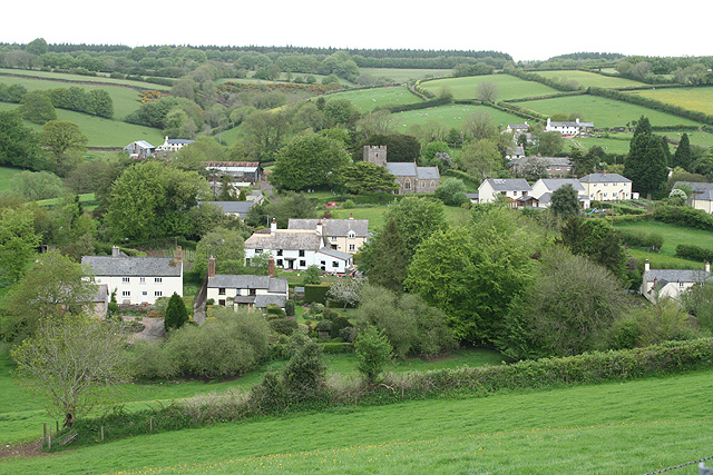
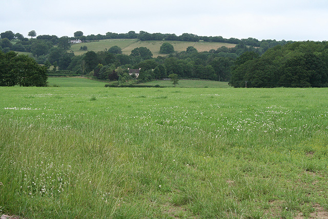
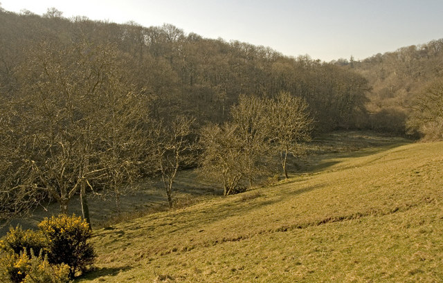
Longmead Copse is a stunning woodland located in Devon, England. Covering an area of approximately 300 acres, this ancient forest is a haven for nature enthusiasts and a popular destination for outdoor activities. The copse is situated near the village of Longmead, surrounded by rolling hills and picturesque countryside.

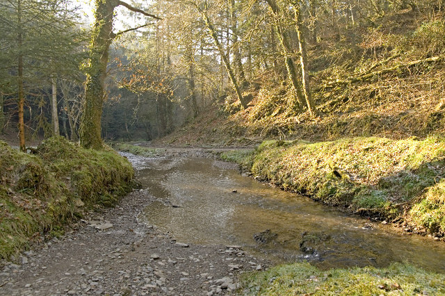
The woodland is primarily composed of native broadleaf trees, such as oak, beech, and birch, which create a dense canopy overhead. This canopy provides a sheltered habitat for a diverse range of wildlife, including deer, badgers, and numerous species of birds. The forest floor is adorned with a carpet of wildflowers, ferns, and mosses, adding to the enchanting atmosphere of the copse.

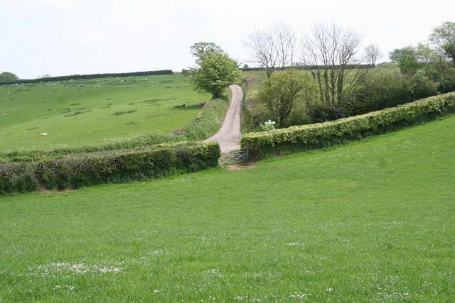
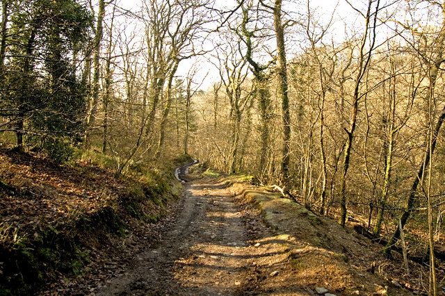
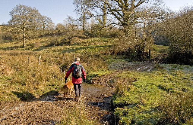
Longmead Copse boasts an extensive network of walking trails, allowing visitors to explore and appreciate the beauty of the woodland. These trails cater to all levels of fitness and offer breathtaking views of the surrounding landscape. Additionally, there are designated picnic areas and benches scattered throughout the copse, providing the perfect opportunity for visitors to relax and soak in the tranquility of the forest.

The copse is also home to a variety of historical and archaeological sites, including ancient burial mounds and remnants of Iron Age settlements. These sites offer a glimpse into the rich history of the area and add an element of intrigue to any visit.

Overall, Longmead Copse is a captivating destination for nature lovers, history enthusiasts, and anyone seeking solace in the midst of nature's beauty. Its diverse flora and fauna, coupled with its rich history, make it a truly remarkable woodland in the heart of Devon.

If you have any feedback on the listing, please let us know in the comments section below.

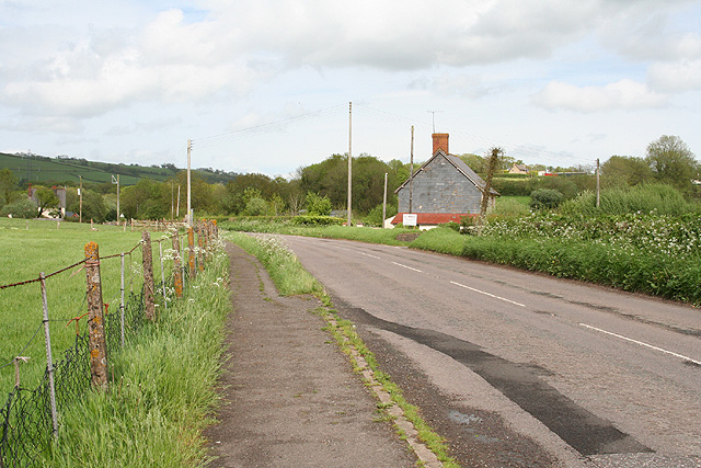
Longmead Copse Images

Images are sourced within 2km of 51.017844/-3.4564418 or Grid Reference SS9725. Thanks to Geograph Open Source API. All images are credited.

Morebath : Timewell Hill, B3190 Looking along the road.
Morebath : Timewell Hill, B3190
Looking along the road.
Claypits Claypits is a widespread collection of dwellings near Morebath.
Claypits
Claypits is a widespread collection of dwellings near Morebath.
River Batherm Valley The River Batherm flows beneath the trees in the middle distance
River Batherm Valley
The River Batherm flows beneath the trees in the middle distance
Shillingford The village of Shillingford is situated on the B3227
Shillingford
The village of Shillingford is situated on the B3227
Morebath Station (disused) The old stone buildings of Morebath station are visible behind the hedge at the top of the field. Morebath is over 1 mile away.
Morebath Station (disused)
The old stone buildings of Morebath station are visible behind the hedge at the top of the field. Morebath is over 1 mile away.
Court Farm Some of the buildings of Court Farm are just visible at the end of this track
Court Farm
Some of the buildings of Court Farm are just visible at the end of this track
Bampton: nearing Hone Cross On the footpath from Skilgate. Looking south east
Bampton: nearing Hone Cross
On the footpath from Skilgate. Looking south east
Bampton: the Batherm valley near Petton Looking south south west. Beyond the woods in mid distance can be seen the B3227 road from Wiveliscombe to Bampton – beneath the tip of the pylon. In this corridor the formation of the long-closed Taunton-Barnstaple railway also survives. That’s a pheasant in the foreground
Bampton: the Batherm valley near Petton
Looking south south west. Beyond the woods in mid distance can be seen the B3227 road from Wiveliscombe to Bampton – beneath the tip of the pylon. In this corridor the formation of the long-closed Taunton-Barnstaple railway also survives. That’s a pheasant in the foreground
Bampton: near Great Rill Farm Looking north-north-west. The farm on the right is Higher Dayles
Bampton: near Great Rill Farm
Looking north-north-west. The farm on the right is Higher Dayles
Bampton: near Way Farm Looking north east on the B3227 road to Wiveliscombe
Bampton: near Way Farm
Looking north east on the B3227 road to Wiveliscombe
Bampton: above Quartley Farm Looking south west. The town of Bampton is beyond the first hill on the left
Bampton: above Quartley Farm
Looking south west. The town of Bampton is beyond the first hill on the left
Skilgate: towards the village Seen from the track and public footpath from Haynes Down. Looking north
Skilgate: towards the village
Seen from the track and public footpath from Haynes Down. Looking north
Morebath: Timewell House Looking north on the Bampton-Watchet road
Morebath: Timewell House
Looking north on the Bampton-Watchet road
Morebath: near Keens Barn Looking north-north-west
Morebath: near Keens Barn
Looking north-north-west
Ben Brook, Skilgate Wood The bridleway crosses the Ben Brook at a ford which necessitates travelling downstream several metres before gaining the far bank.
Ben Brook, Skilgate Wood
The bridleway crosses the Ben Brook at a ford which necessitates travelling downstream several metres before gaining the far bank.
Bridleway, Skilgate Wood The path passes several pheasant rearing pens and there was plenty of game to be seen.
Bridleway, Skilgate Wood
The path passes several pheasant rearing pens and there was plenty of game to be seen.
Stream crossing  below Skilgate Wood Unfortunately there is no right-of-way for a circular walk from Skilgate but the woodland rides cry out for permitted status.
Stream crossing below Skilgate Wood
Unfortunately there is no right-of-way for a circular walk from Skilgate but the woodland rides cry out for permitted status.
Skilgate Wood Overnight frost lingers in the valley as this side of the hill has yet to see the Winter sun.  The meadow slope (R) rises towards Leigh Down.
Skilgate Wood
Overnight frost lingers in the valley as this side of the hill has yet to see the Winter sun. The meadow slope (R) rises towards Leigh Down.
Show me another place!

Longmead Copse is located at Grid Ref: SS9725 (Lat: 51.017844, Lng: -3.4564418)

Administrative County: Devon

District: Mid Devon

Police Authority: Devon and Cornwall

What 3 Words

///valley.descended.continues. Near Dulverton, Somerset

Related Wikis

Shillingford, Devon

Shillingford is a village two miles (3 km) northeast of Bampton on the River Batherm in Mid Devon, England, close to the border with West Somerset. It...

Church of St John, Skilgate

The Anglican Church of St John in Skilgate, Somerset, England was built in the 14th century. It is a Grade II* listed building. == History == The church...

Skilgate

Skilgate is a village and civil parish 5 miles (8 km) east of Dulverton and 8 miles (13 km) west of Wiveliscombe in the Somerset West and Taunton district...

Morebath

Morebath is an upland village in the county of Devon, England. It is mostly given over to sheep-farming, and situated on the southern edge of Exmoor. An...

Nearby Amenities

Located within 500m of 51.017844,-3.4564418
Power: pole
Lat/Long: 51.014919/-3.4613076
Power: pole
Lat/Long: 51.0153409/-3.4594891
Power: pole
Lat/Long: 51.0161019/-3.4564447
Power: pole
Lat/Long: 51.0168038/-3.4534863
Power: pole
Lat/Long: 51.0173336/-3.451319
Power: pole
Lat/Long: 51.0177082/-3.4497875
The data included in this document is from www.openstreetmap.org. The data is made available under ODbL.

Have you been to Longmead Copse?

Leave your review of Longmead Copse below (or comments, questions and feedback).