Clarkston

Settlement in Lanarkshire

Scotland

Clarkston

The Episcopal Church of St.Paul and St. John the Evangelist, Monklands Built in 1897 to a design by Henry Denison Walton.
The Episcopal Church of St.Paul and St. John the Evangelist, Monklands Credit: Jonathan Thacker

Clarkston is a small village located in the South Lanarkshire council area of Scotland. Situated approximately 7 miles southeast of Glasgow, it is positioned between the towns of East Kilbride and Busby. With a population of around 2,500 residents, the village offers a peaceful and close-knit community atmosphere.

One of the notable features of Clarkston is its beautiful surroundings. Surrounded by greenery and rolling hills, the village provides residents with stunning views of the Scottish countryside. There are also several parks and open spaces, such as Overlee Park and Williamwood Golf Course, which offer recreational opportunities and a chance to enjoy nature.

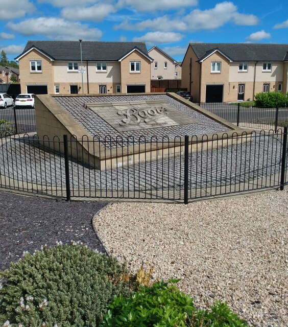
Clarkston has a small but vibrant town center, which is home to a variety of local shops, cafes, and restaurants. It also boasts excellent transport links, with regular bus services connecting the village to nearby towns and cities. The Clarkston railway station provides convenient access to Glasgow city center and other destinations.

The village is known for its strong sense of community and is home to various community groups and clubs, offering activities for people of all ages. Clarkston Primary School and Williamwood High School are the main educational institutions serving the village, ensuring a good standard of education for local children.

Overall, Clarkston offers a picturesque and peaceful setting, combined with convenient access to amenities and a strong community spirit, making it an attractive place to live or visit in Lanarkshire.

If you have any feedback on the listing, please let us know in the comments section below.
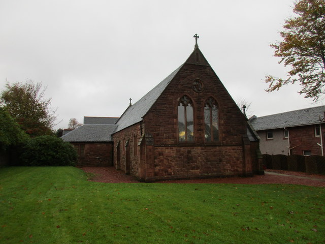
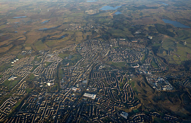
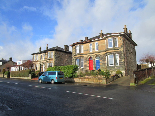
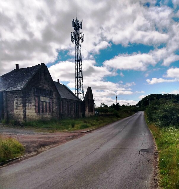
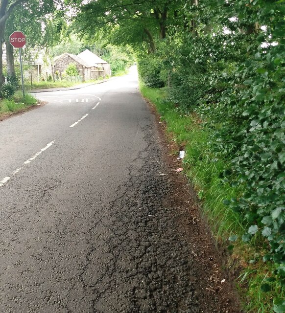
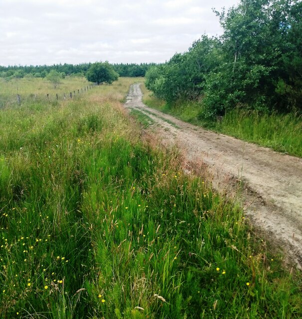
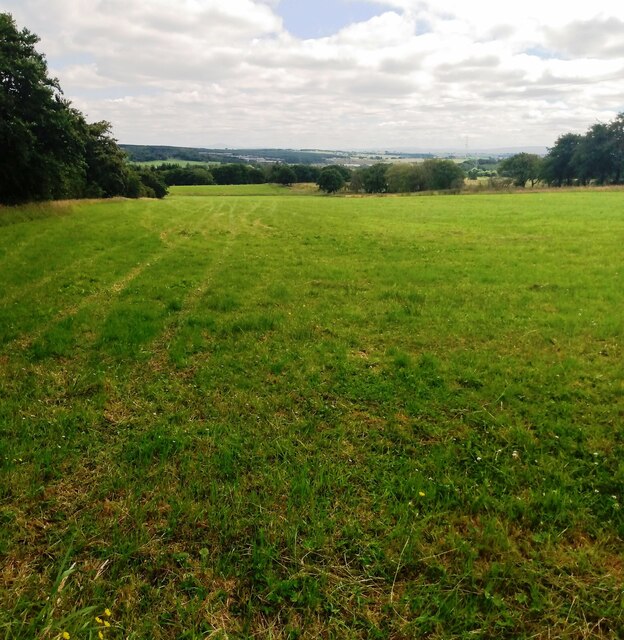
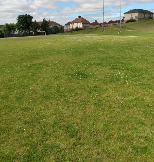
Clarkston Images

Images are sourced within 2km of 55.871501/-3.950831 or Grid Reference NS7865. Thanks to Geograph Open Source API. All images are credited.

The Episcopal Church of St.Paul and St. John the Evangelist, Monklands Built in 1897 to a design by Henry Denison Walton.
The Episcopal Church of St.Paul and St. John the Evangelist, Monklands
Built in 1897 to a design by Henry Denison Walton.
Airdrie from the air The town centre is in the foreground. New Broomfield Park, home of Airdieonians FC <span class="nowrap"><a title="https://www.airdriefc.com/" rel="nofollow ugc noopener" href="https://www.airdriefc.com/">Link</a><img style="margin-left:2px;" alt="External link" title="External link - shift click to open in new window" src="https://s1.geograph.org.uk/img/external.png" width="10" height="10"/></span> , is to the right of centre.
Airdrie from the air
The town centre is in the foreground. New Broomfield Park, home of Airdieonians FC LinkExternal link , is to the right of centre.
Shops on Graham Street, Airdrie
Villas, Drumbathie Road, Airdrie
Airdrie Market Building Dates from 1856, designed by James Thomson <span class="nowrap"><a title="http://www.scottisharchitects.org.uk/architect_full.php?id=203300" rel="nofollow ugc noopener" href="http://www.scottisharchitects.org.uk/architect_full.php?id=203300">Link</a><img style="margin-left:2px;" alt="External link" title="External link - shift click to open in new window" src="https://s1.geograph.org.uk/img/external.png" width="10" height="10"/></span> Built as a Corn Exchange. <span class="nowrap"><a title="http://portal.historicenvironment.scot/designation/LB48553" rel="nofollow ugc noopener" href="http://portal.historicenvironment.scot/designation/LB48553">Link</a><img style="margin-left:2px;" alt="External link" title="External link - shift click to open in new window" src="https://s1.geograph.org.uk/img/external.png" width="10" height="10"/></span>
Airdrie Market Building
Dates from 1856, designed by James Thomson LinkExternal link Built as a Corn Exchange. LinkExternal link
The Robert Hamilton, Bank Street, Airdrie Designed by James Thomson 1874 <span class="nowrap"><a title="http://www.scottisharchitects.org.uk/architect_full.php?id=203300" rel="nofollow ugc noopener" href="http://www.scottisharchitects.org.uk/architect_full.php?id=203300">Link</a><img style="margin-left:2px;" alt="External link" title="External link - shift click to open in new window" src="https://s1.geograph.org.uk/img/external.png" width="10" height="10"/></span>  This was formerly a branch of the Royal Bank of Scotland.
The Robert Hamilton, Bank Street, Airdrie
Designed by James Thomson 1874 LinkExternal link This was formerly a branch of the Royal Bank of Scotland.
New Cross, Airdrie Pretty much the centre of town.
New Cross, Airdrie
Pretty much the centre of town.
Bank Street, Airdrie The former Townhouse dominates with its steeple.
Bank Street, Airdrie
The former Townhouse dominates with its steeple.
Market Street, Airdrie The steeple of the former Town House at the end of the street.
Market Street, Airdrie
The steeple of the former Town House at the end of the street.
Morrisons supermarket and car park, Airdrie
Baxter's bus, no.70, Airdrie Bus Station – 1970 Baxter's ran a substantial network of town services in Airdrie until 1962 when the company was bought by Eastern Scottish, the main operator in the area. Initially buses were painted in standard Eastern Scottish green, but a local outcry saw a reversal of this, and the local identity was re-instated, eventually being phased out by 1977.

No.70 is a Leyland PD2/41, with lowbridge body by Massey Bros of Wigan, new in 1959, representing Baxter's standard vehicle through the 1950s. It also carried Eastern Scottish fleet number HH38.

The bus station site is now occupied by Airdrie Sheriff Court.

This is one of a series of views featuring buses in the 60s, 70s, and 80s.
<a title="https://www.geograph.org.uk/search.php?i=2114547&displayclass=slide" href="https://www.geograph.org.uk/search.php?i=2114547&displayclass=slide">Link</a>
Baxter's bus, no.70, Airdrie Bus Station – 1970
Baxter's ran a substantial network of town services in Airdrie until 1962 when the company was bought by Eastern Scottish, the main operator in the area. Initially buses were painted in standard Eastern Scottish green, but a local outcry saw a reversal of this, and the local identity was re-instated, eventually being phased out by 1977. No.70 is a Leyland PD2/41, with lowbridge body by Massey Bros of Wigan, new in 1959, representing Baxter's standard vehicle through the 1950s. It also carried Eastern Scottish fleet number HH38. The bus station site is now occupied by Airdrie Sheriff Court. This is one of a series of views featuring buses in the 60s, 70s, and 80s. Link
Roundabout: Ballochney Road Serving present and future housing developments
Roundabout: Ballochney Road
Serving present and future housing developments
The old with the new A mobile phone mast beside a chapel and school ruin which is over 100 years old
The old with the new
A mobile phone mast beside a chapel and school ruin which is over 100 years old
Junction on Ballochney Road There is a stop sign but going straight ahead continues as Ballochney Road
Junction on Ballochney Road
There is a stop sign but going straight ahead continues as Ballochney Road
Track north of Ballochney Road Leading into area of reclaimed opencast
Track north of Ballochney Road
Leading into area of reclaimed opencast
Silage has been lifted Large grass field at Meadowhead
Silage has been lifted
Large grass field at Meadowhead
Football pitch: Rawyards This was previously a red ash pitch which I mistakenly assumed would become an all weather pitch
<a href="https://www.geograph.org.uk/photo/1227124">NS7766 : Rawyards park</a>
Football pitch: Rawyards
This was previously a red ash pitch which I mistakenly assumed would become an all weather pitch NS7766 : Rawyards park
Housing development on former Boots Factory site Panel from front of building as a memorial
<a href="https://www.geograph.org.uk/photo/1227119">NS7766 : Boots factory: Airdrie</a>
Housing development on former Boots Factory site
Panel from front of building as a memorial NS7766 : Boots factory: Airdrie
Show me another place!

Clarkston is located at Grid Ref: NS7865 (Lat: 55.871501, Lng: -3.950831)

Unitary Authority: North Lanarkshire

Police Authority: Lanarkshire

What 3 Words

///twist.loved.park. Near Airdrie, North Lanarkshire

Nearby Locations

Clarkston Dunrobin

Related Wikis

Drumgelloch railway station

Drumgelloch railway station is a railway station serving the east of Airdrie, North Lanarkshire, Scotland. It is located 600 yards (550 m) east of the...

Drumgelloch railway station (1989)

Drumgelloch railway station was a railway station serving Drumgelloch, an eastern suburb of Airdrie, North Lanarkshire, Scotland. The station was managed...

Wester Moffat Hospital

Wester Moffat Hospital is a health facility in Towers Road, Airdrie, North Lanarkshire, Scotland. It is managed by NHS Lanarkshire. It is a Grade B listed...

Gartcairn F. A. Juniors

Gartcairn Football Academy Juniors, commonly referred to as Gartcairn Juniors, are a Scottish semi-professional football club from the town of Airdrie...

Nearby Amenities

Located within 500m of 55.871501,-3.950831
Drumgelloch
Public Transport: stop_position
Railway: stop
Train: yes
Wikidata: Q5309156
Wikipedia: en:Drumgelloch railway station
Lat/Long: 55.867823/-3.9480352
Traffic Signals
Lat/Long: 55.8706364/-3.9459576
Noexit: yes
Lat/Long: 55.8683999/-3.9472961
Traffic Signals
Lat/Long: 55.8702785/-3.946709
Mini Roundabout
Direction: clockwise
Lat/Long: 55.8727804/-3.9491257
Mini Roundabout
Lat/Long: 55.8711269/-3.946634
Turning Circle
Lat/Long: 55.8733527/-3.9530546
Noexit: yes
Lat/Long: 55.8731906/-3.950848
Drumgelloch Business Centre
Addr City: AIRDRIE
Addr Housename: 6
Addr Postcode: ML6 7EW
Addr Street: Drumgelloch Street
Building: office
Description: SPR Martine, SPR Training , SPR & Blueflash Security Limited
Lat/Long: 55.8683798/-3.955867
Power: tower
Lat/Long: 55.8733741/-3.9451159
Power: tower
Lat/Long: 55.8754749/-3.9502993
Traffic Signals
Lat/Long: 55.8682039/-3.9515207
Bicycle Parking
Bicycle Parking: stands
Capacity: 30
Covered: yes
Lat/Long: 55.8676165/-3.948732
Crossing
Crossing: zebra
Lat/Long: 55.8678561/-3.9485229
Crossing
Crossing: zebra
Lat/Long: 55.8683202/-3.9475637
Crossing
Crossing: zebra
Lat/Long: 55.8682349/-3.949123
Crossing
Crossing: traffic_signals
Lat/Long: 55.8702907/-3.9465943
Noexit: yes
Lat/Long: 55.8693232/-3.9485399
Crossing
Crossing: traffic_signals
Lat/Long: 55.8706045/-3.9460662
Bicycle Parking
FIXME: check capacity
Bicycle Parking: stands
Capacity: 24
Covered: no
Lat/Long: 55.8731032/-3.9565827
Crossing
Bicycle: yes
Crossing: unmarked
Crossing Island: yes
Traffic Calming: island
Lat/Long: 55.8732885/-3.9506566
Noexit: yes
Lat/Long: 55.8730667/-3.9505628
Drumgelloch
Name Gd: Druim Gailleach
Naptan AtcoCode: 9100DRMGLCH
Network: National Rail
Public Transport: stop_position
Railway: stop
Train: yes
Lat/Long: 55.867803/-3.9479991
Crossing
Crossing: zebra
Lat/Long: 55.8682495/-3.9478072
Crossing
Crossing: zebra
Lat/Long: 55.8680403/-3.9482622
Crossing
Crossing: zebra
Lat/Long: 55.8679361/-3.9484987
Crossing
Crossing: zebra
Lat/Long: 55.8678272/-3.9487354
Crossing
Crossing: zebra
Lat/Long: 55.8677189/-3.9489656
Crossing
Crossing: zebra
Lat/Long: 55.8676134/-3.9491941
Vending Machine
Check Date: 2023-04-08
Currency GBP: yes
Operator: Abellio ScotRail
Payment Credit Cards: yes
Vending: public_transport_tickets
Lat/Long: 55.8677094/-3.9484584
Tesco Express
Brand: Tesco Express
Brand Wikidata: Q98456772
Brand Wikipedia: en:Tesco
Contact Website: https://www.tesco.com/store-locator/airdrie/connor-st
Operator: Tesco
Shop: convenience
Lat/Long: 55.8709183/-3.9456861
Atm
Lat/Long: 55.8709312/-3.945825
William Hill
Brand: William Hill
Brand Wikidata: Q4053147
Brand Wikipedia: en:William Hill (bookmaker)
Shop: bookmaker
Lat/Long: 55.870991/-3.9458906
Noexit: yes
Lat/Long: 55.8736571/-3.9550145
Noexit: yes
Lat/Long: 55.8737286/-3.9554268
Clarkston
Place: suburb
Lat/Long: 55.8710582/-3.9538979
Drumgelloch
Name Gd: Druim Gailleach
Naptan AtcoCode: 9100DRMGLCH
Network: National Rail
Network Website: https://www.nationalrail.co.uk/stations/dru/
Network Wikidata: Q26334
Operator: ScotRail
Operator Website: https://www.scotrail.co.uk/plan-your-journey/stations-and-facilities/dru
Operator Wikidata: Q18356161
Public Transport: station
Railway: station
Ref Crs: DRU
Train: yes
Wikidata: Q5309156
Wikipedia: en:Drumgelloch railway station
Lat/Long: 55.8676763/-3.9483149
Charging Station
Access: yes
Lat/Long: 55.8685937/-3.9481034
Noexit: yes
Lat/Long: 55.8702502/-3.9453605
Noexit: yes
Lat/Long: 55.8703348/-3.94562
Turning Circle
Noexit: yes
Lat/Long: 55.8718131/-3.9460731
Noexit: yes
Lat/Long: 55.8718067/-3.9465164
Noexit: yes
Lat/Long: 55.8721696/-3.9470516
Noexit: yes
Lat/Long: 55.8687392/-3.9447945
Traffic Calming: cushion
Lat/Long: 55.8683314/-3.9458594
Traffic Calming: cushion
Lat/Long: 55.8677357/-3.9470043
Post Box
Post Box Type: pillar
Royal Cypher: GR
Royal Cypher Wikidata: Q33102273
Lat/Long: 55.8678998/-3.9527557
Pharmacy
Clarkston Pharmacy
Healthcare: pharmacy
Lat/Long: 55.8679409/-3.952863
Give Way
Direction: forward
Lat/Long: 55.8678967/-3.9511816
Generator Method: photovoltaic
Generator Output Electricity: yes
Generator Source: solar
Generator Type: solar_photovoltaic_panel
Power: generator
Lat/Long: 55.868665/-3.9495584
Give Way
Direction: forward
Lat/Long: 55.8677473/-3.9531757
Generator Method: photovoltaic
Generator Output Electricity: yes
Generator Source: solar
Generator Type: solar_photovoltaic_panel
Power: generator
Lat/Long: 55.8699376/-3.9467829
Give Way
Direction: forward
Lat/Long: 55.8697479/-3.9459888
Traffic Calming: cushion
Lat/Long: 55.8680354/-3.9465028
Noexit: yes
Lat/Long: 55.8685976/-3.9454044
Generator Method: photovoltaic
Generator Output Electricity: yes
Generator Source: solar
Generator Type: solar_photovoltaic_panel
Power: generator
Lat/Long: 55.8687637/-3.9451017
Generator Method: photovoltaic
Generator Output Electricity: yes
Generator Source: solar
Generator Type: solar_photovoltaic_panel
Power: generator
Lat/Long: 55.8687405/-3.9451596
Generator Method: photovoltaic
Generator Output Electricity: yes
Generator Source: solar
Generator Type: solar_photovoltaic_panel
Power: generator
Lat/Long: 55.8687071/-3.9453531
Generator Method: photovoltaic
Generator Output Electricity: yes
Generator Source: solar
Generator Type: solar_photovoltaic_panel
Power: generator
Lat/Long: 55.8686811/-3.945406
Generator Method: photovoltaic
Generator Output Electricity: yes
Generator Source: solar
Generator Type: solar_photovoltaic_panel
Power: generator
Lat/Long: 55.8686236/-3.9455317
Generator Method: photovoltaic
Generator Output Electricity: yes
Generator Source: solar
Generator Type: solar_photovoltaic_panel
Power: generator
Lat/Long: 55.8685623/-3.9456541
Generator Method: photovoltaic
Generator Output Electricity: yes
Generator Source: solar
Generator Type: solar_photovoltaic_panel
Power: generator
Lat/Long: 55.8684844/-3.9458361
Generator Method: photovoltaic
Generator Output Electricity: yes
Generator Source: solar
Generator Type: solar_photovoltaic_panel
Power: generator
Lat/Long: 55.8684222/-3.9459915
Generator Method: photovoltaic
Generator Output Electricity: yes
Generator Source: solar
Generator Type: solar_photovoltaic_panel
Power: generator
Lat/Long: 55.8683897/-3.9460775
Generator Method: photovoltaic
Generator Output Electricity: yes
Generator Source: solar
Generator Type: solar_photovoltaic_panel
Power: generator
Lat/Long: 55.8683313/-3.9462049
Generator Method: photovoltaic
Generator Output Electricity: yes
Generator Source: solar
Generator Type: solar_photovoltaic_panel
Power: generator
Lat/Long: 55.8682747/-3.9463289
Generator Method: photovoltaic
Generator Output Electricity: yes
Generator Source: solar
Generator Type: solar_photovoltaic_panel
Power: generator
Lat/Long: 55.8682181/-3.9464579
Generator Method: photovoltaic
Generator Output Electricity: yes
Generator Source: solar
Generator Type: solar_photovoltaic_panel
Power: generator
Lat/Long: 55.8681271/-3.9465786
Generator Method: photovoltaic
Generator Output Electricity: yes
Generator Source: solar
Generator Type: solar_photovoltaic_panel
Power: generator
Lat/Long: 55.8681039/-3.9466663
Generator Method: photovoltaic
Generator Output Electricity: yes
Generator Source: solar
Generator Type: solar_photovoltaic_panel
Power: generator
Lat/Long: 55.867974/-3.9468532
Generator Method: photovoltaic
Generator Output Electricity: yes
Generator Source: solar
Generator Type: solar_photovoltaic_panel
Power: generator
Lat/Long: 55.867922/-3.9469293
Generator Method: photovoltaic
Generator Output Electricity: yes
Generator Source: solar
Generator Type: solar_photovoltaic_panel
Power: generator
Lat/Long: 55.8678598/-3.9470831
Generator Method: photovoltaic
Generator Output Electricity: yes
Generator Source: solar
Generator Type: solar_photovoltaic_panel
Power: generator
Lat/Long: 55.8677967/-3.9472204
Generator Method: photovoltaic
Generator Output Electricity: yes
Generator Source: solar
Generator Type: solar_photovoltaic_panel
Power: generator
Lat/Long: 55.8676826/-3.947437
Generator Method: photovoltaic
Generator Output Electricity: yes
Generator Source: solar
Generator Type: solar_photovoltaic_panel
Power: generator
Lat/Long: 55.867716/-3.9473609
Generator Method: photovoltaic
Generator Output Electricity: yes
Generator Source: solar
Generator Type: solar_photovoltaic_panel
Power: generator
Lat/Long: 55.8676399/-3.9475958
Generator Method: photovoltaic
Generator Output Electricity: yes
Generator Source: solar
Generator Type: solar_photovoltaic_panel
Power: generator
Lat/Long: 55.8675796/-3.9477165
Generator Method: photovoltaic
Generator Output Electricity: yes
Generator Source: solar
Generator Type: solar_photovoltaic_panel
Power: generator
Lat/Long: 55.8678886/-3.9463802
Generator Method: photovoltaic
Generator Output Electricity: yes
Generator Source: solar
Generator Type: solar_photovoltaic_panel
Power: generator
Lat/Long: 55.8679322/-3.9462793
Generator Method: photovoltaic
Generator Output Electricity: yes
Generator Source: solar
Generator Type: solar_photovoltaic_panel
Power: generator
Lat/Long: 55.8679963/-3.9461536
Generator Method: photovoltaic
Generator Output Electricity: yes
Generator Source: solar
Generator Type: solar_photovoltaic_panel
Power: generator
Lat/Long: 55.8680278/-3.9460494
Generator Method: photovoltaic
Generator Output Electricity: yes
Generator Source: solar
Generator Type: solar_photovoltaic_panel
Power: generator
Lat/Long: 55.8680724/-3.9458923
Generator Method: photovoltaic
Generator Output Electricity: yes
Generator Source: solar
Generator Type: solar_photovoltaic_panel
Power: generator
Lat/Long: 55.8681308/-3.9457782
Generator Method: photovoltaic
Generator Output Electricity: yes
Generator Source: solar
Generator Type: solar_photovoltaic_panel
Power: generator
Lat/Long: 55.8681893/-3.9456012
Generator Method: photovoltaic
Generator Output Electricity: yes
Generator Source: solar
Generator Type: solar_photovoltaic_panel
Power: generator
Lat/Long: 55.8682542/-3.9454524
Generator Method: photovoltaic
Generator Output Electricity: yes
Generator Source: solar
Generator Type: solar_photovoltaic_panel
Power: generator
Lat/Long: 55.8682839/-3.9452919
Generator Method: photovoltaic
Generator Output Electricity: yes
Generator Source: solar
Generator Type: solar_photovoltaic_panel
Power: generator
Lat/Long: 55.8684036/-3.9450471
Generator Method: photovoltaic
Generator Output Electricity: yes
Generator Source: solar
Generator Type: solar_photovoltaic_panel
Power: generator
Lat/Long: 55.8683693/-3.9451497
Give Way
Direction: forward
Lat/Long: 55.8713222/-3.9470953
Give Way
Direction: forward
Lat/Long: 55.8714039/-3.947191
Give Way
Direction: forward
Lat/Long: 55.8717988/-3.9477119
Give Way
Direction: backward
Lat/Long: 55.8723427/-3.948513
Give Way
Direction: forward
Lat/Long: 55.8723435/-3.9492252
Give Way
Direction: forward
Lat/Long: 55.8730924/-3.9490109
Generator Method: photovoltaic
Generator Output Electricity: yes
Generator Source: solar
Generator Type: solar_photovoltaic_panel
Power: generator
Lat/Long: 55.8727489/-3.9461273
Generator Method: photovoltaic
Generator Output Electricity: yes
Generator Source: solar
Generator Type: solar_photovoltaic_panel
Power: generator
Lat/Long: 55.8730694/-3.946543
Bus Stop
Clarkston, Forrest Street before McGregor Avenue
Bus: yes
Departures Board: timetable
Naptan AtcoCode: 61601047
Naptan NaptanCode: 65236575
Public Transport: platform
Shelter: no
Lat/Long: 55.8676376/-3.9545494
Bus Stop
Clarkston, Forrest Street opp Clarkston Primary School
Bus: yes
Departures Board: timetable
Public Transport: platform
Shelter: yes
Lat/Long: 55.8677594/-3.9524962
Bus Stop
Clarkston, Forrest Street at 97 Forrest Street
Bus: yes
Departures Board: timetable
Naptan AtcoCode: 61601049
Naptan NaptanCode: 65236838
Public Transport: platform
Shelter: yes
Lat/Long: 55.8686067/-3.9507325
Bus Stop
Clarkston, Forrest Street opp 111 Forrest Street
Bus: yes
Departures Board: timetable
Naptan AtcoCode: 61601050
Naptan NaptanCode: 65234957
Public Transport: platform
Shelter: no
Lat/Long: 55.8688359/-3.9498776
Bus Stop
Clarkston, Forrest Street opp Springfield Road
Bus: yes
Departures Board: timetable
Naptan AtcoCode: 61601051
Naptan NaptanCode: 65234847
Public Transport: platform
Shelter: no
Lat/Long: 55.8696702/-3.9482584
Bus Stop
Clarkston, Forrest Street after Towers Road
Bus: yes
Departures Board: timetable
Naptan AtcoCode: 61601052
Naptan NaptanCode: 65235383
Public Transport: platform
Shelter: yes
Lat/Long: 55.8695969/-3.94804
Bus Stop
Clarkston, Forrest Street opp Clarkston Parish Church
Bus: yes
Departures Board: timetable
Public Transport: platform
Shelter: yes
Lat/Long: 55.8718374/-3.9447143
Bus Stop
Clarkston, Forrest Street at Clarkston Parish Church
Bus: yes
Departures Board: timetable
Public Transport: platform
Lat/Long: 55.8725384/-3.9450043
Barrier: cycle_barrier
Lat/Long: 55.8689301/-3.9443737
The data included in this document is from www.openstreetmap.org. The data is made available under ODbL.

Have you been to Clarkston?

Leave your review of Clarkston below (or comments, questions and feedback).