Bampfylde Copse

Wood, Forest in Devon East Devon

England

Bampfylde Copse

Poltimore Churchyard Cross The cross survives as a 15th century socket stone and shaft with a modern head and arms (Scale 1m) <span class="nowrap"><a title="https://historicengland.org.uk/listing/the-list/list-entry/1016219?section=official-list-entry" rel="nofollow ugc noopener" href="https://historicengland.org.uk/listing/the-list/list-entry/1016219?section=official-list-entry">Link</a><img style="margin-left:2px;" alt="External link" title="External link - shift click to open in new window" src="https://s1.geograph.org.uk/img/external.png" width="10" height="10"/></span>
Poltimore Churchyard Cross Credit: Sandy Gerrard

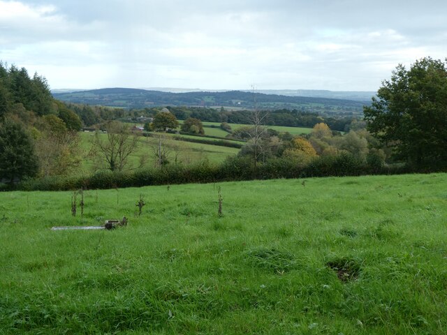
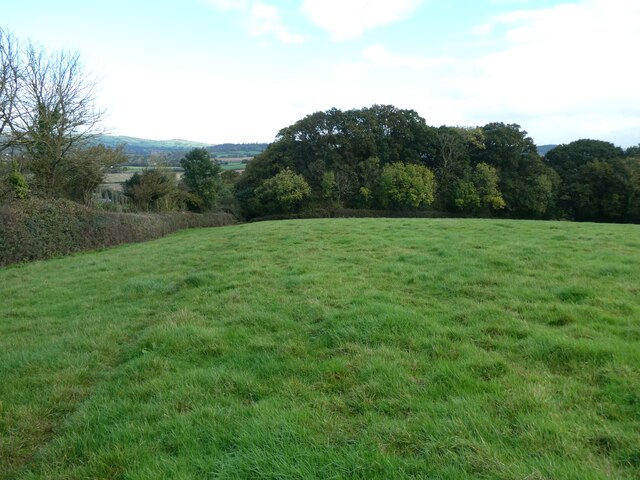
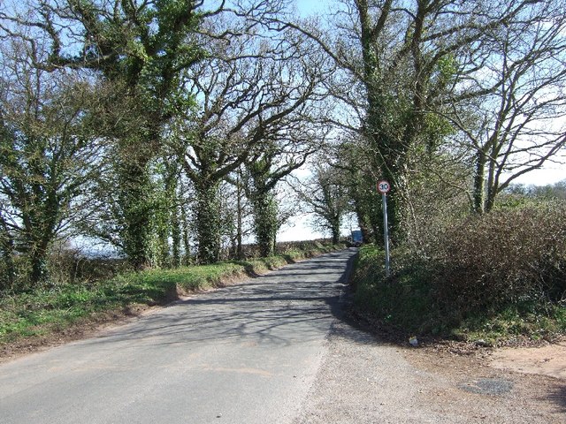
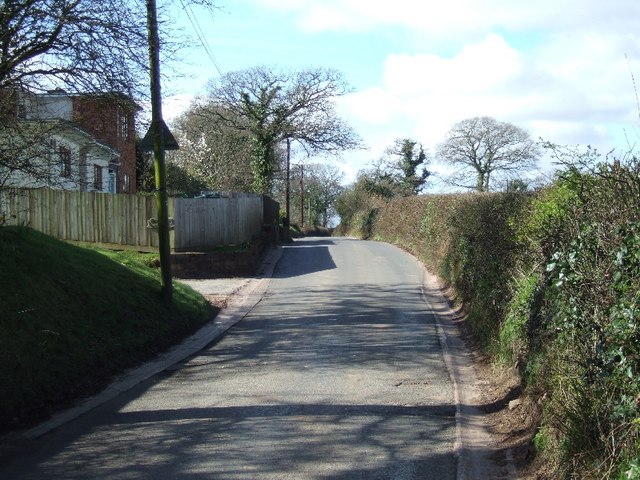
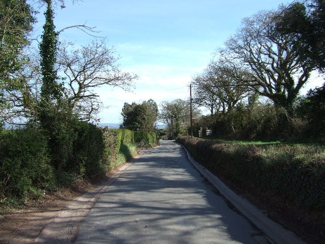
Bampfylde Copse is a charming woodland located in Devon, England. Covering an area of approximately 40 acres, it is nestled in the heart of the picturesque countryside. The copse is situated near the village of Hemyock, providing a tranquil escape for nature enthusiasts and locals alike.

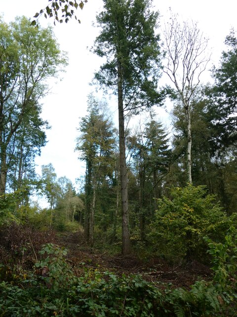
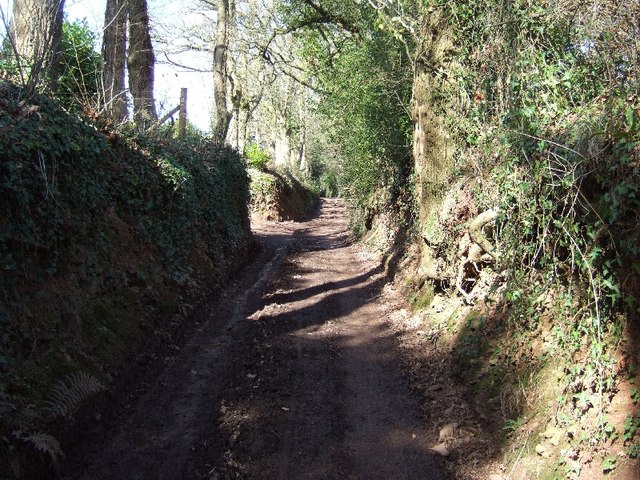
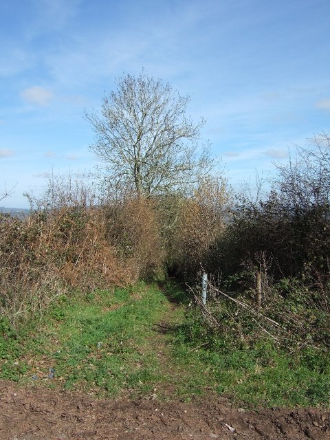
The woodland is predominantly composed of broadleaf trees, with a diverse range of species including oak, beech, and ash. The dense canopy of leaves provides a cool and shaded environment, perfect for a leisurely stroll on a hot summer's day. The forest floor is adorned with a carpet of wildflowers and ferns, adding to the overall beauty and serenity of the copse.

Bampfylde Copse is home to a variety of wildlife, making it an ideal spot for nature lovers and birdwatchers. Visitors may catch a glimpse of woodland creatures such as deer, foxes, badgers, and a plethora of bird species including woodpeckers, tawny owls, and jays.

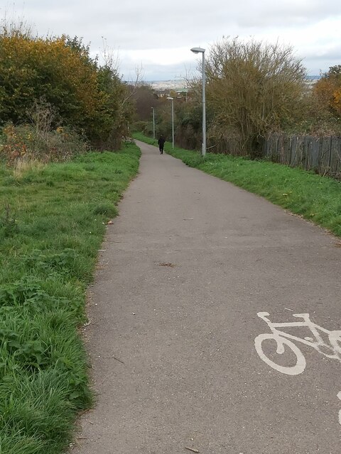
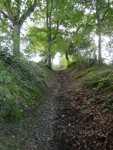
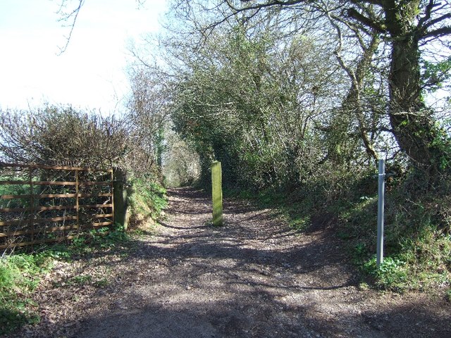
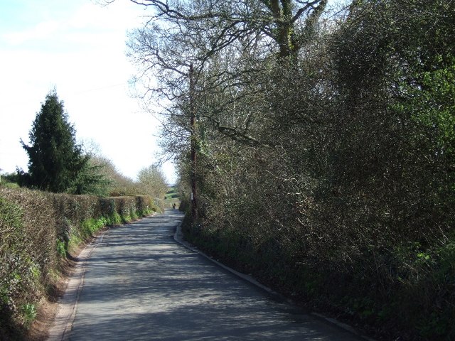
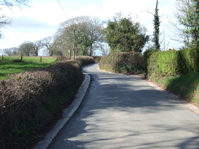
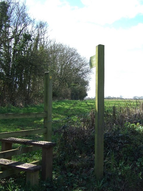
The copse is crisscrossed with a network of well-maintained footpaths, allowing visitors to explore its hidden treasures. These paths lead to several secluded glades and clearings, where one can sit and enjoy the peaceful ambiance of the woodland.

Bampfylde Copse is not only a haven for wildlife and a place of natural beauty, but it also holds historical significance. The copse was once part of the Bampfylde Estate, which dates back to the 14th century. The remnants of the estate, including an old stone bridge and a walled garden, can still be seen within the woodland.

Overall, Bampfylde Copse is a true gem in the Devonshire countryside, offering a tranquil retreat for those seeking solace in nature's embrace.

If you have any feedback on the listing, please let us know in the comments section below.

Bampfylde Copse Images

Images are sourced within 2km of 50.754259/-3.4771216 or Grid Reference SX9596. Thanks to Geograph Open Source API. All images are credited.

Poltimore Churchyard Cross The cross survives as a 15th century socket stone and shaft with a modern head and arms (Scale 1m) <span class="nowrap"><a title="https://historicengland.org.uk/listing/the-list/list-entry/1016219?section=official-list-entry" rel="nofollow ugc noopener" href="https://historicengland.org.uk/listing/the-list/list-entry/1016219?section=official-list-entry">Link</a><img style="margin-left:2px;" alt="External link" title="External link - shift click to open in new window" src="https://s1.geograph.org.uk/img/external.png" width="10" height="10"/></span>
Poltimore Churchyard Cross
The cross survives as a 15th century socket stone and shaft with a modern head and arms (Scale 1m) LinkExternal link
Cycle Path A cyclepath running alongside the railway just north of the Pinhoe Trading Estate in Exeter, Devon.
Cycle Path
A cyclepath running alongside the railway just north of the Pinhoe Trading Estate in Exeter, Devon.
Railway from a Footbridge A view of the railway line, looking towards Exeter, from the footbridge between the Pinhoe Industrial Estate and a small area of park land near the Exeter Arena.
Railway from a Footbridge
A view of the railway line, looking towards Exeter, from the footbridge between the Pinhoe Industrial Estate and a small area of park land near the Exeter Arena.
The M5 north at B 250.4 marker
Old Milestone on Venny Bridge The Milestone is located near the road.  Parish of Exeter (Exeter District). Carved stone post, Exeter granite facets design, erected by the Exeter turnpike trust in the 19th Century. 

Inscription reads:- 
10 / Miles To / Cullompton 

Milestone Society National ID: DV_HNEX14
Old Milestone on Venny Bridge
The Milestone is located near the road.  Parish of Exeter (Exeter District). Carved stone post, Exeter granite facets design, erected by the Exeter turnpike trust in the 19th Century. Inscription reads:- 10 / Miles To / Cullompton Milestone Society National ID: DV_HNEX14
View north-east from Stoke Post Some woodland and farmland on the north of Stoke Hill, Exeter
View north-east from Stoke Post
Some woodland and farmland on the north of Stoke Hill, Exeter
Tree in Huxham Brake, an area of woodland This tree had been left standing when much around it had been felled during forestry work
Tree in Huxham Brake, an area of woodland
This tree had been left standing when much around it had been felled during forestry work
Sunken lane on west of Huxham Brake woodland
Grassland and a faint footpath south of Huxham
Cheynegate Lane Described as "Unsuitable for motor vehicles".  This lane was formerly metalled.
Cheynegate Lane
Described as "Unsuitable for motor vehicles". This lane was formerly metalled.
Bridleway on Beacon Hill
On Beacon Hill, the road to Pinhoe
On Beacon Hill, Dandy Lane to Poltimore A footpath at this end, which broadens into a lane close to Pinhoe.
On Beacon Hill, Dandy Lane to Poltimore
A footpath at this end, which broadens into a lane close to Pinhoe.
Passing White Ladyes
Road passing Huntsland
Road passing Huntsland There is a public footpath sign and a field entrance opposite
Road passing Huntsland
There is a public footpath sign and a field entrance opposite
Stile and footpath to Goffins Farm
Road passing Probus Farm Stud The gateposts on the right for the stud carry carved heads of horses on each one
Road passing Probus Farm Stud
The gateposts on the right for the stud carry carved heads of horses on each one
Show me another place!

Bampfylde Copse is located at Grid Ref: SX9596 (Lat: 50.754259, Lng: -3.4771216)

Administrative County: Devon

District: East Devon

Police Authority: Devon and Cornwall

What 3 Words

///charities.buying.lovely. Near Heavitree, Devon

Related Wikis

Poltimore House

Poltimore House is an 18th-century country house in Poltimore, Devon, England. The Manor of Poltimore was from the 13th to the 20th century the seat of...

Poltimore

Poltimore is a village, civil parish and former manor in the East Devon district, in the county of Devon, England. It lies approximately 5 miles (8.0 km...

Battle of Pinhoe

The Battle of Pinhoe was a battle between the Danes and the men of Devon and Somerset at Pinhoe, Devon. == The battle == In 1001, Vikings laid siege to...

Pinhoe

Pinhoe is a former village, manor and ecclesiastical parish, now a suburb on the north eastern outskirts of the City of Exeter in the English county of...

Pinhoe railway station

Pinhoe railway station is on the eastern edge of the city of Exeter in Devon, England, that serves the village of Pinhoe. It was opened by the London and...

Monkerton

Monkerton is a small hamlet in the village of Pinhoe in the county of Devon. Pinhoe Railway Station is situated there. Monkerton is set to expand hugely...

Stoke Canon

Stoke Canon is a small village and civil parish near the confluence of the rivers Exe and Culm on the main A396 between Exeter and Tiverton in the English...

Exeter Arena

Exeter Arena, formerly known as the Exhibition Fields, is an outdoor sports complex at Whipton Barton in Exeter, Devon. == History == === Early agricultural... ===

Nearby Amenities

Located within 500m of 50.754259,-3.4771216
Battle of Pinhoe
Date: 1001
Historic: battlefield
Lat/Long: 50.7554804/-3.4827303
Mincimore copse
Place: locality
Lat/Long: 50.7547406/-3.4834599
The data included in this document is from www.openstreetmap.org. The data is made available under ODbL.

Have you been to Bampfylde Copse?

Leave your review of Bampfylde Copse below (or comments, questions and feedback).