Clapham Hill

Settlement in Kent Canterbury

England

Clapham Hill

West Cliff Looking at houses on West Cliff.
West Cliff Credit: DS Pugh

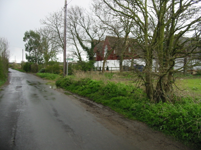
Clapham Hill is a small village located in the county of Kent, England. Situated in the southeastern part of the country, it is nestled amidst the picturesque countryside, offering residents and visitors alike a tranquil and scenic environment. The village is situated on a gently sloping hill, providing stunning views of the surrounding landscape.

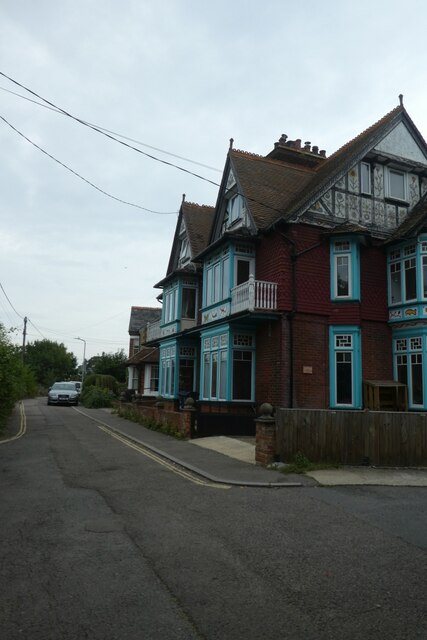
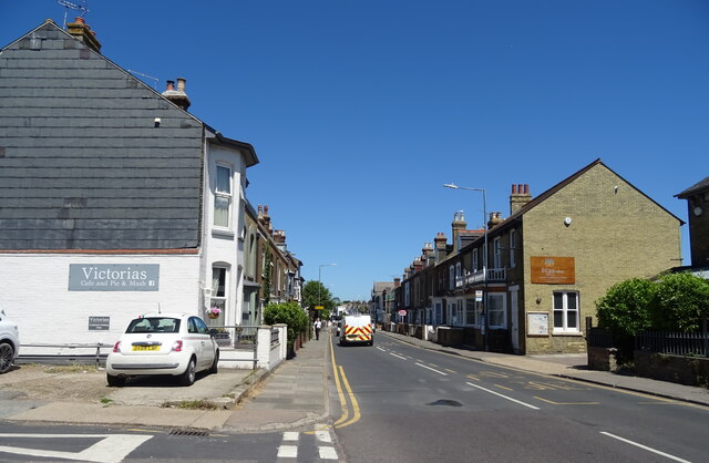
With a population of around 500 residents, Clapham Hill maintains a close-knit community feel. The village is predominantly residential, with a number of charming cottages and houses that showcase traditional English architecture. The streets are lined with well-maintained gardens and lush greenery, adding to the village's aesthetic appeal.

Clapham Hill benefits from its proximity to the nearby town of Canterbury, which is just a short drive away. This allows residents to easily access a wider range of amenities, including shops, restaurants, and leisure facilities. The village also has its own local pub, providing a social hub for residents to gather and enjoy traditional English hospitality.

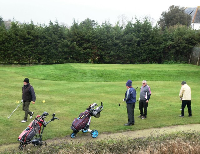
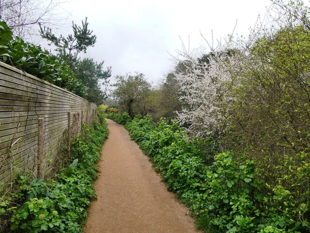
Nature enthusiasts will appreciate the village's close proximity to the Kent Downs, an Area of Outstanding Natural Beauty. This offers ample opportunities for outdoor activities such as hiking, cycling, and wildlife spotting. Additionally, Clapham Hill is well-connected to a network of public footpaths, allowing residents to explore the surrounding countryside at their leisure.

In conclusion, Clapham Hill is a charming village in Kent, offering a peaceful and idyllic setting for its residents. Its picturesque surroundings, strong sense of community, and convenient location make it an attractive place to live or visit.

If you have any feedback on the listing, please let us know in the comments section below.
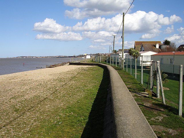
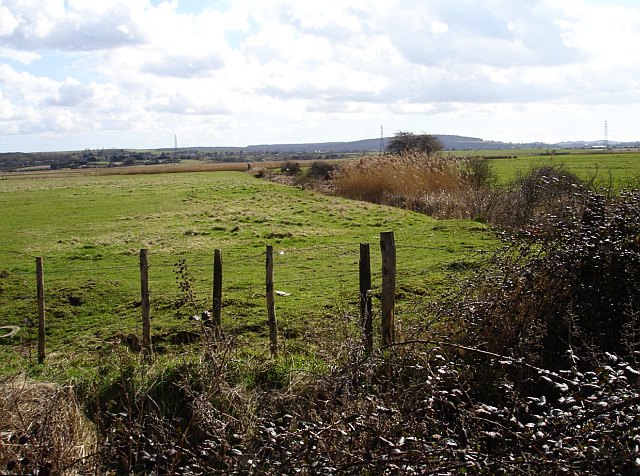
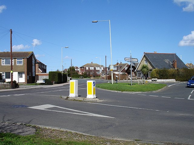
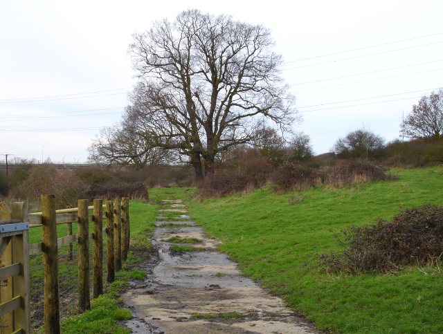
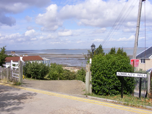
Clapham Hill Images

Images are sourced within 2km of 51.336292/1.0134225 or Grid Reference TR1064. Thanks to Geograph Open Source API. All images are credited.

West Cliff Looking at houses on West Cliff.
West Cliff
Looking at houses on West Cliff.
Old houses on Canterbury Road, Whitstable
Joy Lane, Whitstable
The Two Brewers, Whitstable On Canterbury Road.
See <a href="https://www.geograph.org.uk/photo/7223454">TR1065 : Sign for the Two Brewers, Whitstable</a> for sign.
The Two Brewers, Whitstable
On Canterbury Road. See TR1065 : Sign for the Two Brewers, Whitstable for sign.
Sign for the Two Brewers, Whitstable See <a href="https://www.geograph.org.uk/photo/7223451">TR1065 : The Two Brewers, Whitstable</a> for context.
Sign for the Two Brewers, Whitstable
Canterbury Road (B2205)
Former Toll House, B2205, Whitstable On the Junction with Joy Lane. This view is across Borstal Hill (B2205). The building has been known as "Tollgate Stores" at some point, but lacks a name currently. It served the Whitstable Turnpike Trust up to the mid 19ᵗʰ C.
A view of the property looking down Borstal Hill is <a href="https://www.geograph.org.uk/photo/5317123">TR1065 : Joy Lane at the junction of Canterbury Road</a>.

Grade II listed Nᴼ. 1084965 <span class="nowrap"><a title="https://historicengland.org.uk/listing/the-list/list-entry/1084965" rel="nofollow ugc noopener" href="https://historicengland.org.uk/listing/the-list/list-entry/1084965">Link</a><img style="margin-left:2px;" alt="External link" title="External link - shift click to open in new window" src="https://s1.geograph.org.uk/img/external.png" width="10" height="10"/></span>

Milestone Society National ID: KE.WHI
Former Toll House, B2205, Whitstable
On the Junction with Joy Lane. This view is across Borstal Hill (B2205). The building has been known as "Tollgate Stores" at some point, but lacks a name currently. It served the Whitstable Turnpike Trust up to the mid 19ᵗʰ C. A view of the property looking down Borstal Hill is TR1065 : Joy Lane at the junction of Canterbury Road. Grade II listed Nᴼ. 1084965 LinkExternal link Milestone Society National ID: KE.WHI
West Cliff Footpath, Whitstable North of the railway line and south of Whitstable and Seasalter Golf Course.
West Cliff Footpath, Whitstable
North of the railway line and south of Whitstable and Seasalter Golf Course.
A seat for golf lovers, Whitstable A seat with a good view of Whitstable and Seasalter Golf course from West Cliff footpath.
A seat for golf lovers, Whitstable
A seat with a good view of Whitstable and Seasalter Golf course from West Cliff footpath.
Path across the golf course, Whitstable Running across the centre of Whitstable and Seasalter Golf Course between West Cliff and Island Wall.
Path across the golf course, Whitstable
Running across the centre of Whitstable and Seasalter Golf Course between West Cliff and Island Wall.
Whitstable and Seasalter Golf Course, Whitstable The crossing  point for golfers over the footpath that runs across the centre of the course.
Whitstable and Seasalter Golf Course, Whitstable
The crossing point for golfers over the footpath that runs across the centre of the course.
Golfers, Whitstable On the Whitstable and  Seasalter Golf Course.
Golfers, Whitstable
On the Whitstable and Seasalter Golf Course.
Golfers, Whitstable On the Whitstable and  Seasalter Golf Course.
Golfers, Whitstable
On the Whitstable and Seasalter Golf Course.
Footpath, Whitstable By the golf course, leading to Island Wall.
Footpath, Whitstable
By the golf course, leading to Island Wall.
Footpath, Whitstable Leading over the golf course to West Cliff.
Footpath, Whitstable
Leading over the golf course to West Cliff.
Holiday Park at Seasalter There are many chalet and caravan parks along this shore, this one, near the Blue Anchor pub, is right on the beach, separated only by a lowish sea wall and the Saxon Shore Way. Looking east towards Whitstable.
Holiday Park at Seasalter
There are many chalet and caravan parks along this shore, this one, near the Blue Anchor pub, is right on the beach, separated only by a lowish sea wall and the Saxon Shore Way. Looking east towards Whitstable.
Seasalter Levels Marked on the map as a nature reserve and bordered by caravan parks the marsh (along with Graveney, Cleve and Nagden Marshes to the west) covers an area of about eleven square kilometres between here and Faversham Creek. It has been drained since the sea wall was built in the 14th century and is grazed by sheep and cattle. The feathery tops of the reeds show the positions of the drainage dykes. Looking south from Faversham Road, the pylons are in TR0863.
Seasalter Levels
Marked on the map as a nature reserve and bordered by caravan parks the marsh (along with Graveney, Cleve and Nagden Marshes to the west) covers an area of about eleven square kilometres between here and Faversham Creek. It has been drained since the sea wall was built in the 14th century and is grazed by sheep and cattle. The feathery tops of the reeds show the positions of the drainage dykes. Looking south from Faversham Road, the pylons are in TR0863.
Seasalter Cross Not a stone cross but a cross roads on the south western edge of this ancient borough, first recorded in an Anglo Saxon charter of 785 CE. Faversham Road is now the 'through' road, left for the Blue Anchor pub and the road along the sea wall  to Faversham, straight on for Joy Lane and eventually Whitstable. Church Lane runs right and was the road to Canterbury in Roman times but now runs up to the slip road from the east-bound Thanet Way. The fourth road, beside which I stood, is Seasalter Lane which runs south and under the Thanet Way to Yorkletts.
Seasalter Cross
Not a stone cross but a cross roads on the south western edge of this ancient borough, first recorded in an Anglo Saxon charter of 785 CE. Faversham Road is now the 'through' road, left for the Blue Anchor pub and the road along the sea wall to Faversham, straight on for Joy Lane and eventually Whitstable. Church Lane runs right and was the road to Canterbury in Roman times but now runs up to the slip road from the east-bound Thanet Way. The fourth road, beside which I stood, is Seasalter Lane which runs south and under the Thanet Way to Yorkletts.
Show me another place!

Clapham Hill is located at Grid Ref: TR1064 (Lat: 51.336292, Lng: 1.0134225)

Administrative County: Kent

District: Canterbury

Police Authority: Kent

What 3 Words

///recliner.towers.including. Near Whitstable, Kent

Related Wikis

Duncan Down

Duncan Down is an open, public, area to the south west of Whitstable and is the largest village green in the United Kingdom. It is a 21 hectare (52 acre...

Foxes Cross Bottom

Foxes Cross Bottom is a 4-hectare (9.9-acre) Local Nature Reserve north-west of Whitstable in Kent. It is owned and managed by Canterbury City Council...

Black Mill, Whitstable

Black Mill, or Borstal Hill Mill is a smock mill in Whitstable, Kent, England that was built in 1815. It is now a part of a private residence at the end...

Yorkletts

Yorkletts is a settlement two miles south of Whitstable in Kent in South East England. At the 2011 Census the settlement was included in the Seasalter...

Seasalter

Seasalter is a village (and district council ward) in the Canterbury District of Kent, England. Seasalter is on the north coast of Kent, between the towns...

Seasalter Levels

Seasalter Levels is a 71.4-hectare (176-acre) Local Nature Reserve in Seasalter, on the western outskirts of Whitstable in Kent. It is owned and managed...

Ellenden Wood

Ellenden Wood is a 90.6-hectare (224-acre) biological Site of Special Scientific Interest south of Whitstable in Kent. It is a Nature Conservation Review...

Whitstable Museum and Gallery

Whitstable Museum is a heritage centre in Whitstable, Kent, with Invicta, one of the world's oldest steam engines, the history of the local oyster trade...

Nearby Amenities

Located within 500m of 51.336292,1.0134225
Motorway Junction
Lat/Long: 51.3384503/1.0072086
Bicycle Parking
Bicycle Parking: stands
Capacity: 12
Check Date Capacity: 2023-05-15
Covered: no
Source: survey
Lat/Long: 51.3407661/1.0129243
Power: tower
Source: Bing
Lat/Long: 51.3320811/1.0148382
Barrier: swing_gate
Lat/Long: 51.3397355/1.0091422
Communication Microwave: no
Communication Mobile Phone: yes
Man Made: mast
Operator: O2
Tower Type: communication
Lat/Long: 51.3407153/1.0141918
Gate
Barrier: kissing_gate
Bicycle: no
Foot: yes
Horse: no
Motor Vehicle: no
Lat/Long: 51.3398493/1.0130602
Barrier: kissing_gate
Lat/Long: 51.3343017/1.0084864
Barrier: kissing_gate
Lat/Long: 51.3367887/1.0082045
Barrier: kissing_gate
Lat/Long: 51.3354255/1.0089566
Barrier: kissing_gate
Lat/Long: 51.3388966/1.0102866
Barrier: kissing_gate
Lat/Long: 51.3388322/1.0084002
Communication Mobile Phone: yes
Man Made: mast
Operator: O2
Tower Type: communication
Lat/Long: 51.3373863/1.0139408
Barrier: stile
Lat/Long: 51.3364643/1.0190941
Barrier: stile
Lat/Long: 51.3371315/1.0182573
The data included in this document is from www.openstreetmap.org. The data is made available under ODbL.

Have you been to Clapham Hill?

Leave your review of Clapham Hill below (or comments, questions and feedback).