Hele Plantation

Wood, Forest in Somerset Somerset West and Taunton

England

Hele Plantation

Haddeo Valley Lady Harriet Acland's drive in the Haddeo valley near the village of Bury.
Haddeo Valley Credit: Philip Halling

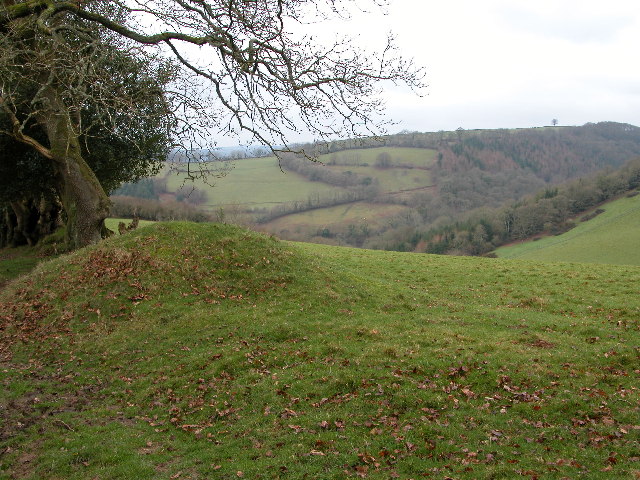
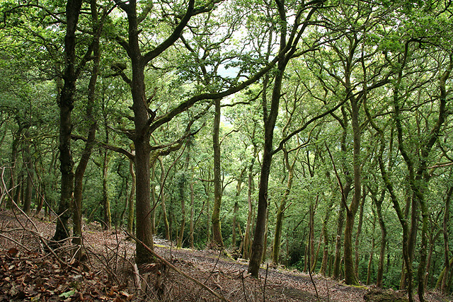
Hele Plantation, located in Somerset, England, is a stunning woodland area known for its natural beauty and diverse wildlife. Spanning over a vast area, the plantation is a haven for nature enthusiasts and a popular destination for outdoor activities.

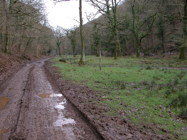
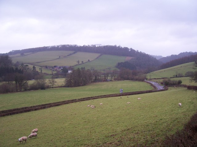
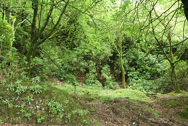
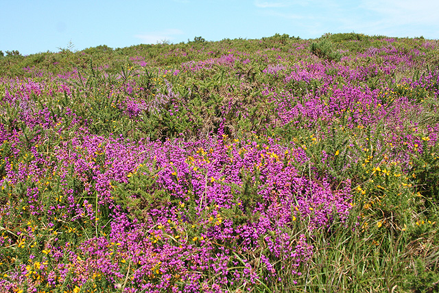
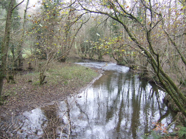
The woodland is primarily composed of mixed deciduous trees, including oak, ash, and beech, which provide a rich and varied habitat for a wide range of flora and fauna. The dense canopy of the trees creates a cool and shaded environment, perfect for a leisurely stroll or a picnic on a sunny day.

Hele Plantation is renowned for its abundance of wildlife. The woodland is home to various bird species, including woodpeckers, nuthatches, and tawny owls. Visitors may also spot small mammals such as squirrels, hedgehogs, and even badgers.

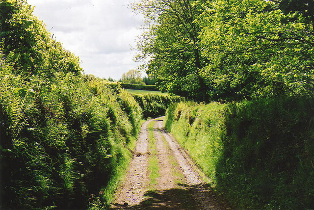
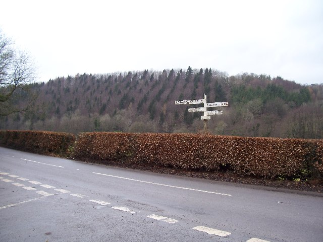
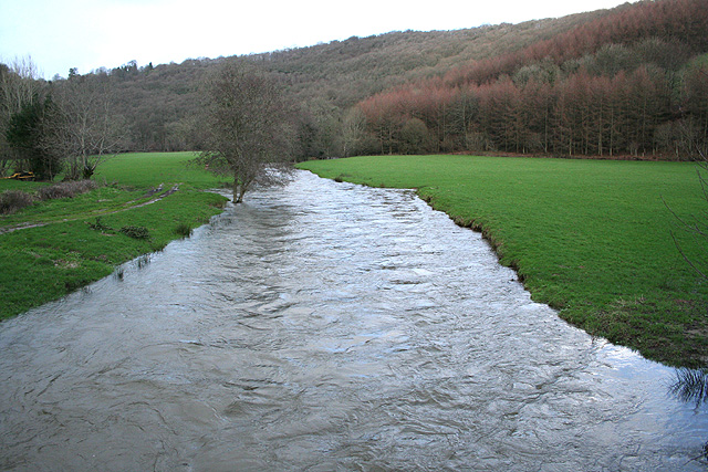
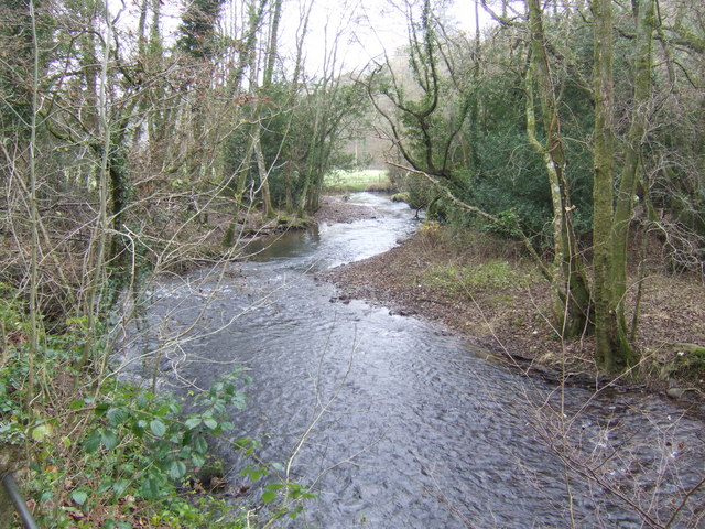
The plantation offers numerous walking trails, allowing visitors to explore the woodland at their own pace. These trails range from short, easy routes suitable for families with young children to longer, more challenging paths for experienced hikers. Along the way, walkers can enjoy beautiful views of the surrounding countryside and may even come across a picturesque stream or pond.

The plantation also provides an excellent opportunity for educational activities and nature studies. Local schools often organize field trips to Hele Plantation, where students can learn about the different tree species, observe wildlife, and study the woodland ecosystem.

Overall, Hele Plantation is a captivating natural gem in Somerset, offering a peaceful escape from the hustle and bustle of everyday life and providing a sanctuary for wildlife and nature lovers alike.

If you have any feedback on the listing, please let us know in the comments section below.

Hele Plantation Images

Images are sourced within 2km of 51.04244/-3.5191937 or Grid Reference SS9328. Thanks to Geograph Open Source API. All images are credited.

Haddeo Valley Lady Harriet Acland's drive in the Haddeo valley near the village of Bury.
Haddeo Valley
Lady Harriet Acland's drive in the Haddeo valley near the village of Bury.
Bridge in village of Bury The bridge and ford crossing the River Haddeo in the village of Bury on Somerset.
Bridge in village of Bury
The bridge and ford crossing the River Haddeo in the village of Bury on Somerset.
Haddeo Valley The Haddeo valley viewed from the Haddon Lane, above the village of Bury.
Haddeo Valley
The Haddeo valley viewed from the Haddon Lane, above the village of Bury.
Dulverton: track running south to Jury Cross The track appears to head towards Pixton Park, just beyond Jury Cross
Dulverton: track running south to Jury Cross
The track appears to head towards Pixton Park, just beyond Jury Cross
Brompton Regis: ford and packhorse bridge at Bury Crossing the river Haddeo, a tributary of the Exe
Brompton Regis: ford and packhorse bridge at Bury
Crossing the river Haddeo, a tributary of the Exe
Brompton Regis: Hunt’s Farm The farm offers bed and breakfast and has organic eggs for sale
Brompton Regis: Hunt’s Farm
The farm offers bed and breakfast and has organic eggs for sale
Bury Cross The junction of 'Bury Cross', looking west towards Pixton Hill.
Bury Cross
The junction of 'Bury Cross', looking west towards Pixton Hill.
Machine Cross The road junction 'Machine Cross', and the Exe valley. The river Exe flows south along the far (western) edge of the valley floor.
Machine Cross
The road junction 'Machine Cross', and the Exe valley. The river Exe flows south along the far (western) edge of the valley floor.
Dulverton: Bath Meadow Drive Looking north-north-west amongst bungalows
Dulverton: Bath Meadow Drive
Looking north-north-west amongst bungalows
Dulverton: entrance to Pixton Park House There are several entrances to the private estate, of which this is one. Some of the others have lodges or gatehouses. Looking west-north-west
Dulverton: entrance to Pixton Park House
There are several entrances to the private estate, of which this is one. Some of the others have lodges or gatehouses. Looking west-north-west
Brompton Regis: the A396 in the Exe Valley River and road adjoin. Looking west-south-west on the edge of Brockhole Wood
Brompton Regis: the A396 in the Exe Valley
River and road adjoin. Looking west-south-west on the edge of Brockhole Wood
Brompton Regis: old quarry On Bury Hill by the road from Machine Cross, and now populated with rhododendrons. Looking north east
Brompton Regis: old quarry
On Bury Hill by the road from Machine Cross, and now populated with rhododendrons. Looking north east
Brompton Regis: Barlynch Wood A hanging wood in the Exe valley. Looking south-south-west
Brompton Regis: Barlynch Wood
A hanging wood in the Exe valley. Looking south-south-west
Dulverton: the Exe above Helebridge Looking north-north-east towards Barlynch Wood
Dulverton: the Exe above Helebridge
Looking north-north-east towards Barlynch Wood
Old hydroelectric scheme  on the Barle below Dulverton This old electricity generating installation can be viewed from the Exe Valley Way, it is viewed across the River Barle. Looking towards the West on a warm winter's afternoon. 
 
(Update: The building has been pulled down since this photo was taken. See forum <a title="https://www.geograph.org.uk/discuss/index.php?gridref=SS9226" href="https://www.geograph.org.uk/discuss/index.php?gridref=SS9226">Link</a> for further information.)
Old hydroelectric scheme on the Barle below Dulverton
This old electricity generating installation can be viewed from the Exe Valley Way, it is viewed across the River Barle. Looking towards the West on a warm winter's afternoon. (Update: The building has been pulled down since this photo was taken. See forum Link for further information.)
Brompton Regis: heather on Haddon Hill Looking north
Brompton Regis: heather on Haddon Hill
Looking north
River Haddeo near Bury, Somerset View downstream near to the point where it meets up with the Exe.
River Haddeo near Bury, Somerset
View downstream near to the point where it meets up with the Exe.
River Haddeo - upstream A meander presents itself nicely by the minor road to Bury enabling an up- and downstream shot from the same spot!
River Haddeo - upstream
A meander presents itself nicely by the minor road to Bury enabling an up- and downstream shot from the same spot!
Show me another place!

Hele Plantation is located at Grid Ref: SS9328 (Lat: 51.04244, Lng: -3.5191937)

Administrative County: Somerset

District: Somerset West and Taunton

Police Authority: Avon and Somerset

What 3 Words

///submerged.symphony.computer. Near Dulverton, Somerset

Related Wikis

Bury Bridge

Bury Bridge at Bury in the parish of Brompton Regis within the English county of Somerset is a medieval packhorse bridge. It has been scheduled as an ancient...

Barlynch Priory

Barlynch Priory (also known as St Nicholas's Priory and sometimes spelled Barlich Priory) in Brompton Regis, Somerset, England was an Augustinian priory...

Bury Castle, Brompton Regis

Bury Castle near Brompton Regis in the English county of Somerset was an Iron Age univallate hillfort which was reused with the creation of a motte after...

River Haddeo

The River Haddeo on Exmoor in Somerset, England flows from the Wimbleball Lake to the River Exe. The valley of the river consists of three tributary valleys...

Dulverton Rural District

Dulverton was a rural district in Somerset, England, from 1894 to 1974. It was created in 1894 under the Local Government Act 1894. In 1974 it was abolished...

Church of All Saints, Dulverton

The Anglican Church of All Saints in Dulverton, Somerset, England was built in the 15th century and largely rebuilt in the 1850s. It is a Grade II* listed...

Dulverton

Dulverton is a town and civil parish in west Somerset, England, near the border with Devon. The town had a population of 1,408 at the 2011 Census. The...

Dulverton Town Hall

Dulverton Town Hall is a municipal building in Fore Street in Dulverton, Somerset, England. The building, which is the meeting place of Dulverton Town...

Nearby Amenities

Located within 500m of 51.04244,-3.5191937
Machine Cross
Junction: yes
Lat/Long: 51.0382821/-3.5187461
Tower Plantation
Place: locality
Lat/Long: 51.0464474/-3.516497
Hele Plantation
Place: locality
Lat/Long: 51.0420474/-3.5192601
Hele Bridge
Place: locality
Lat/Long: 51.0399697/-3.5232985
The data included in this document is from www.openstreetmap.org. The data is made available under ODbL.

Have you been to Hele Plantation?

Leave your review of Hele Plantation below (or comments, questions and feedback).