Annat

Settlement in Ross-shire

Scotland

Annat

A896, Glen Torridon The A896 runs 32 miles from Strathcarron to Kinlochewe.
<span class="nowrap"><a title="https://www.sabre-roads.org.uk/wiki/index.php?title=A896" rel="nofollow ugc noopener" href="https://www.sabre-roads.org.uk/wiki/index.php?title=A896">Link</a><img style="margin-left:2px;" alt="External link" title="External link - shift click to open in new window" src="https://s1.geograph.org.uk/img/external.png" width="10" height="10"/></span>
A896, Glen Torridon Credit: N Chadwick

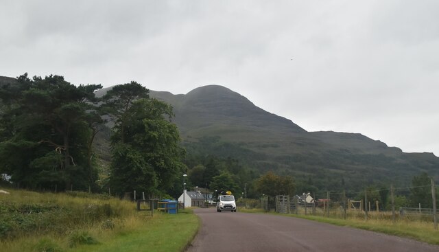
Annat is a small village located in the county of Ross-shire, in the Highlands region of Scotland. Situated about 10 miles northwest of the town of Dingwall, Annat is nestled within a picturesque landscape that showcases the natural beauty of the Scottish Highlands.

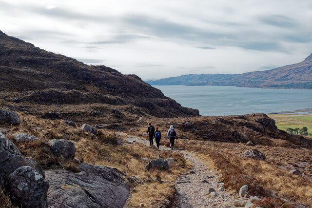
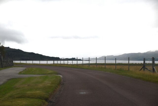
The village is home to a tight-knit community, with a population of around 150 residents. The area is characterized by its tranquil atmosphere and stunning scenery, attracting visitors who seek a peaceful retreat away from the hustle and bustle of urban life. Annat is surrounded by rolling hills, lush green fields, and dense forests, making it an ideal destination for hikers, nature enthusiasts, and photographers.

Despite its small size, Annat offers a range of amenities to cater to the needs of its residents. The village has a local pub, a small convenience store, and a primary school. For more extensive shopping and entertainment options, residents can easily access nearby towns such as Dingwall or Inverness, which are both within a short driving distance.

The history of Annat dates back centuries, and remnants of its past can be seen through various landmarks and historic sites in the area. The village is also well-connected to the rest of the region, with good road links that provide easy access to other parts of Ross-shire and the wider Highlands.

In summary, Annat is a charming village in Ross-shire that offers a peaceful and idyllic setting amidst the scenic Scottish Highlands. With its natural beauty, friendly community, and convenient location, Annat is a hidden gem for those seeking a tranquil escape in the heart of Scotland.

If you have any feedback on the listing, please let us know in the comments section below.

Annat Images

Images are sourced within 2km of 57.52928/-5.52497 or Grid Reference NG8954. Thanks to Geograph Open Source API. All images are credited.
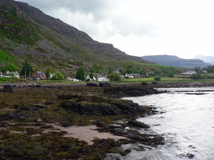
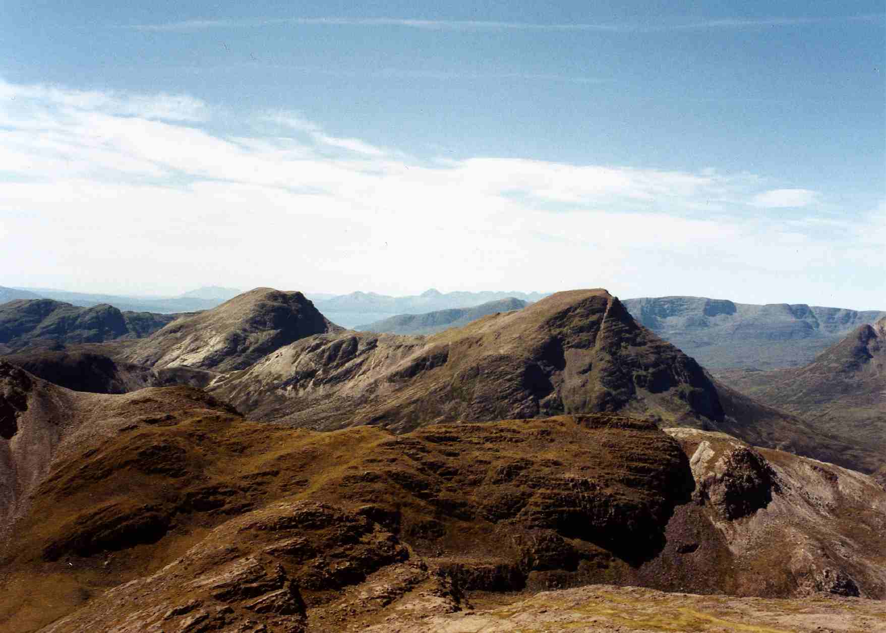
A896, Glen Torridon The A896 runs 32 miles from Strathcarron to Kinlochewe.
<span class="nowrap"><a title="https://www.sabre-roads.org.uk/wiki/index.php?title=A896" rel="nofollow ugc noopener" href="https://www.sabre-roads.org.uk/wiki/index.php?title=A896">Link</a><img style="margin-left:2px;" alt="External link" title="External link - shift click to open in new window" src="https://s1.geograph.org.uk/img/external.png" width="10" height="10"/></span>
A896, Glen Torridon
The A896 runs 32 miles from Strathcarron to Kinlochewe. LinkExternal link
Scottish Hill Tracks 299 and 300 above Loch Torridon In places the track crosses slabs of flat bedding rock, and here helpfully the edge of the path has been marked by stones.
Scottish Hill Tracks 299 and 300 above Loch Torridon
In places the track crosses slabs of flat bedding rock, and here helpfully the edge of the path has been marked by stones.
Inner Loch Torridon and Torridon village from Hill Track 299/300 A view of the transition from moorland brown to greens at the head of Loch Torridon.  Beinn Alligin is the distinctive mountain across Loch Torridon.
Inner Loch Torridon and Torridon village from Hill Track 299/300
A view of the transition from moorland brown to greens at the head of Loch Torridon. Beinn Alligin is the distinctive mountain across Loch Torridon.
Hill Track from Annat to Coulags and Achnashellach The two routes are designated Scottish Hill Tracks 299 and 300, but share the same route out of Annat.
Hill Track from Annat to Coulags and Achnashellach
The two routes are designated Scottish Hill Tracks 299 and 300, but share the same route out of Annat.
Hill Track to Annat from Achnashellach and Coulags Scotways Hill Tracks 299 and 300 make a gradual descent for around 700 metres elevation down to the sea at Annat.
Hill Track to Annat from Achnashellach and Coulags
Scotways Hill Tracks 299 and 300 make a gradual descent for around 700 metres elevation down to the sea at Annat.
Descending towards Annat on the Hill Track The track here follows a bedding plane making it easy underfoot. Loch Torridon in the background.
Descending towards Annat on the Hill Track
The track here follows a bedding plane making it easy underfoot. Loch Torridon in the background.
Glen Torridon from the hill track to Annat The sides of Liathach and Beinn Eighe dominate the northern side of Glen Torridon.
Glen Torridon from the hill track to Annat
The sides of Liathach and Beinn Eighe dominate the northern side of Glen Torridon.
Boulders and bedding plane above Glen Torridon Liathach and Beinn Eighe dominate the north side of Glen Torridon.
Boulders and bedding plane above Glen Torridon
Liathach and Beinn Eighe dominate the north side of Glen Torridon.
On the path to Annat Downhill virtually all the way from here.
On the path to Annat
Downhill virtually all the way from here.
Torridon village from above Annat The village is dwarfed by the flanks of Liathach.
Torridon village from above Annat
The village is dwarfed by the flanks of Liathach.
Torridon Mountain Rescue Team building
New house near Annat
Village below the mountain A view across the fields from Annat to Torridon village which sits almost at sea level with the huge flank of Liathach immediately behind. The mountain goes from sea level to over 1000m in one great sweep. The second highest point of the mountain, Mullach an Rathain [1023m] is just off camera to the right. In the centre of the village buildings can be seen the modern fitness and community centre, which also has an excellent cafe for those exhausted by looking at Liathach.
Village below the mountain
A view across the fields from Annat to Torridon village which sits almost at sea level with the huge flank of Liathach immediately behind. The mountain goes from sea level to over 1000m in one great sweep. The second highest point of the mountain, Mullach an Rathain [1023m] is just off camera to the right. In the centre of the village buildings can be seen the modern fitness and community centre, which also has an excellent cafe for those exhausted by looking at Liathach.
A meadow awaiting the sweep of the hay-maker's scythe A dry-stane wall, topped by three strands of wire that are intended to deter wall climbing sheep, overlooks a meadow scattered with the white seed heads of Cotton-grass, and patiently anticipating the sweep of the hay-maker's scythe. Beyond the vista across Glen Torridon is lost in the mist.
A meadow awaiting the sweep of the hay-maker's scythe
A dry-stane wall, topped by three strands of wire that are intended to deter wall climbing sheep, overlooks a meadow scattered with the white seed heads of Cotton-grass, and patiently anticipating the sweep of the hay-maker's scythe. Beyond the vista across Glen Torridon is lost in the mist.
OS Bench Mark OS rivet bench mark on wall of old graveyard, Annat. The whole thing was covered by moss; the cut arrow is very weathered and doesn't show up well on this photo. 17.6 feet above old datum; re-levelled to 5.924 m in 1975.
OS Bench Mark
OS rivet bench mark on wall of old graveyard, Annat. The whole thing was covered by moss; the cut arrow is very weathered and doesn't show up well on this photo. 17.6 feet above old datum; re-levelled to 5.924 m in 1975.
OS Bench Mark OS cut bench mark on house, formerly a general store (see <a href="https://www.geograph.org.uk/photo/1678346">NG8954 : DJ MacKenzie's General Store, Annat, Torridon, April 1981</a>), close to main road. 4.470 m above datum. This bench mark replaces a 19th-century one at NG89455449 that was destroyed when the road was re-aligned.
OS Bench Mark
OS cut bench mark on house, formerly a general store (see NG8954 : DJ MacKenzie's General Store, Annat, Torridon, April 1981), close to main road. 4.470 m above datum. This bench mark replaces a 19th-century one at NG89455449 that was destroyed when the road was re-aligned.
A896 The A896 runs 32 miles from Strathcarron to Kinlochewe.
<span class="nowrap"><a title="https://www.sabre-roads.org.uk/wiki/index.php?title=A896" rel="nofollow ugc noopener" href="https://www.sabre-roads.org.uk/wiki/index.php?title=A896">Link</a><img style="margin-left:2px;" alt="External link" title="External link - shift click to open in new window" src="https://s1.geograph.org.uk/img/external.png" width="10" height="10"/></span>
A896
The A896 runs 32 miles from Strathcarron to Kinlochewe. LinkExternal link
A896, Annat The North Coast 500 is a 516 mile scenic route around the north coast of Scotland, starting and ending at Inverness Castle. The route is also known as the NC500 and was launched in 2015, linking many features in the north Highlands of Scotland in one touring route.
The route has increased visitor numbers to parts of the north of Scotland, which has brought economic benefits to some areas. The increase in traffic has also led to more instances of bad and dangerous driving, as well as damage to the roads and concerns about the environmental impact. 
Apparently the route was amended in 2022 with detours etc being removed.
Wikipedia: <span class="nowrap"><a title="https://en.wikipedia.org/wiki/North_Coast_500" rel="nofollow ugc noopener" href="https://en.wikipedia.org/wiki/North_Coast_500">Link</a><img style="margin-left:2px;" alt="External link" title="External link - shift click to open in new window" src="https://s1.geograph.org.uk/img/external.png" width="10" height="10"/></span> 
Original route map: <span class="nowrap"><a title="https://en.wikipedia.org/wiki/North_Coast_500#/media/File:North_Coast_500,_Scotland.svg" rel="nofollow ugc noopener" href="https://en.wikipedia.org/wiki/North_Coast_500#/media/File:North_Coast_500,_Scotland.svg">Link</a><img style="margin-left:2px;" alt="External link" title="External link - shift click to open in new window" src="https://s1.geograph.org.uk/img/external.png" width="10" height="10"/></span> 
Latest route map: <span class="nowrap"><a title="https://www.northcoast500.com/explore-the-route/" rel="nofollow ugc noopener" href="https://www.northcoast500.com/explore-the-route/">Link</a><img style="margin-left:2px;" alt="External link" title="External link - shift click to open in new window" src="https://s1.geograph.org.uk/img/external.png" width="10" height="10"/></span>
A896, Annat
The North Coast 500 is a 516 mile scenic route around the north coast of Scotland, starting and ending at Inverness Castle. The route is also known as the NC500 and was launched in 2015, linking many features in the north Highlands of Scotland in one touring route. The route has increased visitor numbers to parts of the north of Scotland, which has brought economic benefits to some areas. The increase in traffic has also led to more instances of bad and dangerous driving, as well as damage to the roads and concerns about the environmental impact. Apparently the route was amended in 2022 with detours etc being removed. Wikipedia: LinkExternal link Original route map: LinkExternal link Latest route map: LinkExternal link
Show me another place!

Annat is located at Grid Ref: NG8954 (Lat: 57.52928, Lng: -5.52497)

Unitary Authority: Highland

Police Authority: Highlands and Islands

What 3 Words

///chosen.writing.outermost. Near Lochcarron, Highland

Related Wikis

Nearby Amenities

Located within 500m of 57.52928,-5.52497
Source: PGS
Lat/Long: 57.5322829/-5.5197417
Source: PGS
Lat/Long: 57.5315139/-5.5200146
Source: PGS
Lat/Long: 57.5309769/-5.5207422
Source: PGS
Lat/Long: 57.5308609/-5.5210832
Source: PGS
Lat/Long: 57.5307205/-5.5214243
Barrier: stile
Lat/Long: 57.5278288/-5.5304935
Crossing
Crossing: unmarked
Lat/Long: 57.5277197/-5.5304686
Barrier: cattle_grid
Source: survey
Lat/Long: 57.5280879/-5.5262131
Recycling
Recycling Cans: yes
Recycling Clothes: yes
Recycling Glass: yes
Recycling Glass Bottles: yes
Recycling Paper: yes
Recycling Type: container
Lat/Long: 57.5281506/-5.5264089
Information: guidepost
Tourism: information
Lat/Long: 57.5308972/-5.5196233
Restaurant
Food at the Inn
Reservation: recommended
Takeaway: no
Toilets: yes
Website: https://www.thetorridon.com/eat-drink/food-at-the-inn/
Lat/Long: 57.5279798/-5.5269909
Restaurant
1887 Restaurant
Contact Website: https://www.instagram.com/thetorridon/
Phone: +44 1445 791242
Reservation: recommended
Takeaway: no
Toilets: yes
Website: https://www.thetorridon.com/eat-drink/1887-restaurant/
Lat/Long: 57.5287932/-5.5281053
Charging Station
Capacity: 2
Operator: evolt
Lat/Long: 57.5281611/-5.5264618
Ford: yes
Lat/Long: 57.5307485/-5.5193719
Ford: yes
Lat/Long: 57.5308485/-5.5196044
Power: pole
Lat/Long: 57.5309173/-5.5179738
Power: pole
Lat/Long: 57.5303954/-5.5184851
Power: pole
Lat/Long: 57.529956/-5.5189434
Power: pole
Lat/Long: 57.5295194/-5.5194388
Power: pole
Lat/Long: 57.5292405/-5.5204307
Power: pole
Lat/Long: 57.5289697/-5.5214112
Power: pole
Lat/Long: 57.528858/-5.5225308
Power: pole
Lat/Long: 57.5287463/-5.5236045
Power: pole
Lat/Long: 57.5286161/-5.5248569
Power: pole
Lat/Long: 57.5284845/-5.5260902
Power: pole
Lat/Long: 57.5283604/-5.5273272
Power: pole
Lat/Long: 57.528346/-5.5274907
Power: pole
Lat/Long: 57.5281514/-5.528932
Power: pole
Lat/Long: 57.52888/-5.5294069
Power: pole
Lat/Long: 57.5292446/-5.5317994
Power: pole
Lat/Long: 57.5295571/-5.5325794
Barrier: kissing_gate
Lat/Long: 57.5291039/-5.5306096
The data included in this document is from www.openstreetmap.org. The data is made available under ODbL.

Have you been to Annat?

Leave your review of Annat below (or comments, questions and feedback).