An Fhuar Ob

Sea, Estuary, Creek in Ross-shire

Scotland

An Fhuar Ob

A896, Glen Torridon The A896 runs 32 miles from Strathcarron to Kinlochewe.
<span class="nowrap"><a title="https://www.sabre-roads.org.uk/wiki/index.php?title=A896" rel="nofollow ugc noopener" href="https://www.sabre-roads.org.uk/wiki/index.php?title=A896">Link</a><img style="margin-left:2px;" alt="External link" title="External link - shift click to open in new window" src="https://s1.geograph.org.uk/img/external.png" width="10" height="10"/></span>
A896, Glen Torridon Credit: N Chadwick

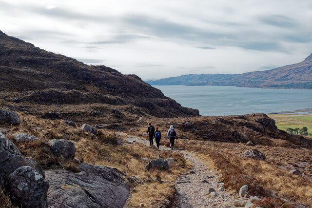
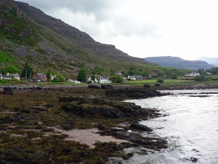
An Fhuar Ob is a small coastal village located in Ross-shire, Scotland. Situated on the shores of the sea, it is surrounded by picturesque landscapes and natural beauty. The village is known for its stunning views of the sea, estuary, and creek, making it a popular destination for nature enthusiasts and tourists.

The sea, with its vast expanse of sparkling blue waters, offers a tranquil setting for visitors to relax and enjoy the peaceful ambiance. The gentle waves crashing against the shore create a soothing soundtrack, inviting visitors to take long walks along the sandy beaches or simply sit and admire the beauty of the surroundings.

The estuary, formed by the convergence of a river and the sea, is a unique feature of An Fhuar Ob. It provides a rich habitat for various marine species and serves as a breeding ground for birds. Visitors can witness a diverse range of birdlife, making it a haven for birdwatchers and wildlife enthusiasts.

The creek, a narrow body of water that flows into the sea, adds to the charm of An Fhuar Ob. It provides a sheltered area for small boats and offers opportunities for boating and fishing activities. The creek also attracts a variety of waterfowl, enhancing the natural beauty of the village.

In addition to its natural attractions, An Fhuar Ob offers a warm and welcoming community. Visitors can explore the local shops, cafes, and restaurants, which offer a taste of traditional Scottish cuisine and hospitality.

Overall, An Fhuar Ob is a hidden gem on the Scottish coast, offering a perfect blend of natural beauty, tranquility, and community spirit.

If you have any feedback on the listing, please let us know in the comments section below.

An Fhuar Ob Images

Images are sourced within 2km of 57.533735/-5.5163241 or Grid Reference NG8954. Thanks to Geograph Open Source API. All images are credited.

A896, Glen Torridon The A896 runs 32 miles from Strathcarron to Kinlochewe.
<span class="nowrap"><a title="https://www.sabre-roads.org.uk/wiki/index.php?title=A896" rel="nofollow ugc noopener" href="https://www.sabre-roads.org.uk/wiki/index.php?title=A896">Link</a><img style="margin-left:2px;" alt="External link" title="External link - shift click to open in new window" src="https://s1.geograph.org.uk/img/external.png" width="10" height="10"/></span>
A896, Glen Torridon
The A896 runs 32 miles from Strathcarron to Kinlochewe. LinkExternal link
Scottish Hill Tracks 299 and 300 above Loch Torridon In places the track crosses slabs of flat bedding rock, and here helpfully the edge of the path has been marked by stones.
Scottish Hill Tracks 299 and 300 above Loch Torridon
In places the track crosses slabs of flat bedding rock, and here helpfully the edge of the path has been marked by stones.
Inner Loch Torridon and Torridon village from Hill Track 299/300 A view of the transition from moorland brown to greens at the head of Loch Torridon.  Beinn Alligin is the distinctive mountain across Loch Torridon.
Inner Loch Torridon and Torridon village from Hill Track 299/300
A view of the transition from moorland brown to greens at the head of Loch Torridon. Beinn Alligin is the distinctive mountain across Loch Torridon.
Hill Track from Annat to Coulags and Achnashellach The two routes are designated Scottish Hill Tracks 299 and 300, but share the same route out of Annat.
Hill Track from Annat to Coulags and Achnashellach
The two routes are designated Scottish Hill Tracks 299 and 300, but share the same route out of Annat.
Hill Track to Annat from Achnashellach and Coulags Scotways Hill Tracks 299 and 300 make a gradual descent for around 700 metres elevation down to the sea at Annat.
Hill Track to Annat from Achnashellach and Coulags
Scotways Hill Tracks 299 and 300 make a gradual descent for around 700 metres elevation down to the sea at Annat.
Scotways Hill Track 299/300 to Glen Carron The route climbs to 700 metres before its descent through Coire Lair to Achnashellach.
Scotways Hill Track 299/300 to Glen Carron
The route climbs to 700 metres before its descent through Coire Lair to Achnashellach.
Descending towards Annat on the Hill Track The track here follows a bedding plane making it easy underfoot. Loch Torridon in the background.
Descending towards Annat on the Hill Track
The track here follows a bedding plane making it easy underfoot. Loch Torridon in the background.
Glen Torridon from the hill track to Annat The sides of Liathach and Beinn Eighe dominate the northern side of Glen Torridon.
Glen Torridon from the hill track to Annat
The sides of Liathach and Beinn Eighe dominate the northern side of Glen Torridon.
Boulders and bedding plane above Glen Torridon Liathach and Beinn Eighe dominate the north side of Glen Torridon.
Boulders and bedding plane above Glen Torridon
Liathach and Beinn Eighe dominate the north side of Glen Torridon.
On the path to Annat Downhill virtually all the way from here.
On the path to Annat
Downhill virtually all the way from here.
Torridon village from above Annat The village is dwarfed by the flanks of Liathach.
Torridon village from above Annat
The village is dwarfed by the flanks of Liathach.
Doire an Fuaran - Field of Springs An old township, made up of three crofting communities, was here until 1845 when the tenants were forced to leave their land to be replaced by sheep. The ruins of the former crofts are still here in this moorland
Doire an Fuaran - Field of Springs
An old township, made up of three crofting communities, was here until 1845 when the tenants were forced to leave their land to be replaced by sheep. The ruins of the former crofts are still here in this moorland
Faint footpath in Doire an Fuaran (Field of the Springs) A path takes you around the former crofting community which lies in a field behind the village of Fasag
Faint footpath in Doire an Fuaran (Field of the Springs)
A path takes you around the former crofting community which lies in a field behind the village of Fasag
Stream in the Field of the Springs
Torridon Mountain Rescue Team building
New house near Annat
Show me another place!

An Fhuar Ob is located at Grid Ref: NG8954 (Lat: 57.533735, Lng: -5.5163241)

Unitary Authority: Highland

Police Authority: Highlands and Islands

What 3 Words

///insurance.rushed.discouraged. Near Kinlochewe, Highland

Related Wikis

Annat, Highland

Annat (Scottish Gaelic: An Annaid) is a small village at the eastern end of Upper Loch Torridon in Wester Ross, in the Highland council area of Scotland...
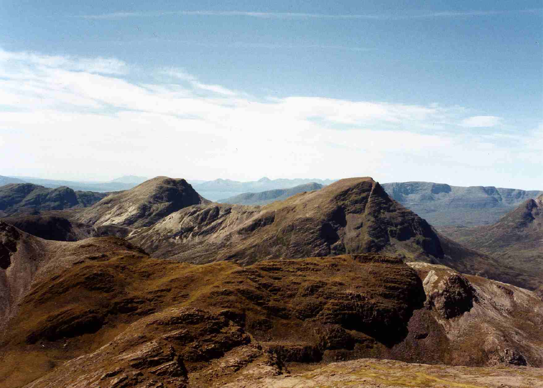
Torridon Hills

The Torridon Hills surround Torridon village in the Northwest Highlands of Scotland. The name is usually applied to the mountains to the north of Glen...

Torridon

Torridon (Scottish Gaelic: Toirbheartan) is a small village in the Northwest Highlands of Scotland. However the name is also applied to the area surrounding...

Beinn na h-Eaglaise (Graham)

Beinn na h-Eaglaise (736 m) is a mountain in the Northwest Highlands of Scotland. It lies in Wester Ross, south of the village of Torridon. A steep mountain...

Beinn Damh

Beinn Damh (or Ben Damph) is a Scottish mountain situated in the wild mountainous area between Upper Loch Torridon and Glen Carron, 25 kilometres north...

Liathach

Liathach (Scottish Gaelic for 'the hoary place'; pronounced [ˈʎiəhəx]) is a mountain in the Torridon Hills, in the Northwest Highlands of Scotland. It...

Falls of Balgy

Falls of Balgy is a waterfall near Torridon in Scotland. == See also == Waterfalls of Scotland == References ==

Maol Cheann-dearg

Maol Cheann-Dearg is a mountain in the Northwest Highlands of Scotland, between Upper Loch Torridon and Loch Carron, in the Coulags deer forest in Wester...

Related Videos

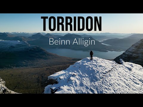
Hiking from Dawn till Dusk - Beinn Alligin - Torridon - Scotland

Route description below... Buy my guidebooks here: Scottish Highlands - Hillwalking Guide ...

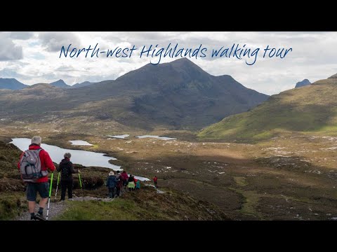
North-west Highlands walking tour

Torridon and Assynt in the undiscovered North West Highlands are some the most remote and scenic parts of mainland Scotland ...

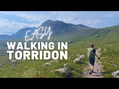
Walking Ben Damph | we had to turn around

Walking to Ben Damph (or Beinn Dàmh) with the kids, but we had to turn around due to heavy rain clouds and some thunder in ...

Beinn Damh Heat Inversion - Stag Mountain - Wild Camp - Torridon-Hill Walking Scotland

A hike and wild camp on the beautiful mountain of Beinn Damh in Torridon meaning stag mountain. The hike also took in the other ...

Nearby Amenities

Located within 500m of 57.533735,-5.5163241
Source: PGS
Lat/Long: 57.5373418/-5.519844
Source: PGS
Lat/Long: 57.536933/-5.5196508
Source: PGS
Lat/Long: 57.5363594/-5.5195371
Source: PGS
Lat/Long: 57.5361092/-5.5193666
Source: PGS
Lat/Long: 57.535801/-5.5188189
Source: PGS
Lat/Long: 57.5353509/-5.5188331
Source: PGS
Lat/Long: 57.5350362/-5.5188028
Source: PGS
Lat/Long: 57.5346879/-5.5188209
Source: PGS
Lat/Long: 57.5344066/-5.5187413
Source: PGS
Lat/Long: 57.5340588/-5.5187981
Source: PGS
Lat/Long: 57.5336194/-5.5190028
Source: PGS
Lat/Long: 57.5331312/-5.5192642
Created By: almien_coastlines
Source: PGS
Lat/Long: 57.532683/-5.519366
Source: PGS
Lat/Long: 57.5322829/-5.5197417
Source: PGS
Lat/Long: 57.5315139/-5.5200146
Source: PGS
Lat/Long: 57.5309769/-5.5207422
Source: PGS
Lat/Long: 57.5308609/-5.5210832
Source: PGS
Lat/Long: 57.5307205/-5.5214243
Post Box
Collection Times: Mo-Sa 10:30
Operator: Royal Mail
Post Box Type: lamp
Ref: IV22 220
Royal Cypher: scottish_crown
Source: survey
Lat/Long: 57.5318046/-5.5179524
Telephone
Booth: K6
Covered: booth
Operator: BT
Phone: +44 1445 791224
Lat/Long: 57.5318318/-5.517874
Bus Stop
Letterbox
Local Ref: AT
Naptan AtcoCode: 6700712349
Naptan Bearing: SW
Naptan CommonName: Letterbox
Naptan Indicator: at
Naptan Landmark: Letterbox
Naptan NaptanCode: 45327679
Naptan Street: A896
Naptan Verified: no
Source: naptan_import
Lat/Long: 57.5318795/-5.5178572
Bus Stop
Letterbox
Naptan AtcoCode: 6700713871
Naptan Bearing: NE
Naptan CommonName: Letterbox
Naptan Indicator: opp
Naptan Landmark: Letterbox
Naptan NaptanCode: 45329234
Naptan Street: A896
Naptan Verified: no
Source: naptan_import
Lat/Long: 57.5319212/-5.5179351
Ford: yes
Lat/Long: 57.5312242/-5.5133695
Annat
Place: hamlet
Lat/Long: 57.5321349/-5.5154183
Ford: yes
Lat/Long: 57.5312714/-5.5133523
Information: guidepost
Tourism: information
Lat/Long: 57.5308972/-5.5196233
Ford: yes
Lat/Long: 57.5307485/-5.5193719
Ford: yes
Lat/Long: 57.5308485/-5.5196044
Power: pole
Lat/Long: 57.5338651/-5.5101963
Power: pole
Lat/Long: 57.5345337/-5.5097674
Power: pole
Lat/Long: 57.5352078/-5.5093074
Power: pole
Lat/Long: 57.5309173/-5.5179738
Power: pole
Lat/Long: 57.5319763/-5.516994
Advertising: board
Lat/Long: 57.5318203/-5.517914
Power: pole
Lat/Long: 57.5303954/-5.5184851
Power: pole
Lat/Long: 57.529956/-5.5189434
The data included in this document is from www.openstreetmap.org. The data is made available under ODbL.

Have you been to An Fhuar Ob?

Leave your review of An Fhuar Ob below (or comments, questions and feedback).