Stevenstone Plantation

Wood, Forest in Devon East Devon

England

Stevenstone Plantation

Trees above the Exe The trees border the course of the dismantled Exe Valley Railway. Seen from a bend in Hulk Lane.
Trees above the Exe Credit: Derek Harper

Stevenstone Plantation is a picturesque woodland area located in the county of Devon, England. Spanning over a vast expanse of approximately 500 hectares, it is a haven for nature enthusiasts and visitors seeking tranquility amidst the beautiful countryside.

The plantation is characterized by its dense forest cover, predominantly consisting of native tree species such as oak, beech, and birch. These towering trees create a captivating canopy, providing shade and shelter for a diverse range of flora and fauna that call Stevenstone Plantation their home.

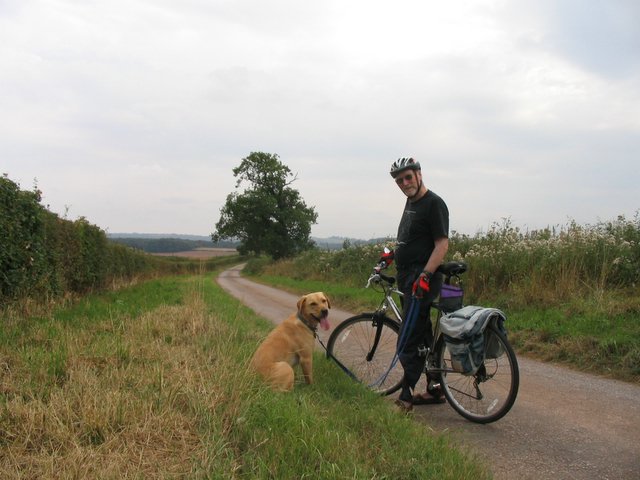
Walking through the plantation, visitors are greeted by a network of well-maintained footpaths and trails that wind their way through the woodland. These paths offer a wonderful opportunity for leisurely strolls, providing glimpses of enchanting wildflowers, vibrant mosses, and ferns that thrive in the damp undergrowth.

The plantation also boasts a rich biodiversity, attracting a variety of bird species including woodpeckers, owls, and warblers. Wildlife enthusiasts may also be fortunate enough to spot small mammals such as rabbits, squirrels, and even the occasional deer.

Stevenstone Plantation is not only a natural haven but also showcases historical significance. The area was once the site of an industrial clay works, with remnants of the old kilns and tramways still visible today. These remnants serve as a reminder of the region's industrial past and add an interesting dimension to the plantation's charm.

Overall, Stevenstone Plantation offers visitors a peaceful retreat, allowing them to immerse themselves in the beauty of nature while also exploring the area's historical heritage.

If you have any feedback on the listing, please let us know in the comments section below.

Stevenstone Plantation Images

Images are sourced within 2km of 50.784607/-3.5352057 or Grid Reference SX9199. Thanks to Geograph Open Source API. All images are credited.

Trees above the Exe The trees border the course of the dismantled Exe Valley Railway. Seen from a bend in Hulk Lane.
Trees above the Exe
The trees border the course of the dismantled Exe Valley Railway. Seen from a bend in Hulk Lane.
Approaching Dunsford Hill Nearing the western end of Hulk Lane.
Approaching Dunsford Hill
Nearing the western end of Hulk Lane.
Junction on Dunsford Hill On the left is Hulk lane, no longer a through road as shown in <a href="https://www.geograph.org.uk/photo/5720208">SS9200 : Hulk Lane closed to through traffic</a>, though it still appears to be on OS maps.
Junction on Dunsford Hill
On the left is Hulk lane, no longer a through road as shown in SS9200 : Hulk Lane closed to through traffic, though it still appears to be on OS maps.
Dunsford Hill near Yellowford Branching off to the left is Thorverton footpath 8, to Berrysbridge.
Dunsford Hill near Yellowford
Branching off to the left is Thorverton footpath 8, to Berrysbridge.
Footpath, Yellowford Thorverton footpath 8, to Berrysbridge, shortly after leaving Dunsford Hill as shown in <a href="https://www.geograph.org.uk/photo/7292767">SS9201 : Dunsford Hill near Yellowford</a>.
Footpath, Yellowford
Thorverton footpath 8, to Berrysbridge, shortly after leaving Dunsford Hill as shown in SS9201 : Dunsford Hill near Yellowford.
Trees in field, Rosepark Looking right from the stretch of path shown in <a href="https://www.geograph.org.uk/photo/7292783">SS9201 : Footpath, Yellowford</a>.
Trees in field, Rosepark
Looking right from the stretch of path shown in SS9201 : Footpath, Yellowford.
Footpath to Berrysbridge Thorverton footpath 8 follows a green lane from Yellowford.
Footpath to Berrysbridge
Thorverton footpath 8 follows a green lane from Yellowford.
Rosepark Cottage Seen from the green lane shown in <a href="https://www.geograph.org.uk/photo/7292944">SS9201 : Footpath to Berrysbridge</a>.
Rosepark Cottage
Seen from the green lane shown in SS9201 : Footpath to Berrysbridge.
Field near Berrysbridge A tree in a bocage-like field crossed by Thorverton footpath 6.
Field near Berrysbridge
A tree in a bocage-like field crossed by Thorverton footpath 6.
East Devon : :Little Nettacott A house with a driveway on the left.
East Devon : :Little Nettacott
A house with a driveway on the left.
Kitts Lane, Nether Exe The wallbox is dated Edward VII <a href="https://www.geograph.org.uk/photo/4265546">SS9300 : Edward VII letter box</a>
Kitts Lane, Nether Exe
The wallbox is dated Edward VII SS9300 : Edward VII letter box
Farmyard at Netherexe Barton
Outbuildings at Yellowford Farm
House at Yellowford
House at Yellowford
Hulk Lane closed to through traffic
Road south of Nettacott
Three-limb Oak on Thorverton-Upton Pyne Road Now reduced to only 2 limbs. This photo faces East with the small road taking you to Brampford Speke and the left bend to Thorverton, 1 mile away.
Three-limb Oak on Thorverton-Upton Pyne Road
Now reduced to only 2 limbs. This photo faces East with the small road taking you to Brampford Speke and the left bend to Thorverton, 1 mile away.
Back road from Raddon to Upton Pyne a quiet road ideal for cycling.
Back road from Raddon to Upton Pyne
a quiet road ideal for cycling.
Show me another place!

Stevenstone Plantation is located at Grid Ref: SX9199 (Lat: 50.784607, Lng: -3.5352057)

Administrative County: Devon

District: East Devon

Police Authority: Devon and Cornwall

What 3 Words

///back.defeated.romantics. Near Silverton, Devon

Related Wikis

Berrysbridge

Berrysbridge is a village in Devon, England. == External links == Media related to Berrysbridge at Wikimedia Commons

Brampford Speke

Brampford Speke ( BRAM-fərdz-beek) is a small village in Devon, 4 miles (6 km) to the north of Exeter. The population is 419. It is located on red sandstone...

Thorverton

Thorverton is a civil parish and village in Devon, England, about a mile west of the River Exe and 8 miles (13 km) north of Exeter. It is almost centrally...
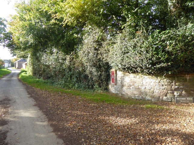
Nether Exe

Nether Exe or Netherexe is a very small village and civil parish in Devon, England. It lies near the River Exe, as its name suggests, about 5 miles (8...

Nearby Amenities

Located within 500m of 50.784607,-3.5352057
The data included in this document is from www.openstreetmap.org. The data is made available under ODbL.

Have you been to Stevenstone Plantation?

Leave your review of Stevenstone Plantation below (or comments, questions and feedback).