Cleave Plantation

Wood, Forest in Devon Mid Devon

England

Cleave Plantation

Cruwys Morchard: near Old Ford House Overlooking a valley; its stream a tributary of the Dart, itself a tributary of the Exe. Looking west-south-west
Cruwys Morchard: near Old Ford House Credit: Martin Bodman

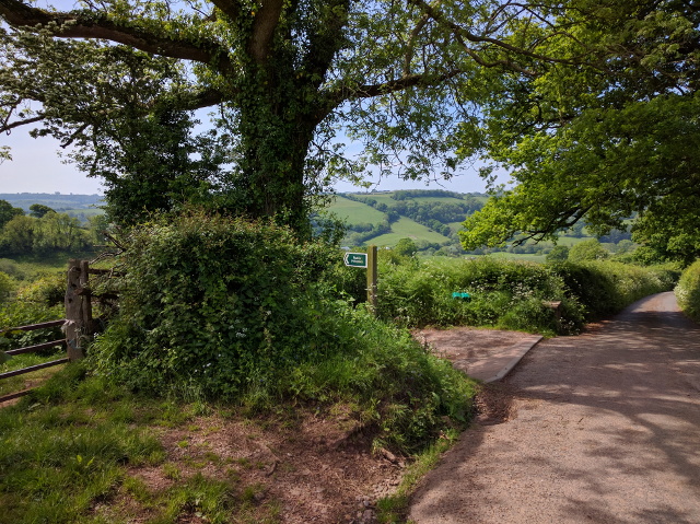
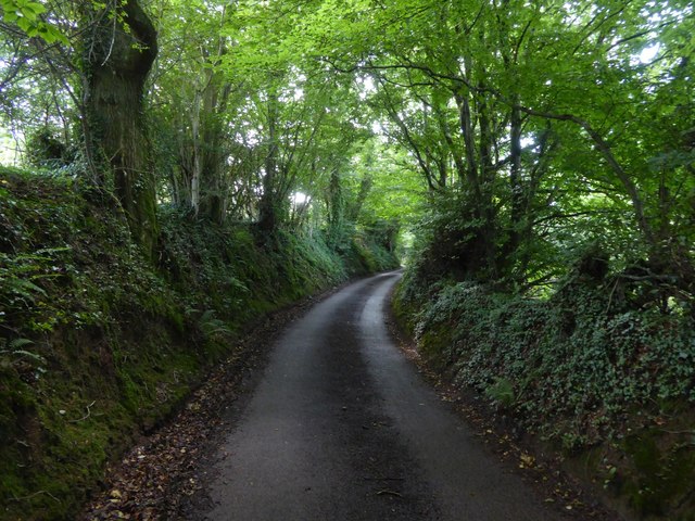
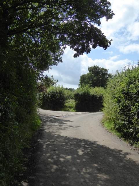
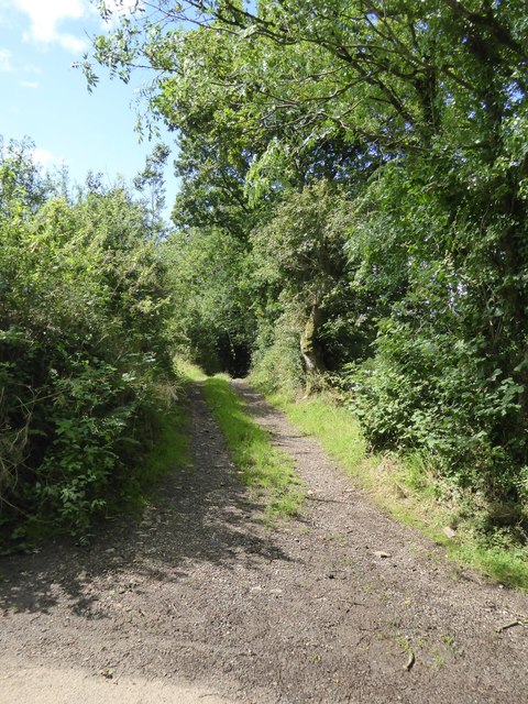
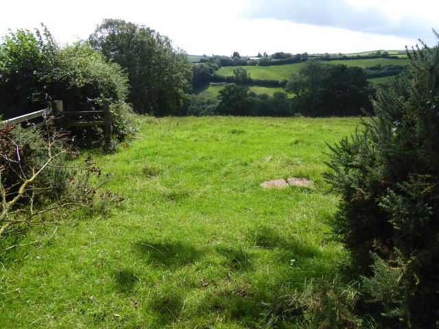
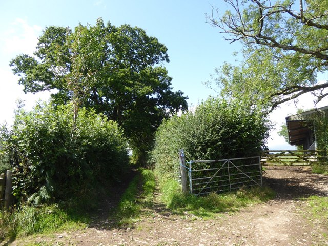
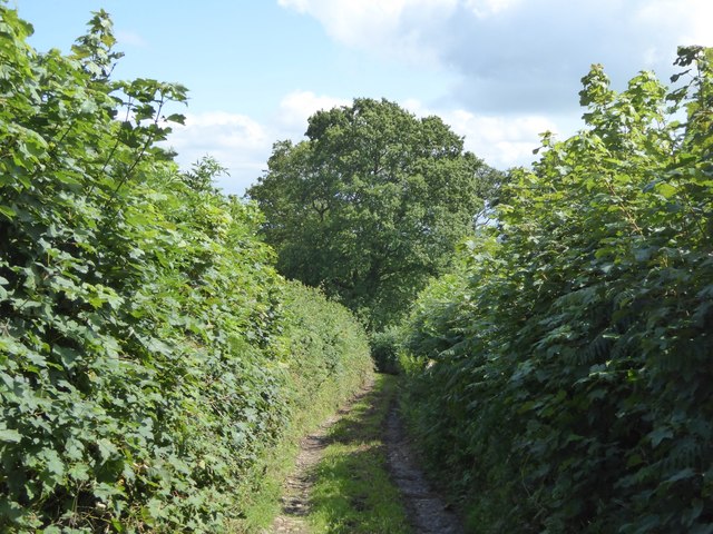
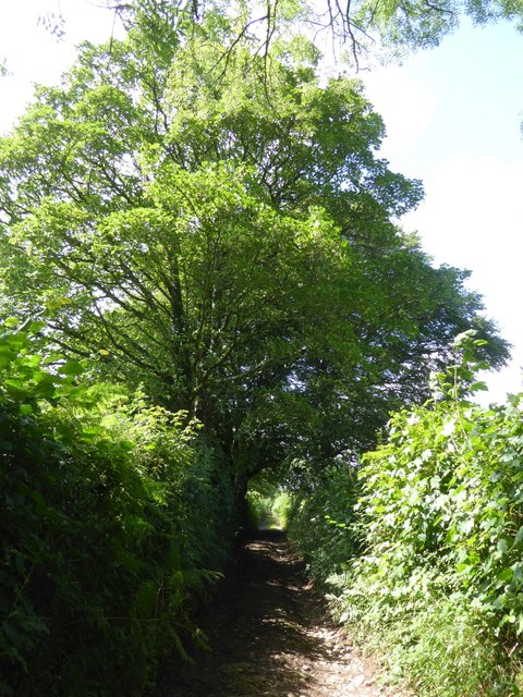
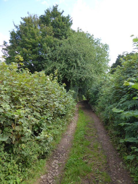
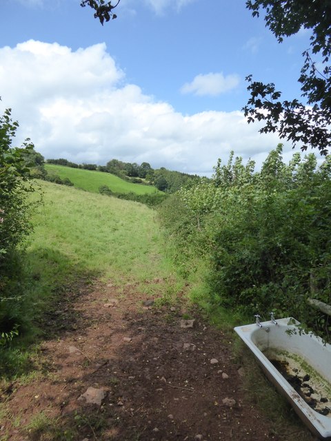
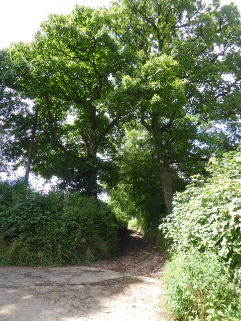
Cleave Plantation is a picturesque woodland located in Devon, England. Spread across a vast area, this plantation is known for its diverse range of flora and fauna, making it a haven for nature enthusiasts and wildlife lovers.

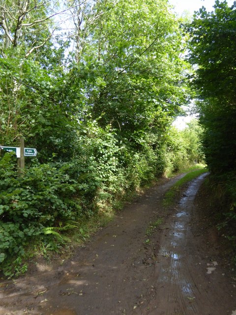
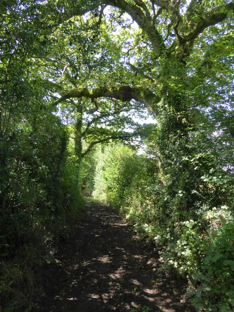
The woodland is predominantly made up of native tree species, such as oak, beech, ash, and birch, which create a dense canopy overhead. The well-maintained trails wind through the plantation, offering visitors the opportunity to explore the beauty and tranquility of the forest. These trails are suitable for walkers of all abilities, ensuring accessibility for everyone.

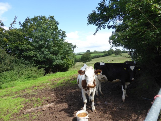
Cleave Plantation is home to a rich variety of wildlife, including several rare and protected species. Deer, foxes, badgers, and rabbits can often be spotted roaming freely within the woodland. Birdwatchers will be delighted to see a plethora of bird species, including woodpeckers, owls, and various songbirds.

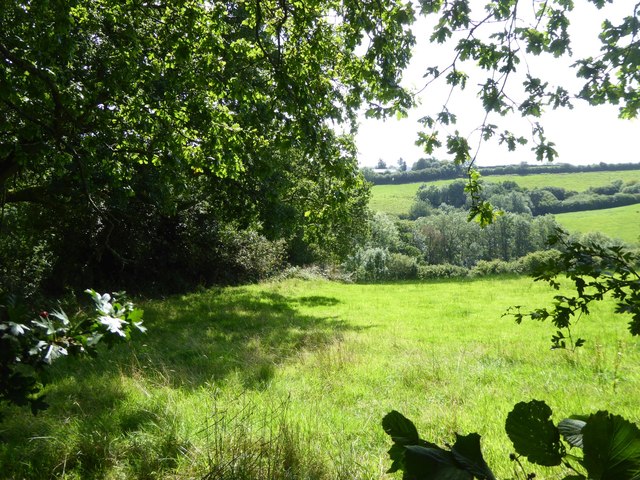
The plantation also boasts a diverse ecosystem of plants and flowers. In spring, the forest floor is adorned with bluebells, primroses, and wood anemones, creating a vibrant and colorful display. During autumn, the trees transform into a symphony of reds, oranges, and yellows, offering a breathtaking spectacle for visitors.

Cleave Plantation is not only a natural treasure but also an important habitat for conservation. Efforts are made to protect and preserve the woodland, maintaining its ecological balance and ensuring its sustainability for future generations.

Visitors to Cleave Plantation can enjoy a peaceful retreat from the hustle and bustle of everyday life, immersing themselves in the serene beauty of nature. Whether it's an invigorating hike, a leisurely stroll, or a spot of birdwatching, this woodland offers something for everyone to enjoy.

If you have any feedback on the listing, please let us know in the comments section below.

Cleave Plantation Images

Images are sourced within 2km of 50.886126/-3.5458061 or Grid Reference SS9110. Thanks to Geograph Open Source API. All images are credited.

Cruwys Morchard: near Old Ford House Overlooking a valley; its stream a tributary of the Dart, itself a tributary of the Exe. Looking west-south-west
Cruwys Morchard: near Old Ford House
Overlooking a valley; its stream a tributary of the Dart, itself a tributary of the Exe. Looking west-south-west
Black Down Copse A stream runs along the edge of the copse and drains into the River Dart, one of numerous wooded side valleys in the area. Seen from the track between Kingdom's Corner and Cotton Farm, as it climbs away from another stream beside Quarry Close Copse.
Black Down Copse
A stream runs along the edge of the copse and drains into the River Dart, one of numerous wooded side valleys in the area. Seen from the track between Kingdom's Corner and Cotton Farm, as it climbs away from another stream beside Quarry Close Copse.
Chicken and lake at Hookway
Public footpath leaving the lane to the left
Hollow Devon lane near Kingdom's Corner
Kingdom's Corner This is a five way road junction; the through road bends to the right, with the access road to Well Town branching to the left.  Two old tracks lead off in the angles
Kingdom's Corner
This is a five way road junction; the through road bends to the right, with the access road to Well Town branching to the left. Two old tracks lead off in the angles
Track west from Kingdom's Corner
Muddy track east from Kingdom's Cross As signed, a bridleway; marked as Larkey Lane on detailed maps
Muddy track east from Kingdom's Cross
As signed, a bridleway; marked as Larkey Lane on detailed maps
Cows in field by Larkey Lane
Larkey Lane
Larkey Lane
Valley below Well Town
Field south of Larkey Lane
Farm buildings by Larkey Lane
Larkey Lane
Larkey Lane
Larkey Lane The surface of the lane here is an outcrop of rock
Larkey Lane
The surface of the lane here is an outcrop of rock
Larkey Lane close to Little Silver
Field with en suite bath Note that the bath is supplied with taps
Field with en suite bath
Note that the bath is supplied with taps
The eastern end of Larkey Lane
Show me another place!

Cleave Plantation is located at Grid Ref: SS9110 (Lat: 50.886126, Lng: -3.5458061)

Administrative County: Devon

District: Mid Devon

Police Authority: Devon and Cornwall

What 3 Words

///romance.grief.straw. Near Tiverton, Devon

Related Wikis

Calverleigh

Calverleigh (anciently Calwoodleigh) is a village and former civil parish and manor, now in the parish of Loxbeare, in the Mid Devon district, in the county...

The Fisherman's Cot

The Fisherman's Cot is an inn on the A3072 road to the northwest of Bickleigh near Tiverton, in northeastern Devon. It is operated by Marston's Inns and...

Cadeleigh

Cadeleigh is a small village in the county of Devon in England. It sits in the hills above the valley of the River Exe and is about 15 km (9 miles) north...

Devon Railway Centre

The Devon Railway Centre is in the village of Bickleigh in Mid Devon, England, at the former Cadeleigh railway station on the closed Great Western Railway...

Nearby Amenities

Located within 500m of 50.886126,-3.5458061
Generator Method: photovoltaic
Generator Output Electricity: yes
Generator Source: solar
Generator Type: solar_photovoltaic_panel
Location: roof
Power: generator
Lat/Long: 50.8855865/-3.5415016
Generator Method: photovoltaic
Generator Output Electricity: yes
Generator Source: solar
Generator Type: solar_photovoltaic_panel
Location: roof
Power: generator
Lat/Long: 50.885515/-3.5415365
Generator Method: photovoltaic
Generator Output Electricity: yes
Generator Source: solar
Generator Type: solar_photovoltaic_panel
Location: roof
Power: generator
Lat/Long: 50.882612/-3.546225
Generator Method: photovoltaic
Generator Output Electricity: yes
Generator Source: solar
Generator Type: solar_photovoltaic_panel
Location: roof
Power: generator
Lat/Long: 50.8825892/-3.5462397
The data included in this document is from www.openstreetmap.org. The data is made available under ODbL.

Have you been to Cleave Plantation?

Leave your review of Cleave Plantation below (or comments, questions and feedback).