Charlwood Brake

Wood, Forest in Devon Teignbridge

England

Charlwood Brake

Farmland, Mamhead Bottom Looking left from <a href="https://www.geograph.org.uk/photo/6833852">SX9279 : Sheep pasture by Oakpark Wood</a>, with woods clothing the slopes of Great Haldon.
Farmland, Mamhead Bottom Credit: Derek Harper

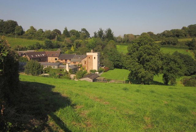
Charlwood Brake is a serene woodland located in the county of Devon, England. Situated near the village of Charlwood, it covers an area of approximately 20 hectares (49 acres). The forest is characterized by a diverse range of flora and fauna, making it an ideal destination for nature enthusiasts and wildlife lovers.

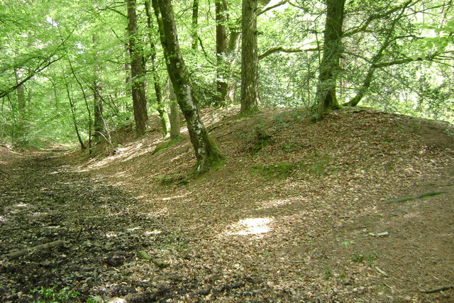
The woodland is primarily composed of broad-leaved trees, such as oak, birch, and beech, which create a dense canopy overhead. As visitors explore the forest, they will encounter a variety of wildflowers, including bluebells, primroses, and foxgloves, adding a splash of color to the landscape during the spring and summer months.

Charlwood Brake is home to a diverse array of wildlife, providing a natural habitat for various species. Birdwatchers will be delighted to spot a range of avian species, including woodpeckers, owls, and warblers. Additionally, the forest is inhabited by mammals such as deer, foxes, and badgers, which can occasionally be observed in their natural surroundings.

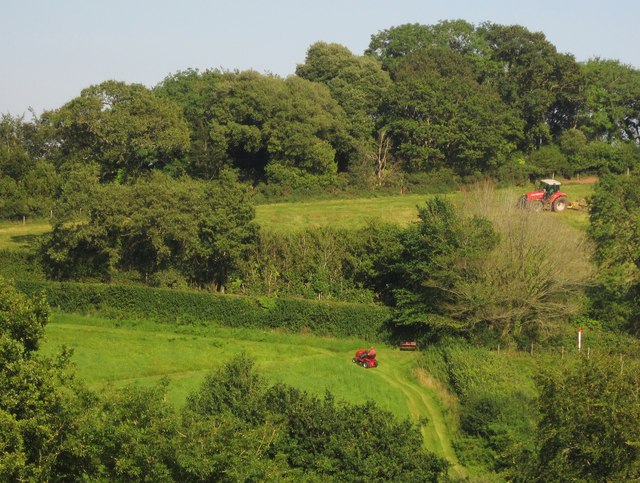
Walking trails wind their way through the woodland, offering visitors the opportunity to explore its beauty. The peaceful atmosphere and tranquil surroundings make it a popular spot for local residents and tourists seeking a respite from the hustle and bustle of everyday life.

Charlwood Brake is a protected area, managed by a local conservation organization. Their efforts ensure the preservation of this natural treasure, allowing generations to come to continue enjoying its beauty and tranquility.

If you have any feedback on the listing, please let us know in the comments section below.

Charlwood Brake Images

Images are sourced within 2km of 50.597717/-3.5399533 or Grid Reference SX9178. Thanks to Geograph Open Source API. All images are credited.

Farmland, Mamhead Bottom Looking left from <a href="https://www.geograph.org.uk/photo/6833852">SX9279 : Sheep pasture by Oakpark Wood</a>, with woods clothing the slopes of Great Haldon.
Farmland, Mamhead Bottom
Looking left from SX9279 : Sheep pasture by Oakpark Wood, with woods clothing the slopes of Great Haldon.
Lane to Westley Manor Looking the other way from <a href="https://www.geograph.org.uk/photo/6833897">SX9279 : Lane by Kiln Brake</a>. This stretch of lane is always damp.
Lane to Westley Manor
Looking the other way from SX9279 : Lane by Kiln Brake. This stretch of lane is always damp.
Cereal crop below Mamhead Bottom Looking right from <a href="https://www.geograph.org.uk/photo/6833897">SX9279 : Lane by Kiln Brake</a>, and left from <a href="https://www.geograph.org.uk/photo/7003379">SX9280 : Lane to Westley Manor</a>, up a field that is central to <a href="https://www.geograph.org.uk/photo/7003214">SX9280 : Farmland, Mamhead Bottom</a> and <a href="https://www.geograph.org.uk/photo/6834331">SX9280 : Farmland below Mamhead Bottom</a>.
Cereal crop below Mamhead Bottom
Cereal crop below Mamhead Bottom Looking right from <a href="https://www.geograph.org.uk/photo/7003395">SX9280 : Cereal crop below Mamhead Bottom</a>, and left from <a href="https://www.geograph.org.uk/photo/7003379">SX9280 : Lane to Westley Manor</a>.
Cereal crop below Mamhead Bottom
Lane to Ashcombe A reverse view of <a href="https://www.geograph.org.uk/photo/7003379">SX9280 : Lane to Westley Manor</a>.
Lane to Ashcombe
A reverse view of SX9280 : Lane to Westley Manor.
Lane to Westley Manor Looking the other way from <a href="https://www.geograph.org.uk/photo/7003452">SX9280 : Lane to Ashcombe</a>.
Lane to Westley Manor
Looking the other way from SX9280 : Lane to Ashcombe.
Holm oak near Westley Manor By the lane from Ashcombe.
Holm oak near Westley Manor
By the lane from Ashcombe.
Trees near Westley Manor At the bend where <a href="https://www.geograph.org.uk/photo/6834452">SX9279 : Valley below Westley Manor</a> was taken, looking right.
Trees near Westley Manor
At the bend where SX9279 : Valley below Westley Manor was taken, looking right.
Gate near Westley Manor From which <a href="https://www.geograph.org.uk/photo/6834452">SX9279 : Valley below Westley Manor</a> was taken.
Gate near Westley Manor
From which SX9279 : Valley below Westley Manor was taken.
Westley House and Manor A spring version of <a href="https://www.geograph.org.uk/photo/3081440">SX9280 : Westley Manor Farm</a>.
Westley House and Manor
A spring version of SX9280 : Westley Manor Farm.
Westley Manor Farm Seen from the lane from Ashcombe.
Westley Manor Farm
Seen from the lane from Ashcombe.
Chudleigh : A380 Heading along the A380.
Chudleigh : A380
Heading along the A380.
Puddle near Waddon Brakes This well-made-up, if wet, track follows close to the perimeter of the triangular-shaped section of Haldon Forest between Ashcombe Cross, Beggar's Bush and Waddon Brakes.
Puddle near Waddon Brakes
This well-made-up, if wet, track follows close to the perimeter of the triangular-shaped section of Haldon Forest between Ashcombe Cross, Beggar's Bush and Waddon Brakes.
A ride in Haldon Forest west of Ashcombe Cross The soundscape: birdsong. Dense pine and Norway Spruce forest to the right blocks traffic noise from the fast A380 about 800 metres away. Just here there is a stand of larch. To the left, oak, pine and birch and a short ride down to a track for forestry operations. The ride pictured seems to have been laid out for public access. It reaches a hairpin downslope then leads back to the unsigned car park <a href="https://www.geograph.org.uk/photo/5807025">SX9079 : Track into the forest, Ashcombe Cross</a>. No map seems to show exactly the paths and rides as they exist on the ground. The surface shows much broken flint: see <a href="https://www.geograph.org.uk/photo/5807108">SX8979 : Fallen Norway Spruce, Haldon Forest west of Ashcombe Cross</a>.
A ride in Haldon Forest west of Ashcombe Cross
The soundscape: birdsong. Dense pine and Norway Spruce forest to the right blocks traffic noise from the fast A380 about 800 metres away. Just here there is a stand of larch. To the left, oak, pine and birch and a short ride down to a track for forestry operations. The ride pictured seems to have been laid out for public access. It reaches a hairpin downslope then leads back to the unsigned car park SX9079 : Track into the forest, Ashcombe Cross. No map seems to show exactly the paths and rides as they exist on the ground. The surface shows much broken flint: see SX8979 : Fallen Norway Spruce, Haldon Forest west of Ashcombe Cross.
Westley Farm A view across the valley shows how the farm is sheltered by the forest behind it.
Westley Farm
A view across the valley shows how the farm is sheltered by the forest behind it.
Westley Manor Farm The farmhouse has a curious tower facing down the valley, visible in <a href="https://www.geograph.org.uk/photo/3080898">SX9279 : Towards Westley Manor Farm</a>. Behind are converted farm buildings around the old farmyard.
Westley Manor Farm
The farmhouse has a curious tower facing down the valley, visible in SX9279 : Towards Westley Manor Farm. Behind are converted farm buildings around the old farmyard.
Two levels of mowing A ride-on mower tours a field at Westley Manor Farm, while a tractor cuts a field above the lane to Ashcombe War Memorial. Behind it, the trees line the green lane shown in <a href="https://www.geograph.org.uk/photo/3081285">SX9280 : Lane junction near Mamhead Grange</a>.
Two levels of mowing
A ride-on mower tours a field at Westley Manor Farm, while a tractor cuts a field above the lane to Ashcombe War Memorial. Behind it, the trees line the green lane shown in SX9280 : Lane junction near Mamhead Grange.
Lane to Ashcombe A small drainage channel from Mamhead Bottom spills onto the lane by the gateway ahead, hence the wet surface.
Lane to Ashcombe
A small drainage channel from Mamhead Bottom spills onto the lane by the gateway ahead, hence the wet surface.
Show me another place!

Charlwood Brake is located at Grid Ref: SX9178 (Lat: 50.597717, Lng: -3.5399533)

Administrative County: Devon

District: Teignbridge

Police Authority: Devon and Cornwall

What 3 Words

///dips.puts.contoured. Near Chudleigh, Devon

Related Wikis

Ashcombe

Ashcombe is a village and civil parish in the Teignbridge district of Devon, England, about eight miles south of the city of Exeter. The parish is surrounded...

Ideford Common

Ideford Common is a Site of Special Scientific Interest consisting of an area of lowland heath in Devon, England. The site is a habitat for nightjars and...

Castle Dyke

Castle Dyke is an Iron Age hill fort situated between Chudleigh and Dawlish in Devon, England. The fort is situated on a hilltop at approximately 140 metres...

Luton, Teignbridge

Luton is a village in Devon, England, within Teignbridge local authority area. Historically Luton formed part of Ashcombe Hundred.The village is in the...

Ideford

Ideford (or Ideford Parish) is a village in the Teignbridge district of Devon, England. It is 5 miles (8 km) north of Newton Abbot. To the west is the...

Haldon Aerodrome

Haldon Aerodrome was the first airfield in Devon. Established in the 1920s as a private flying field, it developed into an airport with scheduled airline...
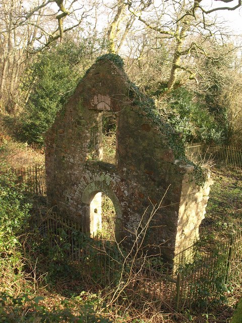
Lidwell Chapel

Lidwell Chapel, also known as St Mary's Chapel, is a medieval chapel, now in ruins, within the parish of Dawlish in Devon, England. The chapel is a Grade...

Mamhead House

Mamhead House, Mamhead, Devon, is a country house dating from 1827. Its origins are older but the present building was constructed for Robert William Newman...

Nearby Amenities

Located within 500m of 50.597717,-3.5399533
Barrier: lift_gate
Lat/Long: 50.5963709/-3.5456409
The data included in this document is from www.openstreetmap.org. The data is made available under ODbL.

Have you been to Charlwood Brake?

Leave your review of Charlwood Brake below (or comments, questions and feedback).