Aller Grove

Wood, Forest in Somerset Somerset West and Taunton

England

Aller Grove

Brushford: Knowle Farm
Brushford: Knowle Farm Credit: Martin Bodman

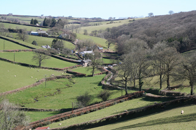
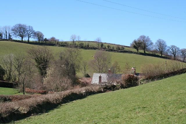
Aller Grove, Somerset is a woodland area located in the county of Somerset, England. Situated near the village of Aller, it is a picturesque spot renowned for its natural beauty and tranquil atmosphere. The grove covers an area of approximately 100 acres and is predominantly composed of dense, lush forest.

The woodland features a diverse range of tree species, including oak, beech, ash, and birch, which create a rich tapestry of colors throughout the seasons. The forest floor is adorned with a variety of wildflowers, ferns, and mosses, further enhancing the area's natural charm.

Aller Grove is home to a wide array of wildlife, making it a popular destination for nature enthusiasts and birdwatchers. It provides a habitat for various bird species, such as woodpeckers, nuthatches, and thrushes, as well as mammals like deer, badgers, and foxes. The grove's peaceful and secluded environment also attracts numerous butterflies and insects.

Visitors to Aller Grove can enjoy leisurely walks along its well-maintained trails, immersing themselves in the tranquility of nature. The area offers a peaceful retreat from the hustle and bustle of everyday life, allowing visitors to unwind and connect with the natural world. Several benches and picnic areas are scattered throughout the grove, providing opportunities for relaxation and enjoying a meal amidst the scenic surroundings.

Aller Grove, Somerset, with its abundant wildlife, diverse flora, and serene ambiance, offers a unique and captivating experience for nature lovers seeking solace in the heart of the English countryside.

If you have any feedback on the listing, please let us know in the comments section below.
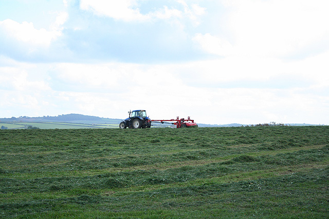
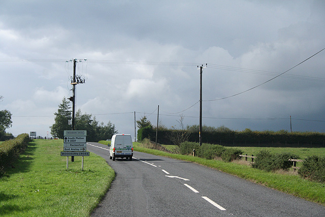
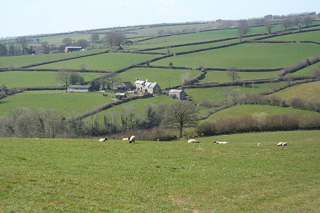
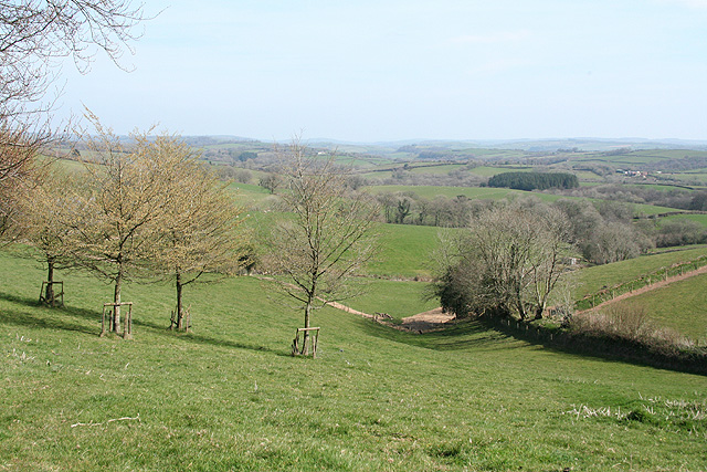
Aller Grove Images

Images are sourced within 2km of 51.017551/-3.6010719 or Grid Reference SS8725. Thanks to Geograph Open Source API. All images are credited.

Brushford: Knowle Farm
Looking North From West Knowle
Brushford: Venn Looking north from the lane between West Knowle and Hawkwell Cross
Brushford: Venn
Looking north from the lane between West Knowle and Hawkwell Cross
East Anstey: Waddicombe Looking north east from the start of a bridleway to Badlake Farm. There is some evidence for a medieval watermill at Waddicombe
East Anstey: Waddicombe
Looking north east from the start of a bridleway to Badlake Farm. There is some evidence for a medieval watermill at Waddicombe
East Anstey: approaching Oak Farm Looking west-south-west on a bridleway from Waddicombe to Dunsley
East Anstey: approaching Oak Farm
Looking west-south-west on a bridleway from Waddicombe to Dunsley
Brushford: Bere A farm in remote country between East Anstey and Dulverton, seen from its entrance gate. The track leading to the farm and on to Broomball Cross is also a public bridleway. Looking north west
Brushford: Bere
A farm in remote country between East Anstey and Dulverton, seen from its entrance gate. The track leading to the farm and on to Broomball Cross is also a public bridleway. Looking north west
East Anstey - The Froude Arms Now closed and a private residence.
East Anstey - The Froude Arms
Now closed and a private residence.
East Anstey School A cold morning!
East Anstey School
A cold morning!
Houses at East Anstey
Brushford: overhead power line A transmission line on Hawtree Moors. Looking south east
Brushford: overhead power line
A transmission line on Hawtree Moors. Looking south east
Brushford: Oldways End A hamlet near the B3227 and on the road to East Anstey. Also on the Somerset – Devon border. Looking east-south-east
Brushford: Oldways End
A hamlet near the B3227 and on the road to East Anstey. Also on the Somerset – Devon border. Looking east-south-east
Dulverton: cottages at Oldways End The Dulverton and Brushford parish boundaries meet here as does the Somerset – Devon border. Looking north west
Dulverton: cottages at Oldways End
The Dulverton and Brushford parish boundaries meet here as does the Somerset – Devon border. Looking north west
East Anstey: by Yanhey Moor Woodland by the entrance to Higher Radnidge Farm and Radnidge House. Looking south-south-east
East Anstey: by Yanhey Moor
Woodland by the entrance to Higher Radnidge Farm and Radnidge House. Looking south-south-east
Oakford: mowing at Western Farm Seen by the entrance to the farm, on the B3227. A sign announces that this is the home of pedigree Holstein Friesians, the ‘Revelsmill Herd’. Looking south-south-east
Oakford: mowing at Western Farm
Seen by the entrance to the farm, on the B3227. A sign announces that this is the home of pedigree Holstein Friesians, the ‘Revelsmill Herd’. Looking south-south-east
East Anstey: Woodburn Cross Looking west-north-west on the B3227; the van is about to turn right towards Oldways End and East Anstey
East Anstey: Woodburn Cross
Looking west-north-west on the B3227; the van is about to turn right towards Oldways End and East Anstey
Brushford: by Trackford Moor On the access road to Lower Sowerhill. Looking south west
Brushford: by Trackford Moor
On the access road to Lower Sowerhill. Looking south west
East Anstey: towards West Liscombe
Dulverton: near Ridlers By the bridleway to Bere and Knowle. Looking east-south-east over a west Somerset landscape
Dulverton: near Ridlers
By the bridleway to Bere and Knowle. Looking east-south-east over a west Somerset landscape
Show me another place!

Aller Grove is located at Grid Ref: SS8725 (Lat: 51.017551, Lng: -3.6010719)

Administrative County: Somerset

District: Somerset West and Taunton

Police Authority: Avon and Somerset

What 3 Words

///domestic.camped.downcast. Near Dulverton, Somerset

Related Wikis

East Anstey

East Anstey is a village and civil parish in the North Devon district of Devon, England. The parish is located in an area which has been designated as...

Oldways End

Oldways End is a hamlet in the civil parish of East Anstey in the North Devon district of Devon, England. Its nearest town is Tiverton, which lies approximately...

Briggins Moor

Briggins Moor is a 15.3 hectare biological Site of Special Scientific Interest in Somerset, notified in 1994. The site is south of Dulverton and close...

West Anstey

West Anstey is a village and civil parish on the River Yeo, about 5 miles west of Dulverton, in the North Devon district, in the county of Devon, England...

Combe, Dulverton

Combe is a historic estate in Somerset, England, situated between the town of Dulverton and the village of Brushford. == Descent == === Taunton Priory... ===

Roachill

Roachill is a hamlet in the civil parish of Knowstone in the North Devon district of Devon, England. Its nearest town is Tiverton, which lies approximately...

Mounsey Castle

Mounsey Castle is an Iron Age irregular triangular earthwork of 1.75 hectares (4.3 acres) north west of Dulverton, Somerset, England. It has been scheduled...

Oldberry Castle

Oldberry Castle (sometimes called Oldbury Castle) is an Iron Age hill fort north west of Dulverton, Somerset, England. It lies approximately 0.5 miles...

Nearby Amenities

Located within 500m of 51.017551,-3.6010719
Power: pole
Lat/Long: 51.0199051/-3.6066317
Power: pole
Lat/Long: 51.0199152/-3.604736
Power: pole
Lat/Long: 51.0199393/-3.6026842
Power: pole
Lat/Long: 51.0199601/-3.6007309
Power: pole
Lat/Long: 51.019982/-3.5987864
Power: pole
Lat/Long: 51.0200029/-3.5966706
The data included in this document is from www.openstreetmap.org. The data is made available under ODbL.

Have you been to Aller Grove?

Leave your review of Aller Grove below (or comments, questions and feedback).