Scrubbed Wood

Wood, Forest in Somerset Somerset West and Taunton

England

Scrubbed Wood

Hedge and layered hedge bordering road on Red Stone Hill
Hedge and layered hedge bordering road on Red Stone Hill Credit: David Smith

Scrubbed Wood, Somerset is a charming forest located in the southwestern region of England. Spanning over several acres, this woodland is a delightful retreat for nature enthusiasts and a popular destination for outdoor activities. The forest is situated in the beautiful county of Somerset, known for its picturesque landscapes and rich history.

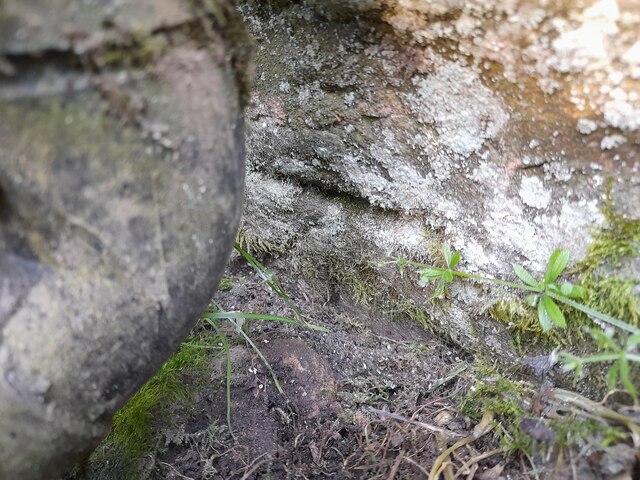
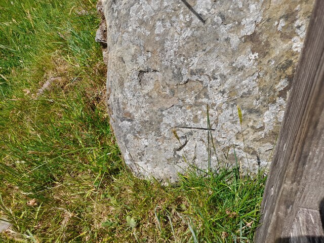
Scrubbed Wood earned its name from the abundance of scrub vegetation that covers the forest floor. This unique feature gives the woodland a distinctive character and provides a habitat for a diverse range of plant and animal species. Walking through the forest, visitors can witness a stunning display of wildflowers, ferns, and mosses thriving amidst the lush greenery.

The woodland offers a variety of trails, making it an ideal spot for hiking, jogging, and cycling. The well-maintained paths wind through the forest, taking visitors on a journey through its enchanting surroundings. Along the way, one can encounter ancient trees, babbling brooks, and small clearings perfect for picnics or relaxation.

Scrubbed Wood is also home to an array of wildlife, including deer, squirrels, and a multitude of bird species. Birdwatchers will be delighted with the opportunity to spot woodpeckers, owls, and various songbirds in their natural habitat.

The forest provides a tranquil escape from the bustling city life, giving visitors a chance to connect with nature and unwind. Whether it's a leisurely stroll or a more adventurous hike, Scrubbed Wood offers an unforgettable experience for all who venture into its captivating embrace.

If you have any feedback on the listing, please let us know in the comments section below.

Scrubbed Wood Images

Images are sourced within 2km of 51.143127/-3.672448 or Grid Reference SS8339. Thanks to Geograph Open Source API. All images are credited.

Hedge and layered hedge bordering road on Red Stone Hill
B3224 east of White Cross
Dense hedge and trees by B3224 west of Exford
Exford : B3223 Looking along the B3223.
Exford : B3223
Looking along the B3223.
Exford : B3223 Looking along the B3223.
Exford : B3223
Looking along the B3223.
Ordnance Survey Cut Mark This OS cut mark can be found on the roadside barn at Edgcott Farm. It marks a point 262.347m above mean sea level.
Ordnance Survey Cut Mark
This OS cut mark can be found on the roadside barn at Edgcott Farm. It marks a point 262.347m above mean sea level.
Ordnance Survey Cut Mark This OS cut mark can be found on Lower Mill House. It marks a point 268.261m above mean sea level.
Ordnance Survey Cut Mark
This OS cut mark can be found on Lower Mill House. It marks a point 268.261m above mean sea level.
Ordnance Survey Cut Mark This OS cut mark can be found on the barn at Downcombe Farm. It marks a point 273.733m above mean sea level.
Ordnance Survey Cut Mark
This OS cut mark can be found on the barn at Downcombe Farm. It marks a point 273.733m above mean sea level.
Ordnance Survey Cut Mark This OS cut mark can be found on the barn SW side of the road. It marks a point 275.144m above mean sea level.
Ordnance Survey Cut Mark
This OS cut mark can be found on the barn SW side of the road. It marks a point 275.144m above mean sea level.
Ordnance Survey Cut Mark This OS cut mark can be found on the west parapet of Silly Bridge. It marks a point 279.993m above mean sea level.
Ordnance Survey Cut Mark
This OS cut mark can be found on the west parapet of Silly Bridge. It marks a point 279.993m above mean sea level.
Ordnance Survey Cut Mark This OS cut mark can be found on the barn at Wellshead. It marks a point 309.310m above mean sea level.
Ordnance Survey Cut Mark
This OS cut mark can be found on the barn at Wellshead. It marks a point 309.310m above mean sea level.
Ordnance Survey Cut Mark This OS cut mark can be found on the gatepost NW side of the road. It marks a point 401.506m above mean sea level.
Ordnance Survey Cut Mark
This OS cut mark can be found on the gatepost NW side of the road. It marks a point 401.506m above mean sea level.
Exford: west from Sellbed Cross Small moorland valleys provide streams feeding the Pennycombe Water. Seen from the lane a little above and to the south west of Sellbed Cross
Exford: west from Sellbed Cross
Small moorland valleys provide streams feeding the Pennycombe Water. Seen from the lane a little above and to the south west of Sellbed Cross
Exford: Lower Newland Cottages probably erected in the 19th century when two limestone quarries were worked nearby; the only local source of limestone on the moor. It was used as fertiliser after being burnt in lime kilns, to neutralise the acidic soils
Exford: Lower Newland
Cottages probably erected in the 19th century when two limestone quarries were worked nearby; the only local source of limestone on the moor. It was used as fertiliser after being burnt in lime kilns, to neutralise the acidic soils
Exford: Pennycombe Water New fencing and hedging at Lower Newland
Exford: Pennycombe Water
New fencing and hedging at Lower Newland
Exford: Newland One of the farm barns utilised water from a small tributary of the Pennycombe Water to drive a waterwheel and farm machinery in the 19th century
Exford: Newland
One of the farm barns utilised water from a small tributary of the Pennycombe Water to drive a waterwheel and farm machinery in the 19th century
Exford: Lower Mill By a lane in the Exe valley leading to Westermill and Larkbarrow Corner. Now a private property
Exford: Lower Mill
By a lane in the Exe valley leading to Westermill and Larkbarrow Corner. Now a private property
"Silly Bridge"  Riscombe A rather narrow bridge over the river Exe with lots of scrape marks from passing traffic.
"Silly Bridge" Riscombe
A rather narrow bridge over the river Exe with lots of scrape marks from passing traffic.
Show me another place!

Scrubbed Wood is located at Grid Ref: SS8339 (Lat: 51.143127, Lng: -3.672448)

Administrative County: Somerset

District: Somerset West and Taunton

Police Authority: Avon and Somerset

What 3 Words

///sheepish.overdone.wept. Near Porlock, Somerset

Related Wikis

Almsworthy Common

Almsworthy Common is a small area of unenclosed land in Exmoor, south-western England. It contains a number of archaeological sites. It is about 2 miles...

Exford, Somerset

Exford is a rural village at the centre of Exmoor National Park, 7 miles (11 km) north-west of Dulverton, and 10 miles (16 km) south-west of Minehead,...

Alderman's Barrow

Alderman's Barrow is a bowl barrow on Exmoor. It was created as a burial chamber in the Bronze Age and subsequently became a marker for the boundary of...

Church of St Mary Magdelene, Exford

The Anglican Church of St Mary Magdelene in Exford, Somerset, England was built in the 15th century. It is a Grade II* listed building. == History == Nothing...

Landacre Bridge

Landacre Bridge carries Landacre Lane across the River Barle near Withypool on Exmoor in the English county of Somerset. It has been designated as a scheduled...

Road Castle

Road Castle is an Iron Age bank and ditch in the West Somerset district of Somerset, England. The hill fort is situated approximately 2 miles (3.2 km)...

Church of St Andrew, Withypool

The Anglican Church of St Andrew in Withypool, Somerset, England was built in late medieval period. It is a Grade II* listed building. == History == The...

Withypool

Withypool (formerly Widepolle, Widipol, Withypoole) is a small village and former civil parish, now in the parish of Withypool and Hawkridge, in the Somerset...

Nearby Amenities

Located within 500m of 51.143127,-3.672448
The data included in this document is from www.openstreetmap.org. The data is made available under ODbL.

Have you been to Scrubbed Wood?

Leave your review of Scrubbed Wood below (or comments, questions and feedback).